Exploring the Late Prehistoric in Central Western Pennsylvania

By Sarah W. Neusius

More than a decade and a half ago, then Director of IUP Archaeological Services, Dr. Beverly Chiarulli, and I observed that Pennsylvania archaeologists sometimes referred to the area around Indiana as vacant during the last centuries of the Pre-Columbian period. The dominant cultural tradition archaeologists recognize for southwestern Pennsylvania after AD 1000 is the Monongahela tradition, and while there had been a lot of research on Monongahela sites in counties to our south and west, there wasn’t much known about the inhabitants of our immediate area. Thus it was fairly logical to assume that this was a cultural backwater or even vacant at this time. The tradition that our area was used only for hunting early in the Historic era also supported this idea.

However, based on work that Dr. Chiarulli had been doing with the Pennsylvania state site files and predictive modeling, she knew that there was a relatively large numbers of Late Prehistoric or Late Woodland village sites recorded – at least 30 apparent villages for the Conemaugh-Blacklick and Crooked Creek watersheds alone. This went against the assumption that this part of the state, which can be called central western Pennsylvania, was a sort of cultural backwater and even uninhabited after AD 1000. The problem obviously seemed to be that most of these sites had not received much professional attention; very little was known about them, and even less was included in the regional literature.

LPP area

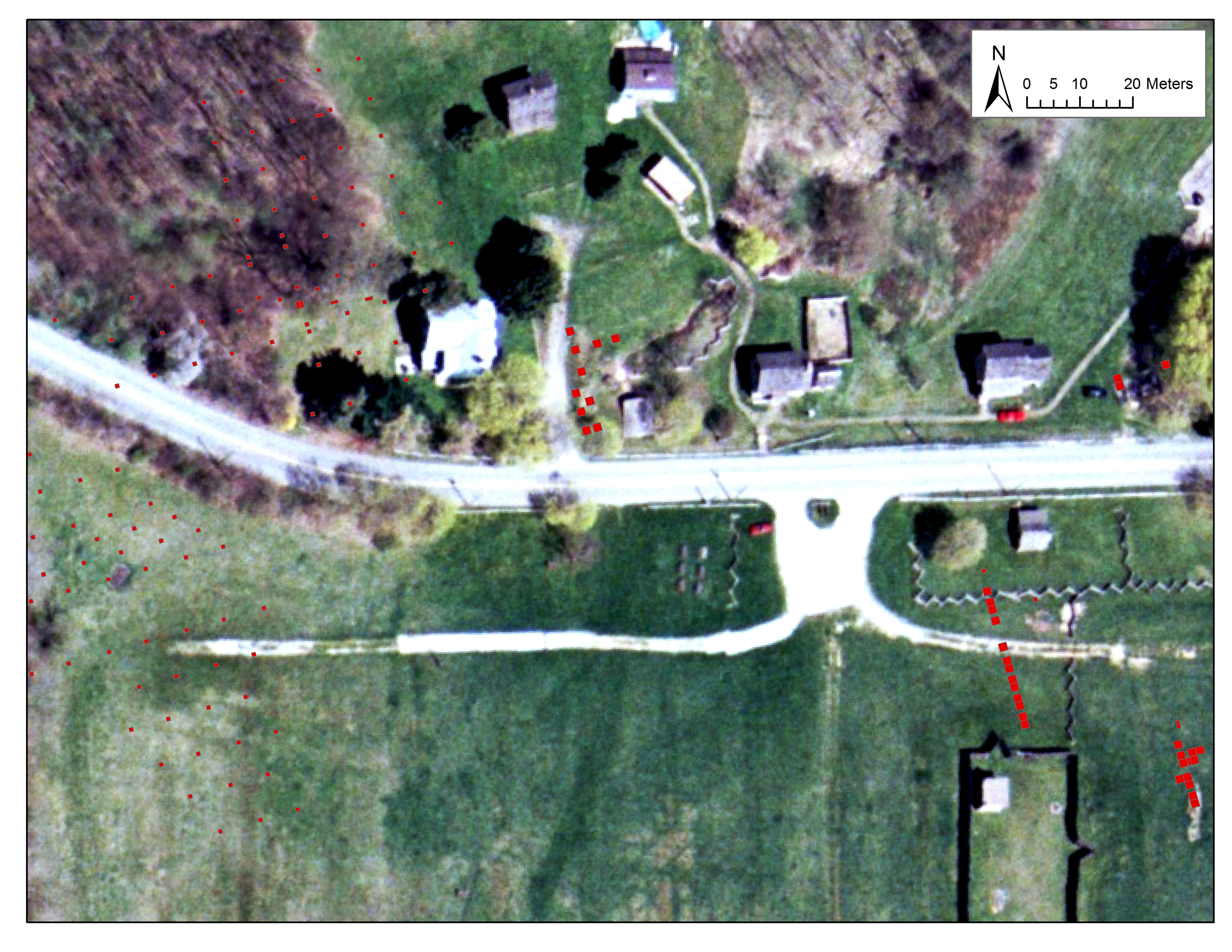
Red circle outlines the approximate area of interest for the IUP Late Prehistoric.

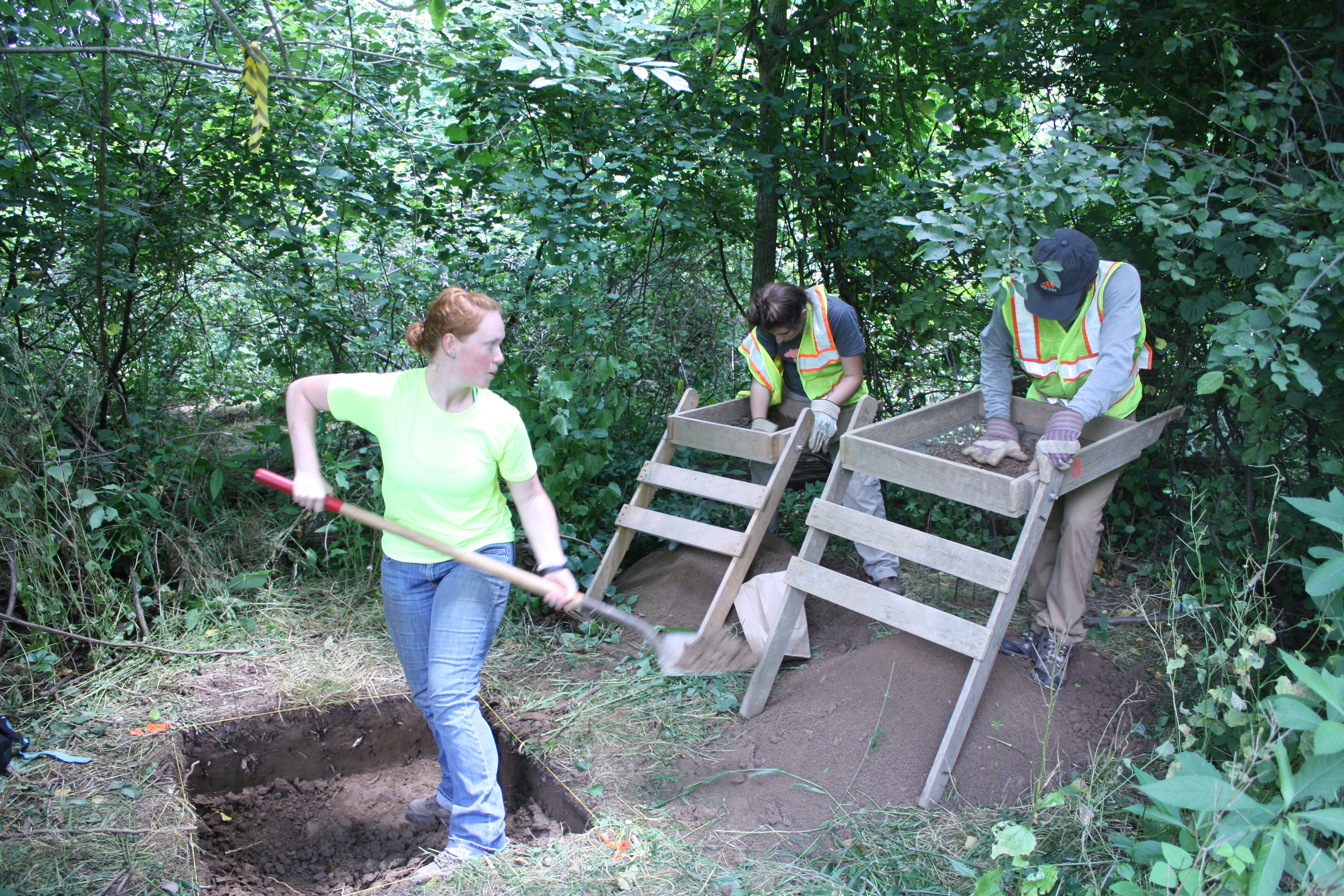
The IUP Late Prehistoric Project or LPP, was initiated because of these observations, and it continues today because there is still a lot to learn. It only made sense for IUP archaeologists to explore these recorded sites. They are accessible, potentially well preserved, and likely to add significantly to Pennsylvania archaeology. Since approximately 2000, many IUP faculty and students have focused on learning more about sites in the Conemaugh-Blacklick, Crooked Creek, and Loyalhanna drainages of west-central Pennsylvania dating between approximately AD 1000 and 1600. We have employed field schools, student projects, and MA thesis research to learn about these sites. We also have been incorporating sites studied by IUP archaeologists during the 1970s and early 1980s as several of these are LPP villages that haven’t been thoroughly analyzed and written up. Occasionally the work of IUP Archaeological Services has dovetailed with these efforts as well. Dr. Chiarulli, myself, and Dr. Phil Neusius all have participated in excavations and analyses related to this project. With this summer’s field school at the Squirrel Hill site, Dr. Homsey-Messer and Dr. Chadwick also have become part of this initiative. Together, we are adding significantly to archaeological knowledge of the distribution of people during the Late Prehistoric. Some of our information has been shared through meetings presentations, Masters theses (available through the IUP website) and publications. However, there is a great deal more to be written about, and I am currently working hardest on this aspect of the project.

Before explaining a little bit more about the areas of research that have been pursued, I’d like to clarify the use of the term Late Prehistoric. You may have learned that Late Woodland is the name archaeologists use for the end of the Pre-Columbian times in places like Pennsylvania. In the southern Midwest and Southeast, Late Woodland follows the collapse of Middle Woodland Hopewellian societies by approximately AD 500. It continues in these areas until Missisisppian cultural developments are evident between AD 800 and 1000, when archaeologists designate a Mississippian period continuing until Historic times. Elsewhere evidence of Mississippian tradition societies has not been found by archaeologists, and in the Upper Midwest the Late Woodland often is not seen as ending until European Contact. The situation on the eastern edges of the MIdwest, is a little more complicated. Some archaeological traditions including the Fort Ancient tradition, found mostly in Ohio and West Virginia, and the Monongahela tradition, found mostly in Pennsylvania and West Virginia, often have been designated as Late Prehistoric because of the similarities in dating, presumed interactions with Mississippian societies, and similar material culture (e.g. shell-tempererd pottery and communities with central plazas). Thus, it has been more common to call Monongahela tradition sites Late Prehistoric than Late Woodland. Because central Western Pennsylvania encompasses the northern edges of the Monongahela area and some of our sites can be considered Monongahela, we use the term Late Prehistoric rather than Late Woodland for our project.

One of the highlights of the LPP is the development of an extensive catalogue of radiocarbon dates for the sites in our area. When we began this project in 2000, there were not any radiocarbon dates for the LPP sites and villages. Now there are approximately 85 dates some of which are standard radiometric dates, but the majority of which are AMS dates. These latter Accelerator Mass Spectrometry dates now are the preferred radiocarbon dating method because they require less carbonized materials – as little as 20 mg as opposed to the 10 grams required for wood charcoal by standard radiometric dating methods. This means less material is destroyed in the dating process. Another advantage of AMS dating is that the dates often are more precise; they usually have date ranges within 50 years plus or minus from the mean. In any case in just over a decade and half we have greatly increased our ability to understand the chronology of the Late Prehistoric in our area. Most importantly we have been able to show that occupation of these watersheds spans the entire Late Prehistoric as shown in this chart of some of the dates we have obtained for Conemaugh-Blacklick Watershed sites. Note the AD years from AD 100 to almost AD 1800 in calibrated years across the bottom of the chart. These dates certainly span the Late

conemaugh dates pic

Radiocarbon date ranges for some Conemaugh-Blacklick watershed sites.

Prehistoric period from AD 1000-AD 1600. Calibrated years are approximations of calendar years based on adjusting radiocarbon years to known fluctuations in the amounts of carbon in the atmosphere. This figure gives you date ranges at both the 68% confidence interval (dark brackets) and the 95% confidence interval (gray lines) so that the earliest date on this chart has a 95% probablity of falling between approximately AD 650 and AD 1175 and a 68% probabilty of falling between approximately AD 775 and AD 1025 while the most recent date falls between ca. AD 1290 and AD 1780 at the 95% confidence interval and between ca. AD1400 and AD 1650 at the 68% confidence interval.

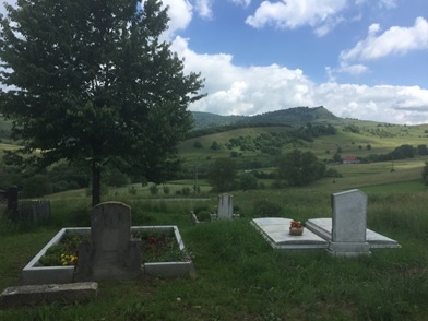
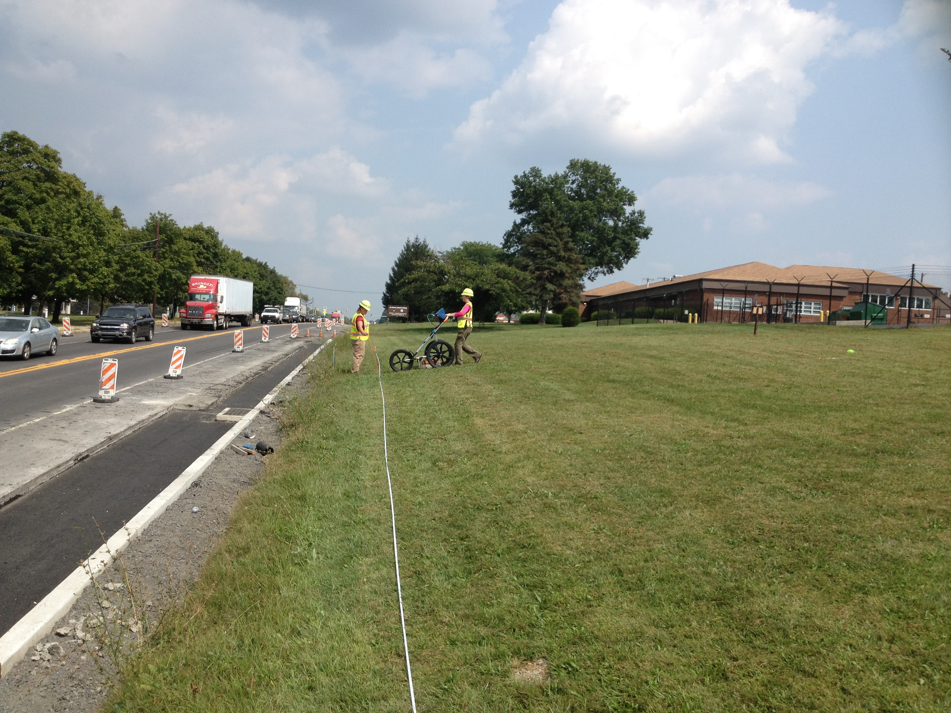
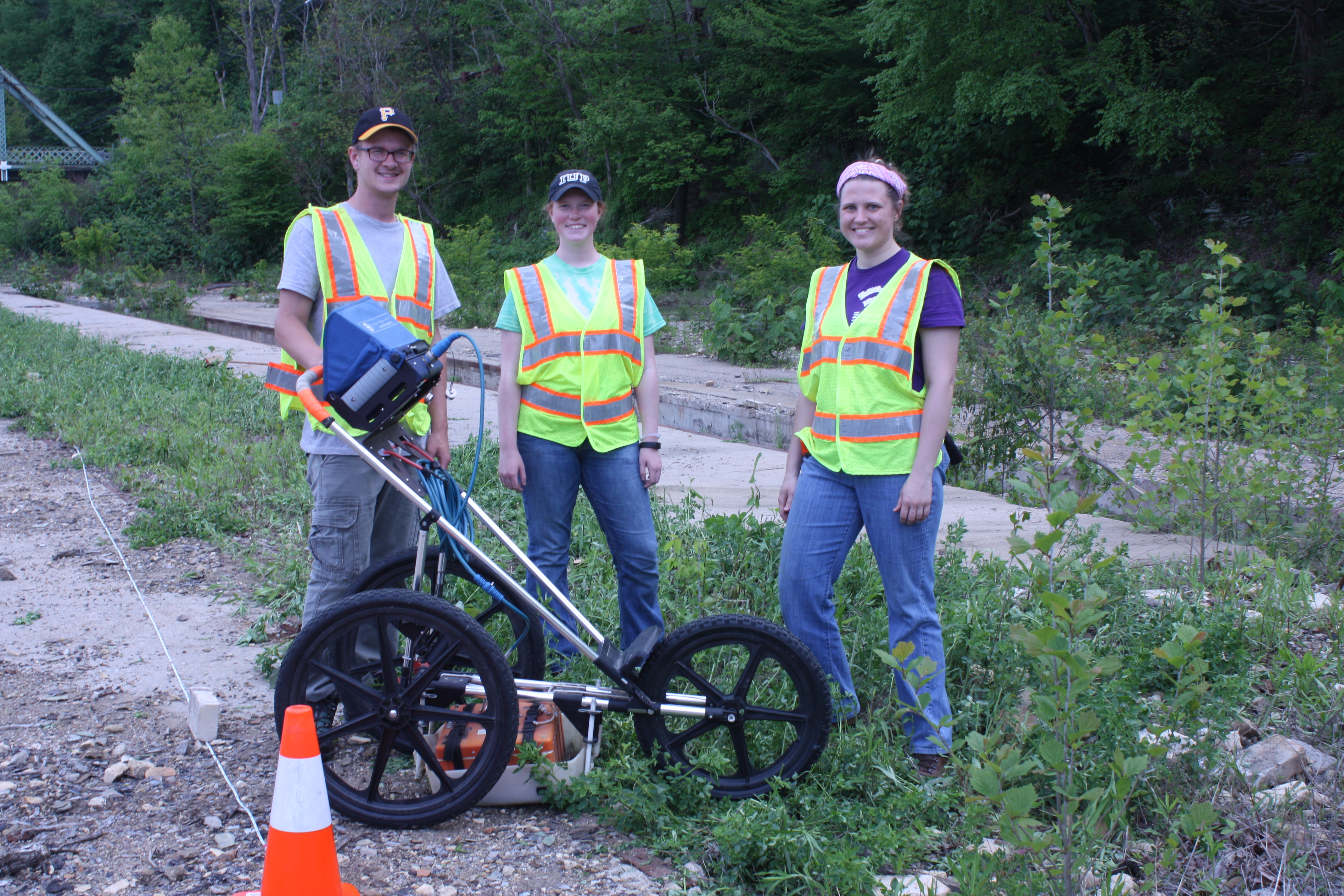
Another highlight of the LPP has been our identification of a possible cultural boundary between Mononghaela people and their neighbors to the north. Although many of our sites can be assigned to the Johnston Phase of the Monongahela tradition, others, especially those in the Crooked Creek drainage, appear not to truly be Monongahela, and to exhibit closer ties to Late Woodland groups living in northwestern Pennsylvania. These more northerly people seem to have made different ceramics, especially pots made with limestone temper as opposed to shell temper, as well as possibly to have less organized villages. Recently, and in part due to LPP research, the Crooked Creek Complex has been defined to encompass these sites, but there is a lot more that needs to be learned about these sites and those still further north, as much of the data remains in the hands of avocational archaeologists, and has only been partially studied. Important Crooked Creek Complex sites for which IUP has collections are Mary Rinn (36IN29) and Fleming (36IN26). This year an undergraduate honors thesis will be exploring the Mary Rinn site through geophysics as well.

ceramics

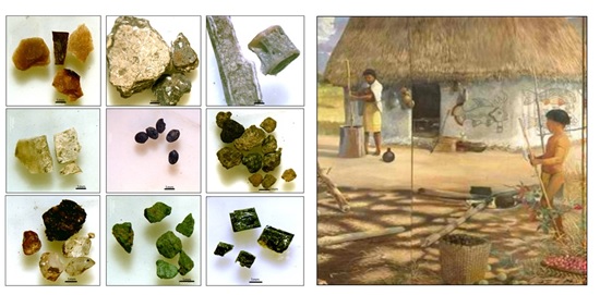
Contrasting ceramics from the Johnston site (Johnston Phase Monongahela) and the Mary Rinn site (Crooked Creek Complex).

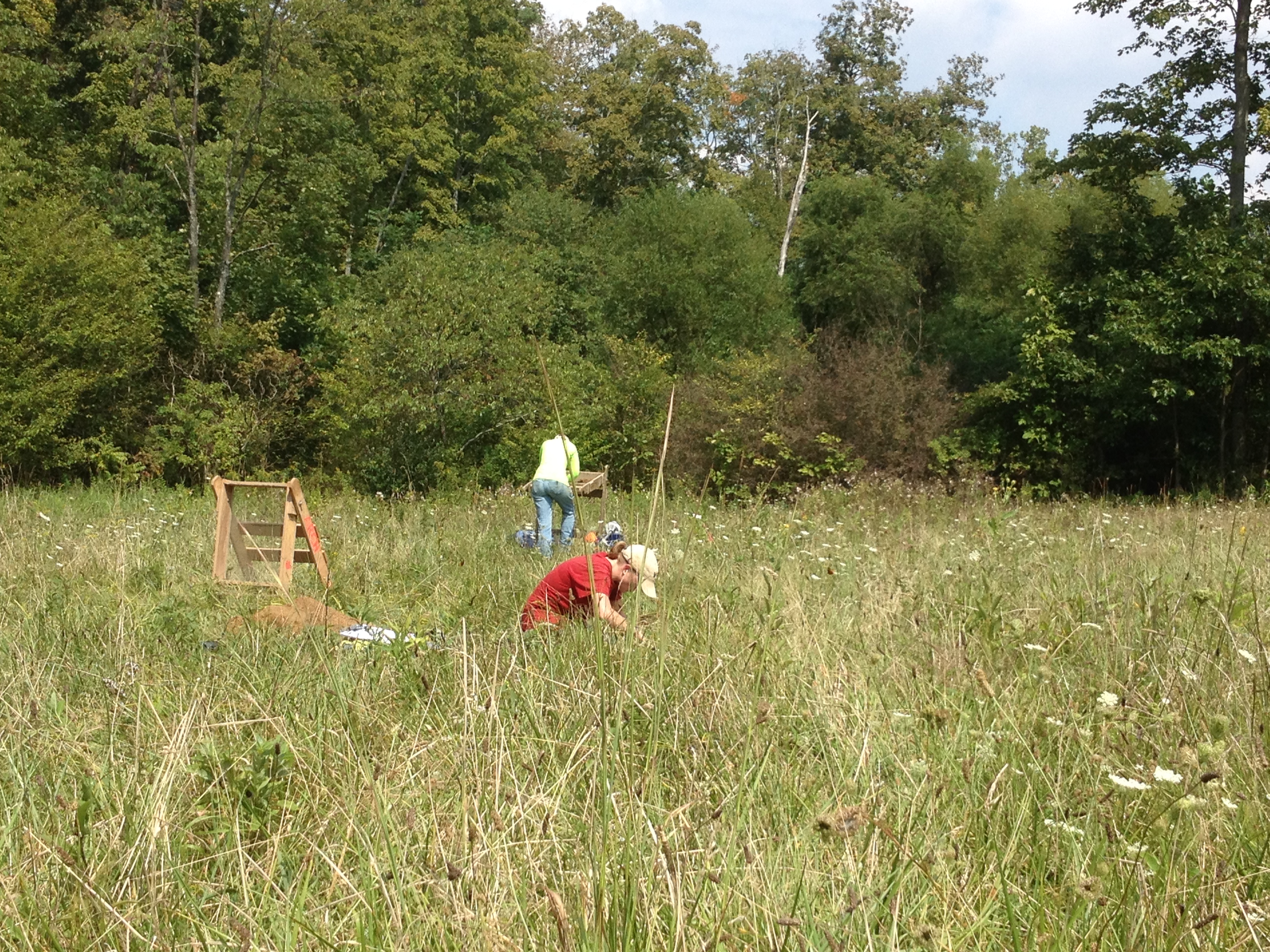
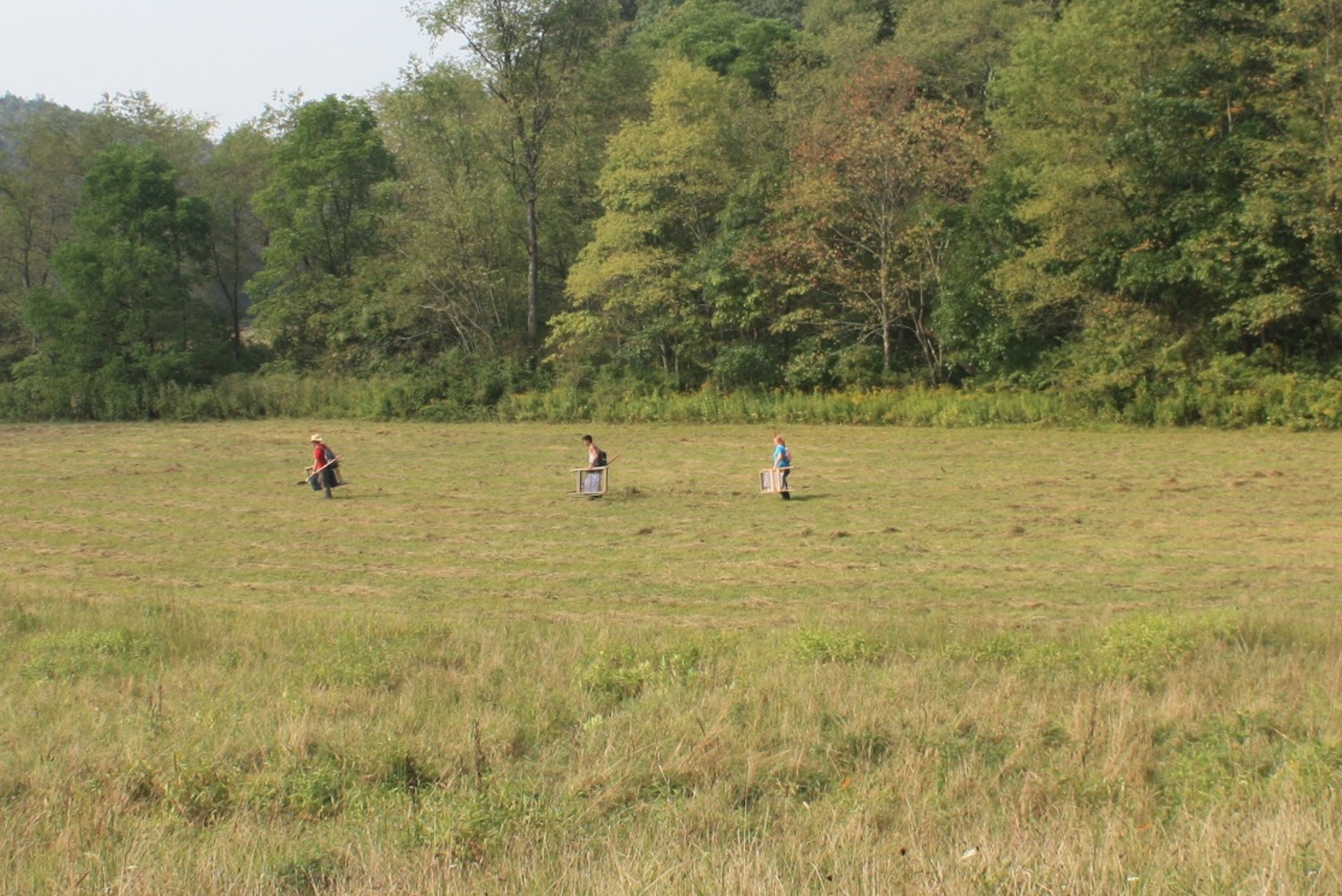
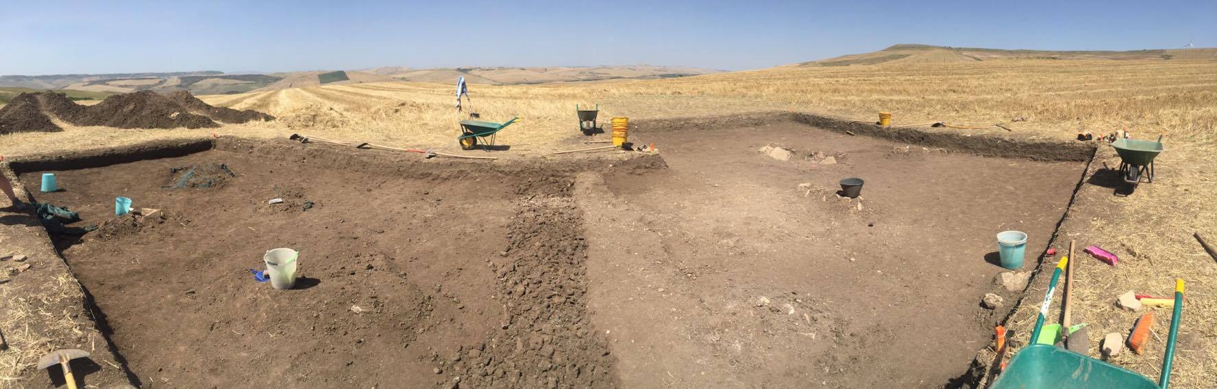
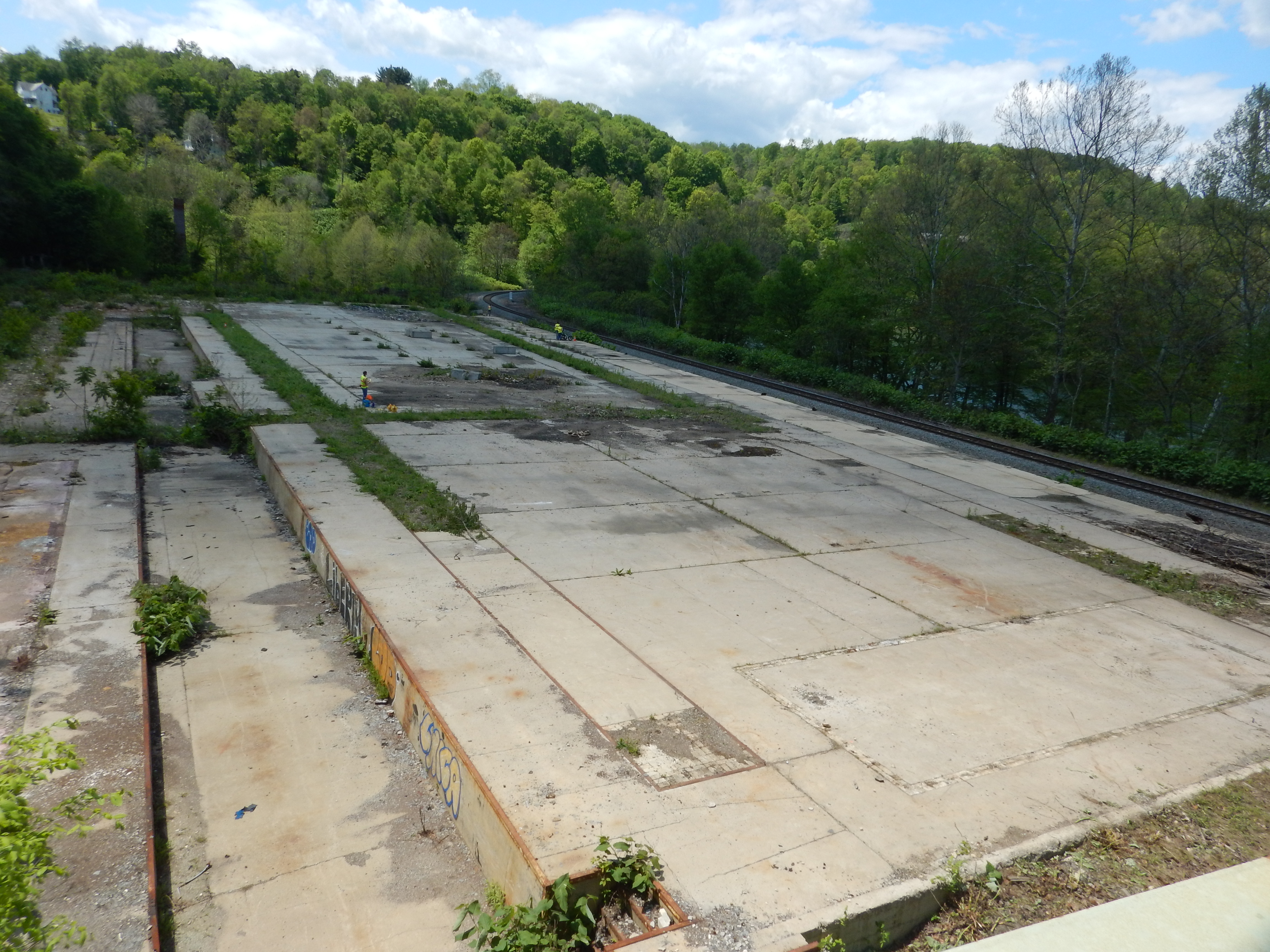
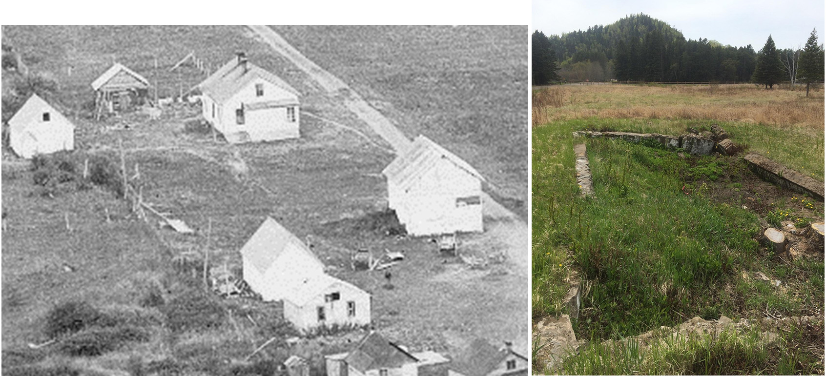
A major undertaking of LPP archaeologists has been re-investigation of the Johnston site (36IN2) , located near Blairsville. This large village site is the type site for Johnston Phase Monongahela (AD 1450-1590), and it may be the second largest known Monongahela village. It was excavated in the 1950s by archaeologists from the Carnegie Museum of Natural History in Pittsburgh before the completion of the Conemaugh lock and dam. Today it is buried beneath flood sediments of the Conemaugh River Lake on land belonging to the US Army Corps of Engineers. By conducting five IUP archaeological field schools at Johnston beginning in 2006, we have added greatly to the information on this site, demonstrating that it is a multi-component site of some complexity, and we have called the definition of the Johnston Phase itself into question. Although, there is still much more potential for research at Johnston, we have obtained more than 40 radiocarbon dates from this site alone and recovered hundreds of thousands of artifacts. As a result, we are pausing in our excavations to take more thorough stock of what we have been learning. Graduate and undergraduate theses have now focused on ceramics, bone tools, faunal remains, lithics, FCR, and botanical remains from the Johnston site. Three others still in progress are exploring the site’s geomorphology, the spatial distribution of materials, and micro-artifactual evidence, and I am immersed in the analysis and write-up of our findings as well.

excavation shot

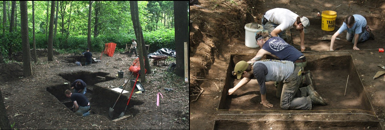
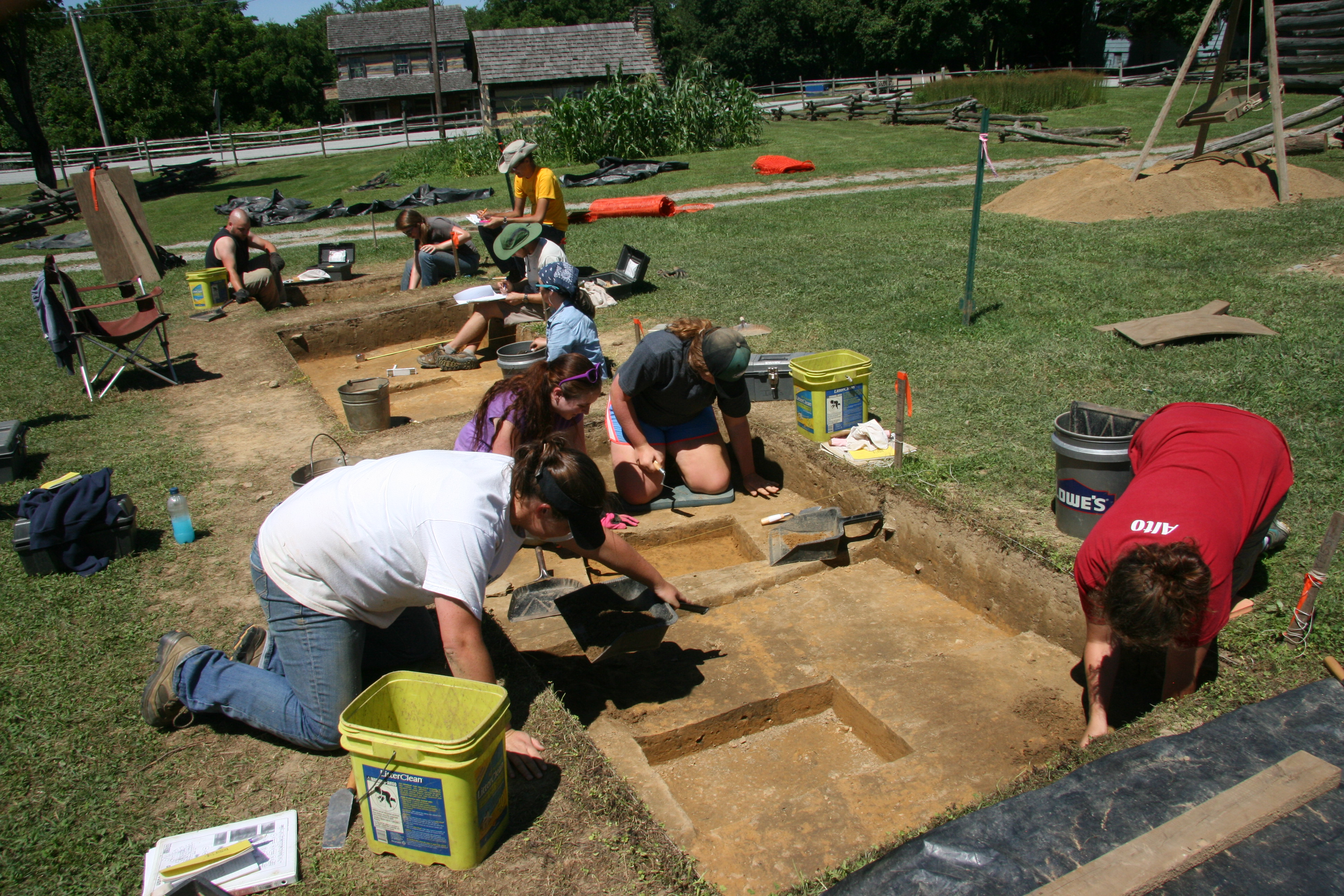
Excavations in progress at the Johnston site, 2012 (left), 2010 (right).

These are only a few highlights of the IUP Late Prehistoric Project, which has been employing excavation, geophysical survey, as well as faunal, botanical, lithic and ceramic analyses to gather evidence concerning the forgotten or porrly understood Late Prehistoric villages of central western Pennsylvania. As a result these villages are forgotten no more. If you are an IUP graduate or undergraduate student, you should consider joining other IUP archaeologists and getting involved with some aspect of this project. There are many worthwhile projects that you might undertake, and I will be happy to explore possibilities with you.   Whether or not the LPP is your cup of tea, it is an important part of the archaeology IUP is doing, and you can anticipate hearing more about it in the future.

Advanced Metal Detecting for Archaeologists at Fort Necessity

Uncontrolled metal detecting can be one of the most destructive activities at an historic-period archaeological site, especially a battle or military site. And it is illegal to metal detect, or remove any artifacts, from a National Park without an Archaeological Resource Protection Act (ARPA) permit. But with the proper research design and permits a systematic metal detector survey can be a very powerful archaeological tool. That’s what 16 IUP students and faculty learned at Fort Necessity this past weekend.

The class was taught by the Advanced Metal Detecting for Archaeologists (AMDA) as a Register of Professional Archaeologists (RPA) continuing education course. In addition to IUP, 10 other participants from Cal, Juniata, University of Binghamton, and the National Park Service took the class. AMDA is a group of professional archaeologists dedicated to integrating metal detecting into archaeological research. Since IUP has an excellent assemblage of geophysical equipment, it was natural for us to add metal detecting to our skill-set.

DSCF2876 - Copy

IUP Anthropology undergraduates Amanda Telep, Chyna Haley, James Miller, and Brendan Cole learning proper technique from AMDA instructor Sheldon Skaggs. Photo by Chris Espenshade.

The class began with a day of lectures on the mechanics and use of metal detectors, as well as many examples of how metal detectors can be used for historic and pre-contact period archaeology. The next two days were spent in the field collecting real archaeology data.

Quick history of Fort Necessity: A 22-year old George Washington was sent to western PA to push the French from the region. On May 28, 1754 colonial and native soldiers under Washington’s command killed Joseph Coulon de Jumonville and most of his force who were carrying a message ordering Washington’s force to leave the area. Expecting a reprisal from the French, Washington’s troops fortified their depot in the Great Meadows, naming it Fort Necessity. On July 3, 1754 French soldiers under the command of Louis Coulon de Villiers, Jumonville’s brother, attached Fort Necessity. After a day of fighting in the rain Washington surrendered. The killing of Jumonville, which Washington admitted to in his surrender, ignited the Seven Years War, the first truly inter-continental war.

DSCF2885 - Copy

Metal detector survey at Fort Necessity National Battlefield. Note the string transects to ensure proper coverage and the pin flags to mark finds. Photo by Chris Espenshade.

It has long been believed that the heaviest French fire came from the tree line southeast of the fort where the trees reached within 60 yards of the fort. That’s where we focused our metal detecting efforts for the field portion of the class. We found evidence of the battle in the form of dropped and fired musket balls as well as other artifacts relating to the attack. These data confirm that at least some of the French were attacking from this location.

We also now have a cadre of IUP archaeologists trained to use metal detectors on an archaeological site – a skill that we can use here and that students can take with them into the professional world. It was a very productive and successful weekend.

DSCF2891 - Copy

AMDA Fort Necessity National Battlefield Class Photo. Photo by Chris Espenshade.

IN SMALL THINGS FORGOTTEN: MICRO-ARTIFACTS

By Lara Homsey-Messer

 Microartifacts are the small materials that fall through a standard ¼” screen. Generally archaeologists who study microartifacts look at the range from 1 to 4 mm, though some brave folks go down to as small as half a millimeter! Artifacts this small are difficult to see and require magnification, making their study somewhat tedious. As a result, they typically receive little attention. Since they are assumed to duplicate the same information we get from macroartifacts, only a handful of American archaeologists routinely study them. However, studies over the last two decades convincingly demonstrate that microartifacts are not simply smaller versions of larger artifacts. Rather they provide different kinds of information which supplement macroartifact studies. For example, at the Mississippian period site of Wickliffe Mounds in western Kentucky, my colleagues and I found tiny copper fragments inside a house structure. Only two slivers were found during 10 years of fieldwork, but when we looked at the microartifact assemblage (derived from the heavy fraction of flotation samples), we found hundreds of pieces—most of them just 1mm small! Even more interesting, chemical analysis of those fragments showed that it wasn’t elemental copper that Mississippian people used to make items of personal adornment (such as ear spools), but a fragile copper oxide, the kind that can be ground into a pigment for paint. Europeans who encountered historic period Native Americans recorded brightly painted houses, so this finding really shouldn’t be all that surprising. And yet if we hadn’t looked, we would not have found evidence for it. Since then we have found micro-sized pieces of other mineral pigments, including galena (black), hematite (red), and kaolinite (white)—all colors that had symbolic significance for Native Americans.

1

Left: microartifacts from Wickliffe Mounds (the copper is center, bottom row). Right: artist’s reconstruction of a painted Mississippian house.

Several IUP students in the Department of Anthropology have incorporated microartifacts in their research. Junior Harley Burgis is looking at microartifacts from the Paleoindian through Archaic site of Dust Cave (in northwestern Alabama) as part of her Honor’s thesis. Harley is comparing microartifacts from different kinds of features, such as hearths, possible storage pits, and middens. The hearths are of particular interest because they come in many shapes and sizes. So far, she has found that the smaller hearths are more likely to contain burned shell and fish bone, while larger hearths seem to have a wider variety of materials, including bird and mammal bones, nutshell, and lithic debitage. Also, the bone is the bigger hearths is calcined, suggesting that those fires burned at a higher temperature than the small hearths. So it seems that at Dust Cave some hearths were reserved for steaming mussels and/or fish at low temperature, and others were multipurpose fires for broiling many kinds of foods at high temperature.

Graduate student Kevin Gubbles (May ‘16) looked at microartifacts as part of his Master’s thesis on fire-cracked rock (FCR) at the Johnston Site, a Monongahela village in western PA. Kevin conducted a neat experiment to figure out how hot and how often rocks need to be heated to create FCR. One of his findings is that repeated heating of sandstone not only cracks the rocks and colors them red, but it also causes micro-sized grains of quartz sand to sluff off, what we call “attrition.” This is especially true for rocks that have been boiled in hot water. And the higher the temperature, the more attrition is produced. Looking through the microartifact assemblage at the Johnston site, there are copious quantities of these single grains that match the physical appearance of the experimentally produced ones, particularly in hearth features. The huge quantities of attrition discovered by Kevin suggest that stone-boiling technologies continued even well after the adoption of ceramics.

2

On left, experimental FCR with micro-sized grains of attrition. At right, archaeological microartifacts from a Johnston Site hearth.

Senior Paige Reimers is also looking at the microartifacts from the Johnston Site as part of her Honor’s thesis. She is comparing the microartifact content of different features to better understand how these they may have functioned. She is particularly interested in comparing the post mold features from the stockade and private domestic structures to post molds found in the central public plaza—a place generally kept free of structures and debris. The presence of posts here is surprising and we hope that microartifacts may shed light on what they were used for. Her analysis has just begun, but so far she has found a lot of the “attrition” mentioned above, supporting Kevin’s results that stone cooking, including stone boiling, was commonly employed at the Johnston Site, creating a long of refuse in the process.

Student Research at Hanna’s Town

Fig4_2015

2015 IUP excavations at Hanna’s Town

Hanna’s Town is arguably the most important historical site in Westmoreland County. As the first British county seat west of the Allegheny Mountains, a toehold for Anglo American western expansion, and the home of the Hanna’s Town Resolves it played important judicial, economic, social, military, and cultural roles in the formation of western Pennsylvania. Robert Hanna purchased a tract of land along the Forbes Military Road at the head of a branch of Crabtree Creek in 1769. Situated between Fort Pitt and Fort Ligonier, Hanna’s tavern Hanna’s became the county seat when Westmoreland County divided from Bedford County in 1773. Hanna also began selling lots in the town that year and Hanna’s Town quickly took shape. As county seat, Hanna’s Town was the site of the county’s first courts, which were “at least an occasional destination for settlers living throughout the southwestern part of [Pennsylvania]” (Carlisle 2005:1). Due to the necessity of occasionally visiting the court for criminal proceedings or land transactions, as well as the settlement’s position along one of the major overland routes to the Northwest Territory, Hanna’s Town developed into a thriving community with approximately 30 homes, a stockade fort, and multiple taverns. A month after the battles of Lexington and Concord, the inhabitants of Westmoreland County adopted the Hanna’s Town Resolves on May 16, 1775. Signed at Hanna’s Town, this document declared that the citizens were “resolved” to resist the tyranny of Britain. The citizens’ resolve continued throughout the war with local men joining local militias and participating in battles throughout the Northwest Territory. In response to these battles as well as American attacks on Native settlements, Hanna’s Town became the target of one of the final acts of aggression in the American Revolution. On July 13, 1782 a raiding party of Native and British soldiers led by Seneca Chief Sayenqueraght attacked the town, burning its buildings and slaughtering livestock. Hanna’s Town never fully recovered from this attack, and was subsequently abandoned as the state road and county seat shifted to Greensburg. Following its abandonment, the land was farmed until its purchase by Westmoreland County in 1969.

Fig1_Excavations

IUP excavations at Hanna’s Town since 2011

IUP entered into an agreement with WCHS in 2011 to provide IUP students and faculty with access to the Hanna’s Town site and associated artifact collections while providing WCHS with new archaeological interpretations and ways to increase awareness of the site’s significance. This is an ongoing relationship with many facets ranging from the creation of a digital artifact catalog and map to consultation regarding ground-disturbing maintenance at the park, but the most important aspect of IUP’s involvement with Hanna’s Town has been hands-on student education through field schools, class projects, theses, and work experience.

Hanna’s Town has also been the subject of seven graduate theses at IUP. These theses cover a range of topics from buttons to geophysics. Two students, Renate Beyer and Stefanie Smith, have completed their theses. Renate reanalyzed the glass and ceramics from the Foreman’s Tavern pits to compare them with a tavern closer to Philadelphia. She found that the Foreman’s were adopting new fashions almost as quickly as their eastern counterparts and that new types of ceramics first appeared in showier pieces such as tea services. Stefanie examined animal bones from the Foreman’s Tavern, Hanna’s Tavern, and Irish House portions of the site to explore variations in diet among the townspeople. Her results showed that most people were eating a mixture of domestic and wild animals, but that the Irish House inhabitants ate significantly more domestic animals than their neighbors. These results suggest that Irish House was inhabited later than the other buildings, an idea supported by the predominance of pearlware, a type of ceramic not introduced to North America until 1780, near this structure. Her research also revealed a substantial number of grey squirrel bones in the Foreman’s Tavern deposits, suggesting that squirrel may have been served in the tavern.

Fig3_2013

Students excavating at Hanna’s Town in 2013

The other theses are still underway but are showing promising results. Ashley Taylor has used a variety of geophysical techniques to investigate the Hanna’s Town cemetery. The cemetery is of particular importance because it is the last aboveground physical link with the original town. Ashley’s research showed that the cemetery was once larger than the current boundary implies by finding several grave shafts outside of the fence. David Breitkreutz is also applying geophysics to give us a better understanding of the site’s layout (Figure 6). Taking advantage of a large ground-penetrating radar recently acquired by IUP, one of only two in the US, he has surveyed much of the area south of Forbes Trail Road. This survey covers areas never before excavated and will be used to guide our 2017 field school excavations. Three other graduate students are focusing on artifacts from the collection. Jay Taylor is analyzing the metal artifacts to better understand what occupations were practiced in the town. Nichole Keener is studying the buttons and other fasteners to reconstruct the clothing of Hanna’s Town residents. Cheryl Frankum is conducting an elemental analysis of redware from the site. Redware, the Tupperware of the 18th century, is the most common artifact in the collection and also the least studied. Cheryl’s research is a first attempt at understanding this important type of artifact and may shed light on where the pots, jars, bowls, and other pieces were coming from.

There are also three undergraduate theses about Hanna’s Town in progress. While undergraduates are not required to complete a thesis doing so gives them an advantage in applying for jobs and graduate school because it shows that they can take a research project from plan to completion. James Miller is studying the distribution of expensive ceramics across the site to determine if there was class variation at Hanna’s Town. Kelsey Schneehagen is looking at Hanna’s Town in a regional context to explore relationships with other settlements in western Pennsylvania. Eden VanTries is studying the people who lived at Hanna’s Town before Hanna (or even his predecessor, Jacob Miers). In the course of previous excavations several stone tools have been recovered. Eden is analyzing these artifacts to understand when previous groups lived on the ground that became Hanna’s Town. As these graduate and undergraduate theses are completed copies are filed with the WCHS so that they are available to other researchers.

An Undergraduate Abroad 2: Cemetery Excavations in Romania

By Harley Burgis

3This summer I spent three weeks in Odorheiu Secuiesc, Romania learning how to excavate human skeletal remains. I worked at Valeni (Patakfalva), a medieval church and cemetery site. Although the modern cemetery is slowly encroaching the medieval one, the site is still more or less intact. Our job was to excavate the human remains from three different trenches, so that the site directors could learn more about the history of the people who inhabited this part of Romania and see how they are linked to present day populations in the area. I specifically spent the whole three weeks excavating a juvenile. This was very taxing, because of three reasons: 1) because of the2 sun and incessant heat, I was working with baked out clay, 2) there was so much back fill bone on top that was not associated with the individual, and 3) I had to use wooden picks to do the entire excavation, because of how fragile juvenile bones are and how close the bones were together. After I finished excavating the individual, I learned how to map the bones, which was a very meticulous task. In the end, I had a great time in Romania, I met amazing people from all over the world, and I learned a lot about the culture there and how to excavate human remains.

The Archaeological Services Center at IUP

By Bill Chadwick

The Archaeological Services Center (Center) is a faculty-led applied archaeology research center that utilizes graduate and undergraduate student workers located in the Department of Anthropology at Indiana University of Pennsylvania. The Centers’ primary goal is to provide opportunities to both graduate and undergraduate students to obtain experience supervising and conducting field and laboratory archaeological projects prior to graduation. The Director of the Center, Dr. William Chadwick, is the only regular faculty staff member of the Center.

Ashley excavating a shoveltest

Ashley McCuistion and Hannah Harvey digging test pits.

The Center offers a wide array of services to public and private organizations to assist in cultural resource and historic preservation projects required by state, federal and local laws or as part of environmental impact assessments. Since 1989, the center has conducted more than $5,000,000 in projects and technical assistance to agencies as diverse as the Pennsylvania Historical and Museum Commission, the Pennsylvania Department of Transportation, Indiana County, the Pennsylvania Department of Environmental Protection, the National Park Service, the U.S. Army Corps of Engineers–Pittsburgh District, the Allegheny National Forest and numerous planning commissions. The services that the Center provides include, but are not limited to, Geomorphological Reconnaissance and Geophysical Surveys, Consultation, Phase I discovery, Phase II evaluations, and Phase III excavations of significant archaeological sites. The Center is focused on those sites and projects located in the Upper Ohio Valley.

Hannah and Emily using the GPR

Hannah Harvey and Emily Masters conducting a ground penetrating radar (GPR) survey for Pennsylvania DOT.

Archaeological projects through the Center provide students opportunities to have hands-on experience working with some of the technologies that are at the forefront of archaeological research and the Cultural Resource Management (CRM) industry. The Center has access to the latest geospatial technologies including, but not limited to, real-time sub-meter accurate GPS units, a Nikon Total Data Station, a Leica Scan Station C10 3D Laser Scanner, and ESRI ArcMap software. The geophysical equipment and methods used on projects by the Center can include two Ground-Penetrating Radar systems, Gradiometry, Resistivity, Conductivity, Electromagnetic Induction, and Metal Detection. The available laboratory equipment includes an Olympus DELTA Professional XRF, a Nikon Eclipse E200 Polarizing Trinocular Microscope, and a Flote-Tech Flotation System. Geomorphological equipment that can be used during the projects include Edelman and Buck Augers, Gouge Augers, Piston Samplers, and sediment analysis equipment such as a drying oven, electronic scales, sediment splitters, and a set of sediment sieves and a sieve shaker.

Whether continuing on into graduate studies or entering the CRM industry, students who have the opportunity to participate in projects through the Center have a enhanced understanding of the real-world application of methods and technologies that are used to study archeological resources. This knowledge gained through the Center provides students experience beyond the classroom that is invaluable when moving from their academic lives into their professional careers.

Crew walking across floodplain

Off to work we go!

Voices from the Field: A Graduate Student Abroad

By Sarah Henley

Map1This summer I went to Menorca Spain to attend the Sanisera Archaeology Institute for International Field Schools and took a course on underwater archaeology from June 10-18, 2016. First I will share information on Menorca and the archaeological site where we worked then give an account of my time there. (Note: I was not able to catch/record all the history of the site so there are some gaps).

Sanitja

Port of Sanitja

Menorca is one of three islands off the eastern coast of mainland Spain. The other two islands are Mallorca and Ibiza. The official languages spoken on Menorca are Spanish and Catalàn. The locals also speak English, however the clarity and quality varies. The Sanisera Archaeology Institute is currently excavating the Roman city of Sanisera located on one of the northern peninsulas, and the underwater archaeology course focused on Port Sanitja. The shipwreck sites dated between the 4th century B.C. and 4th century A.D., and recovery/projects have been conducted since the 1950s.

Each day we would start out by diving for about 40 minutes at 54 feet. After diving we would head back to the field school to have lecture, lunch, and do some identification of Amphoras or ceramic vessels used to transport wine, olive oil, salted fish, etc. on ships, drawing, photography for 3D modeling, and 3D modeling.

bascillica

Ancient basilica

The first day the underwater group got to tour Port Sanitja, and see and hold some of the artifacts that had been discovered. Throughout the week we learned and applied the Sanisera methodology of underwater archeological survey such as linear and circular survey, documentation, and 3D modeling to name a few. One of the things I will never forget was trying to take photos of artifacts underwater. My dive buddy and I had to take pictures of two Amphoras. The Amphoras were in a hole, surrounded by sea grass, next to a rock wall, and a bunch of fish that would not go away. When taking photos underwater you have to keep the area clear around the artifacts, not stir up the sand, and watch your bouncy. It was not easy.

Ciutadella

Downtown Ciutadella

Each day we finished around 2:15pm, and would drive back to the residency were we had “dinner” at 2:45pm, and had the rest of the day to explore or do whatever we wanted to. The Town in which we stayed in was Cituadella on the western coast of the island. Cituadella is the second largest town on the Island along with the town of Mahon on the eastern coast.

CaveDiving

Cave Diving (photo by dive buddy Jenna Zwiller)

During my time on Menorca I also got to go cave diving, which was amazing. Everyone in the dive group went. We first took a 10-minute boat ride out to a bay surrounded by rock cliffs. Then we dove for about 5 minutes to reach the entrance of the cave, and then dove 150 meters to the end of the cave were we surfaced. Diving into the cave was an experience. It slowly becomes dark and cold and at a couple points everything becomes blurry because of the mix of warm and cold water. Once at the end of the cave we swam on the surface and got to look at the stalactites, which were beautiful. When returned near the entrance we dove back down and swam out. Diving/swimming out of the cave felt like something out of National Geographic. The rock wall surrounding the entrance silhouetted the beautiful blue water that had light shining through it. I almost did not go because I was having some ear trouble, but I am so glad I went. When diving you have to equalize your ears as you descend and ascend. However, as a child I had many ear infections, which has left behind scar tissue and has made my eardrums less flexible. Diving is already hard on the body especially when you dive several days in a row. I was also unable to dive the last couple of course days because of my ears. Overall my experience was amazing and I will never forget it!

Sunset

Sunset from the rooftop in Ciutadella

Voices From the Field: An Undergraduate Abroad

By Sean Duncan

13662448_1145568005484989_292685888_oThe site is located about 15 minutes outside of Gravina in southern Italy. It’s called Vagnari and it’s a second century Roman cemetery located in a field surround by rolling hills. The primary person and leader of the dig is Doctor Tracy Prowse from McMasters University in Ontario. We opened two trenches, one that is completely new and another that’s half and half because they weren’t able to excavate some of the burials last year. So far we have around seven burials that have been uncovered. We just got down to layer where we can trowel away the burials which is about 35-45 cms down.

13692146_1145568162151640_107592640_o

I’ve learned that archaeology is a lot different here than it is in states. For example, we don’t sift every bit of dirt and for a majority of the dig we used pick axes and shovels. We also just ignore and throw away Roman tile, which would be the sort of thing we would document in American field school. I think the most challenging thing was adapting to the trench style digging and generally different style of archaeology. But it was only a little bit of a learning curve and I quickly adapted to learning how to pick away the dirt rather then slowly trowel it away.

13709585_1145568002151656_1993467834_o

Pennsylvania Highway Archaeological Survey Team – MidSeason Update

By Kate Peresolak

IMG_4367

The 2016 PHAST Interns: (l to r) Brendan Cole, Kelsey Schneehagen, and Sarah Henley.

At this point in the summer, time is flying PHAST, at least for the members of PennDOT’s Highway Archaeological Survey Team. As the field director, I supervise three graduate and/or undergraduate students hired as PennDOT interns and, together, we complete small archaeological investigations ahead of PennDOT transportation projects. This year’s crew includes Sarah Henley, an IUP Graduate student, and two IUP archaeology undergraduates: Brendan Cole and Kelsey Schneehagen.

DSCN1033

Brickworks foundation, Westmoreland County.

This PHAST season began in May, and fieldwork for seven of our current 11 projects for the 2016 season is complete. We worked near a Berks County covered bridge dating to 1869 and a culvert replacement area in Juniata County. We also utilized Ground Penetrating Radar (GPR) to survey the remnant concrete foundation of a large historic brickworks in Westmoreland County. Additional GPR survey, archaeological testing, and two days at an urban site in Pittsburgh are only some of the projects that await us.

IMG_4542

Just some of the artifacts recovered from a recent PHAST project.

Cultural resource interns from Harrisburg and other state locations spend one to two days working with PHAST to experience archaeological fieldwork in Pennsylvania. In addition to working with other interns, the crew networks with established field archaeologists and other professionals working in cultural resource management (CRM). They are exposed to varying field conditions, projects, and also laboratory tasks including report graphics production, ArcMap figure creation, curation documentation, and artifact analysis.

IMG_4591

Kelsey slingin’ soil.

The crew’s employment will continue through October, which is enough time to also learn how artifact and documentary collections are prepared for submission to the State Museum of Pennsylvania.

Check back in September for a final update on our summer activities!

IMGP1508

Kate checking the soil profile at the bottom of an excavation unit.

Voices from the Field: Interning at Grand Portage National Monument

By Danielle Kiesow

This summer I’m the archaeology intern at the Grand Portage National Monument in the most northern tip of Minnesota along the shores of Lake Superior and it’s been a great experience! Grand Portage National Monument is unique in that it’s located within the Grand Portage Reservation (home of the Grand Portage Band of the Lake Superior Chippewa, Minnesota Chippewa Tribe, also known as the Ojibwe or Anishinaabe) so I have the chance to work alongside the locals and together we can learn more about their past.

I’m accompanied by the Chief of Resources at the Park, Bill Clayton, and Jammi Ladwig, a PhD candidate at the University of Minnesota. We’re doing a lot of different things during my summer here including monitoring sites for any looting, helping out with some excavations at Isle Royale National Park just a few miles away in Lake Superior, participating in cultural resource management (CRM) work, archival research, working on my thesis, and even chainsaw training. Definitely the most challenging part of my internship is finding time to do everything!

NWC Depot

The reconstructed Great Hall in the North West Company Depot overlooking Lake Superior.

Grand Portage is known for its importance in the fur trade, and in fact it’s named after the 8.3-mile portage from Lake Superior to the Pigeon River that divides Minnesota from Ontario. Through previous archaeology from the 1930s and into the 1970s, Grand Portage National Monument has been able to reconstruct the stockade and some of the buildings of the North West Company’s depot that existed from 1731-1803.

Montreal Canoe

What better way to learn a little bit about the lives of the voyageurs than paddling in a replica Montreal canoe?

Even though the fur trade is the focus of the park here, my thesis work is all about what happened after the fur trade: when the English packed up their things (including a few of the buildings) and moved across the newly designated border to establish Fort William (today Thunder Bay, Ontario). The Hungry Years, as they’re still called by the descendants on the reservation, followed the end of the fur trade and lasted into the beginning of the reservation era, when the U.S. government wrote the Treaty of 1854 that established the Grand Portage Reservation. My thesis is looking at the land use and gardening or farming practices on the reservation from 1854 until 1930 to analyze the relationship between the Ojibwe at Grand Portage and the Indian Agents from the Bureau of Indian Affairs (BIA). This time period has, until recently, been largely ignored by the National Monument and much of the descendent community that can remember what life was like during this period have passed. It’s important for all of us – the National Park Service, the descendent community, and everyone else – to understand the suffering that resulted out of racism and to celebrate the strength and perseverance of the Grand Portage Ojibwe. Knowing that my thesis is one of the first research projects about the Ojibwe perspective during the transition into living on the reservation is definitely the best part of my internship.

I have been conducting research at the Minnesota History Center in St. Paul and the National Archives in Chicago for more background into the BIA-Grand Portage relations before I excavate the yard of a former BIA building in August. The most important thing I’ve learned during my research is the resiliency and resourcefulness of the Grand Portage Ojibwe throughout the years. Instances like creating tolls and selling items along the Grand Portage to earn money from the voyageurs, petitioning the Indian Agency and making their voices heard during a time where Indian Agents called them the sons and daughters of the Commissioner of Indian Affairs (and treated them as such), and never leaving their land or their fishing economy even though they were without electricity until the 1950s and without plumbing until 1976.

BIA Combined

Before and after: a ca. 1920 photograph of the BIA building (top of the photo) with surrounding yard and outbuildings, looking northeast. The foundations of the building are seen in the next photo taken this summer, looking southwest.