Archaeology Day 2018

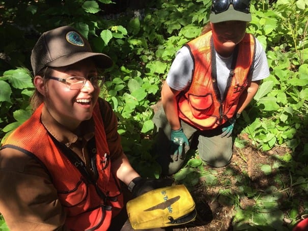
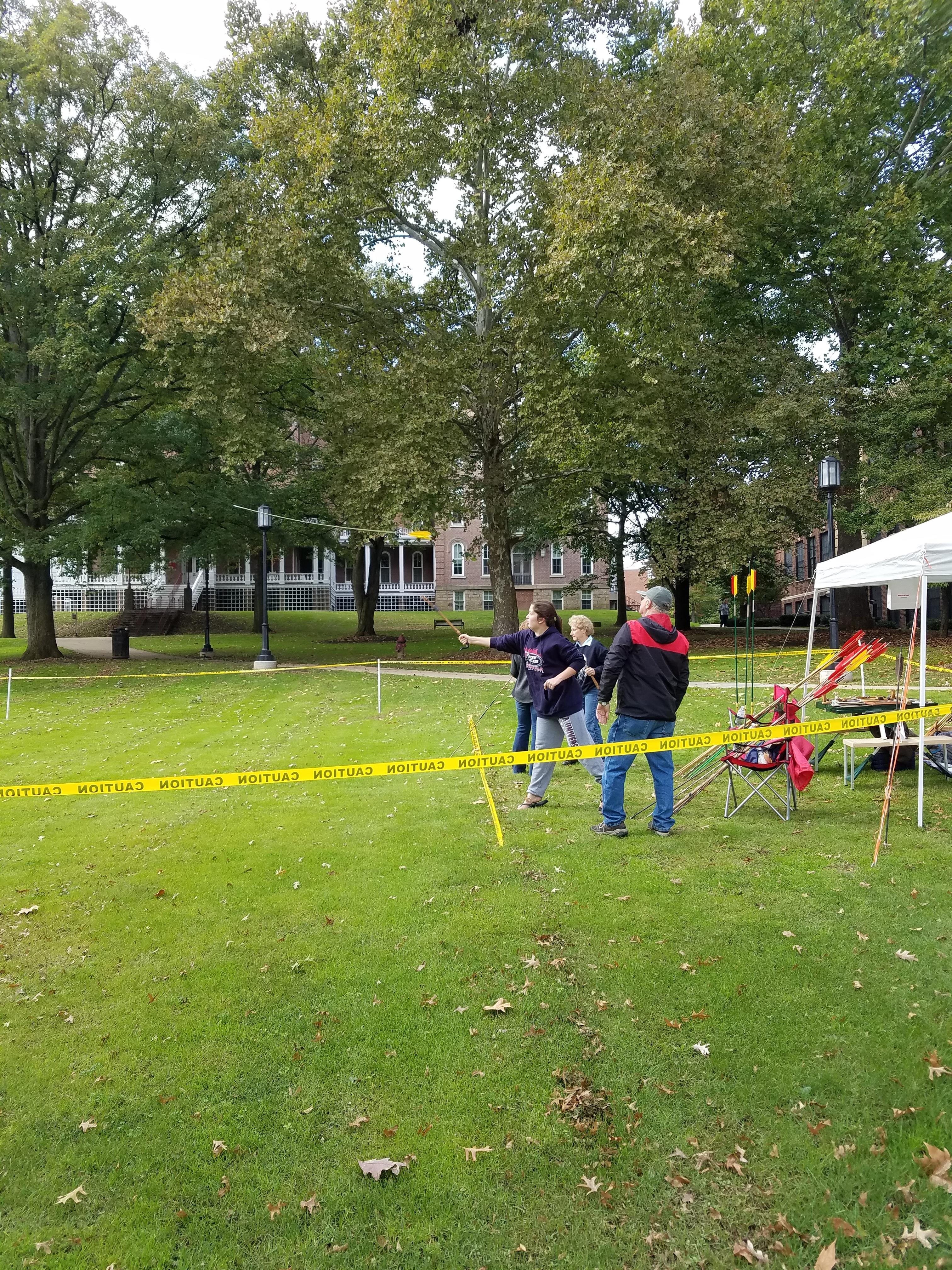
This past Saturday, in the middle of midterms, we hosted our annual International Archaeology Day Open House.  For once in Indiana, PA the weather decided to surprise us in a kind manner.  For what was supposed to be a day of rain turned into a rather nice day even if it was a little chilly.    It made for a spectacular Archaeology Day.  The weather was good enough for our largest attraction to be set up, the atlatl range!  You don’t even need to know the word atlatl to know that throwing spears is incredibly fun.  Though I will clarify, an atlatl is a tool that extends your reach and lets you throw a spear harder and farther than you could without.

Andy the atlatl guy talking a guest through how to use an atlatl.

She hit the target.

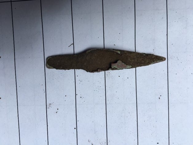
After being drawn in by the tempting offer of spear throwing, there was a whole floor of McElhaney dedicated to archaeology in various forms.  From historic and pre-contact artifacts to flotation, zooarchaeology, archaeology in the media and more.  Frankly it would be more fun to just show you so take a little look below.

Chris showing off a bow he made.

Tyler shows folks the ropes (and how they are made)

Chris showing off his knowledge of pre-contact tech.

Jessie handling the pre-contact table.

Janee running the zooarchaeology table.

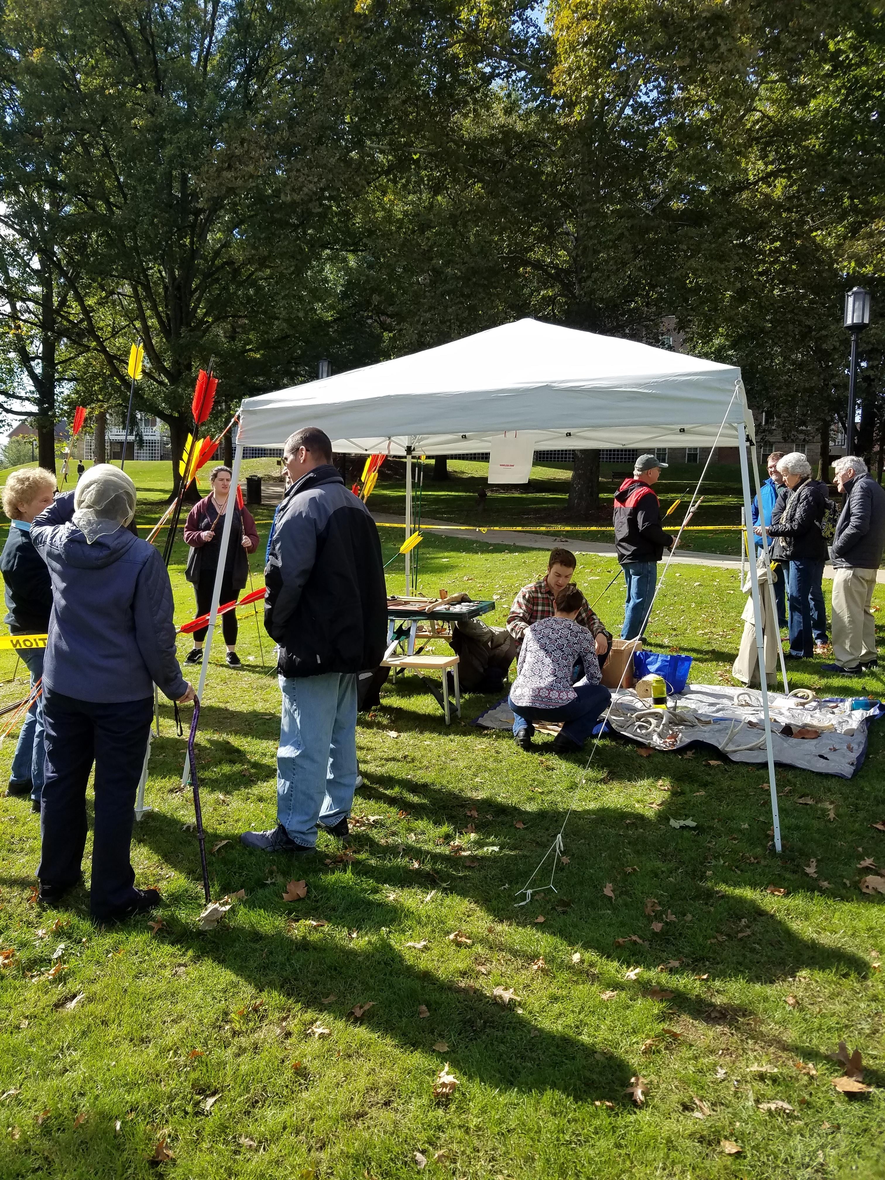
A nice gathering of folks around the atlatls and pre-contact technologies.

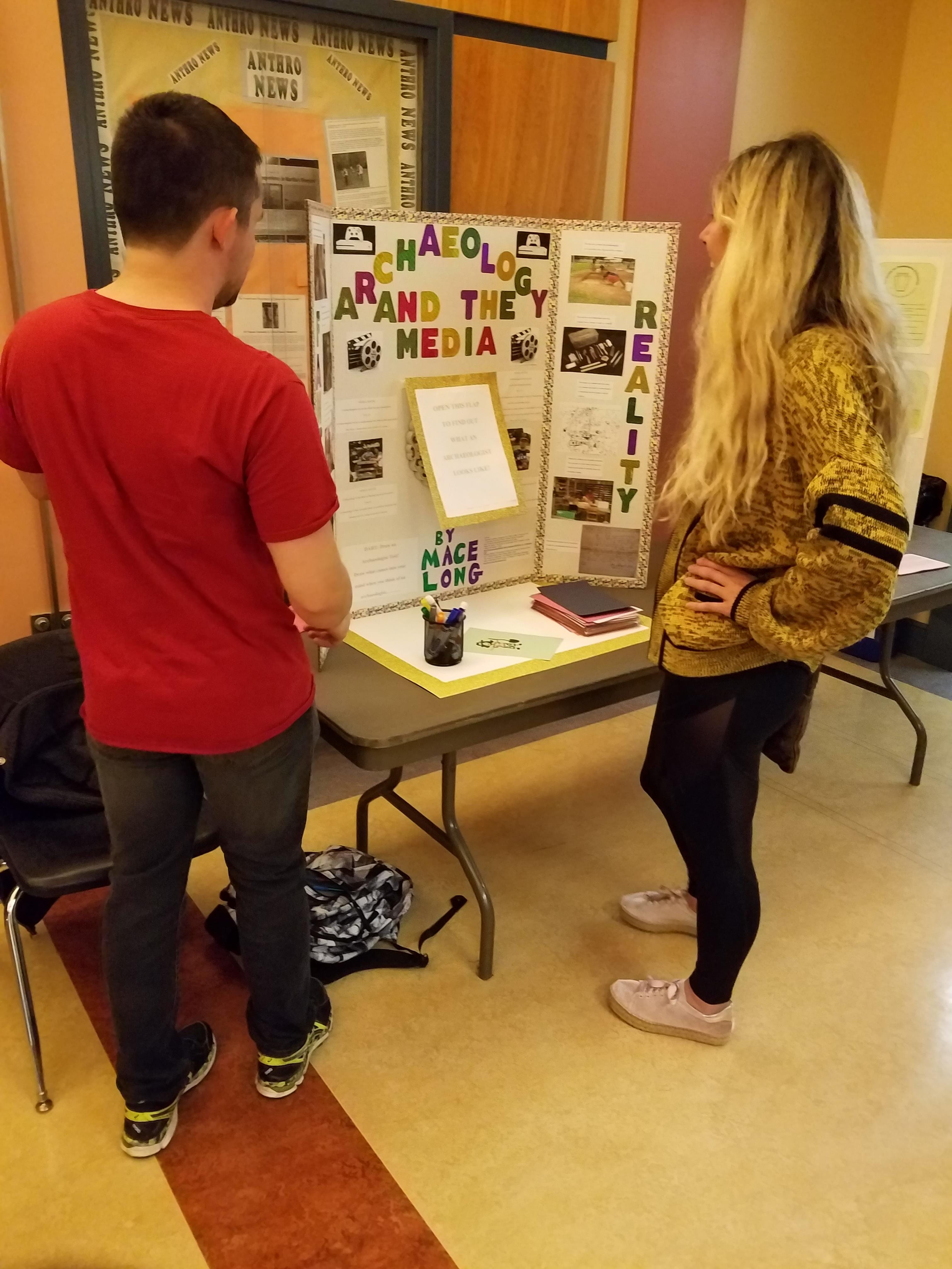
Mace shows what a real archaeologist looks like. *SPOILER: There’s a mirror in the center*

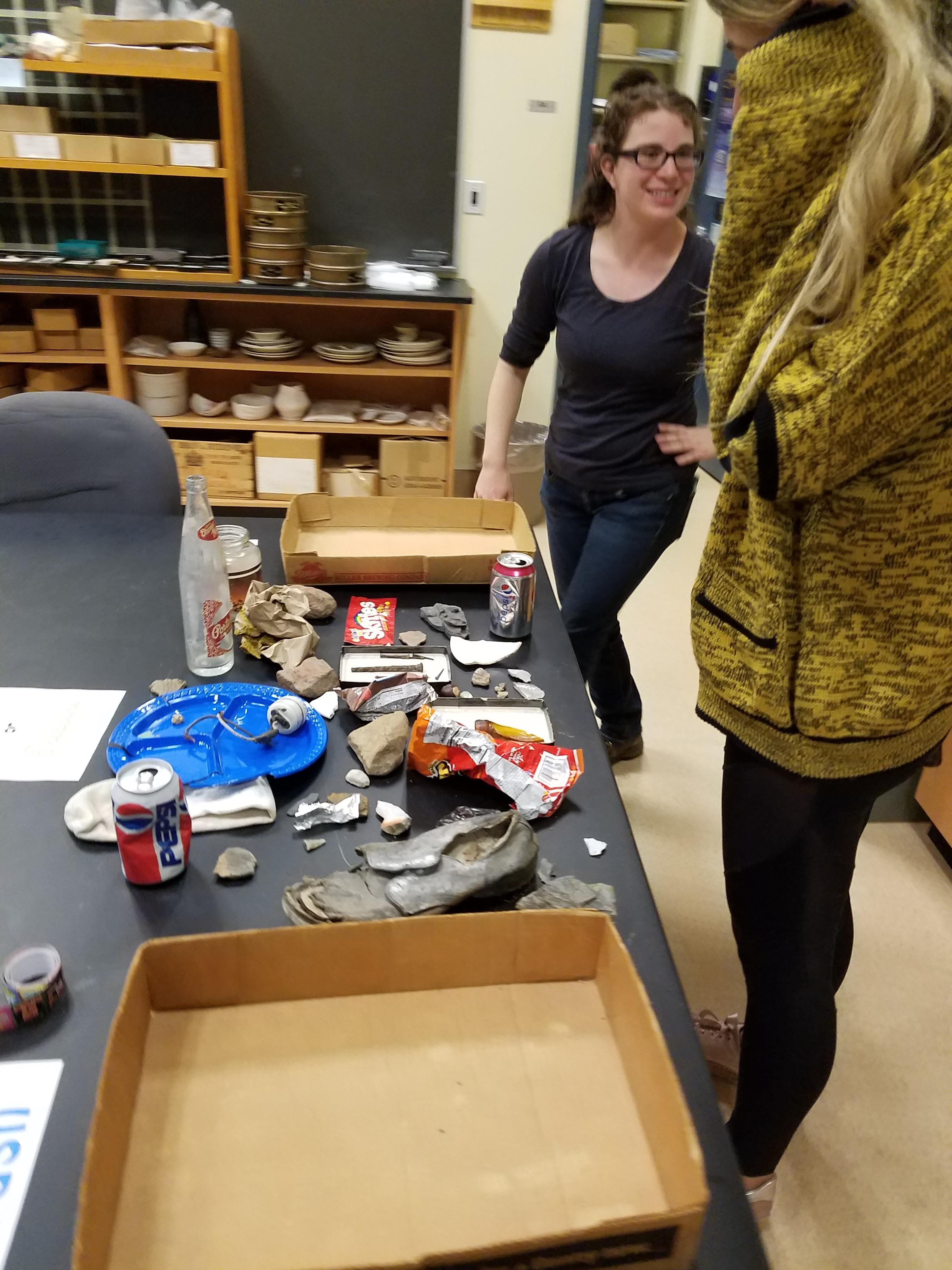
Is it trash or treasure? Well, Angela’s reluctance to be in a photo definitely created a treasure.

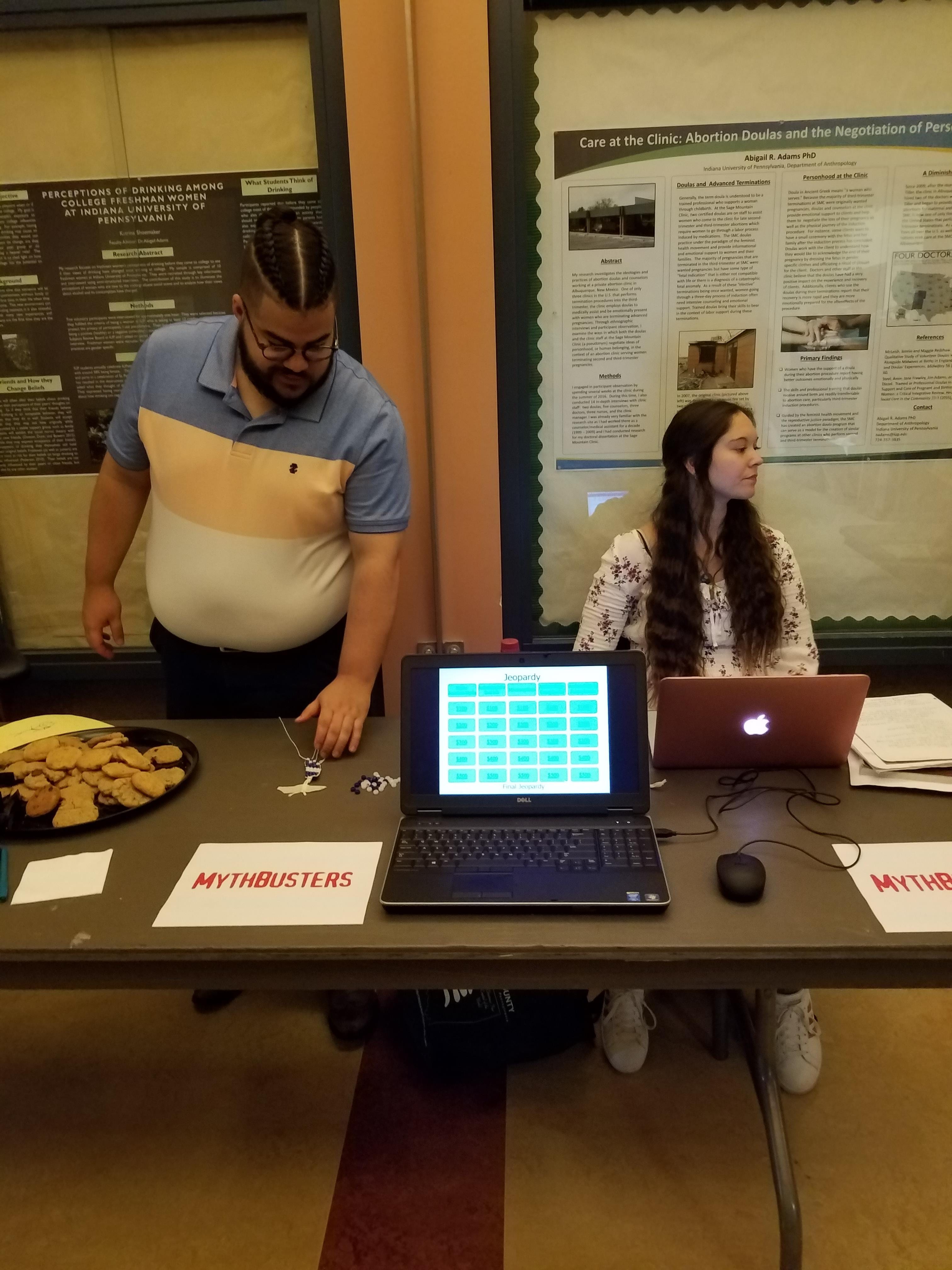
Carlos and Heather bustin’ myths about archaeology.

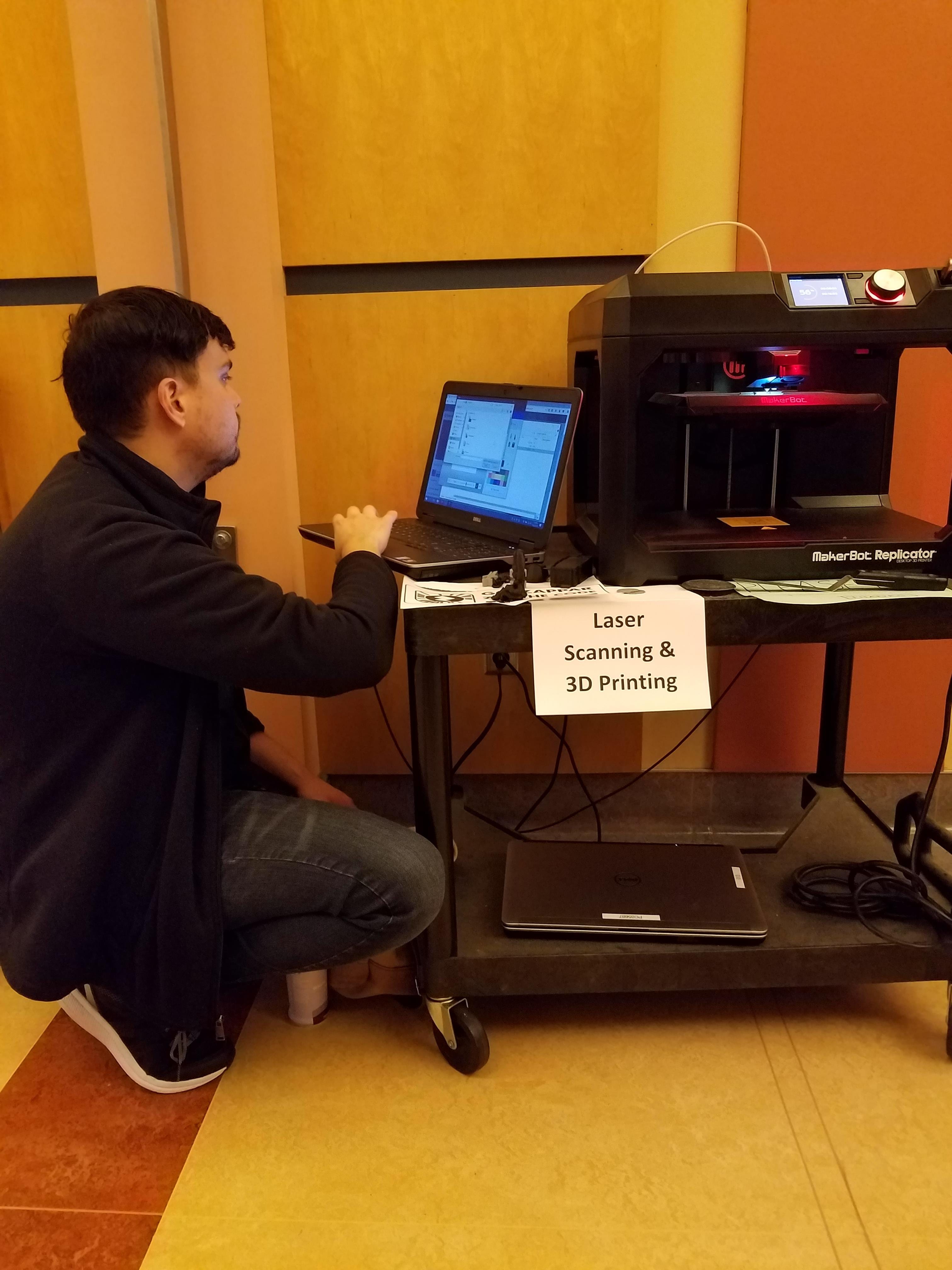
Jared does his thing with the 3D printer.

Brianna talks shop about hominin and hominid skulls

I would like to share a few final thoughts and I encourage replies in the comment section below. We had a smaller turnout this year than years past.  That was partly advertising, partly weather, and partly timing as this year’s Archaeology Day did not fall along homecoming.  I’m nowhere near disappointed though.  Actually, it’s the opposite, I’m ecstatic because those who showed up took interest in what we had to offer.  Quite a few people hung around for a good hour or so (a third of the events length) and asked questions.  There’s a part of me that wants to reach out to as many people as possible but if overall numbers drop while engagement is increased, I’m fine with that.  I wonder if people were more willing and eager to engage because the turnout was smaller, there wasn’t a feeling that you needed to rush along.

I would like to give a special thanks to Andy and Lori Majorsky for giving their awesome atlatl demonstrations, Susanna Haney for the flint knapping demo, and last, but certainly not least, everyone that came together to make Archaeology Day a success!

IUP Anthropology Department

Monitoring at Fort Necessity

By: Matthew Bjorkman

 Over the summer I was the crew chief for a monitoring project at Fort Necessity in Farmington, PA. This was my first opportunity to work professionally as a crew chief, as well as my first experience with monitoring work. Monitoring is different than most archaeology jobs. Our job was to watch and monitor a construction crew working at the site, and make sure that no archaeological resources were disturbed. If archaeological resources were unearthed, we would need to excavate and document the resources in a timely manner, so work could continue. The crew and I would also have to provide information to the construction crew, comprised of non-archaeologists, about what we were seeing and about the possible impacts the construction could have on archaeological features or artifacts.

The machinery and crews at work.

The construction crew was working to remove an old parking lot and retention pond that were constructed by the Civilian Conservation Corp (CCC) in the 1930s. At the time of the construction of the parking lot and retention berm, the National Park Service (NPS) had a philosophy of getting visitors as close to the park as the possible and having the park in good condition to receive these visitors. The CCC parking lot is located just northeast of the reconstructed fort, so close that visitors at the time would not even need to exit their vehicle to see the fort. The retention pond was constructed to help control drainage and make the park more accessible. For some back story, Fort Necessity is located in a large, natural clearing called the Great Meadows. At the time of the battle in 1754, the Great meadows would have been less inviting to human traffic than it is today. The two creeks in the meadow (Great Meadow Run and Indian Run) would have snaked through the meadow and would have been surrounded by grasses and wetland plants. By all accounts, the Great Meadows was a wet place, especially during the Pennsylvania summers when thunderstorms routinely pummel the area. Long story short, when the land became a national park, multiple modifications were made to the landscape for the sake of the visitors. Today, the NPS has a new philosophy about presenting Fort Necessity to the public. In 2016, the NPS began implementing the Great Meadows Restoration Project to remove artificial landscape modifications (among other things) to restore the Great Meadows to how it would have appeared in 1754. The project that the crew and I got to work on was a part of this project.

As the work began it became very apparent that monitoring is not like the other projects that I have worked on in the past. It is MUCH easier. We did not have to dig through clay in the hot, summer sun. Instead, we got to watch large machinery do it for us. The CCC parking lot is not like a typical asphalt parking lot we are all familiar with. This parking lot was created using fill, mostly clay, that was packed down to create an impervious surface for vehicles to drive on. The parking lot was buried over the years by topsoil and vegetation that had grown over it after the parking lot went out of use just a few years after it was constructed. The construction crew removed the topsoil with a bulldozer and a trackhoe at an impressive rate (minus the rain delays, because, Pennsylvania).

As the topsoil was removed, the crew used metal detectors to look for metallic artifacts and walked across the area to visually inspect for other artifacts. After the topsoil was removed, the construction crew began removing the parking lot fill layer. This was when communication between the archaeology crew and the construction crew was the most important. Underlying the parking lot fill is the historic A horizon, or in other words the historic ground surface. It was this layer that we did not want to dig through as it has a high potential to have archaeological resources. It may seem funny to hear that the archaeologists did not want to find artifacts. However, this project was not an excavation, it was to monitor the construction to ensure archaeological resources were not affected. As the construction crew moved through the fill, we needed to be vigilant and prepared to stop the machine operators if features appeared, or before the historic A horizon was contacted. Thankfully, the crew and I were able to develop a good working relationship with the operators (they even let me sit in one of the machines and showed me how it works!) and develop trust in each other’s expertise.  In all, the removal of the parking lot and retention pond went very smoothly.

I said earlier that our goal was not to find artifacts, but we did find some interesting things that are worth reporting in this blog post.

Figure 1: Yale padlock faceplate.

The metal detectors helped us locate some items of interest. We found a Yale brand padlock faceplate (Figure 1) that probably dates to the late 1890s- early 1900s. The bulldozer pulled up the base of an old flagpole (Figure 2) that once stood in the field as well as a US Department of Interior survey datum marker (Figure 3). A side note, in the picture you will notice that printed on the survey datum are the words “Unlawful to disturb,” and when we pulled this up I got very nervous, but it all turned out well. My two crew members (Shout out to Britney Elsbury-Orris and Hannah Winters) located three articulating pieces of a blue transfer print ceramic vessel (Figure 4). Lastly, in the parking lot fill layer, we located a completely intact glass insulator (Figure 5), that were commonly used on telegraph lines in the 19th and 20th centuries.

Figure 2: Flagpole base that got pulled up by the bulldozer.

Figure 3: US Department of Interior survey datum.

Figure 4: Articulating blue transfer print ceramic pieces with Romantic style design.

Figure 5: Glass insulator located in the parking lot fill.

In all the project was a great experience for everyone on the crew. Fort Necessity is a wonderful and notable place that I have had the pleasure of working at over the last two summers. I was personally able to gain valuable experience leading a crew, but more importantly I learned how to interact with the construction crew and develop a working relationship that allowed for the project to go smoothly. The guys working the machines were a pleasure to work with and I hope I can work with them again on a project someday. Lastly, go visit Fort Necessity National Battlefield! It’s free, fun, and not that far from Indiana or Pittsburgh. While you are there make sure to visit Jumonville Glen and Braddock’s Grave which are located just up the road from the fort.


IUP Anthropology Department

I Can Munsell That (Part 2)

Welcome everyone, it’s time for another edition of my personal favorite posting series, “I Can Munsell That.”  Today we have a special guest, Mr. Bonejangles!  Mr. Bonejangles, do you have anything to say to our wonderful audience?  Oh, I guess you can’t really talk without lips or a tongue or lungs or some form of Re-Animator fluid…  You know what Mr. Bonejangles, we’ll get to work on that as soon as this post is finished.

I don’t know if that’s what it’s called.  It’s a nutcracker that’s been sitting in this office for I don’t know how long.  It looks a little spooky, so I’m just going to assume he’d be a spooky bloke with some wise guy sense of humor, chattering his teeth at jokes or in between some skeletal pun.

As I’m sure you can see, Mr. Bonejangles is a very photogenic skeleton/nutcracker.  However, he does not fit well with a Munsell Soil Color Book.  His colors are a little too glossy to truly match so a few are as close as I could reasonably match.  Bonejangles has five main colors that seem relatively consistent throughout, though there may be some variance in shading, lighting, thickness of paint, or my eyes playing tricks on me.  Mr. B. has two shades of white that I matched closely with colors on the White Page (who would’ve guessed).  The white used for his skeleton minus the skull looked to be 9.5/N (white) and the white of his skull 8/N (white).  Then there is the shiny black which I matched closest on Gley 1 with 2.5/N (black).  I do think his color could be better matched, however I did not have access to a page devoted to the differences between dark black and slightly darker black.  Bonejangles also has these brilliant green highlights along his skull which matched almost perfectly (in my eye) with 10Y 6/4 (pale olive).  Finally, the final color that makes his spookiness pop, bright red eyes, which look like 10R 3/6 (dark red) or at least that’s the closest color I could find.  I admit his eyes are a bit too bright but I must work with what I have.

I would like to leave you on a side note, IUP Anthropology Department is hosting an Open House for International Archaeology Day on Oct. 20th from 12:00-3:00pm on the ground floor of McElhaney Hall.  We are displaying artifacts, faunal specimens, student research, flintknapping and atlatl demonstrations outside (weather permitting).  We hope to see you there!


IUP Anthropology Department

Isle Royale National Park

By: Genevieve Everett


If someone told me a year ago I’d be living and working at Isle Royale National Park (ISRO in NPS speak) in the middle of Lake Superior, I would have said, “Where?” Obviously, I knew where Lake Superior was, but I knew nothing about the cultural history and the archaeology of the region, especially that of Isle Royale. Once I heard about the job/Pathways internship (thank you Danielle!), I began the arduous process of applying on USAJobs.com. After a month or more of waiting, I was offered a position as a seasonal Arch Tech for ISRO! May 29th came fast, and before I knew it, I was on the Ranger III floating across Lake Superior to one of the most beautiful places I’ve ever had the pleasure of living and working for three plus months.

An office with a view!

A little background on the island…Isle Royale became a National Park in 1940, opening it up to the American public, and protecting it from further development. Before the inception of the park, Euro American fisheries and cabins dotted the shorelines, mining companies prospected for copper, and long before that, native peoples utilized the island, “Minong”, meaning “The Good Place”, for its plentiful resources, including caribou, sugar maple, and fish. Additionally, the island is one of the first places where American Indians mined copper industriously, which is best exampled at Minong Mine on the island’s north shore.   All these histories are intertwined into a complex network of traditional beliefs, stories, and experiences that make this place so intriguing.

Marley in front of one of the prehistoric copper mining pits

This summer I got to work with a fantastic group of people: my supervisor, Seth DePasqual, and my two co-workers, Marley Chynoweth and Rudy Martinez II. Throughout the summer, we performed site monitors around the island, checking on existing sites, assessing their condition and potential threats. For example, some sites are near the shoreline where there is potential for erosion. It is our job to record this and make a determination for future remediation. Another project that I really enjoyed was a pedestrian survey to find an early 20th century fur trappers cabin near one of the inland lakes. All that we knew was that it was at the southwest end of the lake, which covered a large swath of land. Several of our sites were only accessible by water, so, we got to spend a lot of time paddling! In addition, Marley and I had a chance to leave the island for a week to work at a Fur Trade site with our friend Danielle (IUP Applied Arch alumna) along the Grand Portage in Minnesota. Several trade items were recovered from this site, including, glass beads and tinkling cones.

2018 ISRO CRM crew on the trusty Nighthawk!

For me, the highlight of this summer was the Relict Shoreline Survey (RSS). The relict shoreline or Nipissing (ca. 5,000 years B.P.) lake water levels were much higher than they are today. Using GIS and LiDAR, Seth located areas along the old Nipissing shoreline that might have a good place to land a canoe back in the day.  Using a Garmin GPS, we would bushwhack to these areas. Today, they do not look like the beaches that they were 5 millennia ago, instead, there are thick groves of trees and other vegetation. It isn’t until you sink a shovel test in that you tend to find fine beach sands and pebbles. We had a lot of success in locating new sites this summer, all of which had chipped stone artifacts and/or copper (modified/natural) artifacts.

Danielle and Marley showing off a copper knife with tang from one of the Nipissing sites

Small copper point found in a tree throw at a Nipissing site

As a kid I wanted to go to sleep away summer camp, but never did. Well, that wish came true this summer, because living at Isle Royale was like adult summer camp. On the weekends I’d hike the Mott loop, a 2.7 mile trail on Mott that has some of the most beautiful views (in my opinion) on the island, picking wild blueberries along the way. Early in the summer, I took a weekend trip to Amygdaloid Island with some friends to see more of the north shore. That same weekend, we hiked back from McCargoe Cove, down past West Chickenbone Lake (lots of moose there), east along the Greenstone, up to the Ojibway Tower, and back down to Daisy Farm. I caught my first ever lake trout. I swam in the cold, cold waters of Lake Superior at night, and quickly ran back to the sauna to warm up. Got to go to the Rock of Ages lighthouse, that is being restored back to its original glory by https://rockofageslps.org/. Was part of a Search and Rescue (SAR) crew, carrying an injured visitor out of the back country on a litter. Kayaked from Mott to Rock Harbor, and back again on a particularly calm day…..

Kayaking down Lorelei Lane

My “backyard”

Rock of Ages Lighthouse

Okay, I’m done blabbering on. The point is, this was an incredible summer filled with so many personal and professional experiences that I will never forget. By extension, I feel more confident in my abilities as an archaeologist. While it was hard to leave the island last week, I am ready to take on the next challenge…hopefully somewhere just or equally as beautiful as Isle Royale.

IUP Anthropology Department