Building a Career in Cultural Resource Management Archaeology

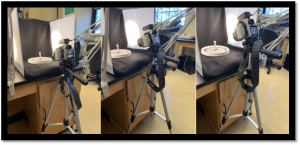
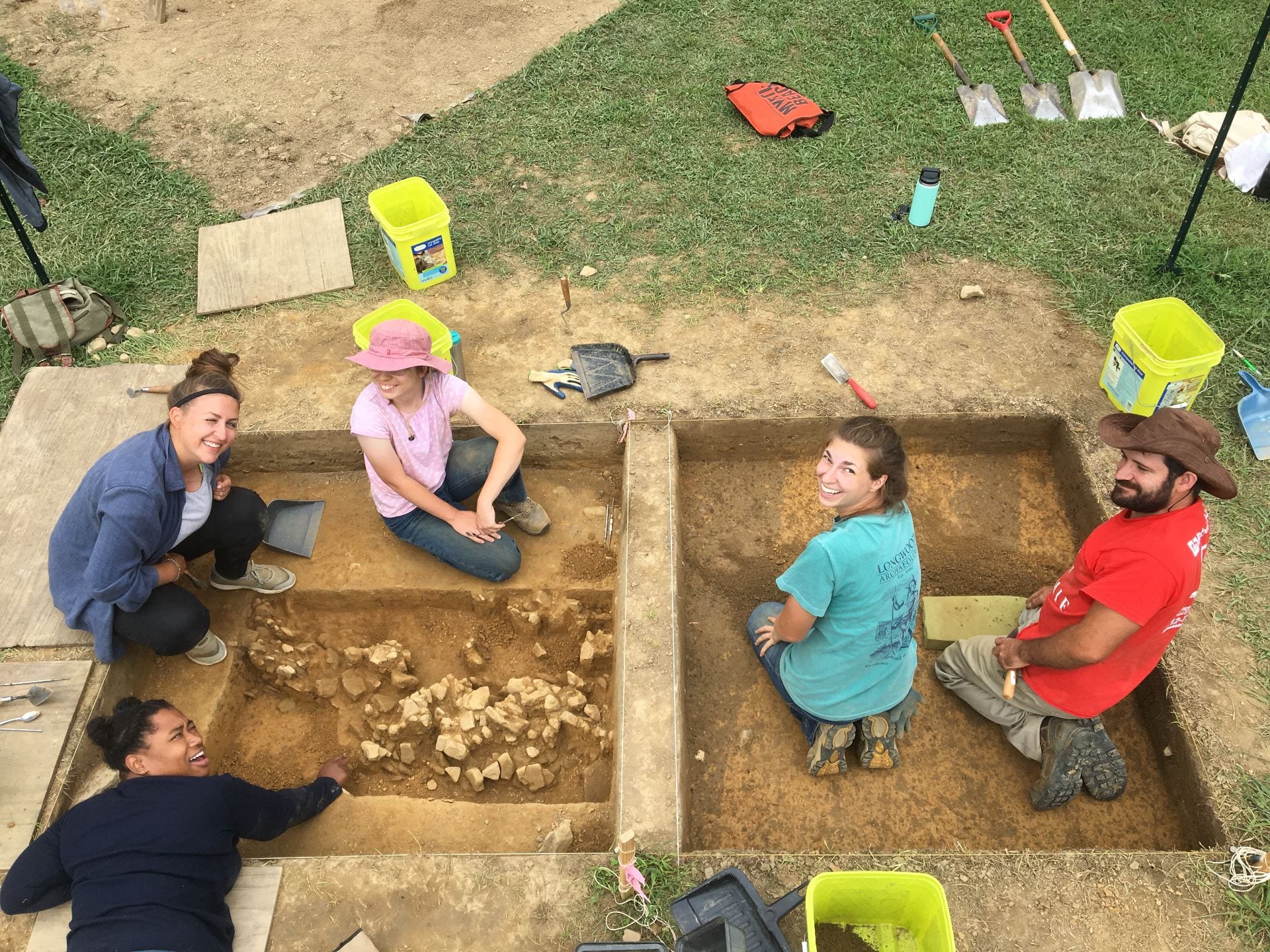
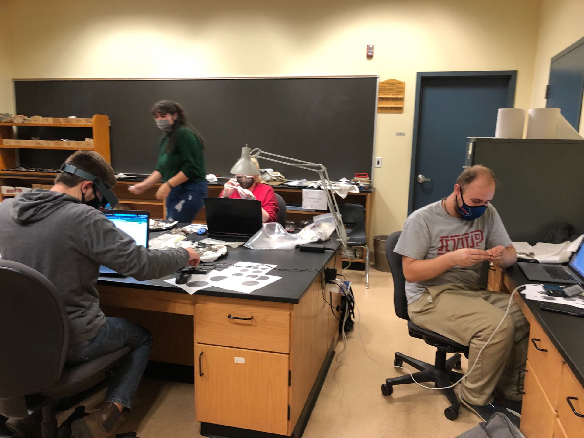
On April 5th, not only were students participating in Scholars Forum here at IUP, but we also invited students to our final Graduate Colloquium of the semester, which was a Virtual CRM Workshop. Hosted by The Eastern States Archaeological Federation Student Engagement Committee, Dr. David Leslie invited students and early career archaeologists to a presentation on applying for jobs in cultural resource management (CRM). Dr. Leslie is the Director of Archaeological Research and a Principal Investigator for Heritage Consultants, LLC in Connecticut. His goal of his presentation on Building a Career in Cultural Resource Management in Archaeology, was to provide useful advice on getting started in this growing field and provide students with more knowledge on how to advance their careers in archaeology.

The presentation began with an overview of CRM before discussing career paths. Over 90% of the archaeology that occurs in the United States is completed in a CRM setting; CRM is generally done at a faster pace than academic archaeology. There are three phases of excavation in CRM archaeology, Phase I, II, and III, but there can be many exceptions to this tradition structure. When a survey first takes place, they happen in conjunction with participating stakeholders. Stakeholders can include Federal and State recognized Native American Indian tribes, Federal Agencies, SHPO (State Historic Preservation Officer) offices, property owners, historical societies, the general public, and more. Coordination with all potential stakeholders is required both before and during each phase of the project.

During a Phase IA Survey, site identification is the main objective. It involves an assessment of a project area typically involving a bureaucratic organization (SHPO), archaeologists in CRM, and/or municipal offices, in order to identify if a parcel is archaeology sensitive. Besides excavating, soil coring is also another way to do a Phase I survey. In a Phase IB survey, one determines if an archaeological site is present within a project area, which is generally done through shovel test pit (STPs) surveys; and the presenter noted that the best surveys are done using a systematic grid survey at this stage, with judgmentally placed STPs as well. These intervals vary but are generally between 15 and 7.5 meters depending on the sensitivity and project size. The Mid-Atlantic region of the U.S. is also in feet, with intervals between 50 and 25 feet. The presenter then described Phase II surveys. They noted that during this phase, the goal is to try to determine the spatial boundaries of the site within the project area, which includes the horizontal and vertical stratigraphy of the site. To test the site at higher intervals, additional STPs, at around 5 m or 16 ft intervals, are opened, and selected excavation units (EUs) are opened, around 1×1 m or 5×5 ft in the Mid-Atlantic region. Geophysical assessments of the sites are also conducted. During the Phase II process the site will be assessed for significance at the federal, state, and local levels, which vary in their specific criteria. During the Phase III process, if the site is eligible for the National Register, or some other state or local preservation, it must be avoided by development, or the effects of the development must be mitigated. Avoidance is preferred, but not generally prudent or feasible, as infrastructure projects may outweigh preservation in place or resources. Mitigation for archaeology generally involves excavation of a site and specialized analyses of the material record. Because most sites are Eligible for the National register under Criteria D (research potential), mitigation is most common as a Data Recovery Program (DPR), typically as widescale excavations. The percentage of the site excavated may differ depending on the data recovery efforts. However, while rate, it could in clue up to 100% of the site within the project area, but more generally, anywhere between 3%-5% of the site, if a large project area, or 20-30%, if a small project area, are excavated. Sometimes DPRs include partnering with academic or for-profit labs, depending on site type, importance, funding sources, etc. Some examples include, expanding documentary or deed research, microscopic use-wear analysis, protein residue analysis, radiocarbon or OSL dating, geochemical analysis, and more. You can find published examples of DPRs in academic journals, at presentations at conferences, at public presentation, in public booklets and websites, etc. The presentation then focused on other CRM projects and tasks that can be undertaken including burial ground investigations, using GPR/Magnetometer/Resistivity/UAV, conducing architectural history assessments, battlefield surveys, and metal detecting surveys, as well.

Careers in CRM where then discussed. It was explained that most undergrads or graduate students without field experience start out as field technicians. To beef up ones resume or experience they can volunteer locally or seek out CRM firm internships. Starting out as a field technician though does provide a good, grounded perspective on field data collection, the speed of surveys, and the comradery of archaeological field crews. Basically, everyone starts out at this level. Field technicians are generally those with an undergraduate degree in anthropology or archaeology, or some related field. They need to have successfully completed and archaeological field school, local ones versus ones abroad are generally preferred by CRM companies. Most of the training as a field tech will be specific to paperwork, field techniques, and more, which will vary from company to company. The presenters commented that there are many different ways to conduct good archaeology, but these can vary between academic field schools and places you have previously worked at. While an M.A. in archaeology is certainly valuable and can aid you in a career in CRM, the presenters noted that you should not expect a supervisory position without commensurate (to the supervisory position) field experience in CRM. A field director leads a group of field technicians, ensures that the job is completed on schedule, lays out STPs and EUs for and with the crew, manages the crew in the field, conducts quality control of the excavation techniques applied by the crew, ensures that the paperwork is accurate and complete, and often has two or three years of field experiences (which is typically required as well). A project archaeologist manages several field projects, may visit sites and lead field crews, can spend more time in the field for complicated surveys (Phase II and III), writes portions or entire technical reports, conducts data analyses depending on their skill set (e.g., lithic analysis, zooarchaeological, spatial), typically needs to have several years of experience under their belt, and generally an M.A. is required.

The presentation then turned to careers in CRM. Certain skills are required, and depending on the course that you take or have access to, you can become specialized in a range of fields that align and enhance your CRM work. Training in and experience with GIS, total station or UAV surveys, human osteology, zooarchaeology, lithics analysis, historical deeds, mapping, or documentary research, geology, sedimentology, ceramic analyses, collections based work, soil flotation, artifact identification, artifact conservation, public history, art and architectural history, and more, are all skills and knowledge that would be useful to have a background in before entering a career in CRM. While many of these analyses are specialized, there may be departments or classes you can take to learn some of these skills during you time in undergrad and grad school. The presenters suggested that in undergrad you should think about minoring in GIS, geodesy (survey), geology, history, geography, remote sensing, biology, chemistry, and/or environmental studies. In grad school, they suggested that students focus on coursework in any of these fields as well.

The presenters also made suggestions for creating an appealing resume for CRM firms. They suggest that you play to your strengths, emphasize your field schools, archaeological experiences, and other related skills. You should denote your education level, list professional memberships, put in other previous jobs if light on archaeological fieldwork, and include any archaeo-specific computer programs you have experience with (e.g., artifact database intry, ArcGIS, Surfer, Metashape). They noted that it is ok if you resume is only one or two pages long at this stage, and that you should not include basic computer skills on your resume, as it is assumed that people should have these (classist, but a requirement for the job, as well).

The presenters claim that there has never been a better time to be employed in CRM, than now. They predict that the gross annual domestic spending on CRM from 2022-2031 is expected to rise from $1.46 to $1.85 billion. It is also expected that there is to be more than 11,000 jobs in CRM created in the upcoming decade, of which around 8,000 will be archaeologists. There is currently a job shortage in CRM at all stages, field technicians, crew chiefs, project archaeologists, and project managers, which has resulted in wage increases across all jobs. Field technicians in the Northeast five years ago were paid $15-16 an hour and can now expect $18-$22 depending on their experience. Per diem rates ($40-$50 per day) and mileage reimbursements are now more standard, and there are potentially higher rates in other parts of the country too. With an example position of a field tech with a B.A. and limited experience, they were expected to make around ~48K per year, from their hourly wage, per diem, and milage. Rates will continue to increase during the job crunch, and field directors and project archaeologists can expect an hourly rate of $23 or potentially higher, depending on experience.

The Zoom presentation was then opened discussion, with Heritage Consultants stating that they were hiring for field technician positions at around $18-22 an hour, and $45 a day per diem & milage. There is also another Zoom call on April 26th by the White Mountain National Forest via the New Hampshire Archaeology Society, which will discuss opportunities in archaeology centered on the different aspects of positions within federal agencies. It was a great presentation, informative and educational, and perfect for someone who needed either a refresher on CRM or just a basic overview!

Follow IUP Anthropology on FacebookTwitter, and Instagram


Green Cabin Quarry Rhyolite Flakes: By Dr. Lara Homsey-Messer

Several undergraduate and graduate students are working in the IUP Archaeology lab processing thousands to rhyolite flakes excavated from the Green Cabin quarry site, located in Adams County, PA, on the hillslopes of South Mountain, just east of the Carbaugh Run Natural Area. Green Cabin is one of hundreds of quarry loci where rhyolite for making stone tools was quarried prehistorically in the South Mountain region.

The Precambrian-aged rhyolite in South Mountain originated as lava over 500 million years ago. About 250 million years ago, this lava was altered by heat and pressure associated with mountain building resulting from the collision of North America and Africa. This process resulted in a strong, fine-grained, and intergranular texture conducive to knapping into stone tools. Rhyolite varies widely in color and texture, sometimes even within one quarry location. During the Archaic and Woodland cultural periods, Native Americans quarried for high-quality material in pits measuring approximately 6-8 feet in depth and 20 feet in diameter. Today, the quarry pits appear as subtle depressions that have been backfilled prehistorically by the excavation of adjacent pits, as well as historically by erosion and vegetative debris.

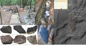
What has long puzzled archaeologists is why prehistoric people went to so much work to dig pits down to bedrock when it could have been more easily collected from the surface. The other question of interest is why they quarried in some locations and not others where rhyolite outcrops. In order to help answer these questions, and with a permit from the PA SHPO and DCNR, Paul Marr of Shippensburg University began excavating the Green Cabin site in 2020. Thousands of flakes and debitage were recovered from 3 pits approximately a meter deep each.

Students are conducting a lithic and geologic analysis of the material. This includes measuring the size of the flakes, determining the type of flake, as well as describing the geology in terms of color, texture, volcanic structures and phenocrysts (i.e., large crystals of quartz and potassium feldspar embedded in the fine-grained groundmass).

Usually, quarry lithics exhibit evidence for early-stage reduction:  large flakes with a lot of weathering rind on them—this cortex must be removed in order to evaluate the suitability of the stone for knapping, and to reduce the initial size of cobbles for transport elsewhere for further reduction. But at Green Cabin, we were surprised to find a large proportion of small, later stage reduction flakes, suggestion that more reduction was happening at this quarry then one would expect.

The answer may lie partly in the unique geologic setting of Green Cabin itself. Marr notes several anomalous features: the site sits on a mid-slope bench rather than a ridgetop like most of the quarries; there are no outcrops of similar rhyolite within several hundred meter; and it is covered by a thick layer of colluvium, such that bedrock is very deep here—the prehistoric miners were not digging to bedrock in this location.  Marr argues that this flow of material plucked fractured bedrock from upslope and moved it downhill, making quality rhyolite available near the surface.

Work is ongoing and is expected to continue into the spring semester. We also anticipate comparing the material from Green Cabin to material excavated at ridgetop quarry sites in the region. As we increase our sample size and see a wider array of material from other sites, we hope to be able to answer some of the questions related to selection criteria, quarry location, and why the quarried material was reduced further here than at other quarry locations.

For more information visit: https://www.iup.edu/anthropology/research/antiquity-of-the-south-mountain-landscape.htmlv

September Colloquium: What We Did This Summer/Recently

This Wednesday, the 22nd, six of our Applied Archaeology graduate students at Indiana University of Pennsylvania presented at our monthly colloquium on What We Did This Summer/Recently. We heard from some amazingly talented students, eager to share their adventures and discoveries!

First year graduate student Emma Frauendienst.

First year graduate student Emma Frauendienst.

After a great introduction from Dr. Lara Homsey-Messer, Emma Frauendienst started us off with her presentation about her summer fieldwork at the Poverty Point World Heritage Site. Poverty Point, one of the largest Archaic Period sites in North America, is located in Louisiana. Her work, titled Downhole Geophysical Investigations of the West Plaza Rise at the Poverty Point World Heritage Site, began after receiving a grant, and facing both covid and flooding setbacks. Her team extracted 21 new soil cores, focusing on the West Plaza Rise to determine if it was a natural or constructed feature. After analysis of the cores and magnetic susceptibility data showing heavy cultural fill, it was determined that the West Plaza Rise was culturally constructed!

First year graduate students Mikala Hardie and Richard Farley.

Mikala Hardie and Richard Farley then discussed their experiences as Graduate Assistants during IUP’s Newport Field School. Newport, a small shipping town located along the Conemaugh River, was occupied from around 1790 into the early 19th century. The excavation began with shovel test pits, ground penetrating radar, and several test units, before excavation units were opened. The woods crew, led by Mikala, worked to find the walls of the general store, while also uncovering artifacts such as, porcelain, faunal remains, mochaware, and a builder’s trench, to name a few. The field crew, supervised by Richard, focused on finding the blacksmith shop and hotel, along the way uncovering post holes, slag, redware, pearlware, creamware, and transfer printed earthenware, among other things. The field school utilized photogrammetry, magnetometry, GPS, and a total station to also collect valuable information about the site. If anyone wants to know more about what it’s like as a graduate assistant at a field school, just ask Mikala and Richard, who also filled out forms and logs, took lots of pictures, and organized and supervised those working at the site!

Second year graduate student Ashely Nagle and first year graduate student Sonja Rossi-Williams.

Ashley Nagle and Sonja Rossi-Williams presented next about their time spent as Graduate Assistants in Lower Saxony, Germany at IUP’s Forensic Field School! From July to mid-August, they worked at a World War 2 B-24 aircraft crash site! They used GPR to first define the sides of their 2X2, and then used shovels more than trowels to remove the soil in their units. The team learned about archaeological methods and practices used in Germany and took several excursions across Germany, including to Hannover, Berlin, and Munich, making this an incredible cultural experience as well as archaeological. They did not find what they were looking for, an unaccounted-for soldier, but they did make progress on the site itself. The team were even featured in a German newspaper! In the future, the site will most likely undergo more excavations, hopefully by IUP students!

First year graduate student Luke Nicosia.

Luke Nicosia was the final presenter, recounting his internship in July and August this summer with the Landmark Society of Western New York, a historic preservation agency.  Founded in 1937, it is one of the oldest such societies in the US and seeks to advise property and homeowners on historic preservation planning and awareness, raise funding, and protect local historic sites. Luke conducted fee-for-service survey work and worked on their library projects. He edited site narratives and report drafts, finished reconnaissance on a survey on village properties, did covenant review, and worked in the library scanning and inventorying. He finished a massive slides project after scanning and digitizing over 80,000 slides over the course of many years (this is not his first time interning with the Landmark Society)! He also mentioned that there are many ways one can get involved in the field of historical preservation, many that align with the field of archaeology!

Thank you to all the presenters and everyone who attended our first colloquium of What We Did This Summer/Recently!

Hello Everyone! A Mini Introduction

Happy Labor Day! I hope everyone, especially the archaeologists out there, are getting plenty of rest today! My name is Bridget Roddy, and I am the new Public Archaeology Graduate Assistant. I am starting my first year in the graduate program for Applied Archaeology here at Indiana University of Pennsylvania. I completed my undergrad degree in 2020 from Ohio Wesleyan University, double majoring in Sociology/Anthropology and Psychology and minoring in International Studies. During my time there I received a grant to travel to Romania for a month for an archaeological excavation at the Roman fort of Halmyris. This strengthened my interest in archaeology, leading me here to IUP’s Master’s Program. I participated in the Newport Field School this summer, as well. My other interests and hobbies include, running, art, reading, photography, and traveling. I am excited to get started and if anyone has any questions or concerns about the blog, or if you are interested in submitting something to this page, please feel free to reach out to me through my email bzxcc@iup.edu!

Gage Huey Thesis: Social Zooarchaeology At the Philo II Village

Written by Gage Huey

Zooarchaeology, or the study of animal remains in archaeological contexts has addressed the utilitarian aspects of human-animal interaction through decades of research on nutrition, seasonality, domestication, and the various techniques of carcass procurement and processing used by hunting cultures across the globe. As a result, traditional zooarchaeological interpretations rarely address the non-utilitarian meaningfulness of animals to the peoples whose material cultures we study. The way that archaeologists tend to think about human and animal relationships in the past typically reflects the structures and assumptions from our own worldview. These assumptions situate animals as an Other to humans, they serve our needs and can be used by humans but are fundamentally a different Thing. Over the centuries, these constructed differences between human beings and nature became more naturalized, fitting seamlessly into the colonial worldview that characterizes our “modern world”. Because scientific paradigms like anthropology were constructed within this worldview and the structures it produces. The interpretations we make as scientists reflect these as well. I believe this has led to misinterpretation of animal bones present at precontact sites through a largely Western perspective.

Indigenous peoples across the world (and specifically here on Turtle Island) see and saw the natural world in ways that would be incompatible with traditional zooarchaeological interpretation. So, my thesis research engages with an assemblage of animal remains through a perspective that acknowledges that prior to the arrival of Europeans (and continuing until today), Native peoples engaged with the environment not in terms of utilization, but in terms of relationships. The assemblage I’ve analyzed is from the 13th century (c.700 BP) Fort Ancient village,

Philo II (33MU76) located in Gaysport, Ohio. This village was constructed alongside an especially nice stretch of the Muskingum River known as the Philo Bottoms. This floodplain was home to Indigenous Ohioans for centuries, evidenced by the mound complex on the ridge overlooking

Philo II. These folks would’ve made pottery out of clay and mussel shells collected from the river, shared their pit-houses with dogs and stored maize, and hunted a variety of animals. The bones of these animals frequently ended up in subterranean “storage pits”, and vary in their number, species, and bone type (element) from feature to feature. Within the 55 features I analyzed, 27% of the bones were so fragmented they could only be reliably identified as indeterminate vertebrate. The remainder of the bones were identified to species when possible, but were broadly 63% mammal, 3% bird, 2% reptile, and 5% fish. The Philo Peoples would have had stories, songs, and all manner of cultural practices that engaged with these creatures not as animals in the Western sense, but as non-human persons that participated in society just as the humans did.

These relationships likely were not thought of in

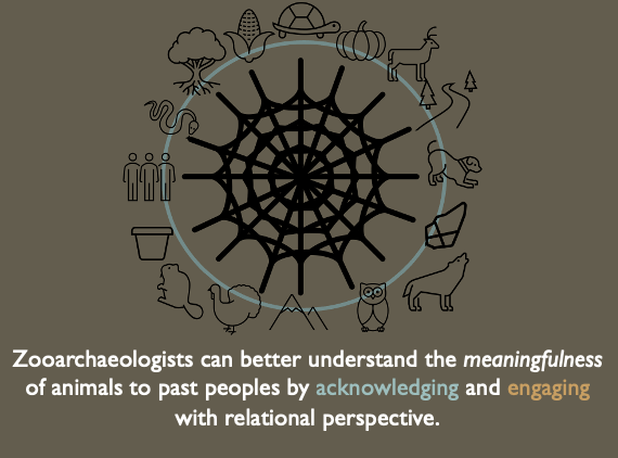
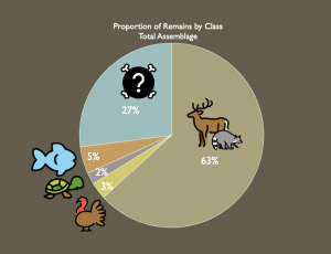
an allegorical or metaphorical sense, they were a historical, lived reality. Imagine that a great ceremony was to be held in the plaza of Philo II, and the ceremony required music. The turtles whose shells were harvested to make instruments for the ceremony were taking part in the ceremony itself. In one sense, they were there (i.e., the turtles were plentiful) because they wanted to be there. And because the turtles had graciously attended the feast, there were particular cultural practices to ensure that they were honored and would continue to engage with the people in this way.

Through my research, I am arguing that the pit features at Philo II are physical manifestations of the intersocial relationships between humans and non-human animal persons. The construction of these features would have disposed of animal bone and provided a means of constructing and naturalizing the relationships present between the Philo Peoples and the animals in which they shared an environment. They may also have connections to cultural practices of memory-making, linking them to their Late Woodland ancestors who moved great amounts of earth to combine bones, sediments, and artifacts into highly meaningful spaces. If zooarchaeologists acknowledge and engage with Indigenous scholars and the perspectives they bring to the field, it would provide an opportunity for old collections to be re-interpreted and analyzed in a new light that more accurately reflects the cultural context of the peoples whose cultures we study.

Follow IUP Anthropology on Facebook, Twitter, and Instagram

Jamie Kouba Thesis: Bringing Archaeology into the 3-Dimesional Age

Written by Jamie Kouba

The most daunting part of earning your master’s degree has got to be picking a thesis topic.  After a year of anxiety-inducing ideas coming and going, I was talking to a second-year graduate student about technological advances in archaeology and something finally clicked.  As it turns out, there is a real need to establish digital repositories of 3D osteology comparative collections of both human and non-human specimens for researchers.  Digital comparative collections are a valuable resource for

Jamie taking photographs of a bone to make her 3D model

zooarchaeologists, bioarcheologists, osteologists, and non-specialists alike.  When a bone is recovered in the field, there are several questions that must be addressed immediately.  First, is it bone?  Second, is it human or animal.  Typically, a bone specialist is called in to make identifications, or someone accesses a physical comparative collection and hopefully identifies the unknown element.  However, an expert is not always available, and physical collections take up a lot of space, money, and time to maintain, limiting access to them.  One of the ways to supplement those issues is to reference a digital collection.  There are numerous websites out there, including Bone ID, Idaho Virtual Museum, and Sketchfab.  Different websites use different formats for how they display their specimens.  For instance, Bone ID provides 2D images, and Idaho Virtual Museum provides 3D scans, and Sketchfab is loaded with photogrammetric 3D models.  This thesis was born out of one question: are all of these digital references equal in their ability to provide identifications?


While doing research, I found that there was a lot of information on 2D references and 3D scanned references, but very little on the use of photogrammetry to create 3D models.  I had a feeling that 3D photogrammetric models would be the most effective form of digital reference. Photogrammetry uses a

The photogrammetry set up

series of photos to create photo-realistic 3D models.  An object is set on a rotating platform, and photos are taken all the way around it, from 3 different heights, then the object is rotated 180 degrees and the process is repeated.  This technique allows for a 360-degree view to create a 3D model with.  My thesis was designed to answer three research questions based on digital comparative collections: 1) Are photogrammetric 3D models useful in identifying osseous materials?  2) Can 3D models provide a more accurate identification than 2D photo references for osteological comparison?  3) Can 3D digital comparative specimens be used to supplement physical specimens that are not available?

In order to answer these questions, my thesis had several parts.  The first thing that I did was to create my own digital repository by creating 3D models using photogrammetry.  I made twenty models from the bones of bear, pig, cow, and human bone clones.  I also made a second digital repository of 2D images of those same bones.  Next, I designed a Qualtrics survey to test the efficacy of 2D/3D references.  I surveyed 20 people, half received 2D references, half received 3D references.  I would have preferred a larger sample, but the Covid-19 pandemic made it difficult to conduct these in person tests on a large scale.  When the surveys were finished, I ran a statistical analysis to see how effective each reference was in aiding faunal identification.  Along with the photogrammetry and survey parts of my thesis, I also analyzed a 3,600-element sample of faunal remains from Pocky Shell Ring in South Carolina.  I made notes during my identifications as to whether I used digital collections or physical collections to assist in making my identifications.

A 3D model created by Jamie

Upon starting this thesis, I assumed that the results of 2D references versus that of 3D photogrammetric references would be vastly different. What I discovered is that there are a lot of factors that can go into determining whether these references are effective.  These include the size and completeness of the element itself, whether the desired identification is of bone type, species, or which side it came from. All of my participants reported to having less than five years of experience identifying bones, so none of them were experts.  Overall people performed better on identifying bone type on a pig tibia, than they did on a bear metacarpal.  Yet those same people preformed much better on identifying that the metacarpal was from a bear, than that the tibia was from a pig.  What I can say for sure is that it appears that 3D photogrammetric references, on average, work as well as 2D references, with only about a 10% difference between them.  As for my own faunal analysis, I determined that when there are appropriate digital resources available, they are effective in helping to make the correct identification.  At the end of this, I feel that although more research is needed to confirm my results, photogrammetry can be used to create 3D digital references collections, which can be used to effectively identify unknown faunal remains.

Follow IUP Anthropology on Facebook, Twitter, and Instagram

Savannah Weaver Thesis: Investigation of the Brush Valley Lutheran Church Cemetery using Headstone and Geophysical Analysis


Written by Savannah Weaver

For my thesis project I will be surveying the Brush Valley Lutheran Church Cemetery in Indiana County, Pennsylvania. The Brush Valley Lutheran Church (BVLC) established the cemetery in the mid-19th century shortly after establishing the church. The BVLC property was privately owned by the church until the late 20th century. While the Lutheran congregation still rents the property for services, the cemetery is now used by the community as well as the congregation. The main goal of this thesis project is to analyze notable changes in headstone and burial patterns by comparing the privately owned section of the cemetery to the more publicly used section. Using geophysical methods and headstone analysis, surveys will be conducted over select areas within both sections of the cemetery. Comparative analysis based on the results from these surveys will indicate cultural and historical changes within the cemetery. Secondary goals of the project will be to determine if unmarked burials are present within the selected areas and if the headstones align with their designated burials. Few studies use headstone analysis and geophysical methods together when studying cemeteries. Most researchers use one method or the other. Integrating these two methods allows for more unique data and better interpretations of the cemetery. The results will also provide cultural and historical information about the cemetery and the community it is located in.

Headstone analysis and geophysics are the two methods by

which surveys of the cemetery will be conducted. Headstone analysis examines the information on the headstone as well as size, shape, and materials used to craft it. This analysis allows researchers to examine the historical and cultural changes within a given community, such regional patterns, racial, economic, and societal influences on the formation of headstones. For this study, photographs of each of the headstones in selected sections of the cemetery will be taken and catalogued. The catalog will include the inscription, symbol, shape, size, and rock materials of each headstone. A Global Positioning System (GPS) unit will be used to capture data points of each photographed headstone and notable features within the cemetery, such as the chapel and fence line. The GPS data will be used to create a map of the cemetery to be compared against the data from the geophysical surveys.

Alongside headstone analysis geophysical methods will also be used because they provide non-invasive means of collecting data. For this study, Ground Penetrating Radar (GPR) and Electrical Resistivity (ER) will be used. GPR will be able to identify grave shafts because of its ability to detect breaks or voids in the soil. GPR can also reach greater depths in the soil than other near surface geophysical methods as well as indicate size of the anomaly. The other geophysical method being used is ER which measures resistance soil and objects have to an electrical current. Resistance is measured by using electrical probes, spaced at various intervals. The greater the spacing the greater the depth the current will travel. ER can detect features and patterns below the ground surface. It is most successful at indicating stone, brick, cement, and highly compacted soils. Using ArGIS, maps of the GPR and ER data will be compared to each other to determine location of burials (known and unknown), changes in burial patterns, and the relationship between headstones and their designated burials. Changes in burial patterns could include orientation, shape, size, and depth. The use of headstone analysis and both GPR and ER will provide more comprehensive data and better interpretation of the cemetery and the cultural influences it reflects.


Follow IUP Anthropology on Facebook, Twitter, and Instagram

Archaeological Drones

I like to think of myself as someone who enjoys most new technologies, electronics, and things that go beep.  One thing that I’ve hated since they blew up in popularity are drones.  Especially after seeing what people had done with them, like the private citizen who mounted their pistol on a drone and are able to fire at the push of a button.  Unlike our military, a private citizen would have no true need for a drone mounted gun, but I’ll set my politics aside because I’m sure I’ve already upset someone.  Anyway, in the explosion of popularity that drones experienced, I have just seen so many forms of misuse that make me question if these should be owned and operated by the public.  Again, I’ll set my politics aside because this could be a good debate for another day.

Recently, I’ve been becoming more of a fan of drones. And while I don’t see myself buying one at any point, they can be useful for archaeology so I’m finding myself seeing the good in them.  Like any other tool, there is no inherent good or bad, just how they’re used and who uses them.  Looking at drones in archaeology today, it seems like they’re primarily being used for aerial photography which makes sense.  The cost of a drone and a reliable camera would likely be cheaper than having to rent the services of someone who takes aerial photographs, particularly if you consistently have a need for up to date aerial photographs.  So, this makes total sense to me.  But drones do not stop with regular old aerial photography, they’ve been used with thermal imaging cameras which don’t sound all that different or useful compared to aerial photography overall.  However, if you keep in mind that different materials hold heat differently, suddenly structures buried in sand or covered in vegetation are potentially visible.  We’ve even seen drones being equipped with ground penetrating radar, which could provide higher accuracy in data collection by taking out some of the human error.  If we can apply drones like this, then who knows how else we could use them in archaeology?  Let’s just hope that drones, and other cool robots, can’t completely replace us, not yet anyway.

IUP Anthropology Department

Quick Tips on Staying Sane

It’s that time of the semester where things just seem to get crazy.  You have little to no time and a half-dozen papers to finish by the end of next week.  Stress levels are rising, and you find yourself eating more from the vending machines than the actual food you might’ve prepared and stored in the undersized grad student minifridge.  Alright, maybe I’m projecting my own problems onto the situation here, but I think you get the idea.  It’s just the time of the semester where everyone seems to get stressed.  So, between myself and several other grad students, we have put together a list to help accomplish your goals, destress, and survive to the end of the semester.

  1. List out what you need to do and manage your time. I know this is a cookie-cutter type response, but there is merit behind it.  Set a schedule of what you need to get done by when, section off the time you’ll have to work on each project or what you think it will take to accomplish it.  If you finish something off, scratch it off your list.  As the day goes on, you’ll see that you’ve been productive and that might just motivate you to keep going.
  2. You need to rest at some point.  Sure, working hard is a core aspect of grad school, but you don’t need to wear the bags under your eyes like a medal of honor.
  3. Realize that you are a student. I’ll repeat that again for those in the back, you are a student.  This is the time for you to learn and make mistakes.  If you mess up, use it as an example to learn from and move on.
  4. Ask for help. You are probably surrounded by your peers every day, there is no shame in asking for help.  If your peers can’t help you then reach out to your professors.
  5. Take time for yourself to relax, unwind, or whatever. Just give yourself that time to do whatever you want to do.  I find that having a feeling of needing to do nothing from time to time helps keep myself on track.  So, whatever you want to do, do it.  Don’t know what you want to do?  Lucky you, I polled some of the other grad students for their preferred ways to relax: play a video game, maybe something mindless and violent like GTA5; wine and dine yourself; go for a drive somewhere scenic if you can; spend time outside, maybe get a nice walk in; binge your favorite show on Netflix (or whatever streaming service or format you prefer).

Hopefully this quick list is of some help to you potentially over-stressed reader.  Remember, you can do it!

IUP Anthropology Department

IUP’s Upcoming Archaeological Field School

It’s that time of the semester again.  It’s time to start looking at future courses.  For some of the budding archaeologists, that means applying to a field school.  This leads me to the main point, this summer the IUP Anthropology Department will be hosting a summer field school at the site of Newport, Pennsylvania from July 8-August 16.  It is open to anyone who is interested in learning about how archaeology is done.

Screen Time

What happened at Newport?  Great question, convenient voice from nowhere.  Newport was the first Euro-American town settled in Indiana County and dates to around 1790.  At least, it was founded by then.  Being located along the Conemaugh River with a natural stone wharf, Newport was a river town where produce could be loaded onto boats and shipped around, eventually reaching Pittsburgh.  Newport may not have been a large town but by 1816 there were around 30 families living in town.  The town was also comprised of a nail factory, post office, store, and hotel.  As time went on, the post office would shut down (1818) and the town was slowly abandoned throughout the 19th century.

Munsell Practice

What would you be doing there?  That’s another great question my friend.  This answer varies a little bit depending on the specific course you’d take.  There is, of course, the base Archaeological Field School (ANTH 320/520) which acts as your introduction to archaeological survey, field excavation, and laboratory processing.  This means you will get experience in necessary skills like test unit triangulation and excavation, screening, profile and plan mapping, shovel probe excavation (shovel test pits), and compass orientation in the field and proper handling, cleaning, and storage of artifacts in the lab.  There is also the Advanced Archaeological Field School (ANTH 740) which, as the name implies, is the advanced instruction in survey and excavation methods with an emphasis on the application of research designs to field settings and the logistics of supervising projects.  This course is intended for those who have already had a field school and want to learn more about running an archaeological project.  Both courses will be part of geophysical and test pit surveys around the store, hotel, and nail factory.  These surveys will be followed by excavation units to explore the various features and geophysical anomalies found through surveying.

Now, there’s something I always thought to be amazing, and that is what you gather from the field school contributes to the archaeological record.  Your field notes become documentation of the experience.  You, in your own way, will add to the record and our understanding of this site.  Maybe it’s just being part of the data collection or an artifact drawing in your notes (or in my case, counting the trains that pass by on a daily basis) but you will have helped gather information about the site that was not known before.  Frankly, there’s little we know about Newport beyond that synopsis a few paragraphs above.  The initial surveys will add to our knowledge of the site boundaries and the site integrity, this is what you’ll be apart of right from the start.  Maybe that’s less exciting when you’ve had some extensive experience, but the idea that what I did in field school matters is exhilarating to me.

If you’ve made it this far, thank you.  I hope that you’ll indulge my rambling for just a bit longer.  Field school isn’t just something you need to be an archaeologist, it is something you need to really experience archaeology.  The fieldwork isn’t for everyone, but this is your chance to find out if you enjoy it.  Let’s be real here, not every day is pleasant.  Sometimes it’s just too hot or a rainstorm appears out of nowhere.  You could get bit up by the local bug population or sunburned.  If you’re not experienced in manual labor, going out under the sun day after day can be tiring.  While this might sound unpleasant, this is how archaeology is in the field.  I don’t want to scare anyone away but that is fieldwork, but fieldwork is also working together with your peers and instructors, gaining skills as you do so.

Grads and Undergrads working together.

Now, I can never make guarantees, but if my experience is worth anything, I will tell you that going to an IUP field school is an amazing experience.  This experience is enhanced by having supportive professors and peers which is what you find within IUP’s Anthropology Department.   Now, I’m totally biased having started my undergrad career, taking the 2016 field school, and continuing my education into a master’s program here at IUP but that was my experience.  I will always stand by my saying that we have an incredibly supportive department from peers to professors.  Take advantage of this and you will enhance your field school experience.

Hopefully you found this post helpful, and I hope you’ll be joining us for a field school at some point.

A young archaeologist in the making.

IUP Anthropology Department