3D Archaeology: Tech, Techniques, and Applications for Artec3D Scanners

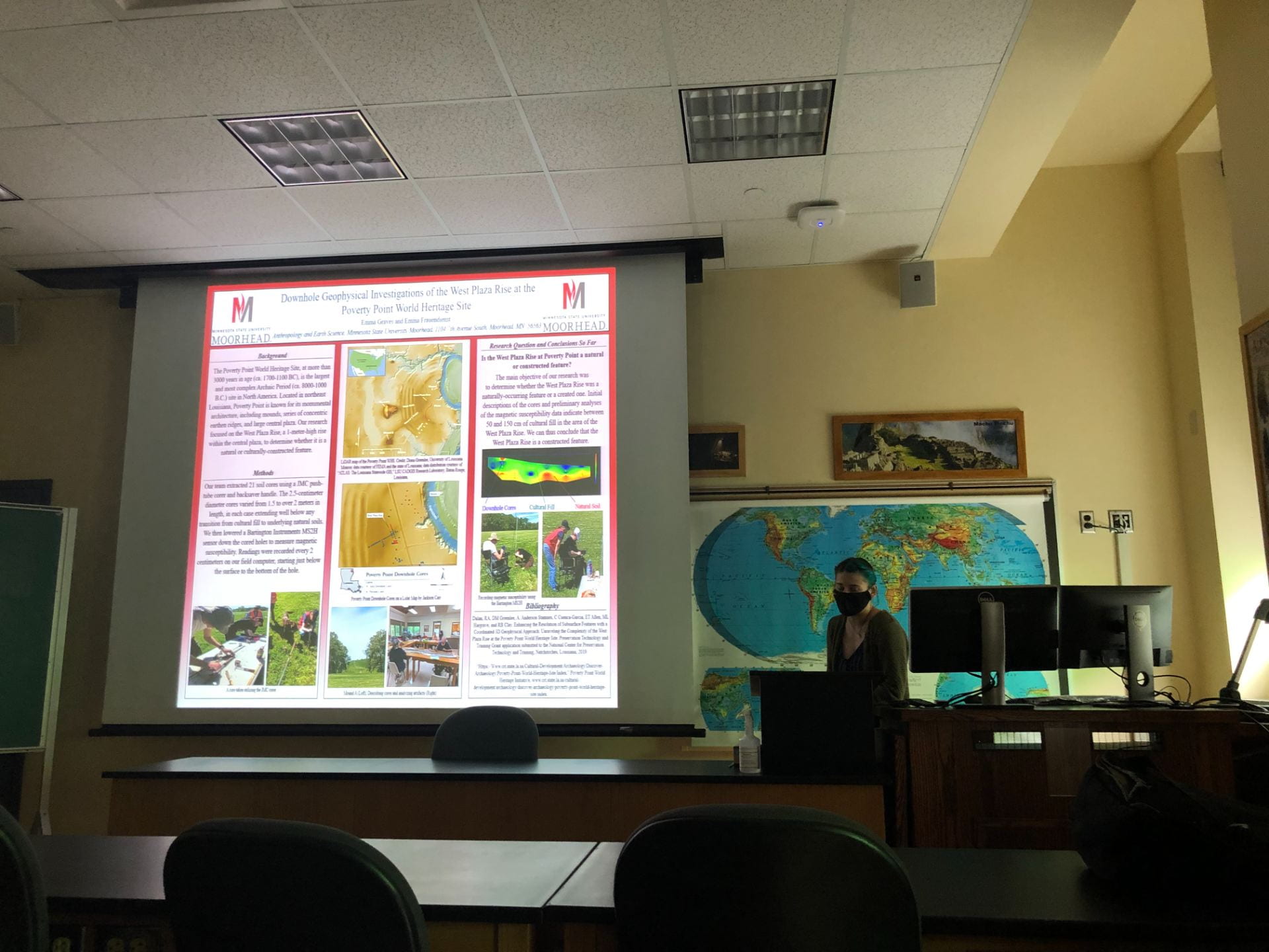
On October 5th, the Pennsylvania Archaeological Council held their first in a series of four programs in honor of 2021 Virtual Archaeology Month. This session was titled 3D Archaeology: Tech, Techniques, and Applications for Artec3D Scanners, and was led by Lisa Saladino Haney, Ph.D., assistant curator of the Carnegie Museum of Natural History, and Josh Cannon Ph.D. from the University of Pittsburgh Honors College.

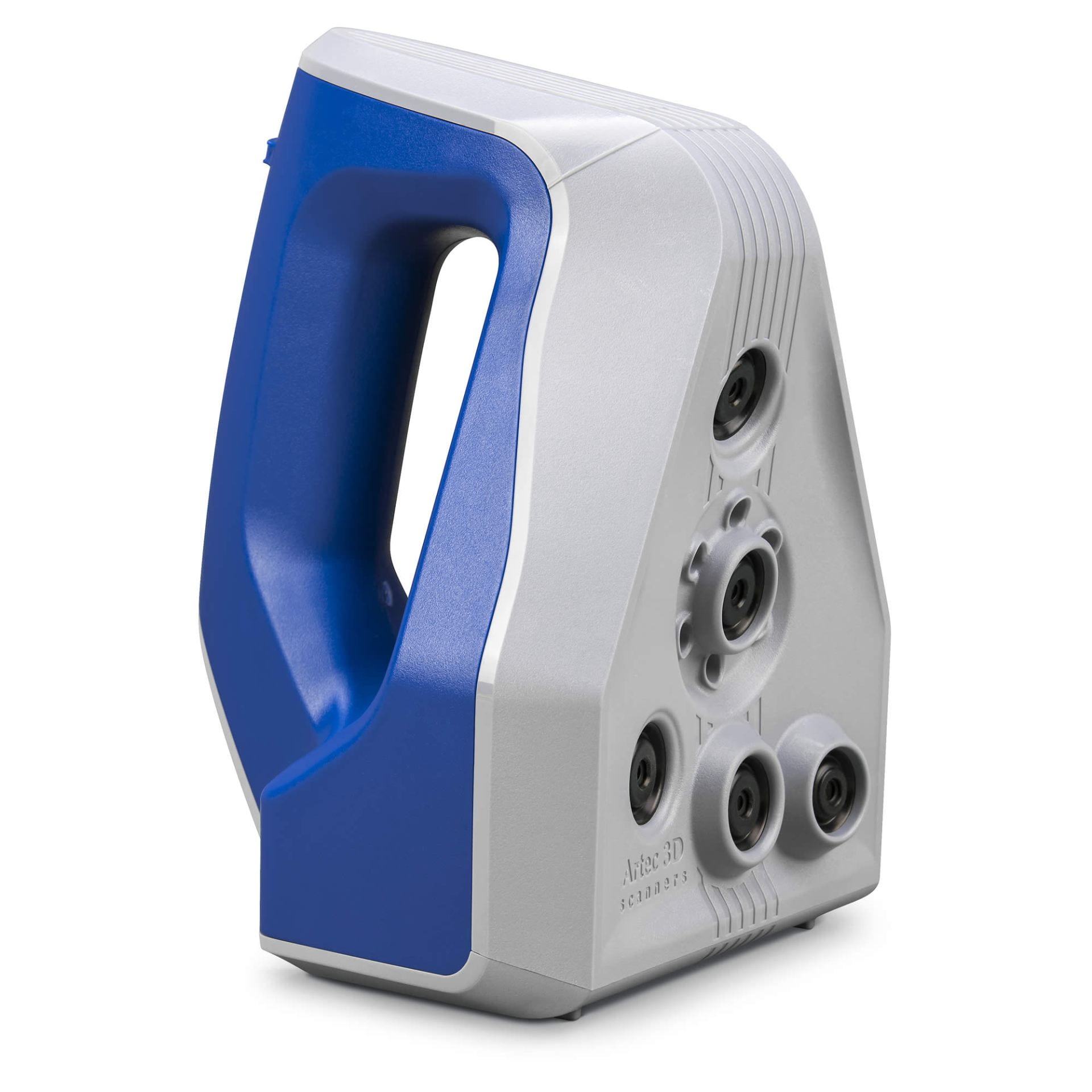
The Artec Space Spider.

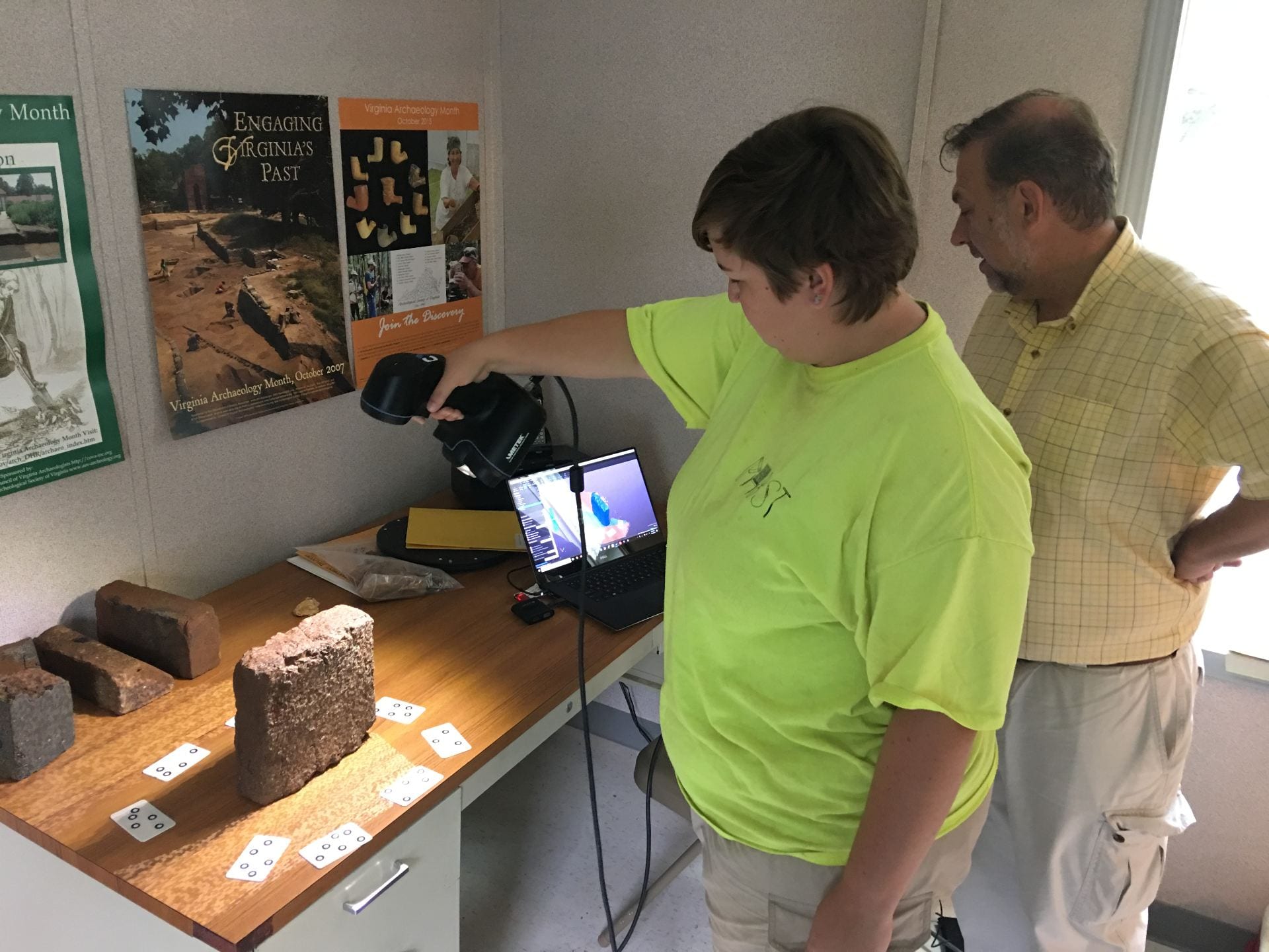
Haney started by describing the types of 3D scanners that she is using and that could be applied to future field archaeology projects. These Artec3D scanners are the Space Spider and Eva. The Space Spider is a handheld, portable scanner that uses blue light technology that works best when scanning smaller objects or finer textures or details. It also works well with complex geometry, sharp edges, and incised ceramics. It has internal temperature stabilization, meaning it works well in the winter and summer. The Eva works better with larger objects and is also portable. It uses structured light scanning technology to capture its images. Because of its larger field of vision, it can capture more in less time. Combining both scanners allow for the collection of even more details. The presenters stated that these scanners work much better with shiny surfaces than photogrammetry. Overall, the scanners capture reflective surfaces, have a higher level of accuracy, and work faster in post-processing than photogrammetry.
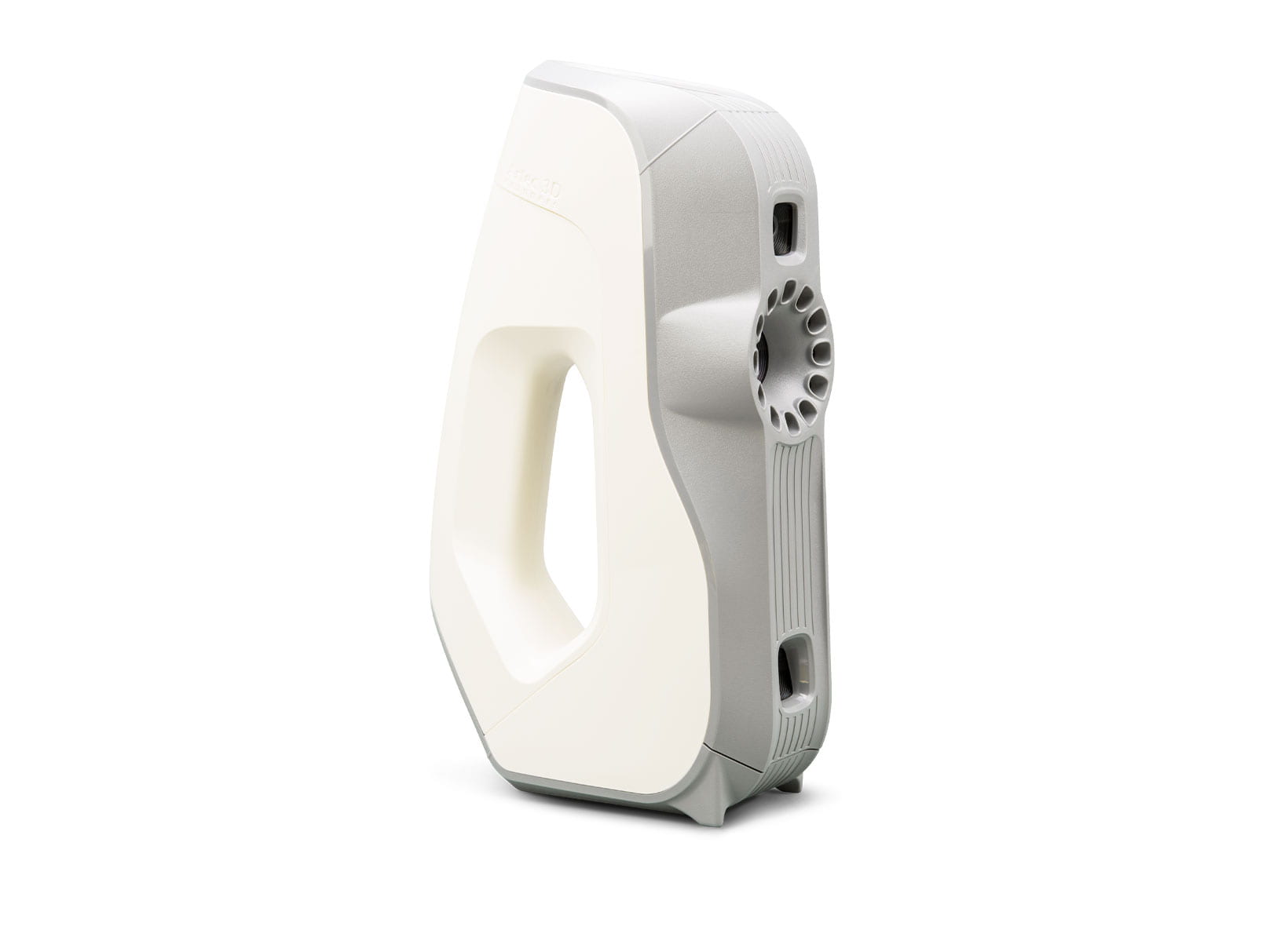
The Artec Eva.

Dr. Haney and Dr. Cannon are working with University of Pittsburg honor students in a museum internship program to instruct them on how to use this technology, and once trained can hopefully send them to other sections of the Carnegie Museum where needed. Projects the scanners are being used for right now include an exhibition titled From Egypt to Pittsburgh, in which the team are scanning small fragments from a 1922 excavation from an Egyptian city called Amarna, in the hopes that the pulverized royal statuary pieces can be reconstructed and used for future research. Another project, Egypt on the Nile, plans on scanning a model of a Dahshur funerary boat to create both a virtual and physical model. They also plan to use the scanners to scan broken pot pieces to then create magnetic replicas that can be used to “put the pot back together” in a sort of puzzle, increasing accessibility and the chance to interact with ‘artifacts’ for the public.

The 3D models created from the scanners are extremely accurate, with precise and detailed measurements. This allows the data from the models to be of high quality scientifically, making them great for sharing to researchers around the world, especially in times of covid where travel and use of collections is limited. The models also aid with conservation efforts, allowing pieces to be brought out, scanned, and then put safely away, with the data being used for study and public engagement. Aligning pottery sherds with the Artec3D software that are difficult to glue together, was also illustrated as a positive example of the scanners’ possibilities.

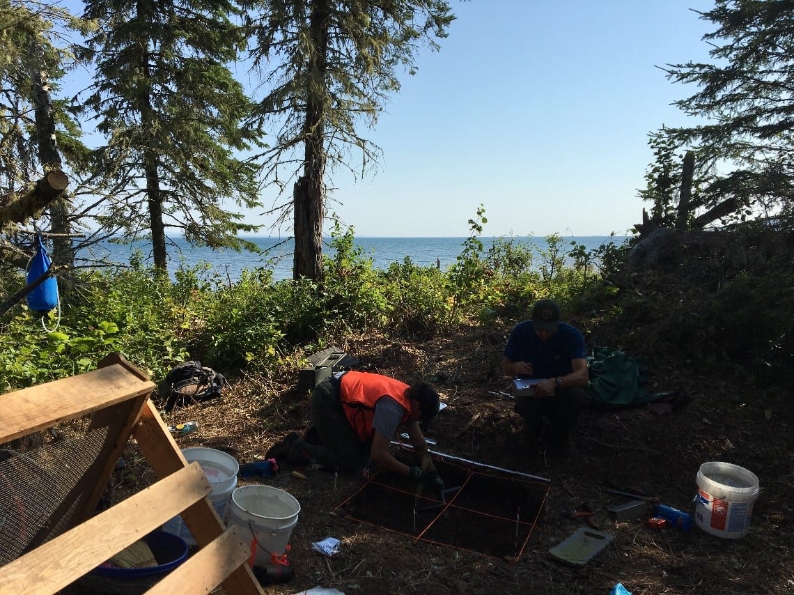
The application for scanners to be used in the field during an archaeological excavation is promising. The scanners could be used to record small finds quickly and could also be used to scan things in situ. The models produced are more detailed, more accurate, and can be done faster than hand drawings. For archeological field surveys, battery packs can be attached to belts to make the light scanners portable and give archaeologists the ability to scan in real time. However, a laptop is needed to be attached as well, to upload the scanned data. The scanner captures images instantly, the Eva can do a square meter at a time. Josh Cannon predicted that it could scan a hearth in about ten minutes. While the scanners can handle temperature changes, it might not fare well with elements like sand or dust, but if taken care of can last a long time.

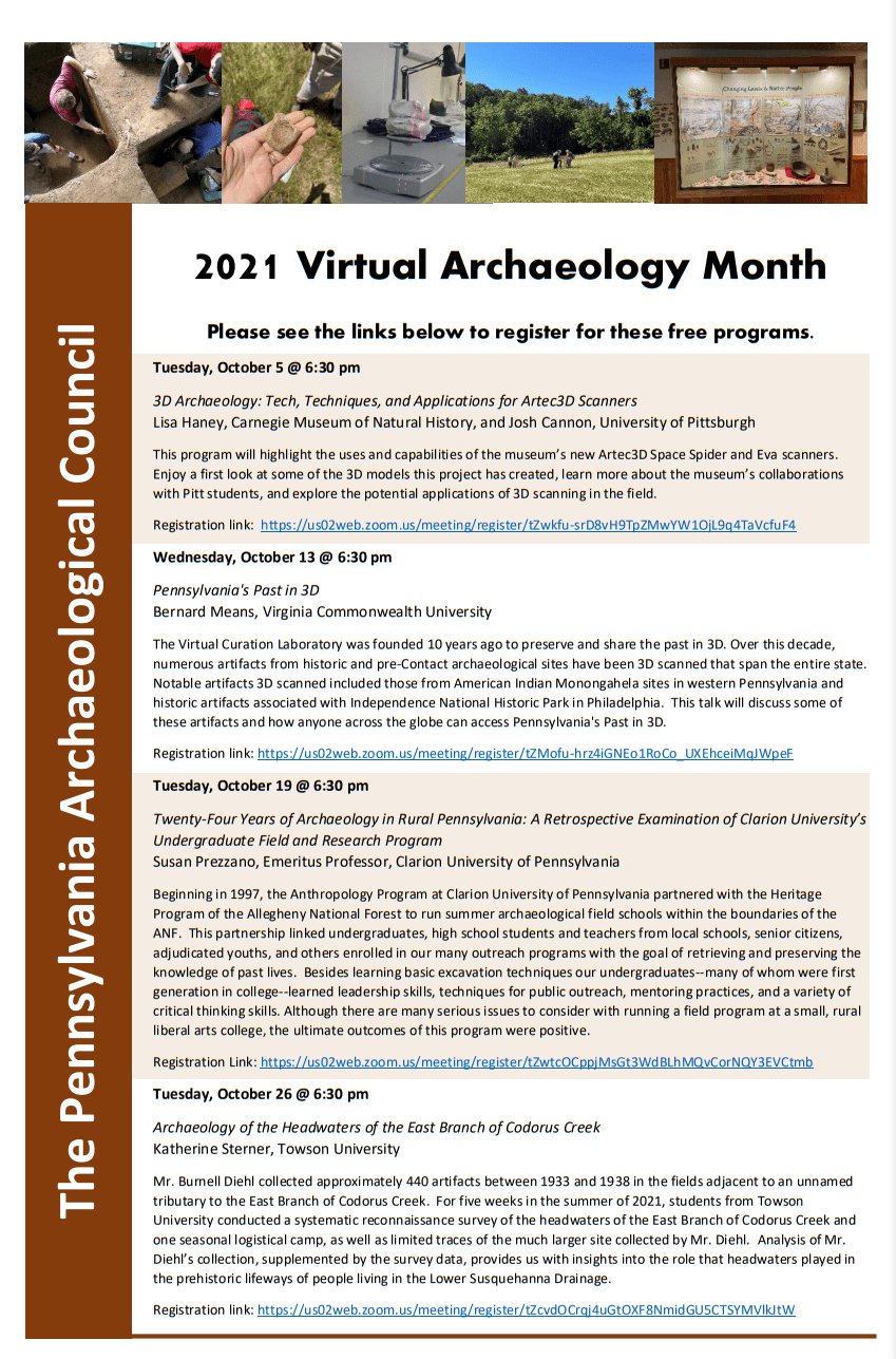
The files of data from the scans are large, and therefore external storage sources are required to remove data from laptops. If files are kept on laptops, processing times will be slowed as the hard drive fills up. The presentation ended with the viewing of a scan of a wolverine skull. It took eight different scans over an hour to create the entire skull. Even the smallest details were visible, and it took up over 1 GB of data.

The presentation was incredibly interesting, and hopefully this technology will be used to aid archaeological excavations in the future. Please consider registering for the other three programs being held throughout the month of October!

Follow IUP Anthropology on FacebookTwitter, and Instagram

https://sourcegraphics.com/3d/scanners/artec/eva/

https://www.javelin-tech.com/3d/3d-scanners/artec-space-spider/


September Colloquium: What We Did This Summer/Recently

This Wednesday, the 22nd, six of our Applied Archaeology graduate students at Indiana University of Pennsylvania presented at our monthly colloquium on What We Did This Summer/Recently. We heard from some amazingly talented students, eager to share their adventures and discoveries!

First year graduate student Emma Frauendienst.

First year graduate student Emma Frauendienst.

After a great introduction from Dr. Lara Homsey-Messer, Emma Frauendienst started us off with her presentation about her summer fieldwork at the Poverty Point World Heritage Site. Poverty Point, one of the largest Archaic Period sites in North America, is located in Louisiana. Her work, titled Downhole Geophysical Investigations of the West Plaza Rise at the Poverty Point World Heritage Site, began after receiving a grant, and facing both covid and flooding setbacks. Her team extracted 21 new soil cores, focusing on the West Plaza Rise to determine if it was a natural or constructed feature. After analysis of the cores and magnetic susceptibility data showing heavy cultural fill, it was determined that the West Plaza Rise was culturally constructed!

First year graduate students Mikala Hardie and Richard Farley.

Mikala Hardie and Richard Farley then discussed their experiences as Graduate Assistants during IUP’s Newport Field School. Newport, a small shipping town located along the Conemaugh River, was occupied from around 1790 into the early 19th century. The excavation began with shovel test pits, ground penetrating radar, and several test units, before excavation units were opened. The woods crew, led by Mikala, worked to find the walls of the general store, while also uncovering artifacts such as, porcelain, faunal remains, mochaware, and a builder’s trench, to name a few. The field crew, supervised by Richard, focused on finding the blacksmith shop and hotel, along the way uncovering post holes, slag, redware, pearlware, creamware, and transfer printed earthenware, among other things. The field school utilized photogrammetry, magnetometry, GPS, and a total station to also collect valuable information about the site. If anyone wants to know more about what it’s like as a graduate assistant at a field school, just ask Mikala and Richard, who also filled out forms and logs, took lots of pictures, and organized and supervised those working at the site!

Second year graduate student Ashely Nagle and first year graduate student Sonja Rossi-Williams.

Ashley Nagle and Sonja Rossi-Williams presented next about their time spent as Graduate Assistants in Lower Saxony, Germany at IUP’s Forensic Field School! From July to mid-August, they worked at a World War 2 B-24 aircraft crash site! They used GPR to first define the sides of their 2X2, and then used shovels more than trowels to remove the soil in their units. The team learned about archaeological methods and practices used in Germany and took several excursions across Germany, including to Hannover, Berlin, and Munich, making this an incredible cultural experience as well as archaeological. They did not find what they were looking for, an unaccounted-for soldier, but they did make progress on the site itself. The team were even featured in a German newspaper! In the future, the site will most likely undergo more excavations, hopefully by IUP students!

First year graduate student Luke Nicosia.

Luke Nicosia was the final presenter, recounting his internship in July and August this summer with the Landmark Society of Western New York, a historic preservation agency.  Founded in 1937, it is one of the oldest such societies in the US and seeks to advise property and homeowners on historic preservation planning and awareness, raise funding, and protect local historic sites. Luke conducted fee-for-service survey work and worked on their library projects. He edited site narratives and report drafts, finished reconnaissance on a survey on village properties, did covenant review, and worked in the library scanning and inventorying. He finished a massive slides project after scanning and digitizing over 80,000 slides over the course of many years (this is not his first time interning with the Landmark Society)! He also mentioned that there are many ways one can get involved in the field of historical preservation, many that align with the field of archaeology!

Thank you to all the presenters and everyone who attended our first colloquium of What We Did This Summer/Recently!

PHAST Activity: Rugh/Haymaker Mill Site

Written by Gage Huey

Haymaker Run Bridge

The Rugh/Haymaker Mill Site (36WM1204) is a historic-period archaeological site located in Murrysville, Westmoreland County, Pennsylvania. This summer, four IUP Archaeology students in the Pennsylvania Highway Archaeological Survey Team (PHAST) recovered diagnostic artifacts from deposits associated with late 18th and early 19th century grist and sawmills that were constructed along Haymakers Run by two early Euro-American settlers, Michael Rugh and his son-in-law, Jacob Haymaker. These early mills used the water from Haymakers Run as a power source for the lumber saws and grinding stones. These mills are indicative of the kinds of early agricultural and industrial enterprises that settlers in this region developed to facilitate both longer and larger-term settlement of this region. Early maps of the region often focus on the industrial and extractive potentials of resources showing major rivers used for navigation, streams for mill placement, and indicating mineral rich for extraction.

This site was identified through a Phase I archaeological survey conducted by PHAST in order to comply with Section 106 of the National Historic Preservation Act (NHPA) of 1966.  The NHPA requires federal agencies (and the state agencies like PennDOT who use funding from federal agencies) to take into account the ways that their undertakings may affect the archaeological resources both above and below the ground surface. The bridge where State Route 4041 crosses Haymakers Run is in need of replacement and because bridges and other transportation related infrastructure falls under PennDOT control, it also falls under NHPA regulations.  In addition to replacement of the bridge structure itself, attention must be given to the construction activities and temporary access needs during construction (i.e. right of way, easements, drainage and erosion control measures, and/or temporary staging or runaround). The improvements may also affect archaeological resources, so cultural resource professionals (CRPs) must employ strategies to determine what may be affected by this undertaking.

In order to begin the Phase I investigation, background research was conducted using resources such as Pennsylvania’s Cultural Resource Geographic

Shovel Test Pit

Information Systems (CRGIS), soil surveys, topographic maps showing landforms, historical maps, and historic period aerial photographs. These sources help us understand what kinds of activities were or were likely happening in a particular area in the past. Once the likelihood of finding archaeological resources is assessed, CRPs visit the site to conduct a pedestrian survey. This field view helps CRPs identify areas of prior disturbance, which informs the development of a below-ground testing strategy. For this project, the excavation of five shovel test pits (STPs) was planned at a regular 15-meter interval to test the below-ground potential for intact archaeological deposits. This summer, the PHAST crew recovered a variety of historic artifacts through the course of excavation.  The recovery of cultural material in the initial 5 STPs resulted in the need for additional testing to confirm the extent of these deposits. Each STP was dug according to Pennsylvania State Historic Preservation Office (PA SHPO) archaeological guidelines, with a diameter of 57 cm to a depth of 10 cm into sterile subsoil to test for all periods of human occupation on this landform. In total, 11 STPs were excavated, recovering 125 artifacts and contributing to the identification of the Rugh/Haymaker Mills site.

Diagnostic ceramic sherd recovered from STPs

Of the 125 artifacts recovered, 69 could be attributed to a particular time period.  These diagnostic artifacts included ceramic sherds, glass, animal bone, and a cut nail. The ceramics were analyzed by PennDOT Senior Archaeologist Angela Jaillet-Wentling who calculated a mean ceramic date of 1815. This date was re-calculated to 1817 based on the presence of olive-colored glass and a machine-cut nail. Accounting for a time lag between artifact manufacture and deposition, the material culture correlates well with the documentary evidence that the Rugh/Haymaker mills was constructed by 1809 and operated until at least 1875. Although the faunal remains from this site were not relevant to the dating of the deposits, the presence of a humerus from a domestic pig (Sus scrofa) certainly adds a depth of detail to the everyday lives of the settlers at the site. The fragmented humerus showed possible evidence of butchery which, along with other faunal remains found on the site, could provide important data to help improve our understanding of the type of foods early Euro-American settlers were raising and/or eating.


Pig humerus fragment recovered from the site

Overall, the archaeological resources encountered during the Phase I Survey resulted in the formal identification of the Rugh/Haymaker Mills Site. Because this potentially eligible site was located within the proposed project area for the bridge replacement, CRPs were tasked with making a choice for the future of this site: further investigation or avoidance. Thankfully, we were able to avoid additional investigation and impacts thanks to early site identification and flexible design. When the work for the Haymakers Run bridge replacement project begins, temporary construction fencing will be placed to protect the Rugh/Haymaker Mills site from any negative impacts that the bridge replacement may cause. This way, the intact archaeological deposits at the site can stay in situ; in other words, the cultural resources will stay where they are for the foreseeable future. This outcome is a best-case scenario because it allows for cooperation between the goals of archaeology and the Pennsylvania Department of Transportation (PennDOT). The proposed bridge replacement over Haymakers Run is able to go forward without major impediments or changes to the project and the undertaking will not negatively affect the archaeological resources associated with the Rugh/Haymaker Mills Site. At its best, Cultural Resource Management gives archaeologists a seat at the table when federally funded undertakings are planned in locations with potential for archaeological deposits. This is a great example of the things that can be accomplished through compliance with Section 106 of the NHPA.

You can read more about their summer here:(https://iblog.iup.edu/trowelsandtribulations/2020/09/25/phast-2020/)

Follow IUP Anthropology on Facebook, Twitter, and Instagram

PHAST 2020

Written by Miriah Amend

From the backwoods of Meadville, to the capital of Pennsylvania, the Pennsylvania Highway Archaeological Survey Team (PHAST) traveled around the state to conduct Phase I survey for several PennDOT projects this summer. The PHAST program provided archaeological field experience for four students from the IUP Department of Anthropology as well as GIS experience for a student from the Department of Geography and Regional Planning. The 2020 PHAST Crew completed 13 projects this summer, at most projects this consisted of digging shovel test pits, or STP’s, each one ranging from a few centimeters to a meter deep in the ground. We worked in a lot of different environments, forests, open fields, even a steep slope. What all these places had in common was being right next to a road or bridge that is planned to be improved or replaced by PennDOT.


Adapting to changes brought on by the COVID-19 Pandemic, the PHAST team did things a little differently this summer. Masking up and distancing during field work and van rides were new challenges, but this summer had familiar field challenges as well- many projects were surrounded by poison ivy or stinging nettles! With all of our projects being off busy roads, we always had to be careful when working, especially when crossing roads or bridges. Weather-wise, the crew was lucky, we only missed one day of field work due to thunderstorms! We spent this rainy-day cleaning artifacts and working on writing and making figures and maps for our reports. At the end of the day, archaeology could still be done, rain or shine!

Working alongside Dr. William Chadwick, the PHAST crew also assisted in a cemetery relocation project just outside of Indiana this summer. The crew took turns using ground penetrating radar (GPR) technology in order to locate potentially unmarked burials. Getting experience running the GPR was a great way to get our feet wet in the exciting world of geophysics, and the preliminary analysis of the data suggests that there we did in fact pass over a few unmarked graves.

Another project the team tackled was between Titusville and Meadville, up in the northwestern part of the state. There, our crew pulled out a variety of historic artifacts such as early 1900’s bottles, ceramic pieces, and various metal scraps, including an old metal shoehorn. This project area was near the foundation of known historic mill, so we weren’t too surprised to find historic material in this area, although I don’t think any of us expected it in this quantity!


Wrapping up the summer, the PHAST crew found even more artifacts- early historic pottery, glass, and even faunal remains! These were recovered during our last project, a bridge replacement near Murraysville. With these findings, additional STPs were required and this project turned from taking one day, to several. Who would have expected historic artifacts to be underneath a dense layer of rock just under the surface? It just goes to show the importance of Phase I survey, you never know what may be just below ground until you look!

Follow IUP Anthropology on Facebook, Twitter, and Instagram

Musings of a Recent IUP Graduate

By Samantha Taylor

Let’s face it…grad school feels like an eternity. My two years at IUP felt almost as long if not longer than my four years in undergrad. It’s only been six months since I received my M.A. from IUP and time is flying by. So much has happened and I’m proud to say that IUP has adequately prepared me for life as a professional archaeologist.

A brick pathway found beneath a potential robber’s trench in front of Spotswood’s Enchanted Castle.

This past summer I accepted a job as the assistant site director for Virginia Commonwealth University’s field school at the Fort Germanna/Enchanted Castle Site in Orange County, Virginia. The position was 15 weeks long and my first foray into supervising. I was nervous to teach students how to dig and to serve as a role model for future archaeologists. My job description included assisting the site director (the amazing Dr. Eric Larsen), supervising our four interns, and teaching field school students. Our goal was to locate the Fort Germanna, an early 18th century fort built by Lt. Governor Alexander Spotswood for German colonists. The fort supposedly intersected the west hyphen of the Enchanted Castle, Spotswood’s house which postdated the abandonment of the fort. This summer we excavated the area to the north of the structure which hugged the façade of the house. While we did not find the fort, we were able to better understand the function of the front lawn of the Enchanted Castle. Meanwhile, students and interns were able to gain valuable experience. I was incredibly fortunate that my boss, interns, and students were all wonderful and talented. During my time at Germanna, I took a particular interest in helping design the four public access days that Germanna hosted this past summer. In fact, I will be chairing a session the first ever paper session on Germanna Archaeology and presenting on Germanna public archaeology at MAAC next spring (be there or be square). I doubt I’ve enjoyed a job as much as I’ve enjoyed my time at Germanna. Not only was my position fulfilling, but I made lifelong friends with my crew and was able to inspire some of them to continue pursuing archaeology as a career.

An overview of all of the Test Units opened at Germanna during the 2018 season.

My job at Germanna came to an end on August 30th, but fortunately my next job was already lined up. I started my current position at New South Associates, Inc. on September 4th. I am an archaeologist/field director at the Greensboro office in North Carolina. My job description includes directing field work and writing reports for various projects across the southeast. I spend about 50% of my job working in the field with a variety of archaeologists who come from all over. The other 50% of my time is spent synthesizing data and writing reports.

The Field School on our last day! We were small but mighty!

While it’s only been six months since I graduated from IUP, I feel as though my post-grad school career has been successful and fulfilling thus far. It’s definitely not always easy, and takes just as much dedication and time-management as school did. I know I have a long road ahead of me still, but wherever archaeology takes me I’ll be happy to go. So, to all the current graduate students and prospective graduate students here’s my advice: grad school is an emotional and physical commitment. It isn’t easy but it is worth it. Your two years in classes will feel like an eternity. Your time spent working on your thesis will feel never-ending. But the good news is that the grass is greener on the other side, and that these challenges will ultimately prepare you for what is ahead. Don’t give up, keep going! Your M.A. is on the horizon!

Learning how to 3D Scan artifacts, courtesy of Dr. Bernard Means from VCU’s Virtual Curation Lab (VCL)

IUP Anthropology Department

Monitoring at Fort Necessity

By: Matthew Bjorkman

 Over the summer I was the crew chief for a monitoring project at Fort Necessity in Farmington, PA. This was my first opportunity to work professionally as a crew chief, as well as my first experience with monitoring work. Monitoring is different than most archaeology jobs. Our job was to watch and monitor a construction crew working at the site, and make sure that no archaeological resources were disturbed. If archaeological resources were unearthed, we would need to excavate and document the resources in a timely manner, so work could continue. The crew and I would also have to provide information to the construction crew, comprised of non-archaeologists, about what we were seeing and about the possible impacts the construction could have on archaeological features or artifacts.

The machinery and crews at work.

The construction crew was working to remove an old parking lot and retention pond that were constructed by the Civilian Conservation Corp (CCC) in the 1930s. At the time of the construction of the parking lot and retention berm, the National Park Service (NPS) had a philosophy of getting visitors as close to the park as the possible and having the park in good condition to receive these visitors. The CCC parking lot is located just northeast of the reconstructed fort, so close that visitors at the time would not even need to exit their vehicle to see the fort. The retention pond was constructed to help control drainage and make the park more accessible. For some back story, Fort Necessity is located in a large, natural clearing called the Great Meadows. At the time of the battle in 1754, the Great meadows would have been less inviting to human traffic than it is today. The two creeks in the meadow (Great Meadow Run and Indian Run) would have snaked through the meadow and would have been surrounded by grasses and wetland plants. By all accounts, the Great Meadows was a wet place, especially during the Pennsylvania summers when thunderstorms routinely pummel the area. Long story short, when the land became a national park, multiple modifications were made to the landscape for the sake of the visitors. Today, the NPS has a new philosophy about presenting Fort Necessity to the public. In 2016, the NPS began implementing the Great Meadows Restoration Project to remove artificial landscape modifications (among other things) to restore the Great Meadows to how it would have appeared in 1754. The project that the crew and I got to work on was a part of this project.

As the work began it became very apparent that monitoring is not like the other projects that I have worked on in the past. It is MUCH easier. We did not have to dig through clay in the hot, summer sun. Instead, we got to watch large machinery do it for us. The CCC parking lot is not like a typical asphalt parking lot we are all familiar with. This parking lot was created using fill, mostly clay, that was packed down to create an impervious surface for vehicles to drive on. The parking lot was buried over the years by topsoil and vegetation that had grown over it after the parking lot went out of use just a few years after it was constructed. The construction crew removed the topsoil with a bulldozer and a trackhoe at an impressive rate (minus the rain delays, because, Pennsylvania).

As the topsoil was removed, the crew used metal detectors to look for metallic artifacts and walked across the area to visually inspect for other artifacts. After the topsoil was removed, the construction crew began removing the parking lot fill layer. This was when communication between the archaeology crew and the construction crew was the most important. Underlying the parking lot fill is the historic A horizon, or in other words the historic ground surface. It was this layer that we did not want to dig through as it has a high potential to have archaeological resources. It may seem funny to hear that the archaeologists did not want to find artifacts. However, this project was not an excavation, it was to monitor the construction to ensure archaeological resources were not affected. As the construction crew moved through the fill, we needed to be vigilant and prepared to stop the machine operators if features appeared, or before the historic A horizon was contacted. Thankfully, the crew and I were able to develop a good working relationship with the operators (they even let me sit in one of the machines and showed me how it works!) and develop trust in each other’s expertise.  In all, the removal of the parking lot and retention pond went very smoothly.

I said earlier that our goal was not to find artifacts, but we did find some interesting things that are worth reporting in this blog post.

Figure 1: Yale padlock faceplate.

The metal detectors helped us locate some items of interest. We found a Yale brand padlock faceplate (Figure 1) that probably dates to the late 1890s- early 1900s. The bulldozer pulled up the base of an old flagpole (Figure 2) that once stood in the field as well as a US Department of Interior survey datum marker (Figure 3). A side note, in the picture you will notice that printed on the survey datum are the words “Unlawful to disturb,” and when we pulled this up I got very nervous, but it all turned out well. My two crew members (Shout out to Britney Elsbury-Orris and Hannah Winters) located three articulating pieces of a blue transfer print ceramic vessel (Figure 4). Lastly, in the parking lot fill layer, we located a completely intact glass insulator (Figure 5), that were commonly used on telegraph lines in the 19th and 20th centuries.

Figure 2: Flagpole base that got pulled up by the bulldozer.

Figure 3: US Department of Interior survey datum.

Figure 4: Articulating blue transfer print ceramic pieces with Romantic style design.

Figure 5: Glass insulator located in the parking lot fill.

In all the project was a great experience for everyone on the crew. Fort Necessity is a wonderful and notable place that I have had the pleasure of working at over the last two summers. I was personally able to gain valuable experience leading a crew, but more importantly I learned how to interact with the construction crew and develop a working relationship that allowed for the project to go smoothly. The guys working the machines were a pleasure to work with and I hope I can work with them again on a project someday. Lastly, go visit Fort Necessity National Battlefield! It’s free, fun, and not that far from Indiana or Pittsburgh. While you are there make sure to visit Jumonville Glen and Braddock’s Grave which are located just up the road from the fort.


IUP Anthropology Department

Isle Royale National Park

By: Genevieve Everett


If someone told me a year ago I’d be living and working at Isle Royale National Park (ISRO in NPS speak) in the middle of Lake Superior, I would have said, “Where?” Obviously, I knew where Lake Superior was, but I knew nothing about the cultural history and the archaeology of the region, especially that of Isle Royale. Once I heard about the job/Pathways internship (thank you Danielle!), I began the arduous process of applying on USAJobs.com. After a month or more of waiting, I was offered a position as a seasonal Arch Tech for ISRO! May 29th came fast, and before I knew it, I was on the Ranger III floating across Lake Superior to one of the most beautiful places I’ve ever had the pleasure of living and working for three plus months.

An office with a view!

A little background on the island…Isle Royale became a National Park in 1940, opening it up to the American public, and protecting it from further development. Before the inception of the park, Euro American fisheries and cabins dotted the shorelines, mining companies prospected for copper, and long before that, native peoples utilized the island, “Minong”, meaning “The Good Place”, for its plentiful resources, including caribou, sugar maple, and fish. Additionally, the island is one of the first places where American Indians mined copper industriously, which is best exampled at Minong Mine on the island’s north shore.   All these histories are intertwined into a complex network of traditional beliefs, stories, and experiences that make this place so intriguing.

Marley in front of one of the prehistoric copper mining pits

This summer I got to work with a fantastic group of people: my supervisor, Seth DePasqual, and my two co-workers, Marley Chynoweth and Rudy Martinez II. Throughout the summer, we performed site monitors around the island, checking on existing sites, assessing their condition and potential threats. For example, some sites are near the shoreline where there is potential for erosion. It is our job to record this and make a determination for future remediation. Another project that I really enjoyed was a pedestrian survey to find an early 20th century fur trappers cabin near one of the inland lakes. All that we knew was that it was at the southwest end of the lake, which covered a large swath of land. Several of our sites were only accessible by water, so, we got to spend a lot of time paddling! In addition, Marley and I had a chance to leave the island for a week to work at a Fur Trade site with our friend Danielle (IUP Applied Arch alumna) along the Grand Portage in Minnesota. Several trade items were recovered from this site, including, glass beads and tinkling cones.

2018 ISRO CRM crew on the trusty Nighthawk!

For me, the highlight of this summer was the Relict Shoreline Survey (RSS). The relict shoreline or Nipissing (ca. 5,000 years B.P.) lake water levels were much higher than they are today. Using GIS and LiDAR, Seth located areas along the old Nipissing shoreline that might have a good place to land a canoe back in the day.  Using a Garmin GPS, we would bushwhack to these areas. Today, they do not look like the beaches that they were 5 millennia ago, instead, there are thick groves of trees and other vegetation. It isn’t until you sink a shovel test in that you tend to find fine beach sands and pebbles. We had a lot of success in locating new sites this summer, all of which had chipped stone artifacts and/or copper (modified/natural) artifacts.

Danielle and Marley showing off a copper knife with tang from one of the Nipissing sites

Small copper point found in a tree throw at a Nipissing site

As a kid I wanted to go to sleep away summer camp, but never did. Well, that wish came true this summer, because living at Isle Royale was like adult summer camp. On the weekends I’d hike the Mott loop, a 2.7 mile trail on Mott that has some of the most beautiful views (in my opinion) on the island, picking wild blueberries along the way. Early in the summer, I took a weekend trip to Amygdaloid Island with some friends to see more of the north shore. That same weekend, we hiked back from McCargoe Cove, down past West Chickenbone Lake (lots of moose there), east along the Greenstone, up to the Ojibway Tower, and back down to Daisy Farm. I caught my first ever lake trout. I swam in the cold, cold waters of Lake Superior at night, and quickly ran back to the sauna to warm up. Got to go to the Rock of Ages lighthouse, that is being restored back to its original glory by https://rockofageslps.org/. Was part of a Search and Rescue (SAR) crew, carrying an injured visitor out of the back country on a litter. Kayaked from Mott to Rock Harbor, and back again on a particularly calm day…..

Kayaking down Lorelei Lane

My “backyard”

Rock of Ages Lighthouse

Okay, I’m done blabbering on. The point is, this was an incredible summer filled with so many personal and professional experiences that I will never forget. By extension, I feel more confident in my abilities as an archaeologist. While it was hard to leave the island last week, I am ready to take on the next challenge…hopefully somewhere just or equally as beautiful as Isle Royale.

IUP Anthropology Department


Humanity and Science Unearth Together at St. Mary’s College of Maryland’s Historical Archaeology Field School

By Mace Long


During the summer, I spent ten weeks concentrating on gaining skills in excavation, data collection and archeological recording in the field, laboratory and classroom at the St Mary’s College of Maryland Historical Archeological Field School. At the late 17th century Leonard Calvert House, I personally unearthed part of a horseshoe, a lock mechanism, Rhenish stoneware, Venetian glass, creamware, projectile points, fragments of oyster shells, iron nails, pieces of clay tobacco pipes and much more. Chief Archaeologist Travis Parno emphasized that “these excavations at the site of Maryland’s first capital have revolutionized the understanding of colonial architecture and the material culture of the period.”

The archeological field school site is part of Historic St Mary’s City surrounded by a large living history area, museum and The Maryland Dove ship. While spending full days excavating at the site, we took turns giving public tours. It was fulfilling to be able to discuss the background history and present the successes of our dig site.


During the Tidewater Archaeology Weekend, I witnessed the incredible instructive value of allowing people of all ages to sift through dirt themselves and be educated physically with exciting hands-on participation. In addition, I greatly enjoyed the variety of field trips to Colonial Williamsburg, Jamestown and Montpelier where we observed methods used by other sites.

As part of the St Mary’s College of Maryland’s Historical Archaeological field school, we boarded and rode the Maryland Dove learning all kinds of techniques and mechanisms regarding 17th century ships. (IUP Graduate Student Mace Long)

The St Mary’s College of Maryland Historical Archaeological Field School was one of the most incredible educational experiences of my life, as it heightened my understanding of A.L. Kroeber’s quote “[Archaeology] is the most humanistic of the sciences and the most scientific of the humanities.”


Photos provided by Mace Long and the Historic Saint Mary’s City Field School Blog

IUP Department of Anthropology

Where in the world are IUP Achaeologists this summer?

Summer is upon us (where did the year go?!) and our applied archaeology students are off to many exciting places and experiences. We are very proud of the hard work of our recent grads and current students, and pleased to see that nearly all of our current students are employed! Here are some highlights:

May 2018 graduation

Recent grads:  Samantha Taylor (MA, ’18) recently completed her thesis on the ceramic assemblage at the African-American diaspora site of Pandenarium. She is currently working as the Assistant Site Director at The Germanna Foundation. Danielle Kiesow (MA, ’18) recently completed her thesis investigating land use and gardening practices on the Ojibwe reservation from 1854 until 1930 to analyze the relationship between the Ojibwe at Grand Portage and the Indian Agents from the Bureau of Indian Affairs.  She is currently working as an Archaeological Technician for the Grand Portage Reservation Tribal Council. Undergraduates Harley Burgis (BA, ’18) and Eleanor Schultz (BA, ’18) recently graduated with Honors. Harley, whose thesis explored prehistoric cooking technologies at the prehistoric site of Dust Cave, is off to work as a field technician for TRC while she takes a gap year between college and grad school. Eleanor, who won this year’s Olin-Fahle award, will begin a graduate program in museum studies at Johns Hopkins University this fall. Congrats Grads!

Year 2 cohort:  these guys are off running! Gen Everett (who has been running this blog admirably for the last 2 years), is working as an archaeological technician for the National Park Service at Isle Royale, enjoying scenery the rest of us are envious of. Britney Elsbury-Orris, Heather MacIsaac and Zane Ermine are serving as crew chiefs on several phase I and geophysical surveys for IUP’s Archaeological Services Center. Zaakiya Cua is working as an archaeological technician for the Allegheny National Forest-Bradford District during the week while writing her thesis on the weekends. Matt Bjorkman is utilizing his GIS certificate training by working part time for IUP’s IMAPS (Institute for Mine Mapping, Archival Procedures, and Safety) program, and conducting fieldwork at the Squirrel Hill site as part of his thesis research. Patrick McGinley is conducting his thesis research using geophysical survey to locate Ft. Halifax along the Susquehanna River in central PA, and Mesfer Alqahtani will soon be defending his thesis, which uses GIS to model the distribution of stone circle structures in northern Saudi Arabia. Mesfer recently won the Dean’s Award for best poster at the 2018 IUP Scholar’s Forum. Congrats to Year 2!

Zaakiyah Cua in the field at the Allegheny National Forest-Bradford District (left) and Sami Taylor diligently taking field notes as the assistant site director for the Germana Foundation (right).

Year 1 cohort: Not to be outdone by the Second Years, the Year 1 cohort is also doing impressive things this summer. Ross Owen, whose thesis explores the management of metarhyolite stone quarries in central PA (funded in part by the South Mountain Partnership), is once again serving as supervisor for the PHAST (Pennsylvania Highway Archaeological Survey Team) program. Assisting him as the PHAST crew are fellow first-years Stephen Campbell, Kristina Gaugler, and Sam Edwards. Andrew Malhotra is interning with the Department of Conservation of National Resources’ forestry division, and Chris Thompson is working as a field technician out in the Badlands region of North Dakota. Joe Bomberger works for the Allegheny National Forest, where he worked prior to matriculating into IUP’s MA in applied archaeology program. Finally, Jessie Hoover has begun research on her thesis at the Mary Rinn site and Anthony Gilchrist is taking an underwater archaeology field school hosted by Lake Champlain Maritime Museum before heading to upstate New York to serve as a crew chief for Dr. David Starbuck’s archaeological field school at French and Indian War site of Rogers Island.

Danielle Kiesow in the field at Grand Portage (left) and Anthony Gilchrist sporting the latest style in underwater archaeology (right).

Keep up the awesome work everyone and can’t wait to hear about your summer adventures at the first Fall Graduate Colloquium!

Visit IUP DEPARTMENT OF ANTHROPOLOGY

IUP at the 83rd Annual Society for American Archaeology Meeeting

By: Genevieve Everett

Cherry Blossoms around the Tidal Basin

Employers should allow attendees/participants the Monday after the Society for American Archaeology (SAA) conference off. Let me tell you, I’m exhausted, but I’m feeling energized by all the amazing papers that I had the chance to hear, and the poster’s that were exhibited throughout the week.

Wednesday morning, myself, and 6 of my classmates (and luggage) crammed into the Arch Services van, and headed to the 83rd Annual SAA conference held in Washington, DC, in the lovely Woodley Park neighborhood. This was my first ever SAA conference. We arrive mid-afternoon at our small, but cozy Air Bnb that was located about a half hour (walk) from the conference center. After settling in a bit, we all walked to the conference center to register. We walked past yellow daffodils and purple flowers’ cascading down stonewalls, the first real sign of spring. One route we could take to and from the conference was through the National Zoo! After a delicious Lebanese meal (and cocktail), we all headed back to the Air Bnb to prepare for the first day of presentations, posters, and seeing old friends/colleagues.

IUP Ethics Bowl team

Thursday morning was a BUSY day. I was up bright and early to go to Sami’s presentation on her thesis research at Pandenarium, a 19th century Freedman site in Mercer County, PA. This was one of her last presentations before she graduates in May! She did really great! Shortly after I wandered around the poster session, and was particularly interested in the Caves and Rockshelter posters. From there, I headed to watch our Ethics Bowl team debate Cornell University. The point of the Ethics Bowl is to put two teams from different universities in front of a panel of judges, and debate about hypothetical (and in some cases based on real events) ethical issues within archaeology. Our team did amazing, however, they did not make it to the final round. Later I walked around the Expo room browsing books and picking up free “swag”, and from there I stopped by to see Sami and Angie Jaillet-Wentling’s poster. They were presenting the results of the public archaeology days they held this past fall at Pandenarium, which contributed to the assemblage Sami was examining for her thesis.

Sami and Angie at their poster session

The remainder of Thursday I spent alone, going from session to session. This past fall I helped excavate a quarry site in Northern Maine (if you go back to the September blog posts, you can read about it) under the supervision of Nathaniel Kitchel and Heather Rockwell. In the afternoon, Nathaniel presented a paper that the two co-authored on the results of this excavation. Next, I stopped by a talk in honor of Dennis Stanford. I especially enjoyed Ciprian Ardelean’s talk that was partially about working with Dennis Stanford, but also the Chiquihuite Cave in Zacatecas Mexico. Mr. Ardelean talked about being an “outsider” from Romania working in the Americas. He also talked about the importance of working with students. More specifically, the merit and value of getting dirty, working in isolation for so many days, being in nature and cooking and enjoying meals together. I really connect with this notion.

Friday I decided to head toward the Washington monument to see the Cherry Blossoms in full bloom. I did a loop around the Tidal Basin, dodging hordes of school groups. Despite the tourist traffic along the way, it was such a pleasant walk. I wanted to hit up the Natural History Museum, but again, it was swamped with school groups, so I turned around and headed back to the conference. I hit up a few more talks, had a drink with my mentor, and went out to Haikan, an amazing ramen place with some friends. The rest of the night was spent celebrating the fact that our classmate/friend Zaakiyah won the Paul Goldberg Award, a national award, awarded to a single MA student in either the geosciences or archaeology!

Zaakiyah with the Paul Goldberg Award!

On Saturday, my main objective was to attend the symposium, “Wicked Awesome” Archaeology: New Data and Directions In The Archaeological Northeast”. A few friends/acquaintances were presenting during this session, including Dick Boisvert and Zachary Singer. Dick Boisvert is my mentor and is on my thesis committee. He talked about the legacy of the State Conservation and Rescue Archaeology Program (SCRAP). Following Dick, Zach discussed “New Investigations of the Paleoindian Component at the Templeton Site in Western Connecticut”. Much like SCRAP, students and volunteers help excavate the Templeton Site, which to me, is always a wonderful collaboration. After their talk I met up with my family, and we walked through the National Zoo. Later, we met up with my boyfriend, and grabbed dinner at a Mexican restaurant where delicious food and margarita’s were consumed.

The Government, University, and Heritage Stewardship crew!

Sunday, the final day of the conference, and the day of my presentation (at 8 am) in the “Government, Universities, and Heritage Stewardship: A Student and Young Professional Symposium”. I was in this symposium with several IUP classmates, some fellow PennDOT interns, and two graduate students from the University of Montana. My paper was titled, “From Field School to Graduate School: How One Public Archaeology Program Has Made It All Possible”. I discussed the benefits/legacy of SCRAP, and how I am using SCRAP data to complete my Master’s thesis. I also provided some preliminary results/conclusions to my thesis research. As my first time presenting at a conference, I have to say, I don’t think I bombed! I felt pretty confident up there, but that took A LOT of practicing over and over again. Everyone that participated in the symposium did great, and each person had a really interesting topic that related to their collaboration with state or federal government agencies. After our symposium, we jumped in the van, and headed back to Indiana.

Personally, the SAA’s were an amazing experience for me. Roughly 20 plus IUP students, past and present, attended the conference. In addition, three professors in the graduate and undergraduate Anthro department presented papers.  It felt really good knowing that IUP had a strong presence, one that shows that we are a tight knit group, and that we are able to successfully transition from our undergraduate or graduate studies into viable careers in archaeology. Most IUP graduates are working in CRM, while some are getting their PhD’s. I hope that we can continue to show the archaeological community that we have a strong program for years to come. See you all next year in Albuquerque!!!

IUP ANTHROPOLOGY DEPARTMENT