Mungo Man and Mungo Lady: Repatriation and Reburial

Easter is almost here, so Happy Easter everyone! Although we could talk about Easter traditions or Jesus’ tomb , we are instead going to talk about putting people back into tombs. Well actually they are unmarked graves in anonymous locations. I am talking about the recent announcement by the Australian government that the ancient remains of 108 Aboriginal people found in Lake Mungo and Willandra Lakes throughout the 1960s-80s, the oldest having died around 42,000 years ago, will be reburied in 26 unknown locations throughout the Mungo National Park, part of the Willandra world heritage area,  in Australia. Among these remains are the well-known Mungo Man and Mungo Lady.

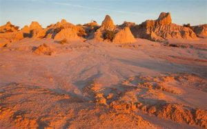
Mungo Lake.

In 1967, geologist Jim Bowler was exploring the lunette (a wind-formed, crescent-shaped dune composed of clay, silt, and sand that occurs on the downwind margins of ephemeral lakes) of the now dry Lake Mungo, observing its ancient layers of sediment. After he returned in 1968, he noticed what appeared to be burnt bones, and returned the next year with archaeologists John Mulvaney and Rhys Jones to uncover Mungo Lady. In 1974, Jim Bowler was continuing his geological studies when he again stumbled upon a white object in the soil, which turned out to be the cranium of the remains that would be called Mungo Man.

Mungo Man and Mungo Lady are among of the oldest anatomically modern human (Homo sapiens) remains found outside of Africa, dating to around 42,000 years ago. Mungo Man was a 1.7m tall hunter-gatherer who lost his two lower canine teeth when he was young and had worn out molar teeth due to his diet. He developed arthritis as he grew older, especially in his right elbow, most likely caused by throwing spears with a woomera (a wooden Australian Aboriginal spear-throwing device, similar to an atlatl) often, and he died at around age 50. His burial ritual is the oldest known example in the world; buried in a lunette, on his back, hands crossed in his lap, with red ochre sprinkled over him. Mungo Lady’s burial is the oldest known cremation in the world. After cremation, her remaining bones were crushed, burned for a second time, and then buried in an expanding lunette. The burials are some of the world’s oldest evidence of ritual cremation and ceremonial burials, again emphasizing the importance of these remains as extremely valuable finds.

Mungo Man.

After extensive negotiations with Aborigional Elders from three traditional tribal groups of the area, the Paakantji, the Ngyiampaa, and the Mutthi Mutthi, Mungo Lady was returned to Lake Mungo in 1992 after being studied at the Australian National University. However, she remains locked in a safe at the Mungo National Park, awaiting reburied as a keeping place has not been reconstructed due to erosion of the lunette. One key to the safe is kept by scientists, the other by the Elders. Mungo Man was also kept at the Australian National University, before being repatriated and returned to Mungo National Park in 2017. In 2018 it was announced by the Australian government that both Mungo Lady and Mungo Man, along with the ancestral remains of 106 people that have been found in the Lake Mungo and Willandra Lakes areas, will be reburied. This proclamation was finally officially approved by the government on April 6th, with the remains to be buried in 26 unmarked sites near and in the Mungo National Park. The remains will be monitored and secure, and their locations will only be known by a select few people belonging to the Aboriginal Advisory Group (AAG).

While this does seem like good news, and the Australian government claims that this is what the local Aboriginal community wants, it has been stated that some locals and descendants of the remains have expressed disappointment in not being consulted and that more input from the Aboriginal community is still needed. Some local Aboriginal peoples feel excluded from the process and some state that they desire not only a reburial but a ceremonial place of significance for the remains. However, it does appear that the proper channels have been taken, as the decision is supported by the AAG. The Willandra Lakes Regional World Heritage Area AAG expressed their desire for reburial in 2018, and today the chairwoman and Mutthi Mutthi elder, Pasty Winch, has expressed that the government has listened to her people. This recent decision is an important move forward for peoples and cultures around the world who wish for the repatriation and burial of ancestral remains.

Follow IUP Anthropology on FacebookTwitter, and Instagram

Further Reading

https://www.bbc.com/news/world-australia-61006118
http://www.visitmungo.com.au/mungo-lady-mungo-man
https://www.nma.gov.au/defining-moments/resources/mungo-lady
https://www.theguardian.com/australia-news/2022/apr/06/mungo-man-and-mungo-lady-to-be-reburied-in-willandra-world-heritage-area-after-federal-decision
https://www.abc.net.au/news/2022-04-06/mungo-man-reburial-on-country-willandra-lakes-federal-government/100967988

Agatha Christie and Archaeology, An Understated Connection

Has anyone watched the movie Death on the Nile recently? Agatha Christie’s 1937 fictional detective story set in Egypt was recently taken to the big screen, sure to wow any audience, archaeologists included! But did you know that Christie has a strong connection to the world of archaeology, which influenced many of her novels other than Death on the Nile, such as Murder in Mesopotamia, published in 1936, where an archaeologist’s wife is killed, and Death Comes as the End, 1945, another mystery set in Egypt taking place in 2000 B.C.E.

She first visited Egypt in 1910 as a debutante, and later set her first novel in Cairo titled Snow Upon the Desert but was unable to get it published. Howard Carter’s discovery of Tutankhamun’s tomb aided her in her first published work, the short story, Adventure of the Egyptian Tomb, in a weekly journal in 1928.

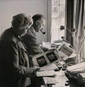
Max Mallowan, Agatha Christie, and Leonard Woolley.

While not a conventional archaeologist, Agatha Christie had a love and passion for the field. Upon an invitation from field director Leonard and his wife Katherine Woolley to the site of Ur in 1928, she took the Orient Express to the Iraqi capital before arriving at the Sumerian city of Ur and coming to understand the methods and awe of archaeology. She spent around 30 years of her life working and living in the East between 1928 and 1958, after meeting her second husband, archaeologist Max Mallowan who was 15 years her junior, at the site in 1930! They would spend fall and spring in the Middle East, summer in England with her daughter Rosalind, and then the rest of the year either traveling or at home. While working and scouting with her husband, she became an assistant, a field hand, and equipped with an understanding of archaeology which spilled into her books.

In 1933, the Mallowans took a Nile River cruise on their way to an archaeological dig which visited the cities of Luxor and Aswan, followed by another steamer the viewed Karnak and Ramses II’s Abu Simbel temples. After a return to Aswan a few years later and then coming back from the winter spent in Egypt, Death on the Nile was written.

Her earlier travels and duty as an archaeologist’s wife took her to Egypt, Syria, Iraq, Greece, Baghdad, Nejef, Kerbala, the site of Nippur, the site of Chagar Bazar, the site of Nimrud, the site of Tell Brak, and many more. Her duties and roles at sites increased as she put archaeology rather than writing first for a change but was still able to bankroll many of her husband’s expeditions through her writing as she spent mornings writing and afternoons completing site work. From 1935-1938 in the

Khabur valley in Syria at the site of Chagar Bazar, Christie would engage in kitchen work, put to use her nursing skills from past experience, supervise the running of meal preparation, collect potsherds, and photograph both the dig and artifacts recovered. Work carried into a second field season in 1936 as they branched into the site of Tell Brak and even into a third until WWII broke out and excavations were halted. The site of Chagar Bazar yielded around 70 cuneiform tablets with insight into the ethnic backgrounds of the former residents of the burned-out palace, and at Tell Brak, the well-known Eye Temple was present. While her husband aided the Air Ministry in Cairo with his knowledge of Arabic during the war, Christie remained in England and published Come, Tell Me How You Live in 1946, a memoir that described her and her husband’s digs in Syria and Iraq.

Agatha Christie photographing an Assyrian ivory figure at Nimrud in Iraq.

At the site of Nimrud from 1949-1959, she began to collect and clean artifacts, even going so far as to use face cream to clean and polish ivory artifacts, a cold-cream wash, as it came to be called. Freed from the social constraints of the Victorian lifestyle, her simplistic tasks that included putting together puzzle-like potsherds, gave her a sense of peace and allowed her to revel in the way archaeology connects the past to the present. At the age of 68, she went on her last dig, which was at Nimrud, still married to Max.

Agatha Christie and Max Mallowan in 1950.

Fictional detective Hercule Poirot states in Death on the Nile, “Once I went professionally to an archaeological expedition and I learnt something there. In the course of an excavation, when something comes out of the ground, everything is cleared away very carefully all around it. You take away the loose earth, and you scrape here and there with a knife until finally your object is there, all alone, ready to be drawn and photographed with no extraneous matter confusing it. That is what I have been seeking to do, clear away the extraneous matter so that we can see the truth, the naked shining truth.” Christie’s interest in archaeology was certainly connected to her love of mysteries. Archaeologists themselves are like detectives, using the left-behind clues of inscriptions or artifacts to decipher the mystery of the past. While Agatha Christie herself was never a recognized archaeologist, and to this day many do not even know about her prominent connections to archaeology, her writings are entrenched in her travels and adventures that inspired readers with her descriptions of ruins and the process of uncovering the past.

Follow IUP Anthropology on FacebookTwitter, and Instagram

Further Reading:

Ladies of the Field: Early Women Archaeologists and Their Search for Adventure: By Amanda Adams

I DIG U Valentine’s Day!

Valentine’s Day is fast approaching, and we are here to gear you up with some archaeological and historical related material to prepare you for this candy-giving, love-spreading holiday! As many know, the origin of Valentine’s Day is rooted both in the Catholic Saint from whom it is named after as well as secular customs. The exact details of how the martyrdom of St. Valentine led to the holiday we celebrate today are not well-known, but the tales are similar. Three different St. Valentines actually share February 14th as their feast day, with the first being a priest and physician in Rome during the third century who is said to have been condemned to death by Emperor Claudius II after either aiding martyrs or by performing marriages after the emperor had outlawed them due to the belief that unmarried men made better soldiers. Another story states that he was a Bishop, Saint Valentine of Terni, who was ordered by Emperor Claudius II to be arrested, beaten, and beheaded as well. The third St. Valentine is said to have served in and become a martyr in Africa, but not much else is known about this saint.

Some legends continue that either the St. Valentine of Rome or the St. Valentine of Terni, while in jail before their executions, signed a letter to the jailer’s daughter whom they had befriended with “From your Valentine,” thus leading to the commonly used expression today. St. Valentine is said to have been buried on the Flaminian way, with Pope Julius I (AD 333-356) building a basilica at the site, preserving his tomb. Archaeological excavations during the 1500s and 1800s at the basilica found evidence of the tomb of St. Valentine, most likely the St. Valentine of Rome, and relics were transferred to the Church of Saint Praxedes in the 13th century, where they remain today. Although each story is slightly different, the underlying themes of the legends are similar.

Around the world, people celebrate St. Valentine in a variety of ways. Of course, we know that Americans typically send cards or letters, chocolate, and flowers to their sweethearts, friends, and family on February 14th. In Denmark, on the same day, friends and sweethearts exchange white flowers called snowdrops and “joking letters” or gaekkebrev, a funny poem or rhyme written on a paper with cut decorations and lacking a signature, with only a number of dots corresponding to the number of letters in the anonymous sender’s name. If you can guess the sender, you will later receive an Easter egg on Easter Sunday, but if you do not, you owe the sender one. In South Korea February 14th was originally a day for women to give chocolate to men as a sign of affection, but marketing has changed it more into a couple’s day. However, on March 14th, also called White Day, men then give women primarily white gifts to answer the Valentine’s Day gifts. And finally, on Black Day, April 14th, singles who did not receive a gift on either of the prior days, eat jjajangmyeon, or Black Noodles. Brazil’s Valentine’s Day is known as Dia dos Namorados, or “Lovers’ Day,” “Day of the Enamored,” or “Boyfriends’/Girlfriends’ Day,” and it is actually celebrated on June 12th. They celebrate on that day due to its’ proximity to St. Anthony’s Day on June 13th, a Saint in Brazil believed to bless young couples with a prosperous marriage. They too, like Americans exchange gifts, flowers, and chocolates, as well as have grand dinners.

The Lovers of Valdaro

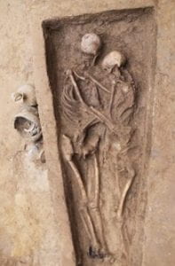
The skeleton’s of the embracing couple from the Northern Wei period (International Journal of Osteoarchaeology).

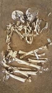
Here are some romantic archaeological discoveries that are sure to make you believe in true love this upcoming Valentine’s Day.  The “Lovers of Valdaro,” the Neolithic, entangled, male and female corpses from 6,000 years ago found in Mantua, Italy in 2007, are well-known figures representing “eternal love”, despite evidence that they were positioned in this way after death because they were buried in a necropolis. In 2021 in the city of Datong, Shanxi Province, China, the remains of a man and women wrapped in an embrace were discovered while excavating more than 600 tombs at a cemetery uncovered during construction work. They lived during the Northern Wei period (386 to 534 A.D.), another example of “embracing each other for eternal love during the afterlife.” Similar intimate burials include the skeletons dating to 5,800 years ago found at Alepotrypa, a cave in Laconia, Greece, the double burials of the Bronze Age Vysotskaya culture in the Ukraine, the two 14th century skeletons holding hands at a site in Leicestershire, England, dozens of Bronze Age couple burials belonging to the Andronovo culture found in Siberia, and many more.

The love letter found on the chest of 16th century mummy of Eung-tae (Andong National University).

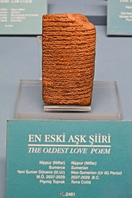
Other romantic discoveries must include love letters. Archaeologists in South Korea found several in a tomb by the mummified body of a 16th century male named Eung-tae, a member of Korea’s ancient Goseong Yi clan. His pregnant wife wrote them around 1568 A.D., expressing her grief and hope of seeing him in her dreams. A 4,000-year-old Sumerian clay tablet called Istanbul #2461 or “The Love Song for Shu-Sin,” holds the Guinness World Record for being the oldest surviving love poem. It is currently held at the Istanbul Museum of the Ancient Orient in Turkey. Dating to around 2025 B.C., it contains a ballad written by the priestess bride professing her love the king Shu-Sin. It is also postulated that this ballad is part of a sacred rite or ‘sacred marriage’ that takes place each year, for a ceremonial and symbolic marriage to the goddess Inanna (the goddess of fertility and sexual love) through one of her priestesses, to make both soil and women fertile.

As the sign says, the world’s oldest love poem.

There are many more symbols of love found amongst archaeological sites, carved into monuments and stone, evident in ancient rings, described and depicted on fading papers, all remnants of the universally shared emotion. As Valentine’s Day approaches, and you receive candy hearts and vibrant red roses, perhaps ponder how archaeologists hundreds or thousands of years from now will interpret the professions of love that you left behind! Have a Happy Valentine’s Day!

Follow IUP Anthropology on FacebookTwitter, and Instagram

Further Reading:

https://www.history.com/topics/valentines-day/history-of-valentines-day-2
https://www.catholiceducation.org/en/culture/catholic-contributions/history-of-st-valentine.html
https://www.huffpost.com/entry/10-valentines-day-traditi_b_9190888
https://www.italy-villas.com/to-italy/2016/curiosities/lovers-of-valdaro
https://www.smithsonianmag.com/smart-news/1500-year-old-chinese-skeletons-found-locked-embrace-180978509/
https://www.ancient-origins.net/news-history-archaeology/skeletons-hugging-021972
https://archaeologynewsnetwork.blogspot.com/2013/11/500-year-old-love-letter-found-buried.html
https://allmesopotamia.wordpress.com/2011/10/28/the-first-love-poem-is-sumerian/

Can You Dig It? An Excavation In Athens

By Heather Lash

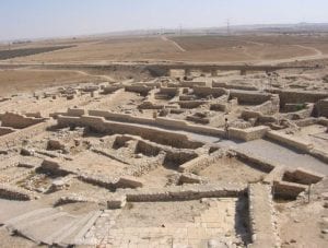
I am not allowed to post pictures of the site, Aixonidai Halai, as are the rules of this excavation, but I will do my best to describe the entire site and my specific working area. The entire site is gated off by a tall metal fence which helps to outline what property is being worked on. Around the site are very elegant two- or three-story white, tan, or yellow plastered apartment buildings all surrounded by their own fence and various types of foliage. A highway runs right in front of the site, and the road which leads to the entrance of the site is a two-way street but really should be a one-way street because the number of cars which park on each side (illegally? legally? who knows because parking laws don’t exist). The entrance of the site is signified by a small clay hill which opens into an area full of rocks, clay, and ruins. To give you a better idea of what I am talking about, see the picture below of another excavation’s ruins. (Thanks to Google for providing this picture when I typed “archaeological ruins” into the search bar. I cannot take credit for this photo.)

Photo belongs to Ben-Gurion University. This site is Tel Be’er Sheva.

Aixonidai Halai looks somewhat like this, except much less clean, and the walls are deteriorating much more than this. Also, there is so much dirt, the dirt is everywhere, even when you do your best to remove it from the rocks to make them clearer. The wind blows, and your entire trench is covered again. Overall though, the picture gives a pretty good idea of what I was working with in Voula. On the first day of excavating, our group of 8 was split into two different teams. My team was in trench A9 and the other team was working in trench A8. Archaeology in Greece is much different than archaeology in the United States, or at least in comparison to the field school experiences I’ve had.

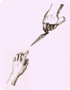
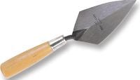
The digging style consists more of fast paced work using pick axes, hand axes, hoes and shovels to clear the dirt more quickly. Trowels are only used for articulation of features, such as walls, or for helping to make the trench walls straight. Not only is the digging style different, but so are the trowels which are used while digging. Non-Greek trowels are very common and used for many other purposes such as gardening or masonry.

Greek Trowel

These trowels are sharp on two sides which connect into a point. Greek trowels are sharp on three sides, and the three sides connect to make the shape of a triangle. Due to my previous use of a non-Greek trowel, I was much more comfortable using what I was familiar with, but it was cool to get some experience with a different kind of tool. This entire excavation overall was a really interesting and different experience because you’ll only really get this kind of digging in Greece.

Non-Greek Trowel


The purpose of our excavation was to continue to discover the story which was uncovered by previous excavations of the area. The trench directly next to mine had stone walls intersecting and opened up into a giant courtyard which was then surrounded by more walls. The foundations of these walls are thought to belong to workshops, and we were attempting to find the remaining outline of these workshops. To start out in our trench, we first needed to remove all the topsoil which included weeds, foliage, and other modern contamination. To do this we each used pick axes across the trench, pulling up the weeds first before we could really dig into the dirt. Once we got a substantial amount of the topsoil ripped up, we would use hoes to create giant dirt piles which we then removed from the trench to start the process all over again until we reached the next layer. While digging we had to pay special attention to what we possibly could be hitting in the off chance we found something of importance. However, most of the inclusions in the topsoil are modern and are not relevant to the project. Once getting through the topsoil, the technique is started all over again, moving between pick axes, hoes, shovels and sometimes the trowels.

Layer 1 quickly became much more interesting than the topsoil. In this layer we began to find materials which gave evidence of our progression towards the time period when these buildings were first built. Our progress of digging slowed as we were told to be cautious when encountering larger rocks as they could be the feature we were looking for. When we found a rock, we would dig around it until our layer was all flat, then we would articulate the edges of the rock to determine if it was just part of the building’s collapse, (meaning no other rocks would be found below it) or if it was actually important and needed to stay in the ground. This process continued for at least one whole week until we pretty much uncovered all of the important rocks and until most of the trench was completely level.

The outcome of the findings from both trenches really helped to put things in perspective and helped to develop and challenge what had previously been found, and determined about the site as a whole. The team in A8 unfortunately did not find any large features or materials which indicated their space was a part of a workshop. They found rocks which contributed to collapse probably from the building which was found in my trench, A9. Despite not finding much, these women worked hard the entire time, and never complained about their situation. Luckily, though, my trench happened to continue and substantiate the story which was discovered before.

Not only did we uncover one large wall, (which helped to give more shape to the walls which were found in the previously excavated trench beside us), we also found a wall which extended perpendicularly from the middle of this large wall. Our professor said this perpendicular wall seemed to have been built at a later time. It was only part of a wall, and seemed to stop purposefully, probably signifying an entrance into a small space which contained evidence of a pythos. This pythos was our big find!!! A pythos in Ancient Greece was a large container used to store materials such as grains or oils and helped to keep them fresh. In our trench, within the small adjacent wall, we discovered the semicircular outline of the pythos and then the presence of many floor tiles around the back end of the pythos, most likely indicating another entrance way into the storage room. In this area, where the larger wall met up with the smaller wall was also the presence of lots of charcoal and a permanently changed soil color.

The charcoal and darkened gray soil color indicated at one point there was a fire in this spot, and in relation to the rest of the building, most likely a fire used to destroy the building after use. Another great find was the presence of steps next to the large wall signifying there was a possibility of at least one other floor in this building. In fact, our professor said by the size of the room, this building we were working in may have been one of the biggest at the site. This is why the other trench had much less luck finding things. A lot of the collapse from our building ended up in their trench. Also, if it was one large room then it would also make sense for them not to find much other than pottery sherds.

Speaking of artifacts, other finds throughout both trenches included pottery handles, stems, bases, fine Athenian blackware, some pieces of marble (not ancient), some building nails (most likely not ancient), some worked bone and shell, and plenty of floor tiles and roofing tiles. We actually found plenty of pottery and a handful of the other stuff throughout our layers but what we really wanted to find was the walls, or a hearth, or a pythos. The fact we were able to help so much and excavate to the best of our abilities and surpass our professor’s expectations was pleasing. It was a lot of fun and we all learned a lot. Yeah, we had to wake up at 5am each morning, and there wasn’t a site bathroom which made things interesting, the weather wasn’t the greatest the entire time, and we probably could have found more than we did, but none of that really mattered to us. We all worked our hardest and were proud of all our work. I would not hesitate to do it all again! Also, Voula is beautiful and I couldn’t be happier to have traveled to the coast every single day. Hopefully soon I’ll get the chance again to dig, and travel.

IUP Anthropology Department

Upcoming Graduate Student Research Presentations from the UK to VA

By: Genevieve Everett

Conference season is upon us! I thought it would be nice to highlight the graduate students that are representing IUP and our department by presenting their research in the form of papers and posters at the following conferences/forums:

  1. The Middle Atlantic Archaeological Conference (MAAC) in Virginia Beach, VA- March 15-18
  2. The Graduate Scholars Forum at KCAC on IUPs campus, April 4
  3. The 89th Annual  Society for Pennsylvania Archaeology(SPA) Meeting in DuBois, PA- April 6-8
  4. The Annualy Society for American Archaeology (SAA) Conference in Washington, DC- April 11-15
  5. The Seminar for Arabian Studies (SAS) in Bloomsbury, London-August 3-5

Below you will read about each student’s individual project/research and which conferences/forum you can find them at this year!

Kristina Gaugler

Presenting research at: IUP Graduate Students Forum

Spatial Database Development for Confluence Park Master Plan

The goal of this project is to create a series of spatial data layers that document the existing environmental conditions at Confluence Park, a 15 acre site managed by the Allegheny Arboretum at Indiana University of Pennsylvania. These maps will contribute to the develop of a support system designed to complement future site planning activities and will include the current topography, vegetation, hydrology, existing structures, and site access points. Factors that may influence the decisions of future planning or construction will be assessed, including the location and condition of on-site sewage systems and retention ponds, riparian zones, and a rapid-bio assessment of streams. This information will help delineate locations on the site that may be suitable for future development. With the tools and basemaps created, users will be able to overlay applications to suit their needs and allow for varying types of analyses to be performed.

Britney Elsbury-Orris

Presenting research at: SPA and SAA

The Kirshner Site (36WM213) is a multi-component site in South Huntington township, Westmoreland county, Pennsylvania that contains two Middle Monongahela villages. Relatively little is known about Monongahela use of animals.  Fortunately, good faunal preservation has made zooarchaeological analyses of materials from this site possible. Identifying and analyzing these faunal remains with respect to taxa and skeletal elements, as well as human and animal modifications, provides important new information. The distribution of faunal remains across the features of the site and its two components has been examined, as they have the implications for relationships between the site’s inhabitants and their environment. These data provide insights into the nature of this site and the activities of its occupants. Comparisons with other faunal studies, like those done on zooarchaeological materials from other Middle Monongahela sites, including the Johnston Site (36IN2) and the Hatfield Site (36WH678), further expands on the understanding of the Kirshner Site and the Middle Monongahela tradition.

Matthew Bjorkman

Presenting research at: IUP Graduate Scholars Forum

Indiana County FEMA Data-based Flood Hazard Analysis

Co-authored with Eisbeiry Cordova-Ortiz & Shanice Ellison

In the past decade we have frequently seen the effects of intense precipitation events, particularly the damage they cause in populated areas. Due to the increased frequency of these events, state and local government officials across the country have developed flood hazard analyses for their jurisdictions. Taking this into consideration, Indiana county is developing a flood management plan to prepare for any adverse effects caused by 100-year storms. Using ArcGIS, a geodatabase was developed to build a 100-year flood depth grid (FDG) using Federal Emergency Management Agency (FEMA) data from Pennsylvania Spatial Data Access (PASDA).  The FDG was used to identify structures that are located in a flood zone and would be susceptible to damage. This project highlights concentrations of vulnerable buildings and provides the value of the estimated monetary damages. These results will assist the county with its development of its comprehensive emergency management plan.

Using LiDAR to Analyze Landscape Evolution: A Case Study of the Squirrel Hill Site (36WM0035)

Light detection and ranging (LiDAR) is an active remote sensing system that has, on occasion, been used by archaeologists to conduct paleolandscape reconstruction studies. Understanding what the landscape looked like is essential for archaeologists to determine how prehistoric sites formed. Rivers are a primary operator in landscape evolution, as meandering and avulsing rivers can create major alterations to a landscape through deposition and erosional processes. Changes in a river’s position on the landscape will have great impacts on the location and preservation potential of archaeological sites This study utilizes LiDAR data from Indiana and Westmoreland counties in Pennsylvania to study landscape evolution near the archaeological site of Squirrel Hill, a Monongahela village site. The goal of the research was to use remote sensing technologies to identify and map extinct channels of the Conemaugh River to understand how the evolution of the landscape around the Squirrel Hill site has affected the site’s formation and preservation.

Samantha Taylor

Presenting research at: MAAC, SPA, SAA

Looking Through Dirty Dishes: A Comparative Analysis of Ceramics at the John and Rosie Allen Residence, Pandenarium, Mercer County, Pennsylvania.

African Diaspora archaeology has become one of the most impactful means by which archaeologists supplement our current understanding of the past. Not only does this subfield have the potential to benefit descendant and local communities, but it also enables professionals to fill in the blank gaps left by the systematic disenfranchisement and intentional illiteracy of an entire group of people. One site with the potential to enhance our understanding of the African Diaspora is Pandenarium (36ME253) a freed African American settlement in western Pennsylvania. Current research at Pandenarium focuses on a comparative ceramic analysis with nearby archaeological sites, other freed African American sites, and slave quarters at plantations. The goal of this research is to determine the socio-economic status of individuals living at Pandenarium, along with participation in local and regional markets. The results of the analysis featured in this paper are a foundation for future comparative studies featuring Pandenarium.

Mesfer Alqahtani

Presenting poster at: SAA and the IUP Graduate Scholars Forum

Presenting paper at: SAS

SAA:

GIS Investigations on Stone-Circle Structures in the North of Saudi Arabia

The theme of the poster will address archaeological phenomena in the north of Saudi Arabia. The archaeological phenomena are stone-built structures that can be seen by satellite images. These stone-built structures have various types, and one of them is the circle type.

The poster will show the method of creating predictive models of stone circles by using the Geographic Information System (GIS). To create these models, two zones from the north of Saudi Arabia should be selected: study zone and applied zone. The study zone is where the distribution of stone circle locations will be analyzed to create predictive models. The applied zone is where predictive models will be applied to be testable in the future.

The predictive models will be based on quantifiable attributes of stone-circle locations from the study zone. These attributes will include the relationship between stone-circle locations and environmental variables such as the landform and the distance of water resources. These attributes will be analyzed by ArcGIS to obtain environmental characteristics representing high, middle, or low probability models for the presence of stone-circle locations. In the applied zone, similar environmental characteristics will be identified to determine high, middle, low predictive models.

SAS:

Geospatial Investigation of Circular Stone Structures in Northern Saudi Arabia

The paper will focus on the circular type of stone-built structures in Harrat Al-Harrah of northern Saudi Arabia. The goal of the research is to recognize the locational patterns for these circular structures based on five quantifiable geographic attributes: elevation, slope, land-cover, distance to sabkhas (temporary water bodies), and distance to wadies (water streams).

The probability modeling methodology conducted uses Remote Sensing and GIS technologies. This study includes identified locations of circular structures in one zone to create the model and a second zone to test the model (225 square miles and 81 squared miles total) of Harrat Al-Harrah, examining the correlative relationship between these locations and the five geographic factors. The results show the favorable geographic factors related to the locations of circular structures in the two zones of Harrat Al-Harrah.

The significance of this research lies in the contribution of recognizing the locational patterns of circular stone structures in two zones of Harrat Al-Harrah that have never been studied before and difficult to access. This pattern will be useful for comparative studies with locational patterns of circular structures in other areas of the Arabian Peninsula when conducting more investigations on this type of stone structures.

IUP Graduate Scholar Forum:

Geospatial investigation of circular stone structures in Northern Saudi Arabia

The theme of this poster will address stone-built structures in northern Saudi Arabia. Specifically, the circular type stone-built structure will be the focus of this research. Stone-built structures are an archaeological phenomena that can be seen via satellite images within this region of the world.

The goal of the research is to recognize the pattern of geographic locations for these circular stone-built structures based on five quantifiable geographic attributes. These attributes include elevation, slope, land-cover, distance to sabkhas (temporary water bodies), and distance to wadies (water streams). Remote Sensing and GIS technologies are used to conduct probability modeling for this research. This study includes identifying all the locations of circular structures in one zone, building a model for their locations, and then examining a second zone using the model. The results show the favorable locations for circular structures in these two zones based on the model.

Ross Owen

Presenting research at: SAA

PennDOT Highway Archaeological Survey Team: Providing Immersive CRM Work Experience to Students

Despite there being more applicants with graduate degrees than there are jobs, the CRM industry suffers from the number of people holding graduate degrees but lacking experience conducting archaeological surveys for Section 106 compliance. Additionally, conducting archaeological surveys is cost-prohibitive and can be a burden on state agencies on projects where federal funds are not involved. These two issues in the field of compliance archaeology prompted the creation of the PennDOT Highway Archaeological Survey Team (PHAST). Through a partnership with Indiana University of Pennsylvania, each year PHAST gives 4 students an opportunity to work on and complete small Phase I and II surveys for the Pennsylvania Department of Transportation. The students gain experience in the field, and are employed in the lab to perform the necessary background research, GIS mapping, curation and documentation following the guidelines of the Pennsylvania Historical and Museum Commission. Much of this experience is outside the purview of most field technician positions. This paper will explore the successes and failures of the PHAST program from both a professional and financial point of view. How have the students benefitted from their experience within the program, and how has the state benefitted from the services provided?

Andrew Malhotra

Presenting research at: SPA (Co-authored with John Nass, Jr. (Callifornia University of Pennsylvania)

Presenting research at: IUP Graduate Scholars Forum

SPA:

Social Signaling and the use of Style Amongst Late Prehistoric Monongahela Populations: Possible Evidence for Intervillage Political Integration

Communication between groups of people occurs for different reasons and, when using material culture, can take many forms. During the Late Prehistoric period evidence of social signaling in the form of shared stylistic traits appears at several late Monongahela villages from southwestern Pennsylvania. The stylistic trait consists of various forms of executing lip decoration on ceramic jars. The form of decoration using various tools results in the lip looking like a piecrust. This specific form of decoration appears from the Johnson site in Indiana County to the Foley Farm site in Greene County.In is the intent of this paper to document the temporal and spatial documentation and the social/political significance of this stylistic design is the subject of this paper.

IUP Graduate Scholars Forum:

Sanborn Maps of Indiana: Reconstructing the Urban Geography of Indiana, PA

This project will consist of analysis of Sanborn Fire Insurance Maps from 1887-1936 of Indiana Borough in order to depict urban growth patterns, major employers and how these factors changed over time. These maps were brought into ArcMap 10.5 to be georeferenced with road intersections and buildings, digitizing the most important ones. Attribute data including census and city directory data was also extracted for database creation. Through construction of a detailed database and data extraction of these maps, the goals of documenting and analyzing how the borough of Indiana and its people have developed and changed through the target years can be achieved. A future goal is to develop an interactive map with attribute information about its features for use by the public and historical society.

Genevieve Everett

Presenting Research at: SAA and Graduate Student Forum (abstract for forum not provided)

From Field School to Graduate School: How One Public Archaeology Program Has Made It All Possible

The Paleoindian Period of New Hampshire has been studied extensively, particularly in the White Mountains. Volunteers and avocationals from the summer field school known as the State Conservation And Rescue Archaeology Program (SCRAP) have excavated several of the known Paleoindian sites in northern New Hampshire. It is the goal of New Hampshire State Archaeologist, Richard Boisvert to make information and data recovered by SCRAP accessible to scholars as potential thesis and dissertation topics.

This paper outlines how the principal investigators participation in the SCRAP field school has been beneficial to her professional and academic career, including her current Master’s thesis. The purpose of this thesis is to produce a spatial and statistical analysis of the artifact assemblage from excavation block K at the Potter Site (27-CO-60) located in Randolph, New Hampshire in comparison with the Jefferson VI (27-CO-74) salvage block in Jefferson, New Hampshire. This comparison not only examines the spatial relationships within one Paleoindian site (27-CO-60), but also helps the principal investigator make inferences about the similarities and differences between two Paleoindian sites in close proximity. Public archaeology programs such as SCRAP are a valuable part of North American Archaeology, without SCRAP this work would not be possible.

Zaakiyah Cua

Presenting research at: SAA and the IUP Graduate Scholars Forum

SAA:

Loyalhanna Lake: a Geoarchaeological Approach to Understanding the Archaeological Potential of Floodplains

Unlike uplands, floodplains generally yield stratified deposits that may include deeply buried landscapes and archaeological sites. Most state specifications for cultural resources surveys require floodplains to be geomorphically evaluated in order to identify buried landscapes. This is most frequently accomplished via trenching, an effective, but timely, costly, and sometimes destructive method. This project reports on an alternative technique utilizing a multi-proxy methodology coupling geophysical survey with auger sampling. These non-invasive and limited-impact methods produce accurate results without causing extensive destruction to cultural resources. The study area, located along Loyalhanna Creek in Westmoreland Country in western Pennsylvania, is managed by the US Army Corps of Engineers – Pittsburgh District (USACE). As a federal agency, the USACE is mandated to identify and preserve cultural resources by Section 110 of the National Historic Preservation Act (NHPA). Unfortunately, federal agencies often face limited staffing, resources and funding to address management of cultural resources. In addition to proposing a method for identifying buried landscapes, this project also provides a case study of partnerships between federal agencies and public universities; a mutually beneficial collaboration which provides agencies with data essential to land management while simultaneously providing students valuable opportunities to conduct cultural resource management assessments.

IUP Graduate Scholars Forum:

Misery Bay Ice Survey Preliminary Results: a Case Study for Testing Geophysical Methods and Collaboration with Stakeholders

Ground-penetrating radar (GPR) and gradiometry are two geophysical methods typically used by archaeologists in terrestrial environments to locate subsurface features. This study took terrestrial geophysical methods out on the frozen ice surface of Misery By, Presque Isle State Park, PA; testing instrument limits across two acres of the bay. If successful, this study has major implications to geophysical maritime investigations, broadening the reach of cultural resource management within these environments by government agencies. In addition to testing new methodology, the project was a collaboration between the PA DCNR, Regional Science Consortium, PA Sea Grant, PASST, and Indiana University of Pennsylvania Applied Archaeology program. The collaborative and public nature of the project drew in stakeholders, largely contributing to the success of the study. This poster presents the preliminary results of the project; both a case study for testing new methods, and the positive implications for collaborative and public cultural resource surveys.

Heather R. MacIsaac

Presenting research at: IUP Graduate Scholars Forum

The Squirrel Hill site in Westmoreland County, Pennsylvania, was a Monongahela village inhabited from A.D. 1450 to A.D. 1613. Past research conducted by IUP archaeologists at the Squirrel Hill site uncovered evidence of housing, storage areas, and burials. There are conflicting interpretations of the village’s development and expansion over time. One interpretation is that the site contains a single village with an open, central plaza for communal activities, and that the village gradually expanded southward. Another interpretation is that the site contains two overlapping villages occupied at different times. To evaluate these interpretations, this research incorporates a statistical analysis of artifacts and a spatial analysis of structural features based on materials from the 2016 IUP archaeological field school. This research also investigates whether the Squirrel Hill site was inhabited by Monongahela traditional people only or by an amalgamation of Monongahela tradition and nearby McFate phase people.


IUP ANTHROPOLOGY DEPARTMENT
My thesis fieldwork in Cyprus (by Sarah Henley)

This past May, I traveled to Cyprus to conduct my Masters thesis research. The purpose of my research is to use portable X-Ray Fluorescence (pXRF) analyze the elemental composition of Roman and Late Roman Period (30 B.C. to A.D. 614) Cypriot Red Slip ware (CRS) sherds, which basically provides a chemical “fingerprint” for sherds made from different clay sources.  My original goal was to compare my results to naturally-occurring clay bed samples in order to investigate their origin of manufacture, as well as regional trade patterns across Cyprus and parts of neighboring Turkey.

I traveled with Dr. Robert S. Moore from the IUP History department, and Dr. William R. Caraher from the University of North Dakota History department. We spent the first night in Larnaca, Cyprus, which is located in Larnaca Bay on the southeastern part of the island. Larnaca is a somewhat noisy city, with an oceanfront full of restaurants, an ancient fort at one end, and a marina on the other. There is also a beautiful church located down the road from the fort. Throughout the city there are various types of architecture, which gives the city character. As you make your way down small alleys you can find shops and more restaurants. The beach was also nice, but not as beautiful as other places I have seen in the Mediterranean.

The next day, we traveled to Polis, which is located on the western side of the island, and to give you an idea of the island’s size it took about 3 hours to get there from Larnaca. The inner terrain of Cyprus is beautiful with the Troodos Mountains, and the southwestern coast, which both reminded me of Greece. Polis was a nice small town, and much quieter then Larnaca.  The next 4 days we worked in a small, fairly dirty, basement where all the ceramic artifacts were curated. The first day I spent running tests with CRS body sherds to figure out how to go about collecting my data. I had not anticipated for each ceramic sherd to have concretion, which are limestone deposits that accumulate on artifacts that have been in the ground for long periods of time. Concretion can only be completely removed by acid, which takes a great amount of time to remove.  The next 3 days I spent collecting my data. I tried to test areas on each sherd that had the least amount of concretion.  On May 20th we returned to Larnaca. The last 4 days we worked in a warehouse, which was cleaner then the curation building in Polis. The sherds were in bags, which were in crates that were marked by excavation unit(s). Dr. Moore had e-mailed me a list of the CRS sherds, and I pulled them from the crates, and bags. Fortunately, these sherds had less concretion on them because they were surface finds.

XRF unit (left) and example of concretion on an CRS sherd (right)

A professor from Messiah College’s history department, Dr. David K. Pettegrew, an associate of Dr. Moore and Dr. Caraher’s, brought a group of undergraduate students to Cyprus. On my last day I had the opportunity to talk to the students about pXRF and my thesis. While in Cyprus Dr. Moore showed me the sites in which the sherds I tested came from. In Polis the sherds were excavated from the porch of a Christian basilica dating to the 6th/7th century A.D. In Larnaca the sherds were collected from a Roman Period site that used to be a major southern port town.  Overall, I had a  good experience; the only down side was I was not able to collect clay bed samples as originally planned. Later in June I will be meeting with the Applied Research Lab people at IUP, who will help me to statistically statistically analyze my data.

IUP Department of Anthropology

IUP Archaeologists March for Science

By: Genevieve Everett

Last Saturday, Earth Day, Dr. Sarah, Danielle, Kate, Jared, Heather, Sami and I woke up in the early morning hours to hit the road for the March for Science in Washington DC. The weather forecast was calling for rain all day, so we came mostly prepared for that, with our signs of support in tow. We arrived at the Metro Station around 9 am, still feeling groggy from our early start, but energized to join the thousands of people coming to the march for science.

Bill Nye!

After a short Metro ride, we were heading toward the National Monument where we stood in line looking on at the beautiful new National Museum of African American History and Culture . We were surrounded signs that read “Science not Silence” and people in lab coats. Waiting in line to get into the rally, the rain began with a light drizzle. Inside the gates we made our way through the crowds to stand in front of a giant jumbo-tron to watch the many speeches that were planned for the day. Different scientists or supporters of science, young and old came to speak about the importance of science, and how it has impacted their lives and the lives of others. Sadly, no archaeologists spoke, but it was inspirational nonetheless. And finally….BILL NYE THE SCIENCE GUY came out to end the rally. The rain began to pick up, but the moment we had all been waiting for had finally come! He stood at the podium speaking about the need to encourage lawmakers to take the sciences seriously for the well being of all. As a kid I idolized Bill Nye, and now that I’ve grown up I still see the same passion that came through my television set, and it makes me feel a glimmer of hope for the future of science and our planet, because as many signs around us said, “THERE IS NO PLANET B”.

With time to kill, we stopped and got some lunch at a little deli where we had a chance to “dry” off a bit. With our stomachs full, we headed toward the front of the march. Waiting on the side of the road we watched as Bill Nye and a long line of smiling faces proudly held a “March for Science” banner. We joined the masses of people, holding our own signs high. We heard the occasional call and response chant of,  “WHAT DO WE WANT? EVIDENCE BASED SCIENCE. WHEN DO WE WANT IT? AFTER PEER REVIEW!”. There was an overall feeling of connectedness, and it was an awesome feeling. The march ended at Union Square across from the Capitol Building where everyone dispersed to go back to their normal lives.

A week later I am sitting at my computer thinking how lucky I am to be able to stand up for what I believe in. Archaeology may not be the first thing people think of when they think of science, but we are scientists through and through. With the treat to cultural resources in this country, we must work to preserve and protect them, because they are non-renewable resources, just like our precious planet. Although last Saturday was a long day after being up early and getting soaked, it was completely worth it in the name of science!

IUP Department of Anthropology

American Grad Students in Canada: Our trip to the SAA, eh.

By: Matthew Bjorkman and Britney Elsbury-Orris

Hello! We are Matthew Bjorkman and Britney Elsbury-Orris, and this is our first contribution to Trowels and Tribulations, and honestly…what took so long! We are both first-year graduate students in the Applied Archaeology program, and we have had the pleasure of attending way too many conferences this semester. At the end of the fall semester, while we were riding the high of turning in our final assignment, we volunteered to become members of the IUP Ethics Bowl team. While we did not fully understand the time commitment we had just signed up for (we blame the lack of sleep), we knew that it would give us an opportunity to flex our ethics muscles in competition at the 82nd annual meeting of the Society for American Archaeology in Vancouver, British Columbia.

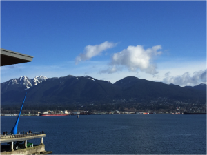
Beautiful view outside the Convention Center

Despite being poor college students once again , we were able to book our trip. Departing from Pittsburgh at way-to-early in the morning, we had a short layover in the San Francisco airport before finally arriving in Vancouver the day before the conference (Trip bonus: we flew on United on both legs of our trip and neither of us was asked to give up our seat or got stung by a scorpion). After wandering aimlessly in the city for an hour, we arrived at our hotel, Hotel Blu. The hotel was fantastic, far too classy for this duo. Our first day, the day before the start of the conference, was spent figuring out how to get our phones to work in a foreign land, and meeting up with Ethics Bowl teammates and other IUP students. We got together and searched for a spot to grab dinner. After searching for a restaurant that Matt swears was selling a pound of wings for $3, we abandoned our search and settled for the White Spot. Here we tested the local brews, ate exotic poutine, and discussed our up-coming presentations and competition.

IUP Ethics Bowl team!

The Ethics Bowl was on the first day of the conference. Fighting off jet lag and the exhaustion of traveling 3,000 miles, team IUP arrived at the Hyatt hotel at 7:30 in the morning. Practice run-downs of our cases and guidance from our mentor did little to calm our nerves. With friends and fans in the crowd, our team performed wonderfully, crushing the cases that were presented. We solved the issue of the troubled museum exhibit, and we fixed Sandy Melmac’s curation crisis. Sadly, we did not crush the competition, and lost by 1 point to the home town Simon Fraser University.

The Ethics Bowl was over before we wanted it to be, but we were now able to experience all the SAA conference had to offer. At first, the number of things happening at the conference was overwhelming. With over 4,000 attendees, this was the largest conference that either of us had attended. We explored the program and the convention center, highlighting presentations we wanted to try to get to. The beautiful part about the SAA conference is that there are sessions on just about any archaeological topic you can think of. Over the course of the conference, we attended presentations on Classic Maya architecture, isotope analysis of faunal remains, geoarchaeology, territorial behavior and ecology, and more. We vi

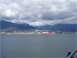
Looking across the bay at North Vancouver

sited the poster presentations of our IUP colleagues and explored the projects of archaeologists from around the world. We even networked at a CRM (cultural resource management) expo with other archaeologists who were looking for people to work for them over the summer, part-time, and permanently.

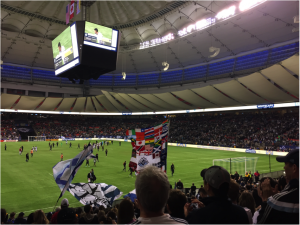
Even though we were in Vancouver for a conference, we made time to have a little vacation for ourselves. We explored the city experiencing its beautiful scenery and the other great things that Vancouver had to offer. We reunited with long lost friends from our undergrad days at Penn State and even met up with those we had already met at IUP over countless dinners and drinks. We also had the opportunity to attend a MLS soccer game featuring the Vancouver Whitecaps and the LA Galaxy. We sat in the supporter’s section and like to think we were the reason why the Whitecaps got their 4-2 upset victory.

Go Whitecaps!

In conclusion, even though we did not win the Ethics Bowl, we still had a lot of fun on our trip. The Ethics Bowl gave us the opportunity to get an idea of how we should prepare and what we should expect next year in Washington D.C., when we win. 😉 We got to attend presentations in which we learned about various archaeological work being done throughout the United States and even within Canada and other countries and gained ideas for our future research. We got to see old faces in which we talked with them over many dinners and drinks. We even got to meet new ones in prospects for a CRM job in the future and go to our first MLS soccer game. If you get the chance, take the opportunity to attend this conference. It will definitely benefit you in the long run! Hopefully we will see you all next year in Washington D.C. for the 83rd annual SAA meeting and our second Ethic’s Bowl appearance.

IUP Department of Anthropology

Archaeology and the Public: A New Way To Bridge The Gap

By: Genevieve Everett

This semester we have been talking a lot about how to get the public involved/interested in archaeology and the preservation of cultural resources. Most importantly, how can we make what we do relevant to people outside of our field?  We have read Jeremy Sabloff’s book, “Why Archaeology Matters”, which discusses the many ways in which archaeologists are contributing on a local, regional, national and global scale.  According to Sabloff, as archaeologists we should be “working for living communities, not just in or near them”(Sabloff 2008:17). An excellent example of someone that is attempting to work with the public is ‘space archaeologist’, Sarah Parcak.  Parcak’s new project, GlobalXplorer allows the public to get involved in the effort to combat looting of archaeological sites around the world.

Sarah Parcak is an Egyptologist, and is best known for her work looking at satellite images to find archaeological sites and signs of looting. According to the website, “So far, Dr. Parcak’s techniques have helped locate 17 potential pyramids, in addition to 3,100 potential forgotten settlements and 1,000 potential lost tombs in Egypt — and she’s also made significant discoveries in the Viking world and Roman Empire.” (GlobalXplorer 2017). Check out the TED talk for which Parcak earned the  2016 TED prize of 1 million dollars. Parcak used her award to create GlobalXplorer as a way to train the public to spot looting on satellite images. I went to the website, and decided to sign up as a global explorer. Once signed up, there is a short tutorial video that explains what looting typically looks like when looking down on the earth from a satellite. Once the tutorial is done, a satellite image/tile is brought up, and based on what your learned in the tutorial, you must decide if this tile displays looting or not. It’s much harder than you think, because trees, bushes and mounds of dirt kind of look like looting pits; however, once you look at enough tiles you begin to recognize the pits versus the natural landscape. To date, over 44,000 people have signed up to look at the tiles, and over 9 million tiles have been explored so far!

The work that Parcak has done is incredible, and for an archaeologist like myself, I find this to be extremely fascinating, and an awesome platform for getting the public involved in a joint effort to protect cultural resources. People are drawn to research like Parcak’s, because it is innovative and interactive. Just spouting facts at people about why looting is bad is not enough; rather, giving people the knowledge and tools to combat looting makes them feel like they are making a contribution to something big. Parcak’s research seems to be bridging the gap between archaeologists and the public, creating a new generation of stewards. As more people get involved with this project, there is a better chance that archaeological sites will be protected from looting and destruction. I am really excited to see how GlobalXplorer progresses!

IUP Department of Anthropology

The Final Countdown for Graduate School – Round 2…..

By: Jared Divido

It’s hard to believe that I’m already mid-way through my last semester of graduate school in the MA in Applied Archaeology program here at IUP.  The saying “time flies” could not be more applicable to the feelings and experiences that come along with graduate school.

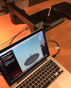
I’m currently on spring break working on the data analysis phase of my thesis research, which involves testing the feasible use of 3D scanning technology for constructing comparative faunal (animal) bone specimens.  Three-dimensional technology has been making a lot of headway in the field of archaeology as a method for constructing or re-constructing 3-dimensional models of found artifacts, site structures, and even site profiles.  The 3D scan of a given object enables the researcher to create a fairly accurate digital model, which could then be used in a multitude of ways for things such as digital archival storage, research collaborations via file sharing, 3D printing for educational purposes, etc.  My background research has found that much of the applicability of 3D scanning has largely focused on the 3D printing aspect of the technology, yet there has been little attention given to usability of the 3D scans as raw data themselves.  My thesis research is attempting to focus on an important aspect of zooarchaeology, which requires a well established comparative animal bone reference collection for the identification and analysis of animal bones that are recovered from archaeological sites.

Animals bones at archaeological sites are often found fragmented, but they can provide the researcher with a wealth of information about the past, including things such as the human subsistence strategies, tool making/tool use, environmental conditions and changes, etc.  A comparative reference collection can often help identify the bone down to taxon or species level by looking at the surface features on the fragmented skeletal element.  Yet, the accessibility of a well established comparative animal bone collection requires a lot of laboratory space and the availability of wide range of animal species.  This often requires researchers to borrow or loan specimens from other institutions, which can be a rather costly and timely process in the end.  I’m ultimately trying to determine if 3D scanning technology could complete replace this process by using the 3D scans in place of the physical skeletal specimens.

At the end of March, I will be travelling to Vancouver, Canada to present a poster presentation on my research at the Society for American Archaeology’s 82nd Annual Meeting.  This will be a great opportunity to share my research findings with others in the field, while also being there to show support for my fellow colleagues whom are also presenting at the conference.  Furthermore, as Danielle mentioned in her blog post, conferences are a great way to network with colleagues and other respected professionals in the field.

I will admit that my academic and professional career interests have not always been oriented toward archaeology or cultural resource management (CRM).  In May 2012, I graduated from IUP with a Bachelor of Arts in Anthropology with the intent to pursue a career in forensic anthropology.  I worked hard to make that dream a reality by travelling nearly 3,580 miles away from home to attend school at the University of Dundee, which is located in Dundee, Scotland.  While at the University of Dundee, I had the opportunity to study at the Centre for Anatomy and Human Identification, under the direction of Professor Dame Sue Black (a highly respected forensic professional in the UK).  One might wonder how I transitioned from forensic anthropology to the study of archaeology, but there is a rather intricate connection between the two fields.  My thesis research in the UK involved testing forensic methodologies for cut mark analysis, which are actually deeply rooted in past archaeological field investigations and techniques.

Thus, following the completion of my first master’s degree, I travelled to the Spanish Balearic Islands to perform my first archaeological field school, which involved the excavation and analysis of Roman funerary units and human remains, dating from the 14-16th centuries.  Upon my return back to the United States after my field school, I came to the realization that I wanted to gain more knowledge and experience in archaeology.  I was very happy when I discovered that IUP had an Applied Archaeology program because of my past experience with the faulty during my undergraduate program.  In July 2015, I participated in my second archaeological field school with IUP, which was focused on the excavation of an identified GPR anomaly at Historic Hanna’s Town (1773-18th century) in Westmoreland County, Pennsylvania.  I can honestly say that IUP has well prepared me for a career in archaeology or CRM.  I am currently a graduate research assistant for Dr. Sarah Neusius, which has provided me with opportunities to work with the IUP faunal comparative collection, various archaeological faunal assemblages, and faunal databases from numerous prehistoric sites.

The faculty has a real concern and interest for the success of its students.  I have also made some wonderful friendships and created great memories along the way that will last a lifetime.  I look forward to finishing up my final semester and seeing what my future holds upon graduation in August!

IUP Department of Anthropology