Humanity and Science Unearth Together at St. Mary’s College of Maryland’s Historical Archaeology Field School

By Mace Long


During the summer, I spent ten weeks concentrating on gaining skills in excavation, data collection and archeological recording in the field, laboratory and classroom at the St Mary’s College of Maryland Historical Archeological Field School. At the late 17th century Leonard Calvert House, I personally unearthed part of a horseshoe, a lock mechanism, Rhenish stoneware, Venetian glass, creamware, projectile points, fragments of oyster shells, iron nails, pieces of clay tobacco pipes and much more. Chief Archaeologist Travis Parno emphasized that “these excavations at the site of Maryland’s first capital have revolutionized the understanding of colonial architecture and the material culture of the period.”

The archeological field school site is part of Historic St Mary’s City surrounded by a large living history area, museum and The Maryland Dove ship. While spending full days excavating at the site, we took turns giving public tours. It was fulfilling to be able to discuss the background history and present the successes of our dig site.


During the Tidewater Archaeology Weekend, I witnessed the incredible instructive value of allowing people of all ages to sift through dirt themselves and be educated physically with exciting hands-on participation. In addition, I greatly enjoyed the variety of field trips to Colonial Williamsburg, Jamestown and Montpelier where we observed methods used by other sites.

As part of the St Mary’s College of Maryland’s Historical Archaeological field school, we boarded and rode the Maryland Dove learning all kinds of techniques and mechanisms regarding 17th century ships. (IUP Graduate Student Mace Long)

The St Mary’s College of Maryland Historical Archaeological Field School was one of the most incredible educational experiences of my life, as it heightened my understanding of A.L. Kroeber’s quote “[Archaeology] is the most humanistic of the sciences and the most scientific of the humanities.”


Photos provided by Mace Long and the Historic Saint Mary’s City Field School Blog

IUP Department of Anthropology

I Can Munsell That?

By Zachary Fischer

Today I wanted to bring back an old favorite of the blog, the old field school game, Can You Munsell That?  At the beginning of the week, our cohort Janee brought in a few loaves of pumpkin bread that were just lovely.  As the week went on hungry grad students nibbled on the bread.  This left us with the final slice of a slightly crumbly, but still delicious, pumpkin bread.  So, as I was deciding on what to write, bringing up the Munsell idea, Janee joked that I could Munsell the bread.  I thought to myself, “You know what? I will.”

A chunk of pumpkin bread.


A well loved copy that has served its time in the department.

So what is this Munsell thing that I keep jabbering about?  I’ll give you a quick background.  The Munsell color system was produced by Dr. Albert H. Munsell (1858-1918) who was known as an artist and inventor. He created this system to provide a descriptive and systematic form to communicate color.  We as archaeologists, and archaeologists in training, use this system to describe the color of soil layers in a profile.  Normally, you take a sample, pack it down, and place it under the color chip on the chart.  Be careful to avoid touching the color chips as colors can fade and these books aren’t known to be cheap.  I would love to talk more about the Munsell system itself but I honestly don’t know all that much about it.  This was something of a refresher for me and a learning experience for myself and a few cohorts.

I attempted to do this alone, going from page to page, comparing the color of the bread and those in the charts.  Frankly, I couldn’t get a perfect match but had a thought on the closest color.  I was thinking something along the lines of 10YR 4/6 (dark yellowish brown), truthfully it is a bit more yellow than any of my pages show. Unsure, I did what all good social scientists should do and found new perspectives.  By found I mean left my office to see Janee and Heather who were nibbling away at their own lunches.  Both could see where I was coming from and partially agreed.  There was the suggestion of 7.5YR 5/8 and this interests me.  We may have this standard system but we do not all see the exact same shade or hue.  What I think belongs on 10YR, someone else might think goes on 7.5YR.  However, there is one piece I overlooked and that was the crust.  After consulting the physically closest cohorts, a few of us agree that it’s 10YR 3/6 (dark yellowish brown).  Again, I find it interesting that some colors we see may look the same or completely different.  This makes me wonder how effective the Munsell system will be in the future of archaeology but that’s a thought for another day.  Maybe if I get to do a Part 2 I’ll ramble on the topic.


You can learn more about the Munsell Color System at Munsell.com.

IUP Department of Anthropology

I’m Not Old Enough To Carbon Date Yet

Howdy folks, my name is Zachary Fischer but let’s pretend like you know me and just say I’m Zac.  Let me tell you a little about myself.  I like long walks on the beach, gazing at the stars, and… I’ve just been informed that this is not a dating site.  Great! There goes my plan for an archaeological personal ad (on here anyway).  Well this is awkward and I’m no good at transitions so…

This is my face, you're welcome world.

This is my face, you’re welcome world.

I graduated from Indiana University of Pennsylvania with a BA in Anthropology where I focused on archaeology.  I’m currently a student of the Applied Archaeology MA program at IUP.  I’ll be blunt, archaeology was not Plan A.  I started as a Natural Sciences: Pre-Pharmacy major but organic chemistry blocked that path.  I decided to start looking around for a new venture.  I honestly had no clue what else I wanted to do but I knew I wanted to find something that made me happy.  I remember reading an undergraduate catalog while grabbing lunch and the section that popped out most to me was anthropology.  Something about it took me back to a contemporary anthropology course I took with Dr. Abigail Adams.  It was one of the few courses that I took something away from beyond the course material.  I figured it was worth looking into and took an intro to archaeology course the next semester with Dr. Lara Homsey-Messer.  It stuck on me so I made the switch.  It didn’t take long for me to feel like I made the right decision.  I became more interested with each class I took and field school just cemented that feeling.  I could drag this on and on, and I kind of want to, but I think most of you don’t want my life story and I totally get that.  So I’ll stop this particular line of rambling with this, I consider finding archaeology alongside an incredibly supportive department to be a blessing.  My undergrad years spent with the anthropology department at IUP are something I would never trade away.


Dr. Sarah Neusius showing me how it’s done.


I really don’t have any archaeological experience beyond field school and a few other focused undergrad courses, unless you count watching a ridiculous amount of documentaries on ancient Egypt as a child.  Anyway, I took some time off after graduation with the intent of working in CRM but ended up working for an insurance company in Pittsburgh.  So after about a year later I decided to apply for graduate school, ready to refocus myself on archaeology.  Besides if I didn’t do it now, well, who knows when I would have?  So here I am.  I hope you’ll join me and follow along as I learn with my new cohorts.


IUP Anthropology Department

Where in the world are IUP Achaeologists this summer?

Summer is upon us (where did the year go?!) and our applied archaeology students are off to many exciting places and experiences. We are very proud of the hard work of our recent grads and current students, and pleased to see that nearly all of our current students are employed! Here are some highlights:

May 2018 graduation

Recent grads:  Samantha Taylor (MA, ’18) recently completed her thesis on the ceramic assemblage at the African-American diaspora site of Pandenarium. She is currently working as the Assistant Site Director at The Germanna Foundation. Danielle Kiesow (MA, ’18) recently completed her thesis investigating land use and gardening practices on the Ojibwe reservation from 1854 until 1930 to analyze the relationship between the Ojibwe at Grand Portage and the Indian Agents from the Bureau of Indian Affairs.  She is currently working as an Archaeological Technician for the Grand Portage Reservation Tribal Council. Undergraduates Harley Burgis (BA, ’18) and Eleanor Schultz (BA, ’18) recently graduated with Honors. Harley, whose thesis explored prehistoric cooking technologies at the prehistoric site of Dust Cave, is off to work as a field technician for TRC while she takes a gap year between college and grad school. Eleanor, who won this year’s Olin-Fahle award, will begin a graduate program in museum studies at Johns Hopkins University this fall. Congrats Grads!

Year 2 cohort:  these guys are off running! Gen Everett (who has been running this blog admirably for the last 2 years), is working as an archaeological technician for the National Park Service at Isle Royale, enjoying scenery the rest of us are envious of. Britney Elsbury-Orris, Heather MacIsaac and Zane Ermine are serving as crew chiefs on several phase I and geophysical surveys for IUP’s Archaeological Services Center. Zaakiya Cua is working as an archaeological technician for the Allegheny National Forest-Bradford District during the week while writing her thesis on the weekends. Matt Bjorkman is utilizing his GIS certificate training by working part time for IUP’s IMAPS (Institute for Mine Mapping, Archival Procedures, and Safety) program, and conducting fieldwork at the Squirrel Hill site as part of his thesis research. Patrick McGinley is conducting his thesis research using geophysical survey to locate Ft. Halifax along the Susquehanna River in central PA, and Mesfer Alqahtani will soon be defending his thesis, which uses GIS to model the distribution of stone circle structures in northern Saudi Arabia. Mesfer recently won the Dean’s Award for best poster at the 2018 IUP Scholar’s Forum. Congrats to Year 2!

Zaakiyah Cua in the field at the Allegheny National Forest-Bradford District (left) and Sami Taylor diligently taking field notes as the assistant site director for the Germana Foundation (right).

Year 1 cohort: Not to be outdone by the Second Years, the Year 1 cohort is also doing impressive things this summer. Ross Owen, whose thesis explores the management of metarhyolite stone quarries in central PA (funded in part by the South Mountain Partnership), is once again serving as supervisor for the PHAST (Pennsylvania Highway Archaeological Survey Team) program. Assisting him as the PHAST crew are fellow first-years Stephen Campbell, Kristina Gaugler, and Sam Edwards. Andrew Malhotra is interning with the Department of Conservation of National Resources’ forestry division, and Chris Thompson is working as a field technician out in the Badlands region of North Dakota. Joe Bomberger works for the Allegheny National Forest, where he worked prior to matriculating into IUP’s MA in applied archaeology program. Finally, Jessie Hoover has begun research on her thesis at the Mary Rinn site and Anthony Gilchrist is taking an underwater archaeology field school hosted by Lake Champlain Maritime Museum before heading to upstate New York to serve as a crew chief for Dr. David Starbuck’s archaeological field school at French and Indian War site of Rogers Island.

Danielle Kiesow in the field at Grand Portage (left) and Anthony Gilchrist sporting the latest style in underwater archaeology (right).

Keep up the awesome work everyone and can’t wait to hear about your summer adventures at the first Fall Graduate Colloquium!

Visit IUP DEPARTMENT OF ANTHROPOLOGY

IUP at the 83rd Annual Society for American Archaeology Meeeting

By: Genevieve Everett

Cherry Blossoms around the Tidal Basin

Employers should allow attendees/participants the Monday after the Society for American Archaeology (SAA) conference off. Let me tell you, I’m exhausted, but I’m feeling energized by all the amazing papers that I had the chance to hear, and the poster’s that were exhibited throughout the week.

Wednesday morning, myself, and 6 of my classmates (and luggage) crammed into the Arch Services van, and headed to the 83rd Annual SAA conference held in Washington, DC, in the lovely Woodley Park neighborhood. This was my first ever SAA conference. We arrive mid-afternoon at our small, but cozy Air Bnb that was located about a half hour (walk) from the conference center. After settling in a bit, we all walked to the conference center to register. We walked past yellow daffodils and purple flowers’ cascading down stonewalls, the first real sign of spring. One route we could take to and from the conference was through the National Zoo! After a delicious Lebanese meal (and cocktail), we all headed back to the Air Bnb to prepare for the first day of presentations, posters, and seeing old friends/colleagues.

IUP Ethics Bowl team

Thursday morning was a BUSY day. I was up bright and early to go to Sami’s presentation on her thesis research at Pandenarium, a 19th century Freedman site in Mercer County, PA. This was one of her last presentations before she graduates in May! She did really great! Shortly after I wandered around the poster session, and was particularly interested in the Caves and Rockshelter posters. From there, I headed to watch our Ethics Bowl team debate Cornell University. The point of the Ethics Bowl is to put two teams from different universities in front of a panel of judges, and debate about hypothetical (and in some cases based on real events) ethical issues within archaeology. Our team did amazing, however, they did not make it to the final round. Later I walked around the Expo room browsing books and picking up free “swag”, and from there I stopped by to see Sami and Angie Jaillet-Wentling’s poster. They were presenting the results of the public archaeology days they held this past fall at Pandenarium, which contributed to the assemblage Sami was examining for her thesis.

Sami and Angie at their poster session

The remainder of Thursday I spent alone, going from session to session. This past fall I helped excavate a quarry site in Northern Maine (if you go back to the September blog posts, you can read about it) under the supervision of Nathaniel Kitchel and Heather Rockwell. In the afternoon, Nathaniel presented a paper that the two co-authored on the results of this excavation. Next, I stopped by a talk in honor of Dennis Stanford. I especially enjoyed Ciprian Ardelean’s talk that was partially about working with Dennis Stanford, but also the Chiquihuite Cave in Zacatecas Mexico. Mr. Ardelean talked about being an “outsider” from Romania working in the Americas. He also talked about the importance of working with students. More specifically, the merit and value of getting dirty, working in isolation for so many days, being in nature and cooking and enjoying meals together. I really connect with this notion.

Friday I decided to head toward the Washington monument to see the Cherry Blossoms in full bloom. I did a loop around the Tidal Basin, dodging hordes of school groups. Despite the tourist traffic along the way, it was such a pleasant walk. I wanted to hit up the Natural History Museum, but again, it was swamped with school groups, so I turned around and headed back to the conference. I hit up a few more talks, had a drink with my mentor, and went out to Haikan, an amazing ramen place with some friends. The rest of the night was spent celebrating the fact that our classmate/friend Zaakiyah won the Paul Goldberg Award, a national award, awarded to a single MA student in either the geosciences or archaeology!

Zaakiyah with the Paul Goldberg Award!

On Saturday, my main objective was to attend the symposium, “Wicked Awesome” Archaeology: New Data and Directions In The Archaeological Northeast”. A few friends/acquaintances were presenting during this session, including Dick Boisvert and Zachary Singer. Dick Boisvert is my mentor and is on my thesis committee. He talked about the legacy of the State Conservation and Rescue Archaeology Program (SCRAP). Following Dick, Zach discussed “New Investigations of the Paleoindian Component at the Templeton Site in Western Connecticut”. Much like SCRAP, students and volunteers help excavate the Templeton Site, which to me, is always a wonderful collaboration. After their talk I met up with my family, and we walked through the National Zoo. Later, we met up with my boyfriend, and grabbed dinner at a Mexican restaurant where delicious food and margarita’s were consumed.

The Government, University, and Heritage Stewardship crew!

Sunday, the final day of the conference, and the day of my presentation (at 8 am) in the “Government, Universities, and Heritage Stewardship: A Student and Young Professional Symposium”. I was in this symposium with several IUP classmates, some fellow PennDOT interns, and two graduate students from the University of Montana. My paper was titled, “From Field School to Graduate School: How One Public Archaeology Program Has Made It All Possible”. I discussed the benefits/legacy of SCRAP, and how I am using SCRAP data to complete my Master’s thesis. I also provided some preliminary results/conclusions to my thesis research. As my first time presenting at a conference, I have to say, I don’t think I bombed! I felt pretty confident up there, but that took A LOT of practicing over and over again. Everyone that participated in the symposium did great, and each person had a really interesting topic that related to their collaboration with state or federal government agencies. After our symposium, we jumped in the van, and headed back to Indiana.

Personally, the SAA’s were an amazing experience for me. Roughly 20 plus IUP students, past and present, attended the conference. In addition, three professors in the graduate and undergraduate Anthro department presented papers.  It felt really good knowing that IUP had a strong presence, one that shows that we are a tight knit group, and that we are able to successfully transition from our undergraduate or graduate studies into viable careers in archaeology. Most IUP graduates are working in CRM, while some are getting their PhD’s. I hope that we can continue to show the archaeological community that we have a strong program for years to come. See you all next year in Albuquerque!!!

IUP ANTHROPOLOGY DEPARTMENT

California Love: An Archaeological Survey on Santa Rosa Island

By: Matthew Bjorkman and Britney Elsbury-Orris

During our undergraduate years at Penn State (2013-2014), we worked in the Zooarchaeology labs sorting shell midden assemblages from the California Channel Islands. The project was a part of Dr. Christopher Jazwa’s dissertation, which involved studying how patterns of human settlement, subsistence, and mobility were influenced by the changing environment and cultural factors. Five years later, we were lucky enough to receive an invite from Dr. Jazwa to participate in a week-long survey on Santa Rosa Island. The goals of the project were to survey new areas of the island, primarily the interior, to identify and record new archaeological sites for the National Park Service (NPS). Our team consisted of four members: Ourselves, Dr. Jazwa, and Kirk Schmitz (a master’s student at the University of Nevada, Reno).

Day 1: Visit to La Brea Tar Pits and Pink’s

View of faunal remains in the Observation PitOn our first day in Los Angeles, we visited the La Brea Tar Pits and its associated museum. The La Brea Tar Pits are located in central Los Angeles, and the world’s most famous Ice Age fossil active excavation site. The museum included a park, which contained sculptures of Ice Age animals, a Pleistocene garden, and ongoing excavations of the tar pits, as well as the George C. Page museum. The museum contains fossils excavated from pits, some dating back to the earliest excavation in 1915. The museum contained a fossil lab (called the “Fish Bowl”) that allowed visitors to view the scientists and volunteers in their ‘natural environment’ while they worked to remove tar from the fossilized remains. For us, the coolest part of the La Brea Tar Pits was the Observation Pit, which allowed us to get up close and personal with an active tar pit that still housed the remains of extinct Ice Age animals. After La Brea, we visited Pink’s Hot Dogs in Hollywood to eat some of the most ridiculous hot dogs humans have ever made. The portions were so enormous that it put us into a food coma, allowing us to rest for our trip to the island the following day.

View of faunal remains in the Observation Pit

Pink’s Hot Dogs


Day 2: Traveling to Santa Rosa and Foraging for Dinner

Waking up early is not our thing. Thankfully the jet lag made our 6 A.M. wake-up call much easier. After loading up our gear and supplies into “the Wagon” (as Dr. Jazwa calls it) we departed to the docks in Ventura, Ca. We boarded the Ocean Ranger, a boat owned by the NPS, and we departed on our 3 hour ride to Santa Rosa (Gilligan’s Island anyone??). We arrived at the Santa Rosa dock in the early afternoon and quickly took our belongs up to the park housing. Our first order of business was to travel to the south side of Santa Rosa to collect mussels from the intertidal zone that would be used for isotopic testing…and dinner! The collection process was not as easy as we would have envisioned, since the tide was relatively high that day. Despite taking some unwanted dips in the Pacific Ocean, we were able to collect our sample (approximately 50 mussels and 20 turban snails) and returned back to housing.  Unbeknownst to us, Dr. Jazwa apparently also has his Ph. D. in the culinary arts (not really), as this was the first of many amazing meals he cooked for us during our stay.

Collecting mussels

Midden site along the coast


Day 3+4: Rain, Rain, Go Away!

Our survey got off to a slow start. During the first 3 days we were on Santa Rosa, the island received more rain than it had all year! Santa Rosa is primarily made up of sandstone rock, meaning the roads do not handle water very well, making getting to the survey area impossible. Instead of surveying during these days, Dr. Jazwa gave us a tour of closer sites along the coast. Most of these sites were ones that we had analyzed material from while at PSU. Our tour of the island included visiting the historic ranches, coastal shell midden sites, and Cherry Canyon. While walking through Cherry Canyon, Dr. Jazwa pointed out the numerous rockshelter sites that have been identified.

Rockshelter in Cherry Canyon


Day 4: Let the Survey Begin!

The rain had ceased and we could finally start our survey! Unfortunately, the roads were still closed due to the rain so we had to hike a few miles to our survey area. The hike was generally nice, except for the stream crossings and climbing over a mountain ridge. The plan for the project was to do a surface survey along ridge tops on the interior of the island to locate possible inland habitation sites. Our luck was good from the start, as we were able to identify and record four sites that day. All four sites contained lithic scatters that were visible on the surface. We found some really interesting artifacts at two of the larger sites , such as a volcanic chopper, lithic cores, a part of a sandstone vessel bowl, and a broken projectile point. For each site, we had to record the site boundary and the location of the most significant artifacts using a Trimble. We created a sketch map of these features and took site overview photos, as well as close-ups of the significant artifacts. On our return trip to housing after surveying we walked through one of the only two Torrey Pine stands in the world (the other is a golf course in San Diego). The detour added a couple more miles to our hike, but it was well worth the extra leg pain.

Sandstone vessel fragment

Recording a site

The massive pinecones from Torrey Pines


Day 5: Oh Deer!

We did not have quite as much luck on our second day of survey. We only located one site, but were able to survey a large swath of land. The site we identified was a large shell midden and lithic scatter adjacent to an old road. We found an almost complete chalcedony projectile point (lying in the road!) and two possible groundstone artifacts. While we were not able to locate any other sites, we did find three complete skeletons of deer/elk. We learned that deer and elk populations were brought to the island by humans in the mid 1900s, but were fully eradicated by 2017 to preserve the natural state of the island. With our final day of survey in the books, we headed back to housing to prepare for our departure and the end of our vacation.

View from atop a ridgeline

Chalcedony projectile point


Day 6: Island Packers

We arrived at the dock about an hour and half before our ride home arrived. We used this time to explore the Carrington Point Marine Reserve and play in the sand.  We saw previously identified sites on top of the cliffs, and wandered in coastal caves and rockshelters. An Island Packers boat (equipped with a bar!) picked us and some tourists up to take us back to Ventura. The ocean had some large swells making our return trip exciting or terrifying, depending on how you look at it. We got lucky enough to see some dolphins riding the large waves during the ride, and honestly they were handling the waves better than we were! The Packers boat made a short stop at Painted Cave, a large marine cave on the northern side of Santa Cruz Island, and we were able to take some awesome pictures of it. To put a stamp on our trip, we returned to Pink’s (again) before being dropped off at LAX to return to good ole IUP.

This project was one of the greatest experiences we have had in our young career in archaeology. We were able to learn a lot of new information about the islands, as well as pick up on some new techniques and methods for doing archaeology. We would like to thank Dr. Jazwa for inviting us to be a part of the project, and our professors for allowing us to go on the trip. We recommend visiting the islands if you are ever in southern California!

IUP ANTHROPOLOGY DEPARTMENT

Upcoming Graduate Student Research Presentations from the UK to VA

By: Genevieve Everett

Conference season is upon us! I thought it would be nice to highlight the graduate students that are representing IUP and our department by presenting their research in the form of papers and posters at the following conferences/forums:

  1. The Middle Atlantic Archaeological Conference (MAAC) in Virginia Beach, VA- March 15-18
  2. The Graduate Scholars Forum at KCAC on IUPs campus, April 4
  3. The 89th Annual  Society for Pennsylvania Archaeology(SPA) Meeting in DuBois, PA- April 6-8
  4. The Annualy Society for American Archaeology (SAA) Conference in Washington, DC- April 11-15
  5. The Seminar for Arabian Studies (SAS) in Bloomsbury, London-August 3-5

Below you will read about each student’s individual project/research and which conferences/forum you can find them at this year!

Kristina Gaugler

Presenting research at: IUP Graduate Students Forum

Spatial Database Development for Confluence Park Master Plan

The goal of this project is to create a series of spatial data layers that document the existing environmental conditions at Confluence Park, a 15 acre site managed by the Allegheny Arboretum at Indiana University of Pennsylvania. These maps will contribute to the develop of a support system designed to complement future site planning activities and will include the current topography, vegetation, hydrology, existing structures, and site access points. Factors that may influence the decisions of future planning or construction will be assessed, including the location and condition of on-site sewage systems and retention ponds, riparian zones, and a rapid-bio assessment of streams. This information will help delineate locations on the site that may be suitable for future development. With the tools and basemaps created, users will be able to overlay applications to suit their needs and allow for varying types of analyses to be performed.

Britney Elsbury-Orris

Presenting research at: SPA and SAA

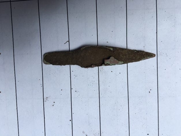
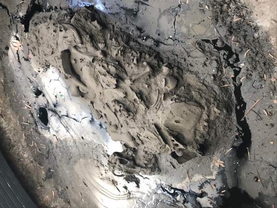
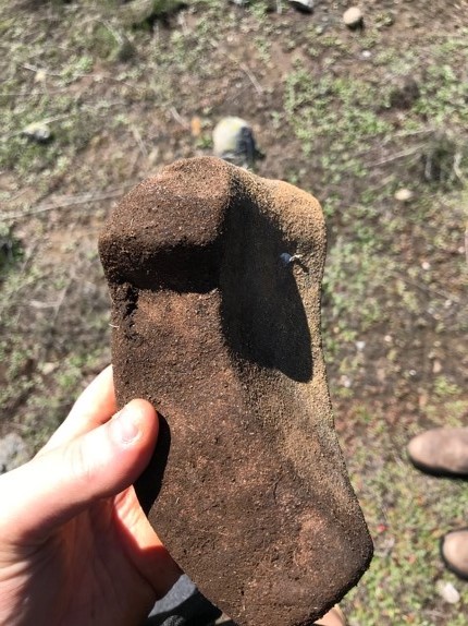
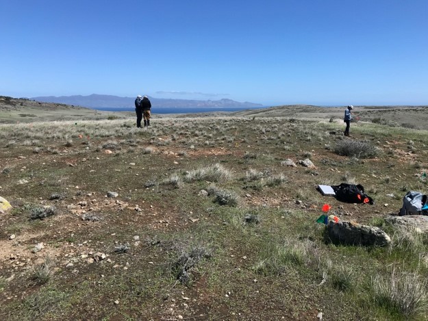
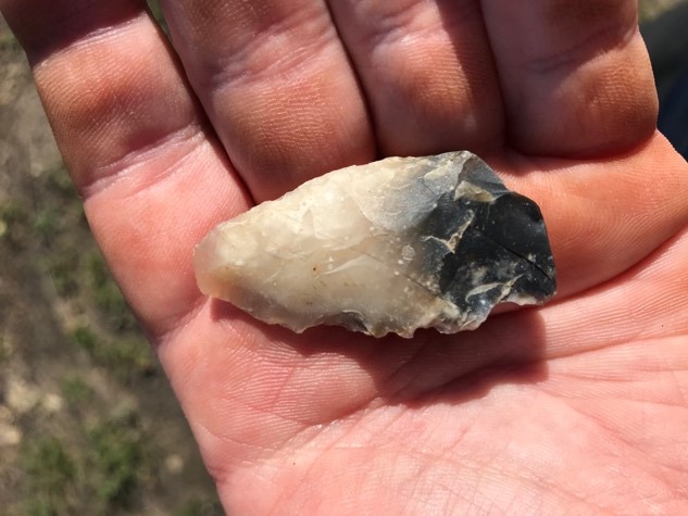
The Kirshner Site (36WM213) is a multi-component site in South Huntington township, Westmoreland county, Pennsylvania that contains two Middle Monongahela villages. Relatively little is known about Monongahela use of animals.  Fortunately, good faunal preservation has made zooarchaeological analyses of materials from this site possible. Identifying and analyzing these faunal remains with respect to taxa and skeletal elements, as well as human and animal modifications, provides important new information. The distribution of faunal remains across the features of the site and its two components has been examined, as they have the implications for relationships between the site’s inhabitants and their environment. These data provide insights into the nature of this site and the activities of its occupants. Comparisons with other faunal studies, like those done on zooarchaeological materials from other Middle Monongahela sites, including the Johnston Site (36IN2) and the Hatfield Site (36WH678), further expands on the understanding of the Kirshner Site and the Middle Monongahela tradition.

Matthew Bjorkman

Presenting research at: IUP Graduate Scholars Forum

Indiana County FEMA Data-based Flood Hazard Analysis

Co-authored with Eisbeiry Cordova-Ortiz & Shanice Ellison

In the past decade we have frequently seen the effects of intense precipitation events, particularly the damage they cause in populated areas. Due to the increased frequency of these events, state and local government officials across the country have developed flood hazard analyses for their jurisdictions. Taking this into consideration, Indiana county is developing a flood management plan to prepare for any adverse effects caused by 100-year storms. Using ArcGIS, a geodatabase was developed to build a 100-year flood depth grid (FDG) using Federal Emergency Management Agency (FEMA) data from Pennsylvania Spatial Data Access (PASDA).  The FDG was used to identify structures that are located in a flood zone and would be susceptible to damage. This project highlights concentrations of vulnerable buildings and provides the value of the estimated monetary damages. These results will assist the county with its development of its comprehensive emergency management plan.

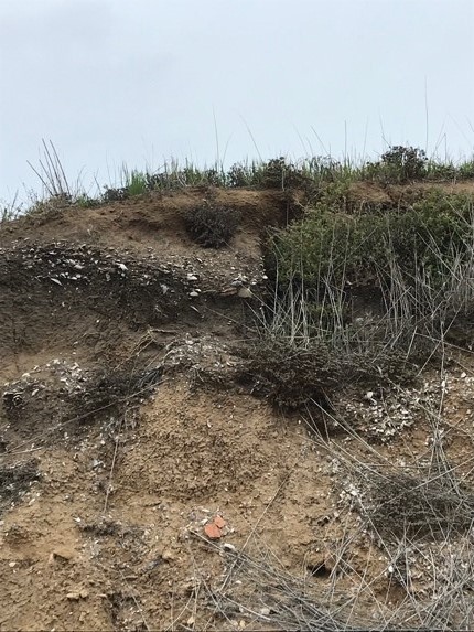
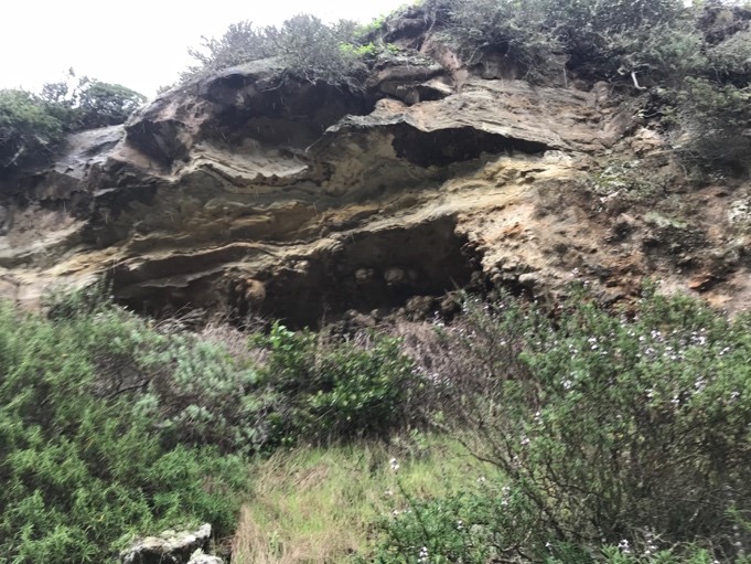
Using LiDAR to Analyze Landscape Evolution: A Case Study of the Squirrel Hill Site (36WM0035)

Light detection and ranging (LiDAR) is an active remote sensing system that has, on occasion, been used by archaeologists to conduct paleolandscape reconstruction studies. Understanding what the landscape looked like is essential for archaeologists to determine how prehistoric sites formed. Rivers are a primary operator in landscape evolution, as meandering and avulsing rivers can create major alterations to a landscape through deposition and erosional processes. Changes in a river’s position on the landscape will have great impacts on the location and preservation potential of archaeological sites This study utilizes LiDAR data from Indiana and Westmoreland counties in Pennsylvania to study landscape evolution near the archaeological site of Squirrel Hill, a Monongahela village site. The goal of the research was to use remote sensing technologies to identify and map extinct channels of the Conemaugh River to understand how the evolution of the landscape around the Squirrel Hill site has affected the site’s formation and preservation.

Samantha Taylor

Presenting research at: MAAC, SPA, SAA

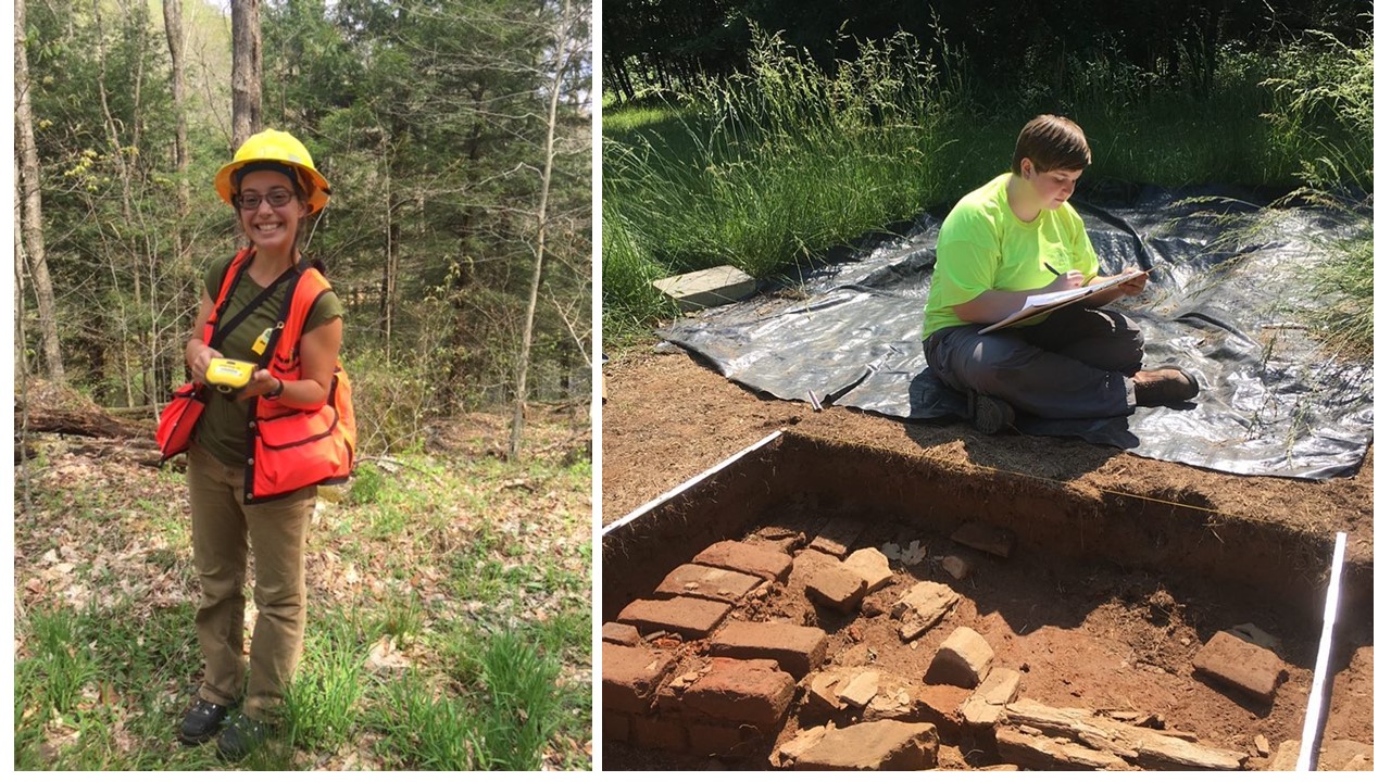
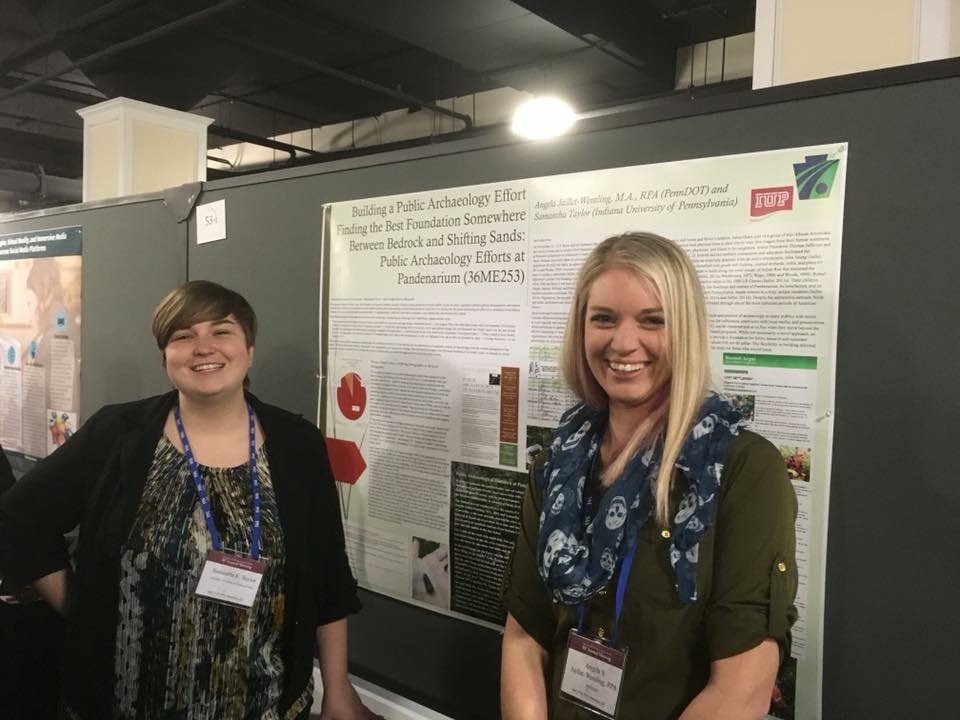
Looking Through Dirty Dishes: A Comparative Analysis of Ceramics at the John and Rosie Allen Residence, Pandenarium, Mercer County, Pennsylvania.

African Diaspora archaeology has become one of the most impactful means by which archaeologists supplement our current understanding of the past. Not only does this subfield have the potential to benefit descendant and local communities, but it also enables professionals to fill in the blank gaps left by the systematic disenfranchisement and intentional illiteracy of an entire group of people. One site with the potential to enhance our understanding of the African Diaspora is Pandenarium (36ME253) a freed African American settlement in western Pennsylvania. Current research at Pandenarium focuses on a comparative ceramic analysis with nearby archaeological sites, other freed African American sites, and slave quarters at plantations. The goal of this research is to determine the socio-economic status of individuals living at Pandenarium, along with participation in local and regional markets. The results of the analysis featured in this paper are a foundation for future comparative studies featuring Pandenarium.

Mesfer Alqahtani

Presenting poster at: SAA and the IUP Graduate Scholars Forum

Presenting paper at: SAS

SAA:

GIS Investigations on Stone-Circle Structures in the North of Saudi Arabia

The theme of the poster will address archaeological phenomena in the north of Saudi Arabia. The archaeological phenomena are stone-built structures that can be seen by satellite images. These stone-built structures have various types, and one of them is the circle type.

The poster will show the method of creating predictive models of stone circles by using the Geographic Information System (GIS). To create these models, two zones from the north of Saudi Arabia should be selected: study zone and applied zone. The study zone is where the distribution of stone circle locations will be analyzed to create predictive models. The applied zone is where predictive models will be applied to be testable in the future.

The predictive models will be based on quantifiable attributes of stone-circle locations from the study zone. These attributes will include the relationship between stone-circle locations and environmental variables such as the landform and the distance of water resources. These attributes will be analyzed by ArcGIS to obtain environmental characteristics representing high, middle, or low probability models for the presence of stone-circle locations. In the applied zone, similar environmental characteristics will be identified to determine high, middle, low predictive models.

SAS:

Geospatial Investigation of Circular Stone Structures in Northern Saudi Arabia

The paper will focus on the circular type of stone-built structures in Harrat Al-Harrah of northern Saudi Arabia. The goal of the research is to recognize the locational patterns for these circular structures based on five quantifiable geographic attributes: elevation, slope, land-cover, distance to sabkhas (temporary water bodies), and distance to wadies (water streams).

The probability modeling methodology conducted uses Remote Sensing and GIS technologies. This study includes identified locations of circular structures in one zone to create the model and a second zone to test the model (225 square miles and 81 squared miles total) of Harrat Al-Harrah, examining the correlative relationship between these locations and the five geographic factors. The results show the favorable geographic factors related to the locations of circular structures in the two zones of Harrat Al-Harrah.

The significance of this research lies in the contribution of recognizing the locational patterns of circular stone structures in two zones of Harrat Al-Harrah that have never been studied before and difficult to access. This pattern will be useful for comparative studies with locational patterns of circular structures in other areas of the Arabian Peninsula when conducting more investigations on this type of stone structures.

IUP Graduate Scholar Forum:

Geospatial investigation of circular stone structures in Northern Saudi Arabia

The theme of this poster will address stone-built structures in northern Saudi Arabia. Specifically, the circular type stone-built structure will be the focus of this research. Stone-built structures are an archaeological phenomena that can be seen via satellite images within this region of the world.

The goal of the research is to recognize the pattern of geographic locations for these circular stone-built structures based on five quantifiable geographic attributes. These attributes include elevation, slope, land-cover, distance to sabkhas (temporary water bodies), and distance to wadies (water streams). Remote Sensing and GIS technologies are used to conduct probability modeling for this research. This study includes identifying all the locations of circular structures in one zone, building a model for their locations, and then examining a second zone using the model. The results show the favorable locations for circular structures in these two zones based on the model.

Ross Owen

Presenting research at: SAA

PennDOT Highway Archaeological Survey Team: Providing Immersive CRM Work Experience to Students

Despite there being more applicants with graduate degrees than there are jobs, the CRM industry suffers from the number of people holding graduate degrees but lacking experience conducting archaeological surveys for Section 106 compliance. Additionally, conducting archaeological surveys is cost-prohibitive and can be a burden on state agencies on projects where federal funds are not involved. These two issues in the field of compliance archaeology prompted the creation of the PennDOT Highway Archaeological Survey Team (PHAST). Through a partnership with Indiana University of Pennsylvania, each year PHAST gives 4 students an opportunity to work on and complete small Phase I and II surveys for the Pennsylvania Department of Transportation. The students gain experience in the field, and are employed in the lab to perform the necessary background research, GIS mapping, curation and documentation following the guidelines of the Pennsylvania Historical and Museum Commission. Much of this experience is outside the purview of most field technician positions. This paper will explore the successes and failures of the PHAST program from both a professional and financial point of view. How have the students benefitted from their experience within the program, and how has the state benefitted from the services provided?

Andrew Malhotra

Presenting research at: SPA (Co-authored with John Nass, Jr. (Callifornia University of Pennsylvania)

Presenting research at: IUP Graduate Scholars Forum

SPA:

Social Signaling and the use of Style Amongst Late Prehistoric Monongahela Populations: Possible Evidence for Intervillage Political Integration

Communication between groups of people occurs for different reasons and, when using material culture, can take many forms. During the Late Prehistoric period evidence of social signaling in the form of shared stylistic traits appears at several late Monongahela villages from southwestern Pennsylvania. The stylistic trait consists of various forms of executing lip decoration on ceramic jars. The form of decoration using various tools results in the lip looking like a piecrust. This specific form of decoration appears from the Johnson site in Indiana County to the Foley Farm site in Greene County.In is the intent of this paper to document the temporal and spatial documentation and the social/political significance of this stylistic design is the subject of this paper.

IUP Graduate Scholars Forum:

Sanborn Maps of Indiana: Reconstructing the Urban Geography of Indiana, PA

This project will consist of analysis of Sanborn Fire Insurance Maps from 1887-1936 of Indiana Borough in order to depict urban growth patterns, major employers and how these factors changed over time. These maps were brought into ArcMap 10.5 to be georeferenced with road intersections and buildings, digitizing the most important ones. Attribute data including census and city directory data was also extracted for database creation. Through construction of a detailed database and data extraction of these maps, the goals of documenting and analyzing how the borough of Indiana and its people have developed and changed through the target years can be achieved. A future goal is to develop an interactive map with attribute information about its features for use by the public and historical society.

Genevieve Everett

Presenting Research at: SAA and Graduate Student Forum (abstract for forum not provided)

From Field School to Graduate School: How One Public Archaeology Program Has Made It All Possible

The Paleoindian Period of New Hampshire has been studied extensively, particularly in the White Mountains. Volunteers and avocationals from the summer field school known as the State Conservation And Rescue Archaeology Program (SCRAP) have excavated several of the known Paleoindian sites in northern New Hampshire. It is the goal of New Hampshire State Archaeologist, Richard Boisvert to make information and data recovered by SCRAP accessible to scholars as potential thesis and dissertation topics.

This paper outlines how the principal investigators participation in the SCRAP field school has been beneficial to her professional and academic career, including her current Master’s thesis. The purpose of this thesis is to produce a spatial and statistical analysis of the artifact assemblage from excavation block K at the Potter Site (27-CO-60) located in Randolph, New Hampshire in comparison with the Jefferson VI (27-CO-74) salvage block in Jefferson, New Hampshire. This comparison not only examines the spatial relationships within one Paleoindian site (27-CO-60), but also helps the principal investigator make inferences about the similarities and differences between two Paleoindian sites in close proximity. Public archaeology programs such as SCRAP are a valuable part of North American Archaeology, without SCRAP this work would not be possible.

Zaakiyah Cua

Presenting research at: SAA and the IUP Graduate Scholars Forum

SAA:

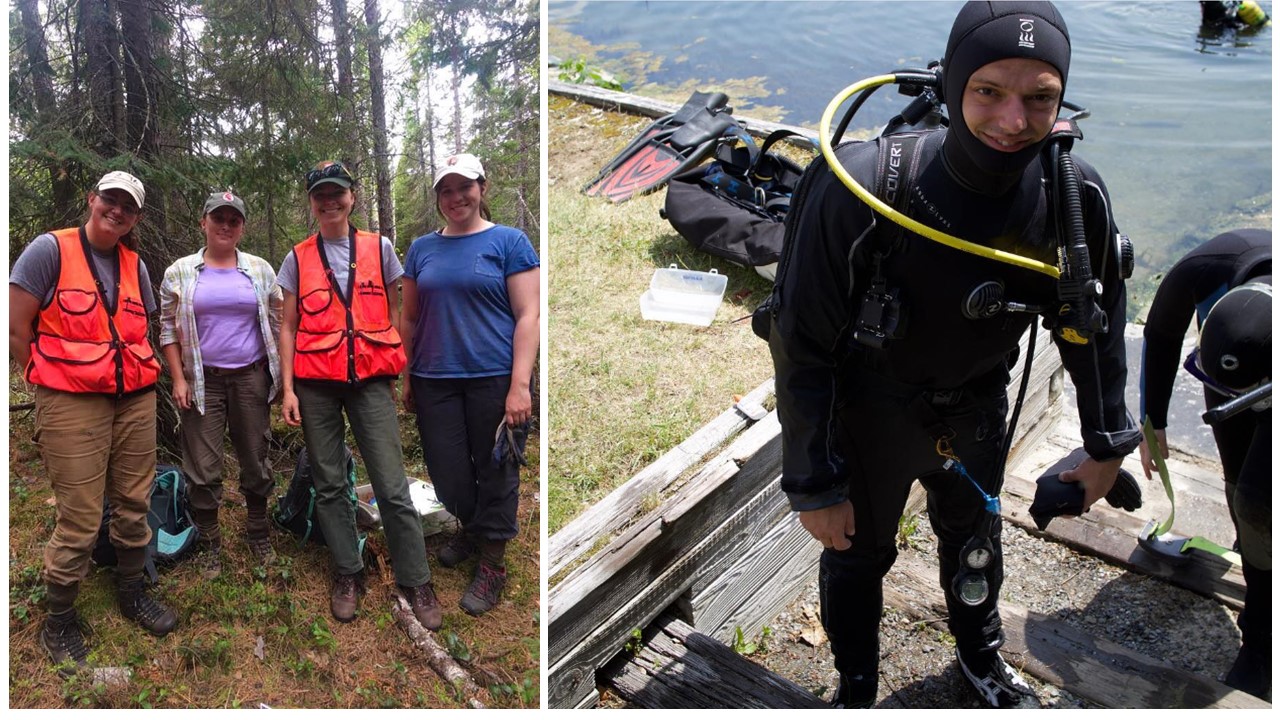
Loyalhanna Lake: a Geoarchaeological Approach to Understanding the Archaeological Potential of Floodplains

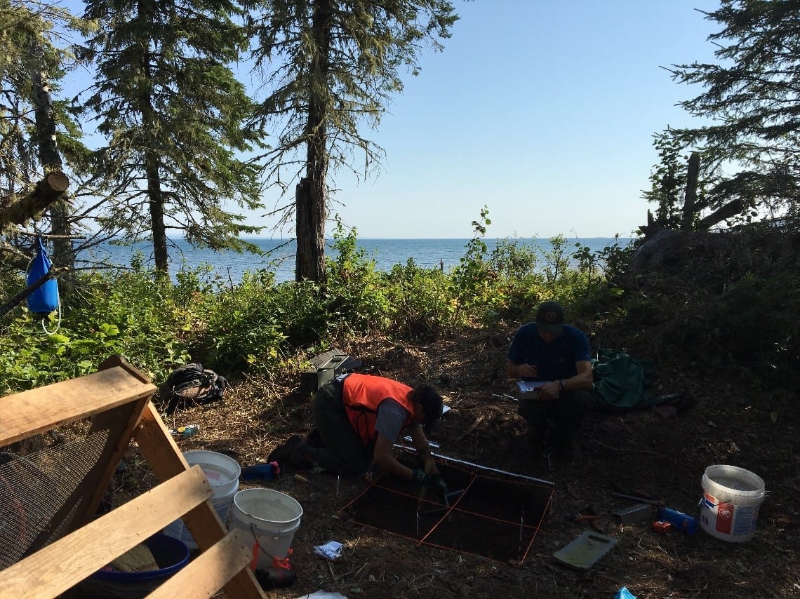
Unlike uplands, floodplains generally yield stratified deposits that may include deeply buried landscapes and archaeological sites. Most state specifications for cultural resources surveys require floodplains to be geomorphically evaluated in order to identify buried landscapes. This is most frequently accomplished via trenching, an effective, but timely, costly, and sometimes destructive method. This project reports on an alternative technique utilizing a multi-proxy methodology coupling geophysical survey with auger sampling. These non-invasive and limited-impact methods produce accurate results without causing extensive destruction to cultural resources. The study area, located along Loyalhanna Creek in Westmoreland Country in western Pennsylvania, is managed by the US Army Corps of Engineers – Pittsburgh District (USACE). As a federal agency, the USACE is mandated to identify and preserve cultural resources by Section 110 of the National Historic Preservation Act (NHPA). Unfortunately, federal agencies often face limited staffing, resources and funding to address management of cultural resources. In addition to proposing a method for identifying buried landscapes, this project also provides a case study of partnerships between federal agencies and public universities; a mutually beneficial collaboration which provides agencies with data essential to land management while simultaneously providing students valuable opportunities to conduct cultural resource management assessments.

IUP Graduate Scholars Forum:

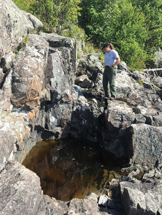
Misery Bay Ice Survey Preliminary Results: a Case Study for Testing Geophysical Methods and Collaboration with Stakeholders

Ground-penetrating radar (GPR) and gradiometry are two geophysical methods typically used by archaeologists in terrestrial environments to locate subsurface features. This study took terrestrial geophysical methods out on the frozen ice surface of Misery By, Presque Isle State Park, PA; testing instrument limits across two acres of the bay. If successful, this study has major implications to geophysical maritime investigations, broadening the reach of cultural resource management within these environments by government agencies. In addition to testing new methodology, the project was a collaboration between the PA DCNR, Regional Science Consortium, PA Sea Grant, PASST, and Indiana University of Pennsylvania Applied Archaeology program. The collaborative and public nature of the project drew in stakeholders, largely contributing to the success of the study. This poster presents the preliminary results of the project; both a case study for testing new methods, and the positive implications for collaborative and public cultural resource surveys.
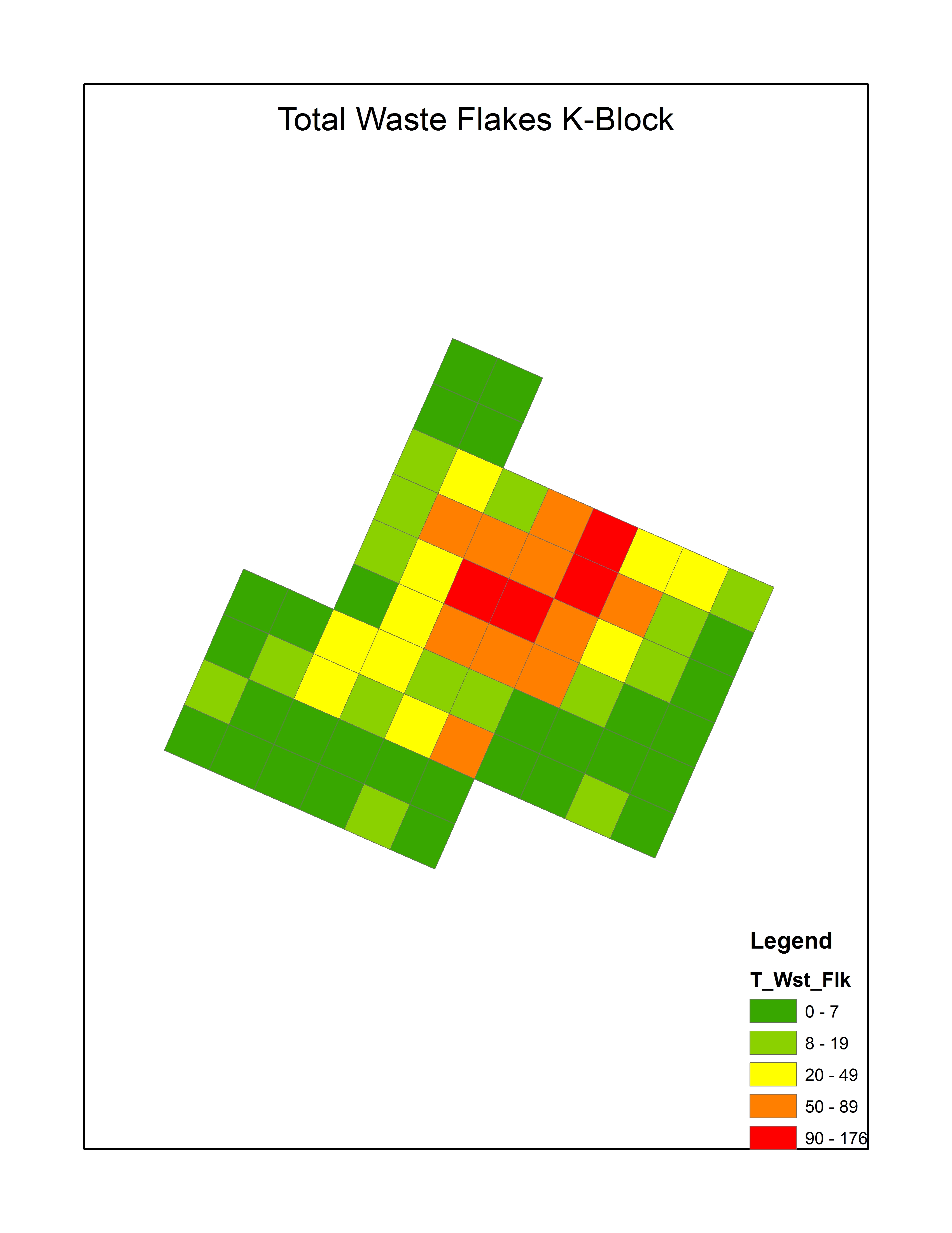
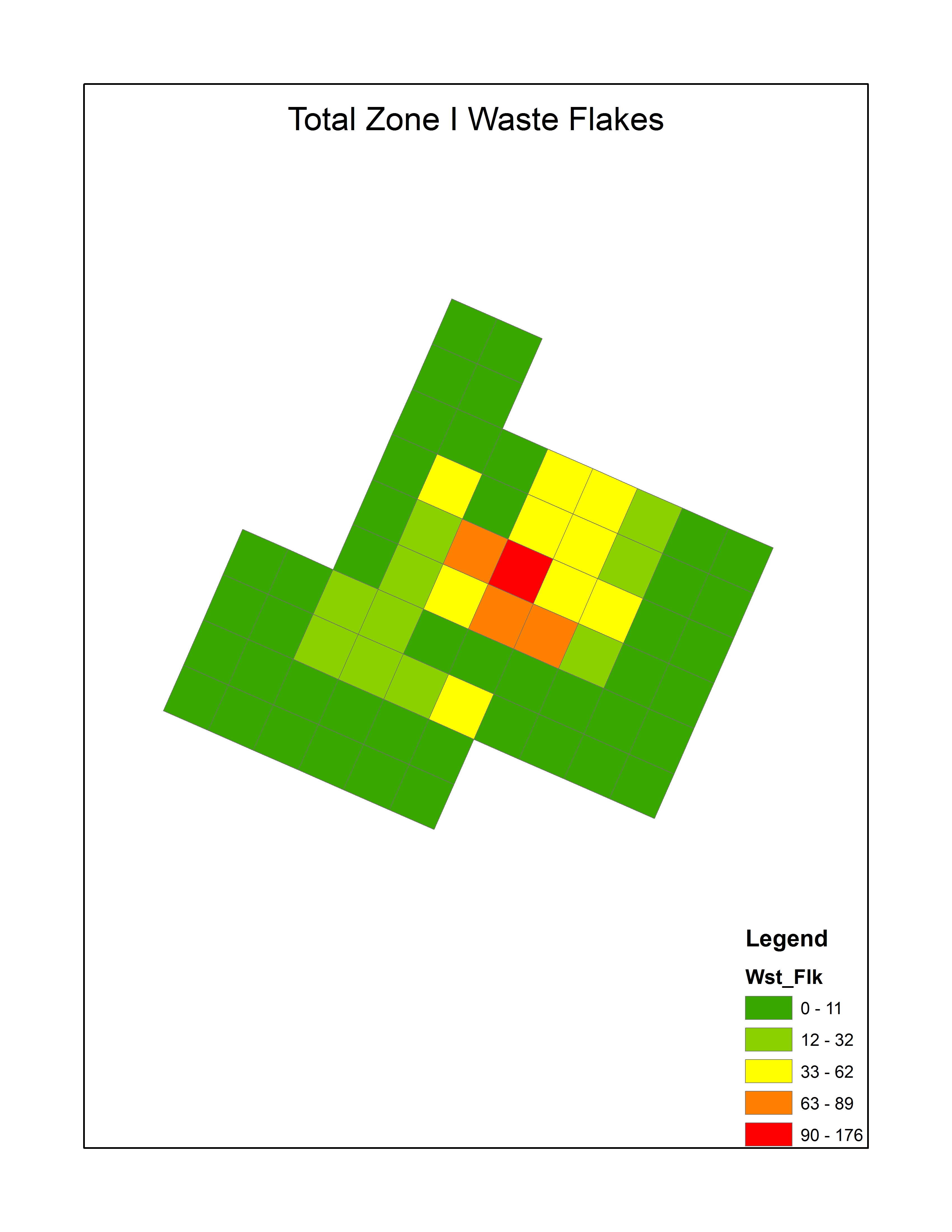
Heather R. MacIsaac

Presenting research at: IUP Graduate Scholars Forum

The Squirrel Hill site in Westmoreland County, Pennsylvania, was a Monongahela village inhabited from A.D. 1450 to A.D. 1613. Past research conducted by IUP archaeologists at the Squirrel Hill site uncovered evidence of housing, storage areas, and burials. There are conflicting interpretations of the village’s development and expansion over time. One interpretation is that the site contains a single village with an open, central plaza for communal activities, and that the village gradually expanded southward. Another interpretation is that the site contains two overlapping villages occupied at different times. To evaluate these interpretations, this research incorporates a statistical analysis of artifacts and a spatial analysis of structural features based on materials from the 2016 IUP archaeological field school. This research also investigates whether the Squirrel Hill site was inhabited by Monongahela traditional people only or by an amalgamation of Monongahela tradition and nearby McFate phase people.


IUP ANTHROPOLOGY DEPARTMENT

One Luddites Journey Learning GIS

By: Genevieve Everett

Before graduate school I asked friends that had been through graduate programs for some advice, and again and again I was warned that it would fly by fast. They weren’t wrong. Here I am, deep into my final semester of graduate school wondering what happened to the time. I guess it’s true, time flies when you’re having fun….or when you’re really stressed out.

One of the most stressful courses I signed up for in this program was the “Applied Spatial Methods in Archaeology” class. This class consisted of learning/using ArcGIS to create viewsheds, data dictionaries, etc., out of archaeological data. I had never used GIS, and I am not the most technologically savvy person out there, so I knew going into this class that I would be out of my comfort zone. I got passing grades in the class, but there were very few moments where I felt fully confident using ArcGIS. It was frustrating, and I hated asking my classmates for help, because we all have our own stresses to deal with. Looking back, I was so thankful that I took the class, because it has been immensely useful since.

Fake Boundary to show use of Websoil Survey and ArcGIS

This past summer working for PennDOT as a PHAST intern I used ArcGIS all the time to georeference historic maps, historic aerials, engineering plans, and to draw in project area boundaries, which I converted into maps for reports. One of my favorite uses of GIS is creating an AOI in Web Soil Survey, which creates a shapefile showing the soil(s) in the project area. First you upload the project area boundary into Web Soil Survey, which displays the project area boundary (in the real world coordinates that you set in ArcGIS), and the soils present within it. You then download the shapefile associated with the AOI, and bring it into ArcGIS. I created a fake project boundary to show what the end product looks like. In this example there are two soils present, 14B and 214A, which have unique names. For example, 14B, which makes up 98% of this fake project boundary is called Sheepscot. Sheepscot is a cobbly very fine sandly loam. Web Soil Survey also provides information about elevation, slope, farmland classification, typical stratigraphic profile information, and parent material. All of this information comes in handy when writing technical reports.

Another reason I am really glad I took that class is that I have been using ArcGIS heavily for my thesis. Part of my thesis is conducting a spatial analysis of lithics and lithic raw material from a Paleoindian site in New Hampshire, in comparison to another site nearby. By extension, I am attempting to determine what type of activity or activities were being carried out in this area. With the help of Dr. Chadwick, classmates, past theses, and my own problem solving (mostly through the ESRI website), I have made a lot of progress and learned a few new things. One of those things was creating a “fishnet” to create the excavation block grid out of two datum points, because there is no GPS data. Most recently I taught myself how to create Choropleth maps. Choropleth maps display where individual or multiple artifacts are in relation to one another in the excavation block using color gradients. As you can see in the image, each color is correlated with a particular number of Waste Flakes, and the quadrants for which they were found. For example, the red quadrants in the “Total Waste Flakes K-Block” image are the quadrants that have a higher count of waste flakes (90-176). I am also looking at the distribution of artifacts by Zone (or Strat), which are easily displayed in these Choropleth maps for comparison (shown below). My next step is to take these Choropleth maps, and do hot spot/cluster analysis.

The moral of the story? Try something new, even if it scares you. It’s cliché, but you’ll never know if you don’t try.

IUP ANTHROPOLOGY DEPARTMENT

Working At the Carnegie Museum: A Love Affair.

By: Kristina Gaugler

The Carnegie Museum and I have a long history.

Early photograph of the Hall of Architecture

I was born and raised in the North Side of Pittsburgh, and like many a “city kid” I was shuttled by school bus to and from the Carnegie Museum throughout grade school, middle school, and high school. I have vivid memories of sitting at the long wooden tables in the museum cafeteria, under enormous glass windows, scarfing my brown bag lunch so I could get back to exploring. I was the kid who shushed classmates who were interrupting the docents, who asked a thousand questions, read every single word on the exhibit displays, and who didn’t want to leave at the end of the day. When I was an angst-ridden teenager, I would hang out at the museum after school, moping around the hall of architecture or sitting alone in the replica Egyptian tomb. Visiting the museum now, so many years later, I still have the same feelings of comfort and wonder as I did when I was younger. As an archaeologist and general history enthusiast, I love all museums, but the Carnegie definitely holds a special place for me. It feels like my museum.

My purpose in writing this post is to share some of my experiences working and volunteering at the Carnegie. I hope that I also highlight the notion that outreach programs and education within public institutions is valuable, worth our efforts, and fun for people of all ages.

I went to the University of Pittsburgh for my undergraduate in anthropology. While attending Pitt I had a work-study position through the Carnegie at the “Bone Hunters Quarry,” where I taught visitors (mostly school groups) about extinct animals through the excavation of a fake site. I learned that if you gave a small child a chisel and told them to dig wherever they wanted, you were very likely to ignite a spark within them that excited their curiosity in the past. Although, on occasion a spark was ignited within them to throw the chisel, sometimes narrowly missing your own head, those times were fun too. Either way, this was the first time that I really began to discover how much I enjoyed talking to visitors about archaeology and history.

Talking with visitors during Artifact I.D. day at the Carnegie

After graduating from Pitt, I found work as an archaeological field technician. Eventually though, I decided that I wanted to take a break from full time field work to prepare to go back to graduate school. Through a series of fortunate events I began, once again, to work for the Carnegie Museum. This time I volunteered at the Edward O’Neil Research Center, which is the Carnegie Museums off-site collections facility. My supervisor and friend, Amy Covell, allowed me the freedom to work on projects that interested me in the lab. When I started volunteering at the annex, the building was in the process of being renovated and many artifacts were going to be moved to new locations. Thus, I began my time there by helping to build permanent supports for fragile materials, including prehistoric pottery, stone tools, and glass artifacts. I learned proper handling of artifacts in accordance with the most current curatorial procedures, and I learned conservation techniques used in cleaning objects, including removing old plastics, adhesives, and ink that were used in the early days of museum storage and curation.

My favorite task at the museum however, was to be a part of the educational outreach programs. Last June I had the opportunity to speak with visitors about archaeology during the Carnegie’s “After Dark Program,” a monthly series where guests can come to the museum in the evening to explore, eat, drink, and hear lectures on various subjects. Another one of my favorite programs at the museum is “Artifact Identification Day.” This event gives visitors the opportunity to bring in their heirlooms and artifacts to have them identified by staff. It is always amazing, and sometimes humorous (see photo of me holding a Lodoicea) to help identify the items that people bring.

Holding a Lodoicea, or sea coconut, during Artifact I.D. Day. Lodoicea is the largest seed in the world! (And yes, it does look like a butt)


I have often thought of the Carnegie as being a museum of a museum. The Carnegie began acquiring artifacts and creating exhibits over a hundred years ago, and many of those early exhibits and artifacts are still on display. Working and volunteering at the museum gave me the opportunity to be a part of the team of people who were helping to conserve and protect these cherished items for future generations. To me, protecting artifacts and archaeological sites begins by showing people why they should care about them. For this reason, programs and institutions that promote stewardship of the past are incredibly important. History is made up of millions of stories. One of those stories is bound to pique the interest of someone! I’m very thankful for my time at the Carnegie, and I look forward to many more years of learning and visiting!

Photo of “Early Hall of Architecture” from: http://carnegiemuseums.org/about-us/our-history/

IUP DEPARTMENT OF ANTHROPOLOGY

“Me Too”: Taking a Stance Against Work-Place Harassment in Archaeology

By: Genevieve Everett

I’ve been thinking a lot about the “Me Too” movement and how women have been affected by work related harassment and assault within the field of Archaeology. As a woman coming to the end of my graduate studies, I am preparing for a future of working as a “field-based scientist”. I have been thinking about what it means to be a woman in the sciences, and the unpleasant experiences so many women have experienced and endured in the not so distant past. I obviously cannot speak for every individual that identifies as female, but I can say that the subject of work place harassment and assault has only recently been publicly addressed, and quantified in two well-known (within the field of Archaeology) surveys. The results of the surveys were provided by the Southeastern Archaeological Conference (SEAC) in “Preliminary Results of the SEAC Sexual Harassment Survey” (Meyers et al. 2015), and in the article, “Survey of Academic Field Experiences (SAFE): Trainees Report Harassment and Assault” (Clancy et al. 2014). While the SEAC survey is very important, and sheds light on improper work related harassment (when is it ever proper?) specific to archaeology, I am going to briefly discuss the SAFE survey.

It should be noted, not all respondents to the SAFE survey were Archaeologists, however, Archaeologists did account for 159 of the respondents (23%), out of a total of 666 total respondents (Clancy et al. 2014). The SAFE survey was distributed as a link through email and social media calling for field-based scientists, such as CRM professionals. Participants were asked to respond to a series of questions pertaining to age, gender, etc. And most importantly, questions related to sexual harassment and assault, whether personal or observed.

In terms of demographics, the results indicate that 77.5% of the respondents were women (Clancy et al. 2014). Likewise, various respondents provided varying sexual orientations and ethnicities, however, majority of respondents were heterosexual and white. Professionally, respondents included, students (grad/undergrad), professors (of all levels), researchers, and all others outside of the field of academia. Long story short, the survey indicated that women at the “Trainee” level of the employment ladder provided that they have experienced either harassment, assault, or both at higher rates than any other professional. For example, 84% of women at the trainee level indicated that they have experienced some sort of work related harassment, while women in “higher” positions experienced lower rates of harassment (Clancy et. al 2014). In the survey, most women indicated that the perpetrators were higher on the “professional hierarchy”, people in “power”.

If we look at trends of the “Me Too” movement, women around the country are coming out with allegations against men of “power”, individuals that control the purse strings. It might not seem like it, but what’s happening in Hollywood and politics is also happening in Archaeology (made clear in the SAFE survey), and it has been happening for a very long time. I’ve heard people say, “Why are women all of a suddenly speaking out?” They’re not “suddenly” speaking out, many women have come forward, but we haven’t heard about it, because the individuals that are, are either not famous enough or they have been ordered under legal agreements to keep silent about the case. I think it’s great that the systemic problem of work place harassment and assault are being addressed in our field, but more needs to be done. I’d be very curious to see the results of a similar survey now, in 2018, when women are banding together to support one another and speak out. I’d like to see responses to how men and women would like to see and contribute to a safe working environment. How can this be achieved? I completely agree with Clancy and her colleagues that the only way to improve the unwanted and uncomfortable situations in the field is, “raising awareness of the presence of hostile work behaviors, discrimination, harassment, and assault (particularly women); creating guidelines for respectful behavior; and adopting independent reporting and enforcement mechanisms” (Clancy et al. 2014). The only way forward is to re-educate professionals, for BOTH men and women at all levels of the profession to take a hard stance against work place assault and harassment, and support those that still fall victim to these experiences.

IUP DEPARTMENT OF ANTHROPOLOGY