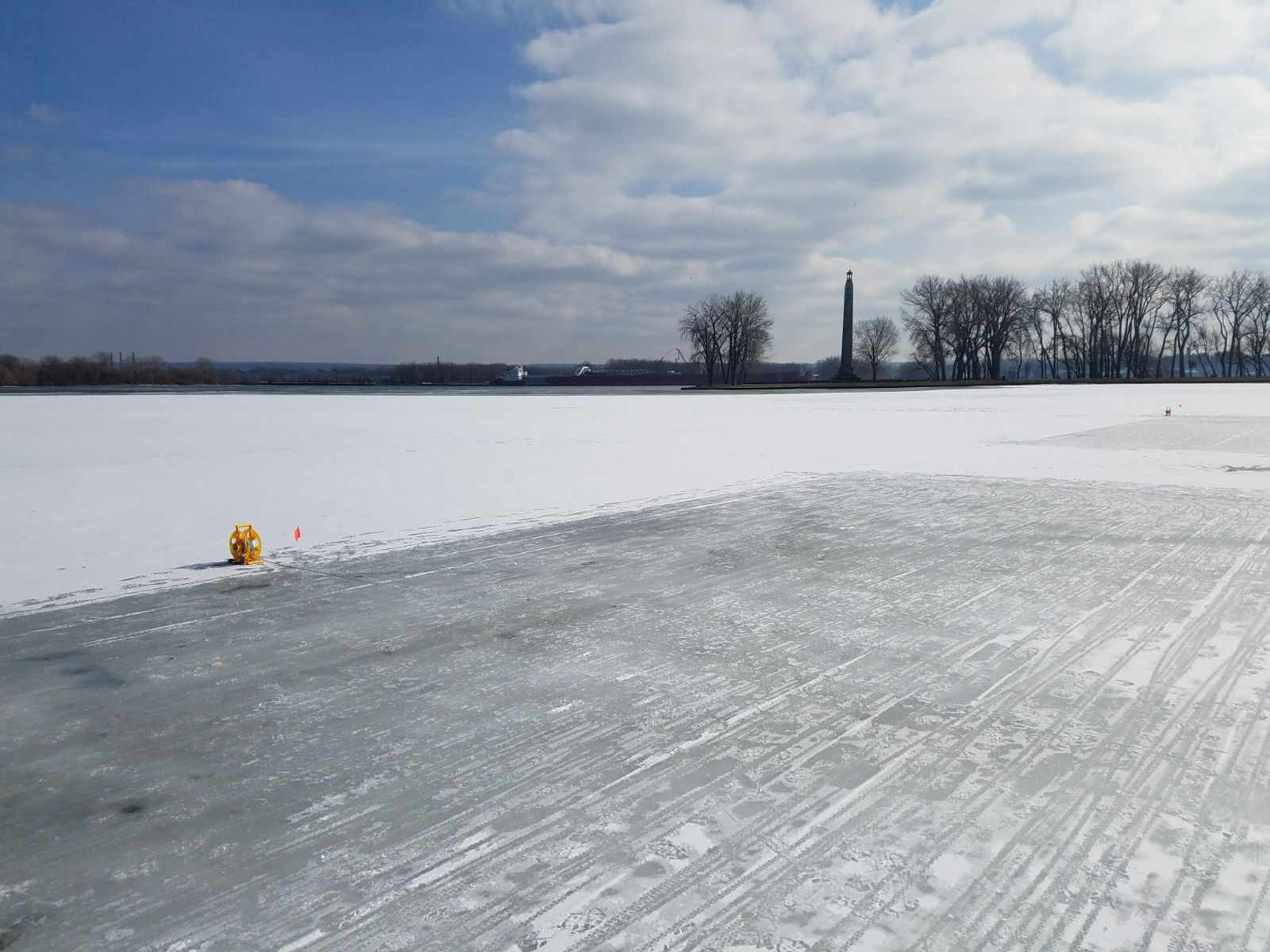
Survey grids with War of 1812 Perry Monument in background
By: Zaakiyah Cua
It’s closing in on sunset and a group of three IUP Applied Archaeology M.A. students along with their professor work quickly collecting geophysical data several meters offshore on Misery Bay of Presque Isle State Park. As they work, a deep guttural groan comes from the ice, roaring under them and shooting off across the bay as quickly as it came. The students pause, look around, and continue their work. They have been hearing these noises from the over 12” thick ice surface all weekend, and have grown accustomed to the strange, eerie sounds. Two weekends ago, IUP Applied Archaeology students and professors conducted a geophysical survey of the frozen Misery Bay under the direction of Dr. Ben Ford, Dr. William Chadwick, and myself. The project was funded through a grant from the Regional Science Consortium and received full support from the PA DCNR and the PA Sea Grant. After spending a weekend on the groaning, moaning Misery Bay, I have come to find out that these sounds mentioned above do not necessarily indicate dangerous ice, they are a product of warming and cooling temperatures.
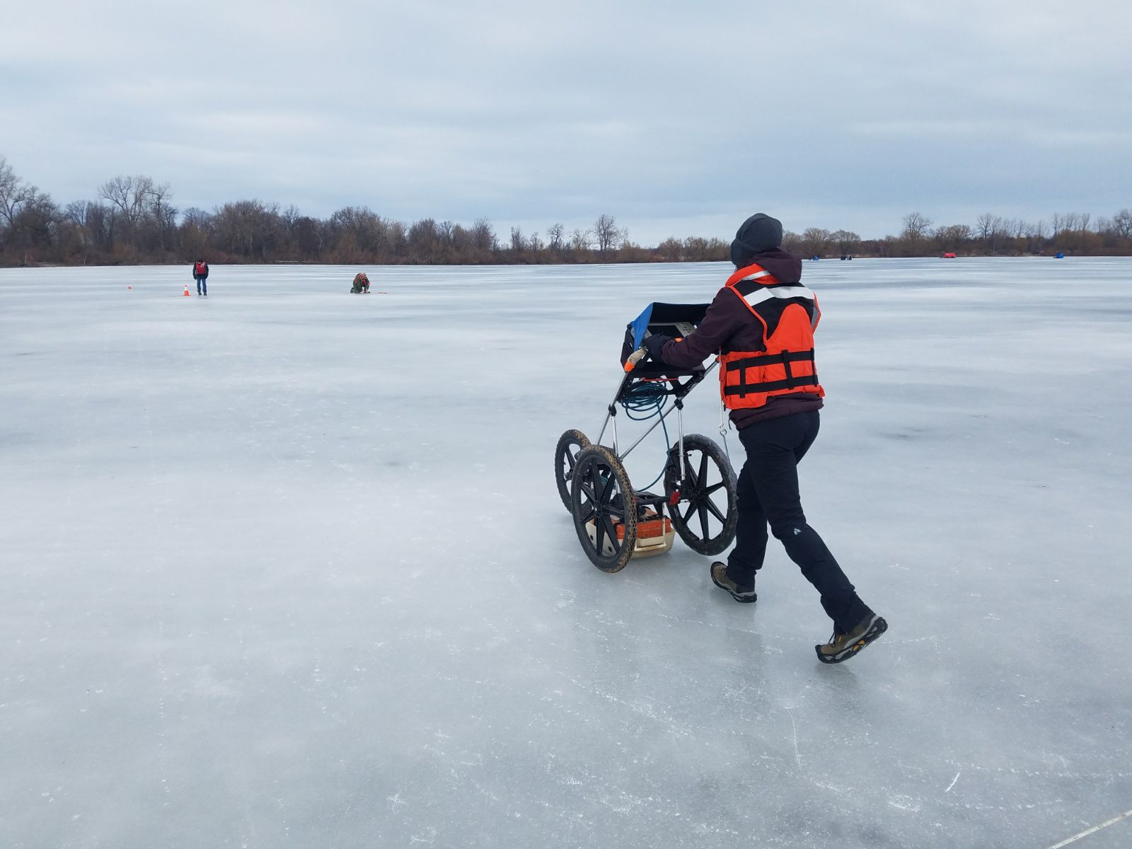
Day 1 GPR
Presque Isle State Park is in Erie, Pennsylvania and consists of a geologic spit complex, essentially a large peninsula sticking out from the mainland. Misery Bay consists of 200+ acres and is situated on the southeastern side of the peninsula. The goals of this project were to test the use of geophysical methods on the ice surface to determine if terrestrial methods could fit into the shallow water niche often difficult to survey with deep water equipment. Ground-penetrating radar (GPR) and gradiometry were the two methods chosen for the project. If successful, not only would this methodology guide subsequent diver surveys, but it could be successful in locating submerged cultural resources such as shipwrecks. Misery Bay was the perfect place to conduct this study as it offered an ice surface associated with a rich maritime history tracing back to at least the War of 1812. First a brief history…

Ross Owen collecting gradiometer data
During the War of 1812 between Great Britain and the United States of America, it was evident that control of the Great Lakes was crucial to victory. The Presque Isle spit formed a natural barrier for the US to build their naval fleet and was utilized for this purpose. A naval base was established on the peninsula, and Misery Bay was utilized to build and repair ships. Following the Battle of Lake Erie, and the US victory, Misery Bay was also used to scuttle, or intentionally sink, some of the warships for preservation, and later use. Since then, two ships have been raised, restored, and used as naval museums. The Erie Maritime Museum, Flagship Niagara, PASST (Pennsylvania Archaeological Shipwreck Survey Team), and other entities have conducted incredible research pertaining to the War of 1812 and the Battle of Lake Erie. Since 1812 and into more recent times, many vessels have been deposited in Misery Bay. With this history in mind, the bay offered an ideal location to test the methods with the possibility of identifying locations of vessels.
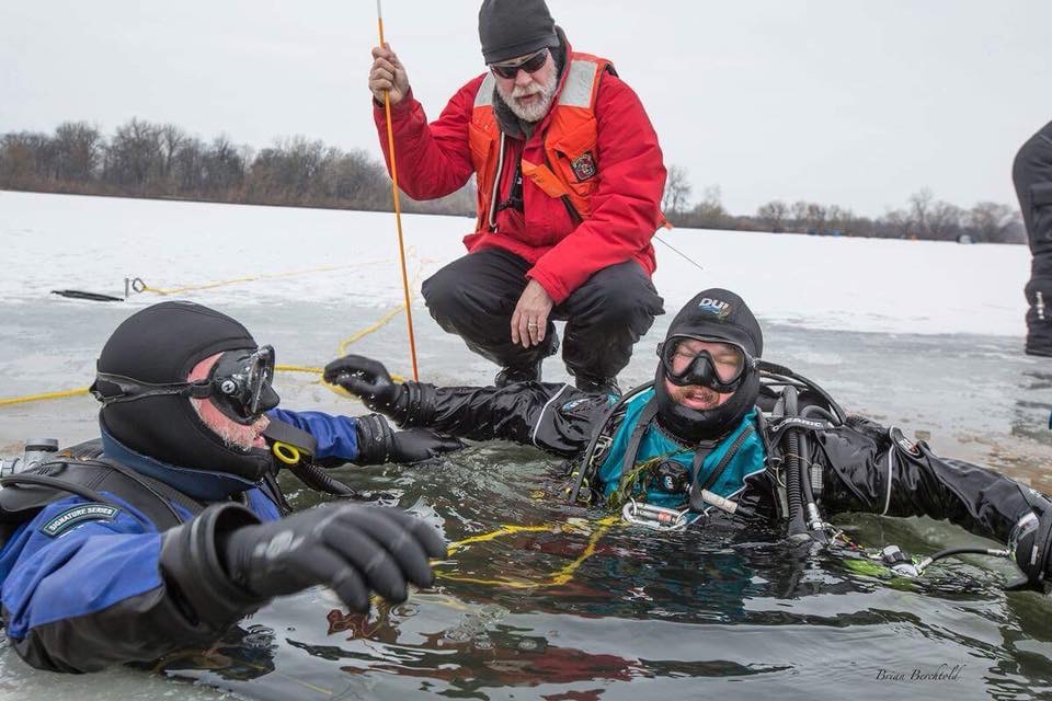
PASST divers in their element
In the three days the survey was conducted, major collaborative efforts between IUP researchers, the PA DCNR, PA Sea Grant, and PASST contributed to an incredibly successful project. Anomalies of interest were identified in the geophysical data, one of which was preliminarily investigated by the PASST divers on the last day of survey. The PASST team cut through the ice, dove down to identify if the anomaly was actually something, and positively identified a structure buried in bay floor sediments. What’s really cool about the PASST team, is that the members are certified divers who partake in survey work as a hobby and have true passion for what they do. During the weekend, IUP researchers also interacted with interested members of the public who stopped by to ask what we were doing out on the ice. These ranged from ice fishermen who shared the bay with us each day to weekend travelers. Finally, the IUP team spoke with the media regarding the survey and its implications to future work. It was definitely an experience talking with the media – it you get a chance, check out the Erie News Now coverage of our work.

Day 1 Pre-Project photo with DCNR and Sea Grant staff.
While the bulk of the post-fieldwork analysis is still underway, this project was quite successful. It offered an incredible opportunity to be involved in truly collaborative work with state agencies, funding entities, avocational groups, the public, and the media. Additionally, the project offered myself and other students involved professional development and a unique set of field skills to add to our toolkits. I especially want to acknowledge the two IUP graduate students who aided with the fieldwork; Steven Campbell and Ross Owen, we couldn’t have done it without your help! Overall this was a phenomenal experience. We lucked out with solid ice and good weather, pulled off a super successful project.