Building a Career in Cultural Resource Management Archaeology

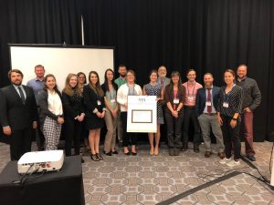
On April 5th, not only were students participating in Scholars Forum here at IUP, but we also invited students to our final Graduate Colloquium of the semester, which was a Virtual CRM Workshop. Hosted by The Eastern States Archaeological Federation Student Engagement Committee, Dr. David Leslie invited students and early career archaeologists to a presentation on applying for jobs in cultural resource management (CRM). Dr. Leslie is the Director of Archaeological Research and a Principal Investigator for Heritage Consultants, LLC in Connecticut. His goal of his presentation on Building a Career in Cultural Resource Management in Archaeology, was to provide useful advice on getting started in this growing field and provide students with more knowledge on how to advance their careers in archaeology.

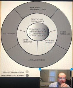
The presentation began with an overview of CRM before discussing career paths. Over 90% of the archaeology that occurs in the United States is completed in a CRM setting; CRM is generally done at a faster pace than academic archaeology. There are three phases of excavation in CRM archaeology, Phase I, II, and III, but there can be many exceptions to this tradition structure. When a survey first takes place, they happen in conjunction with participating stakeholders. Stakeholders can include Federal and State recognized Native American Indian tribes, Federal Agencies, SHPO (State Historic Preservation Officer) offices, property owners, historical societies, the general public, and more. Coordination with all potential stakeholders is required both before and during each phase of the project.
During a Phase IA Survey, site identification is the main objective. It involves an assessment of a project area typically involving a bureaucratic organization (SHPO), archaeologists in CRM, and/or municipal offices, in order to identify if a parcel is archaeology sensitive. Besides excavating, soil coring is also another way to do a Phase I survey. In a Phase IB survey, one determines if an archaeological site is present within a project area, which is generally done through shovel test pit (STPs) surveys; and the presenter noted that the best surveys are done using a systematic grid survey at this stage, with judgmentally placed STPs as well. These intervals vary but are generally between 15 and 7.5 meters depending on the sensitivity and project size. The Mid-Atlantic region of the U.S. is also in feet, with intervals between 50 and 25 feet. The presenter then described Phase II surveys. They noted that during this phase, the goal is to try to determine the spatial boundaries of the site within the project area, which includes the horizontal and vertical stratigraphy of the site. To test the site at higher intervals, additional STPs, at around 5 m or 16 ft intervals, are opened, and selected excavation units (EUs) are opened, around 1×1 m or 5×5 ft in the Mid-Atlantic region. Geophysical assessments of the sites are also conducted. During the Phase II process the site will be assessed for significance at the federal, state, and local levels, which vary in their specific criteria. During the Phase III process, if the site is eligible for the National Register, or some other state or local preservation, it must be avoided by development, or the effects of the development must be mitigated. Avoidance is preferred, but not generally prudent or feasible, as infrastructure projects may outweigh preservation in place or resources. Mitigation for archaeology generally involves excavation of a site and specialized analyses of the material record. Because most sites are Eligible for the National register under Criteria D (research potential), mitigation is most common as a Data Recovery Program (DPR), typically as widescale excavations. The percentage of the site excavated may differ depending on the data recovery efforts. However, while rate, it could in clue up to 100% of the site within the project area, but more generally, anywhere between 3%-5% of the site, if a large project area, or 20-30%, if a small project area, are excavated. Sometimes DPRs include partnering with academic or for-profit labs, depending on site type, importance, funding sources, etc. Some examples include, expanding documentary or deed research, microscopic use-wear analysis, protein residue analysis, radiocarbon or OSL dating, geochemical analysis, and more. You can find published examples of DPRs in academic journals, at presentations at conferences, at public presentation, in public booklets and websites, etc. The presentation then focused on other CRM projects and tasks that can be undertaken including burial ground investigations, using GPR/Magnetometer/Resistivity/UAV, conducing architectural history assessments, battlefield surveys, and metal detecting surveys, as well.

Careers in CRM where then discussed. It was explained that most undergrads or graduate students without field experience start out as field technicians. To beef up ones resume or experience they can volunteer locally or seek out CRM firm internships. Starting out as a field technician though does provide a good, grounded perspective on field data collection, the speed of surveys, and the comradery of archaeological field crews. Basically, everyone starts out at this level. Field technicians are generally those with an undergraduate degree in anthropology or archaeology, or some related field. They need to have successfully completed and archaeological field school, local ones versus ones abroad are generally preferred by CRM companies. Most of the training as a field tech will be specific to paperwork, field techniques, and more, which will vary from company to company. The presenters commented that there are many different ways to conduct good archaeology, but these can vary between academic field schools and places you have previously worked at. While an M.A. in archaeology is certainly valuable and can aid you in a career in CRM, the presenters noted that you should not expect a supervisory position without commensurate (to the supervisory position) field experience in CRM. A field director leads a group of field technicians, ensures that the job is completed on schedule, lays out STPs and EUs for and with the crew, manages the crew in the field, conducts quality control of the excavation techniques applied by the crew, ensures that the paperwork is accurate and complete, and often has two or three years of field experiences (which is typically required as well). A project archaeologist manages several field projects, may visit sites and lead field crews, can spend more time in the field for complicated surveys (Phase II and III), writes portions or entire technical reports, conducts data analyses depending on their skill set (e.g., lithic analysis, zooarchaeological, spatial), typically needs to have several years of experience under their belt, and generally an M.A. is required.
The presentation then turned to careers in CRM. Certain skills are required, and depending on the course that you take or have access to, you can become specialized in a range of fields that align and enhance your CRM work. Training in and experience with GIS, total station or UAV surveys, human osteology, zooarchaeology, lithics analysis, historical deeds, mapping, or documentary research, geology, sedimentology, ceramic analyses, collections based work, soil flotation, artifact identification, artifact conservation, public history, art and architectural history, and more, are all skills and knowledge that would be useful to have a background in before entering a career in CRM. While many of these analyses are specialized, there may be departments or classes you can take to learn some of these skills during you time in undergrad and grad school. The presenters suggested that in undergrad you should think about minoring in GIS, geodesy (survey), geology, history, geography, remote sensing, biology, chemistry, and/or environmental studies. In grad school, they suggested that students focus on coursework in any of these fields as well.

The presenters also made suggestions for creating an appealing resume for CRM firms. They suggest that you play to your strengths, emphasize your field schools, archaeological experiences, and other related skills. You should denote your education level, list professional memberships, put in other previous jobs if light on archaeological fieldwork, and include any archaeo-specific computer programs you have experience with (e.g., artifact database intry, ArcGIS, Surfer, Metashape). They noted that it is ok if you resume is only one or two pages long at this stage, and that you should not include basic computer skills on your resume, as it is assumed that people should have these (classist, but a requirement for the job, as well).

The presenters claim that there has never been a better time to be employed in CRM, than now. They predict that the gross annual domestic spending on CRM from 2022-2031 is expected to rise from $1.46 to $1.85 billion. It is also expected that there is to be more than 11,000 jobs in CRM created in the upcoming decade, of which around 8,000 will be archaeologists. There is currently a job shortage in CRM at all stages, field technicians, crew chiefs, project archaeologists, and project managers, which has resulted in wage increases across all jobs. Field technicians in the Northeast five years ago were paid $15-16 an hour and can now expect $18-$22 depending on their experience. Per diem rates ($40-$50 per day) and mileage reimbursements are now more standard, and there are potentially higher rates in other parts of the country too. With an example position of a field tech with a B.A. and limited experience, they were expected to make around ~48K per year, from their hourly wage, per diem, and milage. Rates will continue to increase during the job crunch, and field directors and project archaeologists can expect an hourly rate of $23 or potentially higher, depending on experience.

The Zoom presentation was then opened discussion, with Heritage Consultants stating that they were hiring for field technician positions at around $18-22 an hour, and $45 a day per diem & milage. There is also another Zoom call on April 26th by the White Mountain National Forest via the New Hampshire Archaeology Society, which will discuss opportunities in archaeology centered on the different aspects of positions within federal agencies. It was a great presentation, informative and educational, and perfect for someone who needed either a refresher on CRM or just a basic overview!

Follow IUP Anthropology on FacebookTwitter, and Instagram


PHAST Activity: Rugh/Haymaker Mill Site

Written by Gage Huey

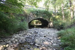
Haymaker Run Bridge

The Rugh/Haymaker Mill Site (36WM1204) is a historic-period archaeological site located in Murrysville, Westmoreland County, Pennsylvania. This summer, four IUP Archaeology students in the Pennsylvania Highway Archaeological Survey Team (PHAST) recovered diagnostic artifacts from deposits associated with late 18th and early 19th century grist and sawmills that were constructed along Haymakers Run by two early Euro-American settlers, Michael Rugh and his son-in-law, Jacob Haymaker. These early mills used the water from Haymakers Run as a power source for the lumber saws and grinding stones. These mills are indicative of the kinds of early agricultural and industrial enterprises that settlers in this region developed to facilitate both longer and larger-term settlement of this region. Early maps of the region often focus on the industrial and extractive potentials of resources showing major rivers used for navigation, streams for mill placement, and indicating mineral rich for extraction.

This site was identified through a Phase I archaeological survey conducted by PHAST in order to comply with Section 106 of the National Historic Preservation Act (NHPA) of 1966.  The NHPA requires federal agencies (and the state agencies like PennDOT who use funding from federal agencies) to take into account the ways that their undertakings may affect the archaeological resources both above and below the ground surface. The bridge where State Route 4041 crosses Haymakers Run is in need of replacement and because bridges and other transportation related infrastructure falls under PennDOT control, it also falls under NHPA regulations.  In addition to replacement of the bridge structure itself, attention must be given to the construction activities and temporary access needs during construction (i.e. right of way, easements, drainage and erosion control measures, and/or temporary staging or runaround). The improvements may also affect archaeological resources, so cultural resource professionals (CRPs) must employ strategies to determine what may be affected by this undertaking.

In order to begin the Phase I investigation, background research was conducted using resources such as Pennsylvania’s Cultural Resource Geographic

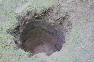
Shovel Test Pit

Information Systems (CRGIS), soil surveys, topographic maps showing landforms, historical maps, and historic period aerial photographs. These sources help us understand what kinds of activities were or were likely happening in a particular area in the past. Once the likelihood of finding archaeological resources is assessed, CRPs visit the site to conduct a pedestrian survey. This field view helps CRPs identify areas of prior disturbance, which informs the development of a below-ground testing strategy. For this project, the excavation of five shovel test pits (STPs) was planned at a regular 15-meter interval to test the below-ground potential for intact archaeological deposits. This summer, the PHAST crew recovered a variety of historic artifacts through the course of excavation.  The recovery of cultural material in the initial 5 STPs resulted in the need for additional testing to confirm the extent of these deposits. Each STP was dug according to Pennsylvania State Historic Preservation Office (PA SHPO) archaeological guidelines, with a diameter of 57 cm to a depth of 10 cm into sterile subsoil to test for all periods of human occupation on this landform. In total, 11 STPs were excavated, recovering 125 artifacts and contributing to the identification of the Rugh/Haymaker Mills site.

Diagnostic ceramic sherd recovered from STPs

Of the 125 artifacts recovered, 69 could be attributed to a particular time period.  These diagnostic artifacts included ceramic sherds, glass, animal bone, and a cut nail. The ceramics were analyzed by PennDOT Senior Archaeologist Angela Jaillet-Wentling who calculated a mean ceramic date of 1815. This date was re-calculated to 1817 based on the presence of olive-colored glass and a machine-cut nail. Accounting for a time lag between artifact manufacture and deposition, the material culture correlates well with the documentary evidence that the Rugh/Haymaker mills was constructed by 1809 and operated until at least 1875. Although the faunal remains from this site were not relevant to the dating of the deposits, the presence of a humerus from a domestic pig (Sus scrofa) certainly adds a depth of detail to the everyday lives of the settlers at the site. The fragmented humerus showed possible evidence of butchery which, along with other faunal remains found on the site, could provide important data to help improve our understanding of the type of foods early Euro-American settlers were raising and/or eating.


Pig humerus fragment recovered from the site

Overall, the archaeological resources encountered during the Phase I Survey resulted in the formal identification of the Rugh/Haymaker Mills Site. Because this potentially eligible site was located within the proposed project area for the bridge replacement, CRPs were tasked with making a choice for the future of this site: further investigation or avoidance. Thankfully, we were able to avoid additional investigation and impacts thanks to early site identification and flexible design. When the work for the Haymakers Run bridge replacement project begins, temporary construction fencing will be placed to protect the Rugh/Haymaker Mills site from any negative impacts that the bridge replacement may cause. This way, the intact archaeological deposits at the site can stay in situ; in other words, the cultural resources will stay where they are for the foreseeable future. This outcome is a best-case scenario because it allows for cooperation between the goals of archaeology and the Pennsylvania Department of Transportation (PennDOT). The proposed bridge replacement over Haymakers Run is able to go forward without major impediments or changes to the project and the undertaking will not negatively affect the archaeological resources associated with the Rugh/Haymaker Mills Site. At its best, Cultural Resource Management gives archaeologists a seat at the table when federally funded undertakings are planned in locations with potential for archaeological deposits. This is a great example of the things that can be accomplished through compliance with Section 106 of the NHPA.

You can read more about their summer here:(https://iblog.iup.edu/trowelsandtribulations/2020/09/25/phast-2020/)

Follow IUP Anthropology on Facebook, Twitter, and Instagram

REAL Destruction

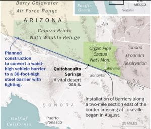
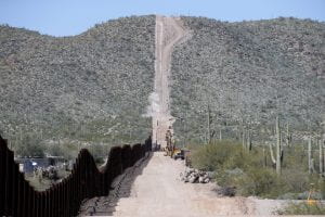
Location of the border wall along the south border of Organ Pipe Cactus National Monument and Cabeza Prieta National Wildlife Refuge

Border wall location: Source NY Times

Many readers are likely aware of the construction of a border wall taking place along the boundary of the Organ Pipe National Monument.  While construction and infrastructure expansion are an inevitable part of society and has the potential to impact archaeological sites, this construction project has completely negated all cultural and environmental resources legislation and is currently destroying culturally sacred sites to the local Native American Tribes.  Normally, such projects go through a survey process laid out in the National Historic Preservation Act of 1966 to identify and mitigate damage to potentially important archaeological sites.  However, the REAL ID Act of 2005 allows the Secretary of Homeland Security to waive all local, state, and federal laws that would impacts construction along the border, negating all the efforts of past government officials to protect not only cultural resources and descendant communities, but also the environment and protected federal lands.

Numerous groups such as SAA

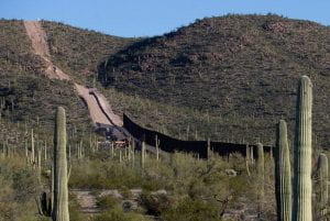
The Border wall going through Monument Hill Arizona. Source: Tuscon.com

and the Sierra Club have condemned the act and the actions following its approval.  SAA detailed their grievances in a letter to Acting Secretary of Homeland Security Chad F. Wolf demanding that all construction efforts cease until proper compliance regulations are completed (Link to letter here).  The construction has thus far destroyed many archaeological sites, sacred Native American burial grounds, and is currently threatening an oasis site which is not only sacred to the Tohono O’odham people but also of natural importance.  The project is using explosives to level Monument Hill, a burial location for Apache warriors.  Not only did the REAL ID Act of 2005 threaten irreplaceable resources, but it also threatens the checks and balances foundation of our government, give the Secretary of Homeland Security power over any law.

Image of Monument Hill showing a dust cloud from an explosion

Explosives being used on Monument Hill likely destroying burials. Source: azcentral.com

It is not only national and international organizations that have condemned these actions, but also news media outlets such as the Washington Post, The New York Times, NPR, and Smithsonian Magazine have also reported on the construction of this 30-foot high wall.  The lack of respect toward remains and burial grounds is not only morally abhorrent but completely goes against the principles of the Native American Grave Protection and Repatriation Act, one of the many acts subverted Homeland Security.  All the laws in place that have been waives for this wall exist for a very good reason.  They are meant to protect human rights, culture, the environment, and endangered species while also allowing for infrastructure expansion.  These laws work in harmony with construction projects not against them.  Amazing things can happen if those at the top simply understand why these so-called blocks on progress exist, how they work, and their actual impact on construction projects.  They do not stop construction or prevent the destruction of all sites.  What they do is mitigate damage in creative and efficient ways.  This might mean a full-scale excavation of the impacted area, or a rerouting of a road, or it could be simply recording what is found and proceeding with the project as planned.  Archaeologists and environmentalists are here to help infrastructure not prevent it.

Follow IUP Anthropology on Facebook, Twitter, and Instagram

Go Forth and Record

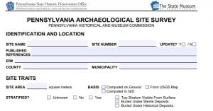
Recording sites is an extremely

Front page of the PASS Form

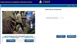
important part of archaeology.  While simply recording a site is much less glamorous and excited than actually getting to research and excavate a site, it does not mean it is any less important.  Arguably, the recording without excavation is more important than the actual excavation.  The State Historic Preservation Office manages the survey documentation and is in the process of creating a new online database called PAShare.  This will eventually replace CRGIS.  Both these databases house all the information about recorded sites.  These sites can include large archaeological investigations to small isolated point finds.  Regardless of their scale, they are all equally important.  Information about possible sites can help to improve CRM investigations, identify locations for research and field schools, and improve predictive models.

Anyone can record a site.  All the forms needed for any type of survey, record, or other investigation can be found on the PHMC’s website at https://www.phmc.pa.gov/Preservation/About/Pages/Forms-Guidance.aspx.  The form specifically for site recording is the Pennsylvania Archaeological Site Survey (PASS) form.  Most of the information in the form is regarding features, artifacts, and time periods present at the site.  It can be used for historic sites, precontact sites, and multi-component sites.  It also asks for information about the site’s location including slope, elevation, bedrock type, water locations and topographic setting.  The environmental information allows for a better categorization of site types and locations.

CRGIS search page

Not all the information provided in this form is given out to the general public.  Contact information for the recorder and property owner is kept confidential.  The exact Lat/Long location of the site is also confidential.  One of the ethical responsibilities of SHPO and any archaeologist is to protect archaeological sites from looting.  Providing exact locations to the general public could lead to looting or inexperienced, unauthorized excavations that harm the site’s integrity.  Location information can be accessed by authorized personnel who are given permission by the SHPO.  Contact information is left completely confidential so there is no worry about some annoying archaeologist contacting you and begging you to dig holes on your property.

For the property owner, there is no obligation or responsibility if a site has been recorded on your property.  The SHPO and government will not limit your access or take away or property.  It is only a recording of archaeological sites and will not impact a property owner’s use of the land.  The recording only comes into play if a Section 106 and CRM survey is needed.  In those cases, the record helps to guide survey analysis and project locations.  The more sites that are recorded the more information can be provided for CRM work without having to go straight into the field.  The only problem is that most of these sites are recorded as a result of CRM work and are only representative of areas that have been impacted by construction.  The survey map is less of a map of sites and more a representation of urban expansion and construction.  Some SPA groups such as the Westmoreland Archaeological Society have started to locate more sites and other groups such as the Carnegie Museum have been going through collections and old excavation reports to record new sites.  As stated, anyone, not just professionals, archaeologists, or institutions, is able to record a site, so go forth and record.

Follow IUP Anthropology on Facebook, Twitter, and Instagram

Posted in CRM

Professionalism and Networking in CRM: Reflecting on a Panel Discussion

Special thanks to our Applied Archaeology Advisory Board: Chris Espenshade-PI, Skelly and Loy; Terry Klein-VP, SRI Foundation; Kate Marcopul-New Jersey State Historic Preservation Office; Ira Beckerman-Cultural Resources Unit Chief, PennDOT (just retired in October); Wade Catts–South River Heritage Consulting.

On Nov. 7, 2018 our Applied Archaeology Advisory Board lead a panel discussion titled “Professionalism and Networking in CRM.”  Essentially, what you should and should not do when trying to get a job or when working in CRM.  In this post, I hope to pass along some of the things that I learned from this discussion.  It is not an all-encompassing list (someone forgot to grab their notebook from the van) but some of the more important points are still rattling around in my head.  So, without further ado, a list of things (with my patented flow of consciousness) to keep in mind when trying to work in archaeology.

  1. Networking is essential, people tend to get jobs because they know somebody who knows somebody. This sounds obvious, particularly for a professional in a field of social science (social being the key word here).  Conferences are a great way to do this, the downside is that they’re expensive.  There are ways to cut some costs as a student (depending on your department) but this leads to the next point.
  2. Get your name known. As a fresh face in the archaeology job market, how do you get known?  Again, this can go back to conferences.  If you can present at a conference, do it.  This is when you can probably apply for funding through your department and cut costs.  Even if you just present a poster, it’s worth it.  People will come to you when presenting a poster and this is a great way to not only network but let your name be seen in an environment that shows you take the field seriously.  As an addition to presenting posters, keep a stack of business cards with you, maybe a stack of resumes, and give them out.  Sure, you may never get a call about a job that way, but this gets your name out there.  If you can’t get to as many conferences as you’d like, then get yourself published.  Maybe you just graduated with an M.A. in Applied Archaeology, you have a thesis, so what do you do with it?  Get a summary published and share what you’ve worked so hard on.  Another option is to get book reviews published.  Reach out to a journal and see if they have a list of books they would like reviewed.  It’s not a guarantee that you’ll get published but not a lot of folks like to do book reviews, so you probably have a good chance (plus you might even get a free book, never say no to a free book).
  3. Resumes and CVs are your first impression to a potential employer (duh). Tailor your resume/CV to fit the company and the job you’re seeking.  Save a little time for yourself and make a full resume, write down everything you can think of, and use it to copy and paste to the resume you want to send out.  Still have people look at it, this just saves you from rewriting everything.  Another thought, think twice about putting your picture on it, I don’t know why anyone would, but it puts people off.  Last thought, put serious consideration into your cover letter.  Try not to paint yourself as an expert in something when the job doesn’t require that, leave it listed in your resume.  Also, treat it like a sample of your technical writing skills because employers do.
  4. Interviews – Learn about the company before going in. Be inquisitive, at the very least ask those cookie-cutter questions like what typical work hours are like or the dress code, show that you’re interested.  Better yet, ask about what the company does besides what you’re applying for.  Beyond this, be thoughtful in your answers and take a minute to think if you need to.  It would be better to be known for taking a moment to respond with something meaningful than blurting out the first, possibly unrelated, thing you can think of.  To use one of my favorite phrases, a closed mouth gathers no foot.
  5. Working – Congratulations, you got a job! What now?  Keep your wits about you, as someone with a graduate degree you’re expected to be able to learn quickly.  You will not know everything, no program will teach you everything, so take things as they come.  If there’s something you don’t know about, try to learn about it on your own but there is nothing wrong with asking questions when you need to.  It’s better to ask first and deal with whatever you must versus making a mistake that you might not be able to fix later.  Also, show your competence at work.  I’m not trying to sound harsh here but that could mean the difference in keeping your job or not at the end of the field season.

Again, special thanks to our Applied Archaeology Advisory Board for this discussion along with giving our students a chance to network.

IUP Anthropology Department

Monitoring at Fort Necessity

By: Matthew Bjorkman

 Over the summer I was the crew chief for a monitoring project at Fort Necessity in Farmington, PA. This was my first opportunity to work professionally as a crew chief, as well as my first experience with monitoring work. Monitoring is different than most archaeology jobs. Our job was to watch and monitor a construction crew working at the site, and make sure that no archaeological resources were disturbed. If archaeological resources were unearthed, we would need to excavate and document the resources in a timely manner, so work could continue. The crew and I would also have to provide information to the construction crew, comprised of non-archaeologists, about what we were seeing and about the possible impacts the construction could have on archaeological features or artifacts.

The machinery and crews at work.

The construction crew was working to remove an old parking lot and retention pond that were constructed by the Civilian Conservation Corp (CCC) in the 1930s. At the time of the construction of the parking lot and retention berm, the National Park Service (NPS) had a philosophy of getting visitors as close to the park as the possible and having the park in good condition to receive these visitors. The CCC parking lot is located just northeast of the reconstructed fort, so close that visitors at the time would not even need to exit their vehicle to see the fort. The retention pond was constructed to help control drainage and make the park more accessible. For some back story, Fort Necessity is located in a large, natural clearing called the Great Meadows. At the time of the battle in 1754, the Great meadows would have been less inviting to human traffic than it is today. The two creeks in the meadow (Great Meadow Run and Indian Run) would have snaked through the meadow and would have been surrounded by grasses and wetland plants. By all accounts, the Great Meadows was a wet place, especially during the Pennsylvania summers when thunderstorms routinely pummel the area. Long story short, when the land became a national park, multiple modifications were made to the landscape for the sake of the visitors. Today, the NPS has a new philosophy about presenting Fort Necessity to the public. In 2016, the NPS began implementing the Great Meadows Restoration Project to remove artificial landscape modifications (among other things) to restore the Great Meadows to how it would have appeared in 1754. The project that the crew and I got to work on was a part of this project.

As the work began it became very apparent that monitoring is not like the other projects that I have worked on in the past. It is MUCH easier. We did not have to dig through clay in the hot, summer sun. Instead, we got to watch large machinery do it for us. The CCC parking lot is not like a typical asphalt parking lot we are all familiar with. This parking lot was created using fill, mostly clay, that was packed down to create an impervious surface for vehicles to drive on. The parking lot was buried over the years by topsoil and vegetation that had grown over it after the parking lot went out of use just a few years after it was constructed. The construction crew removed the topsoil with a bulldozer and a trackhoe at an impressive rate (minus the rain delays, because, Pennsylvania).

As the topsoil was removed, the crew used metal detectors to look for metallic artifacts and walked across the area to visually inspect for other artifacts. After the topsoil was removed, the construction crew began removing the parking lot fill layer. This was when communication between the archaeology crew and the construction crew was the most important. Underlying the parking lot fill is the historic A horizon, or in other words the historic ground surface. It was this layer that we did not want to dig through as it has a high potential to have archaeological resources. It may seem funny to hear that the archaeologists did not want to find artifacts. However, this project was not an excavation, it was to monitor the construction to ensure archaeological resources were not affected. As the construction crew moved through the fill, we needed to be vigilant and prepared to stop the machine operators if features appeared, or before the historic A horizon was contacted. Thankfully, the crew and I were able to develop a good working relationship with the operators (they even let me sit in one of the machines and showed me how it works!) and develop trust in each other’s expertise.  In all, the removal of the parking lot and retention pond went very smoothly.

I said earlier that our goal was not to find artifacts, but we did find some interesting things that are worth reporting in this blog post.

Figure 1: Yale padlock faceplate.

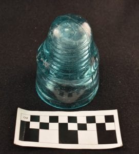
The metal detectors helped us locate some items of interest. We found a Yale brand padlock faceplate (Figure 1) that probably dates to the late 1890s- early 1900s. The bulldozer pulled up the base of an old flagpole (Figure 2) that once stood in the field as well as a US Department of Interior survey datum marker (Figure 3). A side note, in the picture you will notice that printed on the survey datum are the words “Unlawful to disturb,” and when we pulled this up I got very nervous, but it all turned out well. My two crew members (Shout out to Britney Elsbury-Orris and Hannah Winters) located three articulating pieces of a blue transfer print ceramic vessel (Figure 4). Lastly, in the parking lot fill layer, we located a completely intact glass insulator (Figure 5), that were commonly used on telegraph lines in the 19th and 20th centuries.

Figure 2: Flagpole base that got pulled up by the bulldozer.

Figure 3: US Department of Interior survey datum.

Figure 4: Articulating blue transfer print ceramic pieces with Romantic style design.

Figure 5: Glass insulator located in the parking lot fill.

In all the project was a great experience for everyone on the crew. Fort Necessity is a wonderful and notable place that I have had the pleasure of working at over the last two summers. I was personally able to gain valuable experience leading a crew, but more importantly I learned how to interact with the construction crew and develop a working relationship that allowed for the project to go smoothly. The guys working the machines were a pleasure to work with and I hope I can work with them again on a project someday. Lastly, go visit Fort Necessity National Battlefield! It’s free, fun, and not that far from Indiana or Pittsburgh. While you are there make sure to visit Jumonville Glen and Braddock’s Grave which are located just up the road from the fort.


IUP Anthropology Department

IUP Goes to ACRA’s 24th Annual Conference!

By Kristina Gaugler

The American Cultural Resources Association (ACRA) is a national industry trade group whose primary mission is to advocate for the wide-ranging interests of the cultural resource management (CRM) industry. Complete with their own code of ethics and recommended best practices, ACRA members include a diverse group of large and small firms who work across the country in the CRM industry.

Second year graduate students in IUP’s Applied Archaeology program had the opportunity to attend ACRA’s conference this past September 6-9th. The conference was held in the beautiful French Art Deco styled Carew Tower, also called the Netherland Plaza Hotel in Cincinnati, Ohio. Unlike the many academic and research focused anthropological conferences that are held yearly, the ACRA conference is specifically geared to those who work outside of academia, in the private or public sectors of the CRM industry. It is for this reason that attending the conference was such a great experience as it provided valuable insight into the issues facing archaeologists working outside of the academic field. Students had the opportunity to sit in on a number of topics that ranged from how the current political climate was affecting the CRM industry, to how professionals should proceed in the wake of the #metoo movement. This conference also gave students the opportunity to network and engage with business owners and experienced CRM professionals in a relaxed and relatively informal atmosphere.

Photo overlooking the dining hall in Carew Tower, taken by Ross Owen.

The first session of the conference was a discussion on the current political climate in Washington DC. and its impact on the CRM industry, specifically there was a long conversation on how the November mid-term elections could potentially impact the field. Topics that were considered included the current state of infrastructure funding, the push for stream-lining regulations within the administration, and the impacts of changing environmental policy regulations. Presenter Marion Werkheiser, ACRA’s Chief

Lobbyist, noted that the decisions being made in Washington have the potential to create more work for CRM professionals, especially if lands that were formerly protected are opened for development, but that efforts to stream-line undertaking these projects to create money saving short cuts, have the potential to be very destructive to cultural resources.

Session 5 was titled “Building Great Workplaces: How the #MeToo Movement is Affecting the CRM Industry.” This was an excellent discussion on the ways that not only management and business owners should handle the reporting of workplace misconduct or sexual harassment, but also the steps employees can take to be heard, and the legal ramifications of such conflicts. This session was presented by attorney Julie Pugh, which made for an extremely informative dialogue that was given from the perspective of the people who counsel, litigate, and resolve these types of issues. Pugh had a lot of valuable insight on how to handle these difficult situations appropriately, and within the bounds of the law.

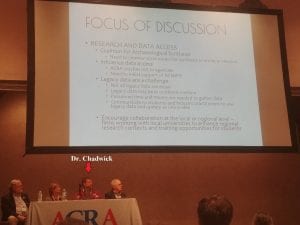
The final session that I found particularly interesting was Session 10, which discussed the ways that the Academy and the CRM industry can promote “synergy” between each other. IUP Professor, Dr. William Chadwick was a panel member during this discussion as he has worked for many years as both an industry professional and as a university professor. A task force was created within ACRA to work towards accomplishing the goal of improving the relationship between CRM and the academy. This session had a lively discussion and audience members were very keen to share ideas and stories, as well as complaints with the panelists and each other. The consensus was of course, that there should much more collaboration between the two fields, however the exact method for promoting this is still debated.

Session 10, Promoting Synergy Between the Academy and CRM Industry

By attending this conference students were given the chance to get an in depth look at the people, companies, and issues that make up the CRM industry. Unlike many other academic conferences, there were very few students in attendance at ACRA. I hope that in the future universities and companies alike can work to encourage more students to attend, as all of us at IUP found the conference to be valuable and fun!

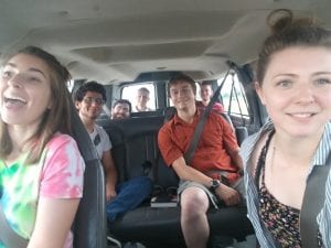
Having fun on our drive to ACRA! Students from left to right; Jessie Hoover, Andrew Malhotra, Joseph Bomberger, Ross Owen, Christopher Thompson, Steven Campbell, Kristina Gaugler


IUP Anthropology Department

Where in the world are IUP Achaeologists this summer?

Summer is upon us (where did the year go?!) and our applied archaeology students are off to many exciting places and experiences. We are very proud of the hard work of our recent grads and current students, and pleased to see that nearly all of our current students are employed! Here are some highlights:

May 2018 graduation

Recent grads:  Samantha Taylor (MA, ’18) recently completed her thesis on the ceramic assemblage at the African-American diaspora site of Pandenarium. She is currently working as the Assistant Site Director at The Germanna Foundation. Danielle Kiesow (MA, ’18) recently completed her thesis investigating land use and gardening practices on the Ojibwe reservation from 1854 until 1930 to analyze the relationship between the Ojibwe at Grand Portage and the Indian Agents from the Bureau of Indian Affairs.  She is currently working as an Archaeological Technician for the Grand Portage Reservation Tribal Council. Undergraduates Harley Burgis (BA, ’18) and Eleanor Schultz (BA, ’18) recently graduated with Honors. Harley, whose thesis explored prehistoric cooking technologies at the prehistoric site of Dust Cave, is off to work as a field technician for TRC while she takes a gap year between college and grad school. Eleanor, who won this year’s Olin-Fahle award, will begin a graduate program in museum studies at Johns Hopkins University this fall. Congrats Grads!

Year 2 cohort:  these guys are off running! Gen Everett (who has been running this blog admirably for the last 2 years), is working as an archaeological technician for the National Park Service at Isle Royale, enjoying scenery the rest of us are envious of. Britney Elsbury-Orris, Heather MacIsaac and Zane Ermine are serving as crew chiefs on several phase I and geophysical surveys for IUP’s Archaeological Services Center. Zaakiya Cua is working as an archaeological technician for the Allegheny National Forest-Bradford District during the week while writing her thesis on the weekends. Matt Bjorkman is utilizing his GIS certificate training by working part time for IUP’s IMAPS (Institute for Mine Mapping, Archival Procedures, and Safety) program, and conducting fieldwork at the Squirrel Hill site as part of his thesis research. Patrick McGinley is conducting his thesis research using geophysical survey to locate Ft. Halifax along the Susquehanna River in central PA, and Mesfer Alqahtani will soon be defending his thesis, which uses GIS to model the distribution of stone circle structures in northern Saudi Arabia. Mesfer recently won the Dean’s Award for best poster at the 2018 IUP Scholar’s Forum. Congrats to Year 2!

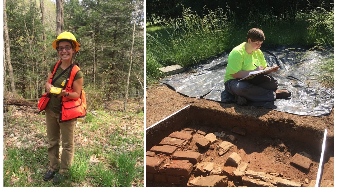
Zaakiyah Cua in the field at the Allegheny National Forest-Bradford District (left) and Sami Taylor diligently taking field notes as the assistant site director for the Germana Foundation (right).

Year 1 cohort: Not to be outdone by the Second Years, the Year 1 cohort is also doing impressive things this summer. Ross Owen, whose thesis explores the management of metarhyolite stone quarries in central PA (funded in part by the South Mountain Partnership), is once again serving as supervisor for the PHAST (Pennsylvania Highway Archaeological Survey Team) program. Assisting him as the PHAST crew are fellow first-years Stephen Campbell, Kristina Gaugler, and Sam Edwards. Andrew Malhotra is interning with the Department of Conservation of National Resources’ forestry division, and Chris Thompson is working as a field technician out in the Badlands region of North Dakota. Joe Bomberger works for the Allegheny National Forest, where he worked prior to matriculating into IUP’s MA in applied archaeology program. Finally, Jessie Hoover has begun research on her thesis at the Mary Rinn site and Anthony Gilchrist is taking an underwater archaeology field school hosted by Lake Champlain Maritime Museum before heading to upstate New York to serve as a crew chief for Dr. David Starbuck’s archaeological field school at French and Indian War site of Rogers Island.

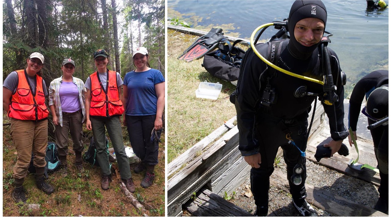
Danielle Kiesow in the field at Grand Portage (left) and Anthony Gilchrist sporting the latest style in underwater archaeology (right).

Keep up the awesome work everyone and can’t wait to hear about your summer adventures at the first Fall Graduate Colloquium!

Visit IUP DEPARTMENT OF ANTHROPOLOGY

IUP at the 83rd Annual Society for American Archaeology Meeeting

By: Genevieve Everett

Cherry Blossoms around the Tidal Basin

Employers should allow attendees/participants the Monday after the Society for American Archaeology (SAA) conference off. Let me tell you, I’m exhausted, but I’m feeling energized by all the amazing papers that I had the chance to hear, and the poster’s that were exhibited throughout the week.

Wednesday morning, myself, and 6 of my classmates (and luggage) crammed into the Arch Services van, and headed to the 83rd Annual SAA conference held in Washington, DC, in the lovely Woodley Park neighborhood. This was my first ever SAA conference. We arrive mid-afternoon at our small, but cozy Air Bnb that was located about a half hour (walk) from the conference center. After settling in a bit, we all walked to the conference center to register. We walked past yellow daffodils and purple flowers’ cascading down stonewalls, the first real sign of spring. One route we could take to and from the conference was through the National Zoo! After a delicious Lebanese meal (and cocktail), we all headed back to the Air Bnb to prepare for the first day of presentations, posters, and seeing old friends/colleagues.

IUP Ethics Bowl team

Thursday morning was a BUSY day. I was up bright and early to go to Sami’s presentation on her thesis research at Pandenarium, a 19th century Freedman site in Mercer County, PA. This was one of her last presentations before she graduates in May! She did really great! Shortly after I wandered around the poster session, and was particularly interested in the Caves and Rockshelter posters. From there, I headed to watch our Ethics Bowl team debate Cornell University. The point of the Ethics Bowl is to put two teams from different universities in front of a panel of judges, and debate about hypothetical (and in some cases based on real events) ethical issues within archaeology. Our team did amazing, however, they did not make it to the final round. Later I walked around the Expo room browsing books and picking up free “swag”, and from there I stopped by to see Sami and Angie Jaillet-Wentling’s poster. They were presenting the results of the public archaeology days they held this past fall at Pandenarium, which contributed to the assemblage Sami was examining for her thesis.

Sami and Angie at their poster session

The remainder of Thursday I spent alone, going from session to session. This past fall I helped excavate a quarry site in Northern Maine (if you go back to the September blog posts, you can read about it) under the supervision of Nathaniel Kitchel and Heather Rockwell. In the afternoon, Nathaniel presented a paper that the two co-authored on the results of this excavation. Next, I stopped by a talk in honor of Dennis Stanford. I especially enjoyed Ciprian Ardelean’s talk that was partially about working with Dennis Stanford, but also the Chiquihuite Cave in Zacatecas Mexico. Mr. Ardelean talked about being an “outsider” from Romania working in the Americas. He also talked about the importance of working with students. More specifically, the merit and value of getting dirty, working in isolation for so many days, being in nature and cooking and enjoying meals together. I really connect with this notion.

Friday I decided to head toward the Washington monument to see the Cherry Blossoms in full bloom. I did a loop around the Tidal Basin, dodging hordes of school groups. Despite the tourist traffic along the way, it was such a pleasant walk. I wanted to hit up the Natural History Museum, but again, it was swamped with school groups, so I turned around and headed back to the conference. I hit up a few more talks, had a drink with my mentor, and went out to Haikan, an amazing ramen place with some friends. The rest of the night was spent celebrating the fact that our classmate/friend Zaakiyah won the Paul Goldberg Award, a national award, awarded to a single MA student in either the geosciences or archaeology!

Zaakiyah with the Paul Goldberg Award!

On Saturday, my main objective was to attend the symposium, “Wicked Awesome” Archaeology: New Data and Directions In The Archaeological Northeast”. A few friends/acquaintances were presenting during this session, including Dick Boisvert and Zachary Singer. Dick Boisvert is my mentor and is on my thesis committee. He talked about the legacy of the State Conservation and Rescue Archaeology Program (SCRAP). Following Dick, Zach discussed “New Investigations of the Paleoindian Component at the Templeton Site in Western Connecticut”. Much like SCRAP, students and volunteers help excavate the Templeton Site, which to me, is always a wonderful collaboration. After their talk I met up with my family, and we walked through the National Zoo. Later, we met up with my boyfriend, and grabbed dinner at a Mexican restaurant where delicious food and margarita’s were consumed.

The Government, University, and Heritage Stewardship crew!

Sunday, the final day of the conference, and the day of my presentation (at 8 am) in the “Government, Universities, and Heritage Stewardship: A Student and Young Professional Symposium”. I was in this symposium with several IUP classmates, some fellow PennDOT interns, and two graduate students from the University of Montana. My paper was titled, “From Field School to Graduate School: How One Public Archaeology Program Has Made It All Possible”. I discussed the benefits/legacy of SCRAP, and how I am using SCRAP data to complete my Master’s thesis. I also provided some preliminary results/conclusions to my thesis research. As my first time presenting at a conference, I have to say, I don’t think I bombed! I felt pretty confident up there, but that took A LOT of practicing over and over again. Everyone that participated in the symposium did great, and each person had a really interesting topic that related to their collaboration with state or federal government agencies. After our symposium, we jumped in the van, and headed back to Indiana.

Personally, the SAA’s were an amazing experience for me. Roughly 20 plus IUP students, past and present, attended the conference. In addition, three professors in the graduate and undergraduate Anthro department presented papers.  It felt really good knowing that IUP had a strong presence, one that shows that we are a tight knit group, and that we are able to successfully transition from our undergraduate or graduate studies into viable careers in archaeology. Most IUP graduates are working in CRM, while some are getting their PhD’s. I hope that we can continue to show the archaeological community that we have a strong program for years to come. See you all next year in Albuquerque!!!

IUP ANTHROPOLOGY DEPARTMENT

One Luddites Journey Learning GIS

By: Genevieve Everett

Before graduate school I asked friends that had been through graduate programs for some advice, and again and again I was warned that it would fly by fast. They weren’t wrong. Here I am, deep into my final semester of graduate school wondering what happened to the time. I guess it’s true, time flies when you’re having fun….or when you’re really stressed out.

One of the most stressful courses I signed up for in this program was the “Applied Spatial Methods in Archaeology” class. This class consisted of learning/using ArcGIS to create viewsheds, data dictionaries, etc., out of archaeological data. I had never used GIS, and I am not the most technologically savvy person out there, so I knew going into this class that I would be out of my comfort zone. I got passing grades in the class, but there were very few moments where I felt fully confident using ArcGIS. It was frustrating, and I hated asking my classmates for help, because we all have our own stresses to deal with. Looking back, I was so thankful that I took the class, because it has been immensely useful since.

Fake Boundary to show use of Websoil Survey and ArcGIS

This past summer working for PennDOT as a PHAST intern I used ArcGIS all the time to georeference historic maps, historic aerials, engineering plans, and to draw in project area boundaries, which I converted into maps for reports. One of my favorite uses of GIS is creating an AOI in Web Soil Survey, which creates a shapefile showing the soil(s) in the project area. First you upload the project area boundary into Web Soil Survey, which displays the project area boundary (in the real world coordinates that you set in ArcGIS), and the soils present within it. You then download the shapefile associated with the AOI, and bring it into ArcGIS. I created a fake project boundary to show what the end product looks like. In this example there are two soils present, 14B and 214A, which have unique names. For example, 14B, which makes up 98% of this fake project boundary is called Sheepscot. Sheepscot is a cobbly very fine sandly loam. Web Soil Survey also provides information about elevation, slope, farmland classification, typical stratigraphic profile information, and parent material. All of this information comes in handy when writing technical reports.

Another reason I am really glad I took that class is that I have been using ArcGIS heavily for my thesis. Part of my thesis is conducting a spatial analysis of lithics and lithic raw material from a Paleoindian site in New Hampshire, in comparison to another site nearby. By extension, I am attempting to determine what type of activity or activities were being carried out in this area. With the help of Dr. Chadwick, classmates, past theses, and my own problem solving (mostly through the ESRI website), I have made a lot of progress and learned a few new things. One of those things was creating a “fishnet” to create the excavation block grid out of two datum points, because there is no GPS data. Most recently I taught myself how to create Choropleth maps. Choropleth maps display where individual or multiple artifacts are in relation to one another in the excavation block using color gradients. As you can see in the image, each color is correlated with a particular number of Waste Flakes, and the quadrants for which they were found. For example, the red quadrants in the “Total Waste Flakes K-Block” image are the quadrants that have a higher count of waste flakes (90-176). I am also looking at the distribution of artifacts by Zone (or Strat), which are easily displayed in these Choropleth maps for comparison (shown below). My next step is to take these Choropleth maps, and do hot spot/cluster analysis.

The moral of the story? Try something new, even if it scares you. It’s cliché, but you’ll never know if you don’t try.

IUP ANTHROPOLOGY DEPARTMENT