Oh Indy

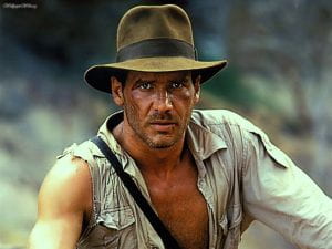
All archaeologists agree that Indiana Jones, while a dreamy professor, is a terrible archaeologist and is more akin to grave robbers than archaeologists.  Although a majority of the actions in these films are fictional, they are based on real world facts.  In Raiders of the Lost Ark, Indy is chased by the Chachapoyan Tribe.  This was a real-life tribe who lived in Peru just prior to the Spanish invasion.  They were conquered by the Inca in 1450.  The temple Indiana Jones robbed was similar to the actual Chachapoyan temple of Kuelap.  Like the fictional temple, Kuelap has a long narrow entrance way that was probably designed as a defensive measure.  The biggest discrepancy is that Kuelap does not have a large rolling boulder that chases looter down the narrow hallway.

Now let’s talk a little about Nazis.  I think it was one of archaeology’s proudest fake moments when Indy punched the Nazi.  This iconic image has become a running meme for archaeologists and very few of us desire to argue against that image.  So real world: Hitler did steal and hide many historically significant artifacts.  There mostly consisted of highly valuable statues, paintings, and books that he stole from Jewish families and businesses and hid in caves across Europe.  The actions of the Monuments Men returned some of these priceless treasures to the public.  While many of the treasures Hitler’s men hunter were real-life works of art, they did pursue mythical artifacts such as the Spear of Destiny, The Holy Grail, and The Ark of the Covenant. The Raiders film could depict what might have happened if the                                                                                    Nazis did find the Ark.

Regardless of all his faults, the Indiana Jones franchise inspired many archaeologists.  Statistics show an increase in archaeology students after the premiere of the first movie.  As well, many famous archaeologists admit to being inspired by Indy.  In 2015 the National Geographic Museum created an exhibit combining the thrills of Indiana Jones with actual artifacts and archaeological education material. Along with inspiring future archaeologists, George Lucas was inspired by real archaeologists including Hiram Bingham, Roy Chapman Andrews, and Sir Leonard Woolley.  Lucas based the films off of the feeling of discovery we all experience.  He did not include many of the necessary but admittedly boring paperwork, layer-by-layer excavation, and cataloging.

Even though these films portray archaeologists as gun toting, whip cracking, Nazi punching, action heroes, we must remember that we are even cooler than that because we take detailed field notes, photograph, map, and preserve the world’s past.

Follow IUP’s Indianas via Facebook, Twitter, and Instagram

IUP Anthropology

The “D” Word…Dinosaurs

If you are an archaeologist, you have probably had to spend a lot of time trying to explain to people that you do not excavated dinosaur bones.  This can be a difficult thing to get across because fossils are generally fascinating and the practice of paleontology has a lot in common with archaeology.  In fact, many paleontologists do not even study dinosaurs.  Both studies use similar recording methods, focusing of stratigraphy, chemical and biological analysis, and careful excavation.  The main different is that paleontologists usually work on a much larger time scale than archaeologists.

The common paleontology term, fossil, was used in the 1600s (during these discipline s infancies) to describe anything that was dug up.  This does not mean it has to be millions for years old or even petrified.  It wasn’t until the 1730s when the term was defined as geological remains.  Between those time periods the beloved term artifact was actually fossil (etymology.com).  Not only do we share terminology we also share our favorite chronology tool – STRATIGRAPHY!  Nils Steensen (Steno) recognized a relationship between tongue-stones (shark teeth) and the sediment layers.  He defined normal thought to say that these strata developed and changes and were not deposited solely by the Great Flood. Later archaeologist such as John Frere discovered that some of the fossils dubbed fairy arrows and thunderbolts were actually stone tools created by humans and could be used to date stratigraphic layers (Harris 1989)

Along with scaring principle research terminology, archaeology and paleontology also have similar sub-fields only distinct in the items of study.  Paleobotanists and archaeobotanists both study plant remains.  However, the paleobotanist studies fossilized plants while the archaeobotanist prefers to work with more recently deposited plant remains.  Both fields have specialties in taphonomy or the study of how living things decay and the biotic or abiotic (mostly seen in archaeology) factors that impact the remains after deposition.  Where things begin to get confusing is in the study of fossilized humans and human evolution or paleoanthropology.  Being as this discipline focuses on fossils but also on human remains it can be considered to be a part of both fields.  This is a distinct overlap that has led to amazing discovers in the realm of human evolution.

With so many overlaps it can be easy to see how people can confuse Indiana Jones with Jurassic Park.   The key here is in nicely, patiently, and happily educating the public on the differences and similarities of paleontology and archaeology.  We need to be able to communicate the complexities of our disciplines in a way that is easily understood but respectful and holistic to both disciples.  While I am sure every archaeologist is tired of hearing “dig up any good dinosaurs?” we must remember that many of our paleontologist cousins feel the same.


Can you dig it?

Reference:

Harris, Edward

1989 Principles of archaeological stratigraphy. 2nd ed. Academic Press, London.


IUP Anthropology

Archaeology Day 2018

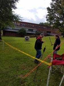
This past Saturday, in the middle of midterms, we hosted our annual International Archaeology Day Open House.  For once in Indiana, PA the weather decided to surprise us in a kind manner.  For what was supposed to be a day of rain turned into a rather nice day even if it was a little chilly.    It made for a spectacular Archaeology Day.  The weather was good enough for our largest attraction to be set up, the atlatl range!  You don’t even need to know the word atlatl to know that throwing spears is incredibly fun.  Though I will clarify, an atlatl is a tool that extends your reach and lets you throw a spear harder and farther than you could without.

Andy the atlatl guy talking a guest through how to use an atlatl.

She hit the target.

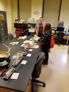
After being drawn in by the tempting offer of spear throwing, there was a whole floor of McElhaney dedicated to archaeology in various forms.  From historic and pre-contact artifacts to flotation, zooarchaeology, archaeology in the media and more.  Frankly it would be more fun to just show you so take a little look below.

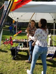
Chris showing off a bow he made.

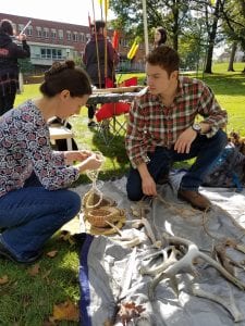
Tyler shows folks the ropes (and how they are made)

Chris showing off his knowledge of pre-contact tech.

Jessie handling the pre-contact table.

Janee running the zooarchaeology table.

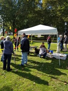
A nice gathering of folks around the atlatls and pre-contact technologies.

Mace shows what a real archaeologist looks like. *SPOILER: There’s a mirror in the center*

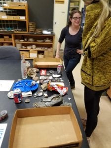
Is it trash or treasure? Well, Angela’s reluctance to be in a photo definitely created a treasure.

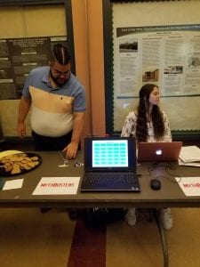
Carlos and Heather bustin’ myths about archaeology.

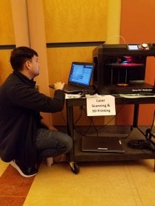
Jared does his thing with the 3D printer.

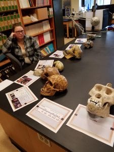
Brianna talks shop about hominin and hominid skulls

I would like to share a few final thoughts and I encourage replies in the comment section below. We had a smaller turnout this year than years past.  That was partly advertising, partly weather, and partly timing as this year’s Archaeology Day did not fall along homecoming.  I’m nowhere near disappointed though.  Actually, it’s the opposite, I’m ecstatic because those who showed up took interest in what we had to offer.  Quite a few people hung around for a good hour or so (a third of the events length) and asked questions.  There’s a part of me that wants to reach out to as many people as possible but if overall numbers drop while engagement is increased, I’m fine with that.  I wonder if people were more willing and eager to engage because the turnout was smaller, there wasn’t a feeling that you needed to rush along.

I would like to give a special thanks to Andy and Lori Majorsky for giving their awesome atlatl demonstrations, Susanna Haney for the flint knapping demo, and last, but certainly not least, everyone that came together to make Archaeology Day a success!

IUP Anthropology Department

Humanity and Science Unearth Together at St. Mary’s College of Maryland’s Historical Archaeology Field School

By Mace Long


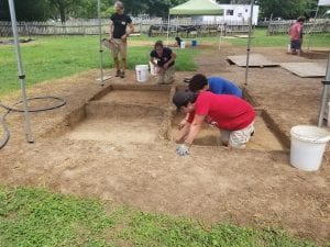
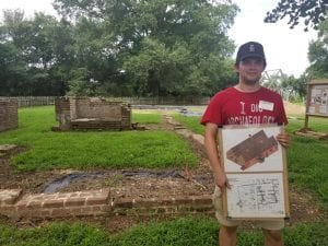
During the summer, I spent ten weeks concentrating on gaining skills in excavation, data collection and archeological recording in the field, laboratory and classroom at the St Mary’s College of Maryland Historical Archeological Field School. At the late 17th century Leonard Calvert House, I personally unearthed part of a horseshoe, a lock mechanism, Rhenish stoneware, Venetian glass, creamware, projectile points, fragments of oyster shells, iron nails, pieces of clay tobacco pipes and much more. Chief Archaeologist Travis Parno emphasized that “these excavations at the site of Maryland’s first capital have revolutionized the understanding of colonial architecture and the material culture of the period.”

The archeological field school site is part of Historic St Mary’s City surrounded by a large living history area, museum and The Maryland Dove ship. While spending full days excavating at the site, we took turns giving public tours. It was fulfilling to be able to discuss the background history and present the successes of our dig site.


During the Tidewater Archaeology Weekend, I witnessed the incredible instructive value of allowing people of all ages to sift through dirt themselves and be educated physically with exciting hands-on participation. In addition, I greatly enjoyed the variety of field trips to Colonial Williamsburg, Jamestown and Montpelier where we observed methods used by other sites.

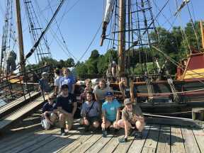
As part of the St Mary’s College of Maryland’s Historical Archaeological field school, we boarded and rode the Maryland Dove learning all kinds of techniques and mechanisms regarding 17th century ships. (IUP Graduate Student Mace Long)

The St Mary’s College of Maryland Historical Archaeological Field School was one of the most incredible educational experiences of my life, as it heightened my understanding of A.L. Kroeber’s quote “[Archaeology] is the most humanistic of the sciences and the most scientific of the humanities.”


Photos provided by Mace Long and the Historic Saint Mary’s City Field School Blog

IUP Department of Anthropology

Upcoming Graduate Student Research Presentations from the UK to VA

By: Genevieve Everett

Conference season is upon us! I thought it would be nice to highlight the graduate students that are representing IUP and our department by presenting their research in the form of papers and posters at the following conferences/forums:

  1. The Middle Atlantic Archaeological Conference (MAAC) in Virginia Beach, VA- March 15-18
  2. The Graduate Scholars Forum at KCAC on IUPs campus, April 4
  3. The 89th Annual  Society for Pennsylvania Archaeology(SPA) Meeting in DuBois, PA- April 6-8
  4. The Annualy Society for American Archaeology (SAA) Conference in Washington, DC- April 11-15
  5. The Seminar for Arabian Studies (SAS) in Bloomsbury, London-August 3-5

Below you will read about each student’s individual project/research and which conferences/forum you can find them at this year!

Kristina Gaugler

Presenting research at: IUP Graduate Students Forum

Spatial Database Development for Confluence Park Master Plan

The goal of this project is to create a series of spatial data layers that document the existing environmental conditions at Confluence Park, a 15 acre site managed by the Allegheny Arboretum at Indiana University of Pennsylvania. These maps will contribute to the develop of a support system designed to complement future site planning activities and will include the current topography, vegetation, hydrology, existing structures, and site access points. Factors that may influence the decisions of future planning or construction will be assessed, including the location and condition of on-site sewage systems and retention ponds, riparian zones, and a rapid-bio assessment of streams. This information will help delineate locations on the site that may be suitable for future development. With the tools and basemaps created, users will be able to overlay applications to suit their needs and allow for varying types of analyses to be performed.

Britney Elsbury-Orris

Presenting research at: SPA and SAA

The Kirshner Site (36WM213) is a multi-component site in South Huntington township, Westmoreland county, Pennsylvania that contains two Middle Monongahela villages. Relatively little is known about Monongahela use of animals.  Fortunately, good faunal preservation has made zooarchaeological analyses of materials from this site possible. Identifying and analyzing these faunal remains with respect to taxa and skeletal elements, as well as human and animal modifications, provides important new information. The distribution of faunal remains across the features of the site and its two components has been examined, as they have the implications for relationships between the site’s inhabitants and their environment. These data provide insights into the nature of this site and the activities of its occupants. Comparisons with other faunal studies, like those done on zooarchaeological materials from other Middle Monongahela sites, including the Johnston Site (36IN2) and the Hatfield Site (36WH678), further expands on the understanding of the Kirshner Site and the Middle Monongahela tradition.

Matthew Bjorkman

Presenting research at: IUP Graduate Scholars Forum

Indiana County FEMA Data-based Flood Hazard Analysis

Co-authored with Eisbeiry Cordova-Ortiz & Shanice Ellison

In the past decade we have frequently seen the effects of intense precipitation events, particularly the damage they cause in populated areas. Due to the increased frequency of these events, state and local government officials across the country have developed flood hazard analyses for their jurisdictions. Taking this into consideration, Indiana county is developing a flood management plan to prepare for any adverse effects caused by 100-year storms. Using ArcGIS, a geodatabase was developed to build a 100-year flood depth grid (FDG) using Federal Emergency Management Agency (FEMA) data from Pennsylvania Spatial Data Access (PASDA).  The FDG was used to identify structures that are located in a flood zone and would be susceptible to damage. This project highlights concentrations of vulnerable buildings and provides the value of the estimated monetary damages. These results will assist the county with its development of its comprehensive emergency management plan.

Using LiDAR to Analyze Landscape Evolution: A Case Study of the Squirrel Hill Site (36WM0035)

Light detection and ranging (LiDAR) is an active remote sensing system that has, on occasion, been used by archaeologists to conduct paleolandscape reconstruction studies. Understanding what the landscape looked like is essential for archaeologists to determine how prehistoric sites formed. Rivers are a primary operator in landscape evolution, as meandering and avulsing rivers can create major alterations to a landscape through deposition and erosional processes. Changes in a river’s position on the landscape will have great impacts on the location and preservation potential of archaeological sites This study utilizes LiDAR data from Indiana and Westmoreland counties in Pennsylvania to study landscape evolution near the archaeological site of Squirrel Hill, a Monongahela village site. The goal of the research was to use remote sensing technologies to identify and map extinct channels of the Conemaugh River to understand how the evolution of the landscape around the Squirrel Hill site has affected the site’s formation and preservation.

Samantha Taylor

Presenting research at: MAAC, SPA, SAA

Looking Through Dirty Dishes: A Comparative Analysis of Ceramics at the John and Rosie Allen Residence, Pandenarium, Mercer County, Pennsylvania.

African Diaspora archaeology has become one of the most impactful means by which archaeologists supplement our current understanding of the past. Not only does this subfield have the potential to benefit descendant and local communities, but it also enables professionals to fill in the blank gaps left by the systematic disenfranchisement and intentional illiteracy of an entire group of people. One site with the potential to enhance our understanding of the African Diaspora is Pandenarium (36ME253) a freed African American settlement in western Pennsylvania. Current research at Pandenarium focuses on a comparative ceramic analysis with nearby archaeological sites, other freed African American sites, and slave quarters at plantations. The goal of this research is to determine the socio-economic status of individuals living at Pandenarium, along with participation in local and regional markets. The results of the analysis featured in this paper are a foundation for future comparative studies featuring Pandenarium.

Mesfer Alqahtani

Presenting poster at: SAA and the IUP Graduate Scholars Forum

Presenting paper at: SAS

SAA:

GIS Investigations on Stone-Circle Structures in the North of Saudi Arabia

The theme of the poster will address archaeological phenomena in the north of Saudi Arabia. The archaeological phenomena are stone-built structures that can be seen by satellite images. These stone-built structures have various types, and one of them is the circle type.

The poster will show the method of creating predictive models of stone circles by using the Geographic Information System (GIS). To create these models, two zones from the north of Saudi Arabia should be selected: study zone and applied zone. The study zone is where the distribution of stone circle locations will be analyzed to create predictive models. The applied zone is where predictive models will be applied to be testable in the future.

The predictive models will be based on quantifiable attributes of stone-circle locations from the study zone. These attributes will include the relationship between stone-circle locations and environmental variables such as the landform and the distance of water resources. These attributes will be analyzed by ArcGIS to obtain environmental characteristics representing high, middle, or low probability models for the presence of stone-circle locations. In the applied zone, similar environmental characteristics will be identified to determine high, middle, low predictive models.

SAS:

Geospatial Investigation of Circular Stone Structures in Northern Saudi Arabia

The paper will focus on the circular type of stone-built structures in Harrat Al-Harrah of northern Saudi Arabia. The goal of the research is to recognize the locational patterns for these circular structures based on five quantifiable geographic attributes: elevation, slope, land-cover, distance to sabkhas (temporary water bodies), and distance to wadies (water streams).

The probability modeling methodology conducted uses Remote Sensing and GIS technologies. This study includes identified locations of circular structures in one zone to create the model and a second zone to test the model (225 square miles and 81 squared miles total) of Harrat Al-Harrah, examining the correlative relationship between these locations and the five geographic factors. The results show the favorable geographic factors related to the locations of circular structures in the two zones of Harrat Al-Harrah.

The significance of this research lies in the contribution of recognizing the locational patterns of circular stone structures in two zones of Harrat Al-Harrah that have never been studied before and difficult to access. This pattern will be useful for comparative studies with locational patterns of circular structures in other areas of the Arabian Peninsula when conducting more investigations on this type of stone structures.

IUP Graduate Scholar Forum:

Geospatial investigation of circular stone structures in Northern Saudi Arabia

The theme of this poster will address stone-built structures in northern Saudi Arabia. Specifically, the circular type stone-built structure will be the focus of this research. Stone-built structures are an archaeological phenomena that can be seen via satellite images within this region of the world.

The goal of the research is to recognize the pattern of geographic locations for these circular stone-built structures based on five quantifiable geographic attributes. These attributes include elevation, slope, land-cover, distance to sabkhas (temporary water bodies), and distance to wadies (water streams). Remote Sensing and GIS technologies are used to conduct probability modeling for this research. This study includes identifying all the locations of circular structures in one zone, building a model for their locations, and then examining a second zone using the model. The results show the favorable locations for circular structures in these two zones based on the model.

Ross Owen

Presenting research at: SAA

PennDOT Highway Archaeological Survey Team: Providing Immersive CRM Work Experience to Students

Despite there being more applicants with graduate degrees than there are jobs, the CRM industry suffers from the number of people holding graduate degrees but lacking experience conducting archaeological surveys for Section 106 compliance. Additionally, conducting archaeological surveys is cost-prohibitive and can be a burden on state agencies on projects where federal funds are not involved. These two issues in the field of compliance archaeology prompted the creation of the PennDOT Highway Archaeological Survey Team (PHAST). Through a partnership with Indiana University of Pennsylvania, each year PHAST gives 4 students an opportunity to work on and complete small Phase I and II surveys for the Pennsylvania Department of Transportation. The students gain experience in the field, and are employed in the lab to perform the necessary background research, GIS mapping, curation and documentation following the guidelines of the Pennsylvania Historical and Museum Commission. Much of this experience is outside the purview of most field technician positions. This paper will explore the successes and failures of the PHAST program from both a professional and financial point of view. How have the students benefitted from their experience within the program, and how has the state benefitted from the services provided?

Andrew Malhotra

Presenting research at: SPA (Co-authored with John Nass, Jr. (Callifornia University of Pennsylvania)

Presenting research at: IUP Graduate Scholars Forum

SPA:

Social Signaling and the use of Style Amongst Late Prehistoric Monongahela Populations: Possible Evidence for Intervillage Political Integration

Communication between groups of people occurs for different reasons and, when using material culture, can take many forms. During the Late Prehistoric period evidence of social signaling in the form of shared stylistic traits appears at several late Monongahela villages from southwestern Pennsylvania. The stylistic trait consists of various forms of executing lip decoration on ceramic jars. The form of decoration using various tools results in the lip looking like a piecrust. This specific form of decoration appears from the Johnson site in Indiana County to the Foley Farm site in Greene County.In is the intent of this paper to document the temporal and spatial documentation and the social/political significance of this stylistic design is the subject of this paper.

IUP Graduate Scholars Forum:

Sanborn Maps of Indiana: Reconstructing the Urban Geography of Indiana, PA

This project will consist of analysis of Sanborn Fire Insurance Maps from 1887-1936 of Indiana Borough in order to depict urban growth patterns, major employers and how these factors changed over time. These maps were brought into ArcMap 10.5 to be georeferenced with road intersections and buildings, digitizing the most important ones. Attribute data including census and city directory data was also extracted for database creation. Through construction of a detailed database and data extraction of these maps, the goals of documenting and analyzing how the borough of Indiana and its people have developed and changed through the target years can be achieved. A future goal is to develop an interactive map with attribute information about its features for use by the public and historical society.

Genevieve Everett

Presenting Research at: SAA and Graduate Student Forum (abstract for forum not provided)

From Field School to Graduate School: How One Public Archaeology Program Has Made It All Possible

The Paleoindian Period of New Hampshire has been studied extensively, particularly in the White Mountains. Volunteers and avocationals from the summer field school known as the State Conservation And Rescue Archaeology Program (SCRAP) have excavated several of the known Paleoindian sites in northern New Hampshire. It is the goal of New Hampshire State Archaeologist, Richard Boisvert to make information and data recovered by SCRAP accessible to scholars as potential thesis and dissertation topics.

This paper outlines how the principal investigators participation in the SCRAP field school has been beneficial to her professional and academic career, including her current Master’s thesis. The purpose of this thesis is to produce a spatial and statistical analysis of the artifact assemblage from excavation block K at the Potter Site (27-CO-60) located in Randolph, New Hampshire in comparison with the Jefferson VI (27-CO-74) salvage block in Jefferson, New Hampshire. This comparison not only examines the spatial relationships within one Paleoindian site (27-CO-60), but also helps the principal investigator make inferences about the similarities and differences between two Paleoindian sites in close proximity. Public archaeology programs such as SCRAP are a valuable part of North American Archaeology, without SCRAP this work would not be possible.

Zaakiyah Cua

Presenting research at: SAA and the IUP Graduate Scholars Forum

SAA:

Loyalhanna Lake: a Geoarchaeological Approach to Understanding the Archaeological Potential of Floodplains

Unlike uplands, floodplains generally yield stratified deposits that may include deeply buried landscapes and archaeological sites. Most state specifications for cultural resources surveys require floodplains to be geomorphically evaluated in order to identify buried landscapes. This is most frequently accomplished via trenching, an effective, but timely, costly, and sometimes destructive method. This project reports on an alternative technique utilizing a multi-proxy methodology coupling geophysical survey with auger sampling. These non-invasive and limited-impact methods produce accurate results without causing extensive destruction to cultural resources. The study area, located along Loyalhanna Creek in Westmoreland Country in western Pennsylvania, is managed by the US Army Corps of Engineers – Pittsburgh District (USACE). As a federal agency, the USACE is mandated to identify and preserve cultural resources by Section 110 of the National Historic Preservation Act (NHPA). Unfortunately, federal agencies often face limited staffing, resources and funding to address management of cultural resources. In addition to proposing a method for identifying buried landscapes, this project also provides a case study of partnerships between federal agencies and public universities; a mutually beneficial collaboration which provides agencies with data essential to land management while simultaneously providing students valuable opportunities to conduct cultural resource management assessments.

IUP Graduate Scholars Forum:

Misery Bay Ice Survey Preliminary Results: a Case Study for Testing Geophysical Methods and Collaboration with Stakeholders

Ground-penetrating radar (GPR) and gradiometry are two geophysical methods typically used by archaeologists in terrestrial environments to locate subsurface features. This study took terrestrial geophysical methods out on the frozen ice surface of Misery By, Presque Isle State Park, PA; testing instrument limits across two acres of the bay. If successful, this study has major implications to geophysical maritime investigations, broadening the reach of cultural resource management within these environments by government agencies. In addition to testing new methodology, the project was a collaboration between the PA DCNR, Regional Science Consortium, PA Sea Grant, PASST, and Indiana University of Pennsylvania Applied Archaeology program. The collaborative and public nature of the project drew in stakeholders, largely contributing to the success of the study. This poster presents the preliminary results of the project; both a case study for testing new methods, and the positive implications for collaborative and public cultural resource surveys.

Heather R. MacIsaac

Presenting research at: IUP Graduate Scholars Forum

The Squirrel Hill site in Westmoreland County, Pennsylvania, was a Monongahela village inhabited from A.D. 1450 to A.D. 1613. Past research conducted by IUP archaeologists at the Squirrel Hill site uncovered evidence of housing, storage areas, and burials. There are conflicting interpretations of the village’s development and expansion over time. One interpretation is that the site contains a single village with an open, central plaza for communal activities, and that the village gradually expanded southward. Another interpretation is that the site contains two overlapping villages occupied at different times. To evaluate these interpretations, this research incorporates a statistical analysis of artifacts and a spatial analysis of structural features based on materials from the 2016 IUP archaeological field school. This research also investigates whether the Squirrel Hill site was inhabited by Monongahela traditional people only or by an amalgamation of Monongahela tradition and nearby McFate phase people.


IUP ANTHROPOLOGY DEPARTMENT
Working At the Carnegie Museum: A Love Affair.

By: Kristina Gaugler

The Carnegie Museum and I have a long history.

Early photograph of the Hall of Architecture

I was born and raised in the North Side of Pittsburgh, and like many a “city kid” I was shuttled by school bus to and from the Carnegie Museum throughout grade school, middle school, and high school. I have vivid memories of sitting at the long wooden tables in the museum cafeteria, under enormous glass windows, scarfing my brown bag lunch so I could get back to exploring. I was the kid who shushed classmates who were interrupting the docents, who asked a thousand questions, read every single word on the exhibit displays, and who didn’t want to leave at the end of the day. When I was an angst-ridden teenager, I would hang out at the museum after school, moping around the hall of architecture or sitting alone in the replica Egyptian tomb. Visiting the museum now, so many years later, I still have the same feelings of comfort and wonder as I did when I was younger. As an archaeologist and general history enthusiast, I love all museums, but the Carnegie definitely holds a special place for me. It feels like my museum.

My purpose in writing this post is to share some of my experiences working and volunteering at the Carnegie. I hope that I also highlight the notion that outreach programs and education within public institutions is valuable, worth our efforts, and fun for people of all ages.

I went to the University of Pittsburgh for my undergraduate in anthropology. While attending Pitt I had a work-study position through the Carnegie at the “Bone Hunters Quarry,” where I taught visitors (mostly school groups) about extinct animals through the excavation of a fake site. I learned that if you gave a small child a chisel and told them to dig wherever they wanted, you were very likely to ignite a spark within them that excited their curiosity in the past. Although, on occasion a spark was ignited within them to throw the chisel, sometimes narrowly missing your own head, those times were fun too. Either way, this was the first time that I really began to discover how much I enjoyed talking to visitors about archaeology and history.

Talking with visitors during Artifact I.D. day at the Carnegie

After graduating from Pitt, I found work as an archaeological field technician. Eventually though, I decided that I wanted to take a break from full time field work to prepare to go back to graduate school. Through a series of fortunate events I began, once again, to work for the Carnegie Museum. This time I volunteered at the Edward O’Neil Research Center, which is the Carnegie Museums off-site collections facility. My supervisor and friend, Amy Covell, allowed me the freedom to work on projects that interested me in the lab. When I started volunteering at the annex, the building was in the process of being renovated and many artifacts were going to be moved to new locations. Thus, I began my time there by helping to build permanent supports for fragile materials, including prehistoric pottery, stone tools, and glass artifacts. I learned proper handling of artifacts in accordance with the most current curatorial procedures, and I learned conservation techniques used in cleaning objects, including removing old plastics, adhesives, and ink that were used in the early days of museum storage and curation.

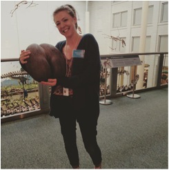
My favorite task at the museum however, was to be a part of the educational outreach programs. Last June I had the opportunity to speak with visitors about archaeology during the Carnegie’s “After Dark Program,” a monthly series where guests can come to the museum in the evening to explore, eat, drink, and hear lectures on various subjects. Another one of my favorite programs at the museum is “Artifact Identification Day.” This event gives visitors the opportunity to bring in their heirlooms and artifacts to have them identified by staff. It is always amazing, and sometimes humorous (see photo of me holding a Lodoicea) to help identify the items that people bring.

Holding a Lodoicea, or sea coconut, during Artifact I.D. Day. Lodoicea is the largest seed in the world! (And yes, it does look like a butt)


I have often thought of the Carnegie as being a museum of a museum. The Carnegie began acquiring artifacts and creating exhibits over a hundred years ago, and many of those early exhibits and artifacts are still on display. Working and volunteering at the museum gave me the opportunity to be a part of the team of people who were helping to conserve and protect these cherished items for future generations. To me, protecting artifacts and archaeological sites begins by showing people why they should care about them. For this reason, programs and institutions that promote stewardship of the past are incredibly important. History is made up of millions of stories. One of those stories is bound to pique the interest of someone! I’m very thankful for my time at the Carnegie, and I look forward to many more years of learning and visiting!

Photo of “Early Hall of Architecture” from: http://carnegiemuseums.org/about-us/our-history/

IUP DEPARTMENT OF ANTHROPOLOGY

My Brief Encounter with a Metal Detecting Hobbyist (Not a Love Story)

By: Genevieve Everett

Over break I was out doing some Christmas shopping at my boyfriends favorite fly shop in Pittsburgh. He spends A LOT of time (and money) there, so he’s gotten to know the staff pretty well, and by default, I have too. Anyway, seeing as I am clueless about fly-fishing one of the staff, Sharon was helping me pick out fly tying material. Sharon proudly introduced me to another regular customer: “This is Gen, she’s studying Archaeology”. The man that she introduced me to immediately decided to tell me that he and his buddies go metal detecting, and all of the “cool” stuff that they’ve found, including, Civil War era buttons, and so on. I nodded as he went on and on about taking objects from areas they knew they were not supposed to be taking them from. He continued to defend his side (at this point I couldn’t get a word in) by stating in some many words, “Why can’t I take these objects and teach my grand children about the past when institutions like the Smithsonian have repositories where artifact assemblages just sit there for years collecting dust?”

Before I go on to tell you how I responded, I will go on to tell you the little that I know about metal detecting in archaeology. Metal detecting is often used as a tool by archaeologists at battlefield and fort sites (Gettysburg, Fort Necessity, etc), because, well, there’s a lot of metal where gunpowder is involved. For example, this summer, the PHAST crew and myself did a metal detecting survey at Fort Deshler, a French and Indian War era fort in Pennsylvania. There are also strict laws (that vary by state) that dictate where and when you can metal detect. According to the Society for American Archaeology, there are distinctions made between private, state, and federal property. If on private property, one must have written permission from the landowner, otherwise it is considered trespassing. Same goes for state property, but this varies by state. Finally, it is typically illegal to metal detect on federal property without a federal permit, much like any federal archaeological work. Metal dectors are definitely breaking the law if they’re disturbing and recovering artifacts from an archaeological site. The moral of the story is, if you’re a metal detecting hobbyist, you better know the laws surrounding the hobby, or you could face jail time and/or fines.

Okay, so my response to the man? I understood where the man was coming from in his final point, so, I didn’t want to come off as “snooty” or “preachy”, because if I’ve learned anything about dealing with the public, that is the first way to make collectors go on the defensive. I told him that his exploits sound really interesting, because, hey, the guy seems like he’s fascinated by the past, even if how he chooses to learn about it is possibly illegal. However, I did tell him that as an archaeologist I have a few suggestions for future metal detecting. I went on to say that he could get in a lot of trouble if he continues to do what he’s doing, especially if the land he’s doing it on is protected. I told him to read up on Pennsylvania metal detecting laws, and if ever in doubt, and when possible, ask for written permission. I told him to photograph and record what he finds and where before pocketing it. In addition, I explained that leaving the found object in the ground, and marking/photographing the location is ideal, and to follow that up by contacting the state archaeologists of the find. By contacting the proper people, he would be making a contribution to the understanding of the past.

I know this guy might not change his ways, but maybe he will? It’s hard to say, since this was such a brief encounter. Before my time in the IUP Applied Archaeology MA Program (no, this is not a plug for the program!) I would not have felt as confident in speaking up about collecting/looting. Like I said above, learning to talk with collectors in a civil manner is the only way to reeducate them about their actions. We may not be able to get through to everyone, but it’s worth the try.

IUP DEPARTMENT OF ANTHROPOLOGY

Yes, Archaeology is a Science Too…

By: Genevieve Everett

For the past few weeks the Public Archaeology class and I have been preparing to host the high school students involved in the Upward Bound Math and Science (UBMS) program. The Upward Bound program aims to serve, “high school students from low-income families; and high school students from families in which neither parent holds a bachelor’s degree” (U.S. Department of Education). UBMS, a local branch of Upward Bound, prepares high school students for college with the possibility of pursuing a career in science, technology, engineering, or mathematics (STEM). The UMBS students are required to come to IUPs campus one Saturday a month for tutoring sessions and/or workshops. This month (November) the students woke up bright and early to participate in four archaeology centric workshops.

In planning for the workshops, our class brainstormed a theme and three objectives to convey the scientific aspects of archaeology. We chose the theme, “Scientific Method” (a concept most high school students have learned), and our three objectives were to show how the scientific method is used in archaeology, highlight the inter-disciplinary aspects of archaeology, and how math and technology aid archaeology. Most importantly, our goal was to provide a hands-on experience that actively engaged the students as opposed to simply teaching them through lecture. The four workshops developed by our class include: Dendrochronology/Archaeoclimatology, Geophysics/archaeology, how to lay out test units (using the Pythagorean Theorem), and dissecting owl pellets/zooarchaeology.

Jessie and I partnered up, and decided to create a dendrochronology workshop, which evolved into a focus on what tree rings (annual growth of a tree) can tell us about past climate events and how this may have effected settlement and subsistence in the past (Archaeoclimatology). I for one knew little about the methods behind “dendro”; therefore, it was a personal learning experience for me. Our learning objectives for this workshop were to show how archaeologists use dendrochronology and the limitations of the dating methods, and the ability to look for past climatic events in tree rings and their effects on the surrounding environment.

One of the horizontal cross cut hand-outs

Jessie and I created a few PowerPoint slides explaining what dendrochronology is and what each tree ring can tell us about the trees growth (i.e. wider rings=healthy growth, smaller rings=dry seasons, less healthy growth). With this information, Jessie and I gave the students two hand-outs displaying horizontal cross cuts of trees that represented two hypothetical beams from two log cabins found in close proximity on the North American Great Plains. In this hypothetical scenario, Jessie and I, the archaeologists asked the students to help determine the first year of growth of each beam, the year each tree was cut, and which drought event (The Dust Bowl or the 1890’s Drought) was present based on the tree rings. The students were given two dates: 1886 and 1919 for first year of growth from which they were asked to count out toward the outer most ring (last year cut) to find the climate event and the year the tree was cut. Likewise, they were asked to make observations and work together to figure out the three objectives of the activity.

A good portion of the students (sorry, no hard statistics) were able to determine the first year of growth by testing out the two dates for first year of growth (1886 and 1919) on one hand-out at a time by counting out and up in time. Counting out and up in time allowed the students to pin-point where the climate events occurred, and finally the year the tree was cut. Other students needed a few hints to get them going. We rounded out the activity by explaining that dendrochronology is by no means a perfect dating tool, instead, we weigh the date from dendro against other methods such as radiocarbon dating and diagnostic artifacts from excavations. Additionally, we discussed the impacts of climate on humans in the past based on our own knowledge of the effects in contemporary contexts.

Overall, as a student of archaeology with an interest in Public Archaeology, this was as much an educational experience for me as it was for them. I’ve had minimal opportunities to interact with the public other than what I’ve done for my graduate assistantship and at field school. When working with the public, especially high school aged kids, you have to be able to balance all the different learning styles (tactile, visual, auditory, etc) in one workshop. This is definitely not easy, and I give teachers props that are able to balance them all. I think that if Jessie and I had a little more time to develop the activity, that our workshop could have the potential to be a valuable teaching tool for all learning styles. One major take away from the student evaluations is that these kids want less lecture and more hands-on activities. Personally, I think that we provided them with plenty of opportunities for hands-on learning, but the audience has spoken, and as educators, it is our duty to adapt to these “criticisms” and work on making these workshops more fun and engaging.

IUP DEPARTMENT OF ANTHROPOLOGY

Drowning in Dirty Dishes: My Thesis Research At Pandenarium

By: Samantha Taylor

Upon enrolling in graduate school, I had a pretty clear understanding of what aspects of archaeology interested me the most: the African Diaspora and historic ceramics. I never imagined that I would actually be able to pull those two interests together into a thesis topic, but here I am over a year later, waist-deep in artifacts from my thesis site.

The Half-Cellar Foundation at the John and Rosie Allen Residence

My thesis research is on Pandenarium, an antebellum (pre-Civil War) African American diaspora site in northwestern Pennsylvania. In its prime, Pandenarium was home to dozens of ex-slaves who had been freed by their owner, Virginia physician Charles Everett, upon his death. Along with freeing his former slaves, Everett’s will also funded the creation of a modest-sized settlement in Mercer County, Pennsylvania. The freed people of Pandenarium arrived to the settlement in the fall of 1854 to find 24 furnished houses that were built by the local abolitionists. Rosie Allen, a first generation occupant of Pandenarium, was quoted saying that the settlement was “just like heaven.” Despite the economic pull of nearby cities such as Sharon, New Castle, and Mercer, Pandenarium was inhabited until the 1930s.

Excavating Test Unit 2 during the first day of the Public Archaeology Event

My research focuses specifically on a single household at Pandenarium belonging to John and Rosie Allen, the original inhabitants and first-generation freed slaves at the site. In particular, I want to compare the ceramics found around the Allen’s half-cellar foundation to those recovered from a nearby (the Old Economy Village), another antebellum freed African American site (Timbuctoo, New Jersey), and a Virginia plantation that neighbored Everett’s (Monticello, Virginia). The comparative analysis focuses on structures at each of these sites that date approximately to the same time period that Pandenarium was inhabited. By conducting this analysis I hope to determine what types of ceramics the Allen’s were using, how they were using them, and in what ways they were participating in the local and regional economy.

After nearly four months of deliberation and planning with my thesis committee, my thesis fieldwork began on July 14th 2017 and was completed September 17th  2017. Of course there was a month-long break in between those dates in which no fieldwork occurred and my hands (and brain?) were bleeding from all of the washing and cataloging I was doing. Fieldwork consisted of a total of 28 shovel tests around the half-cellar foundation, and two judgmental 1-meter by 1-meter test units.

Both professionals and the interested public were involved in the weekends activities

In order to accomplish this I enlisted the help of my committee, fellow graduate students, and the public. The first weekend of fieldwork went without problem. I was assisted by my amazing mentor, Casey Campetti, and was able to clear the land, lay out my STP grid, and even finish digging the first three STPs. However the next three weekends were riddled with bad weather and poor field conditions, causing me to cancel a total of four days of field work. By the first week of August, 25 of my STPs were completed but we were unable to begin the two test units. Angela Jaillet-Wentling, one of my committee members and the only other person to conduct archaeological research at Pandenarium, and I were able to organize a public archaeology weekend at the site in order to introduce the site to the public and finish up my fieldwork.

Pandenarium’s inaugural Public Archaeology Event occurred on September 16th and 17th. The invitation was extended to the local Society for Pennsylvania Archaeology chapter, graduate students and anthropology professors at IUP, retired veterans, a reporter from a local newspaper, and interested members of the local government. A total of 19 individuals attended the public event, 8 of which participated both days. The event consisted of a site tour, a quick informative speech about the site, the excavation of two test units and three STPs, along with a lunch generously provided by the Jaillet-Wentling clan. The event was also featured on the front page of the Record Argus Newspaper on September 24th, 2017. Overall, feedback from the Public Archaeology Event at Pandenarium was positive and most attendants were interested in attending future public archaeol

A small sample of some of the unique artifacts found at Pandenarium

ogy events. Angie and I hope to assist in hosting more public archaeology events at Pandenarium in the future, as the site is a rare glimpse into a marginalized past.

Following Pandenarium’s Public Archaeology Event, my fieldwork was completed and I have been in cataloging hell. I’m being dramatic, I actually really enjoy cataloging, researching, and analyzing everything that has been unearthed at Pandenarium. To date, I have cataloged and washed 3,226 artifacts from Pandenarium. Also, I currently have a really awesome undergraduate student assisting me with washing! So far this whole “thesis” thing has been a really insane, stressful, and educational experience. I feel as though I’ve really grown as an archaeologist and a person. My future goals for this site are the following: to get Pandenarium listed on the National Register, to track down descendants and get them more involved in archaeology and research at the site, and to hopefully inspire someone *cough* Dr. Ford *cough* to start an undergraduate field school at the site.

In the meantime, if you have questions shoot me an email (TJKW@iup.edu) and keep yourself updated on my research by following the hashtag #Pandenarium2017.

Pandenarium Public Archaeology Day 2017 Article

IUP ANTHROPOLOGY DEPARTMENT