IUP Forensic Archaeology Field School

This week’s post was written by first-year graduate student Sofia Arias about her summer work with IUP.

Pretty drive to the site.

This summer, I was able to be a Graduate Assistant for the Field school in Germany in partner with the Defense POW/MIA Accounting Agency (DPAA) to help identify missing in action WWII soldiers. This experience allowed me the opportunity to see what it is like to lead a crew one day as well as learn new methods in general. Methods on the site included test units, shovel test pits, ground penetrating radar (GPR), total station, pedestrian surveys and artifact cleaning/analysis.

Sofia and Ella (another GA) on site.

A typical workday for us was getting up at 6 am, going to breakfast at 6:30 am then leaving to go to the field by 7 am. Being able to work at the site was so beautiful with the huge trees and birds singing all day. Around noon we would eat lunch for about 45 mins. I have never eaten so many PB&J’s than I did on this trip! On some hot days, the local historian/archaeologist Andi would bring us Radlers chilled in the nearby creek. We’d wrap up the workday around 4:30 pm then head back to the town. We would all get back, shower than group up to go get food in the town. It was such a small town we would usually all see each other during the evening. After dinner, it was more than likely you’d end your night with ice cream from the parlor down the street. This was the usual routine everyday Monday through Friday.

This was my first time out of the country which was exciting. Being immersed in another culture across the world was so amazing to experience. The group of students were very fun to be around and go on excursions with. Some of the weekend trips we did include going to Heidelberg, Rothenburg, doing a cave tour and brewery tour.  My favorite part of this trip was seeing all the architecture and nature in Germany. I’m so thankful for this opportunity—I learned a ton about leading fieldwork and got to work with some awesome people along the way.

Department of Anthropology, Geospatial and Earth Sciences at IUP

PHAST Team Summer Work

This week’s post was prepared by Eva Miller, a first-year graduate student in the Applied Archaeology program.

The Pennsylvania Department of Transportation Highway Archaeological Survey Team (PHAST) is a joint program run by IUP and PennDOT. It gives students an opportunity to participate in archaeological survey work over the summer, gaining hands-on experience with all tasks involved with an archaeological project. This summer we were able to work on projects from the initial scoping field view

L to R: Brenden Patterson, Eva Miller, Heidi Hepburn, and Emily Briggs.

to see the proposed project area to all the way through the phase I fieldwork, lab work, and final reports.

This summer’s PHAST team were all archaeology grad students here at IUP. We worked on several projects over the summer, with a focus on areas that would be impacted by bridge replacements and improvements. In order to survey these areas for archaeological resources, we would first measure out our project area, working based on the highway department plans. Then shovel test pits (STPs) were placed at 15 or 7.5 meter intervals in a grid. For some of the projects, judgmental STPs were also excavated. STPs are the most common archaeological survey method and allow larger areas to be covered by sampling with less disturbance to potential sites than opening full excavation units. Each STP is 57 centimeters in diameter and is dug in 10 centimeter levels following the natural stratigraphy, or variation, of the soils. The soil removed from STPs is then worked through a 1/4-inch screen in order to catch artifacts. This allows archaeologists to control for the context of any artifacts they find. It shows where they came from on the site horizontally, since you know where on the grid the STP is, and vertically, since you know how deep each artifact was. Knowing the context lets archaeologists place a find in both space and time making it clearer how different artifacts at a potential site relate to one another.

The first project we worked on was for a bridge crossing over Runaway Run. Although no sites were found in the area to be impacted by the construction, we did come across several interesting artifacts. The Pittsburgh, Summerville, and Clarion Railroad ran through the area starting in 1901, and continued operations there until that spur line, then a part of the Lake Erie, Franklin, and Clarion Railroad, closed in January 1993. Several artifacts likely related to the railroad were found during the excavations (see image below).

This convex piece of rigid red glass is likely from a Fresnel lens. These lenses were used on railroad signals since their early days (red was the first color signal railroads adopted).

Another project PHAST worked on last summer was a survey for a bridge replacement over Dillie Run. Historic maps and aerial photos of the area had shown an early 20th century four square farmhouse on the edge of the project area, and potentially some smaller outbuildings within it. In order to get a better idea of where to look for those we had the opportunity to conduct a geomorphological and geophysical survey with expert geologist Dr. Frank Vento. This involved running a variety of tests to get a look under the ground before deciding where to dig. We took soil cores and ran conductivity and magnetometer tests as well as ground penetrating radar (GPR). GPR sends a signal down into the earth which is reflected back at varying frequencies depending on what it encounters. This can give archaeologists an idea of what lies beneath a field, and how deep they should be looking. We used the results of these tests to influence where we dug STPs, adding several judgmental ones to our 7.5 grid pattern in order to place them over anomalies highlighted by the tests (see image below).

Emily and Frank running the GPR. it was pushed back and forth across one quadrant of the project area at 0.5 meter intervals as indicated by the green flags seen here.

One of the highlights of the summer for PHAST was the opportunity to help with the ongoing work at the Friendly Fire site. During the French and Indian War, a young George Washington spent time at Fort Ligonier here in PA. In November of 1758 he was sent out with some of his Virginian soldiers to assist Colonel Mercer, who had left earlier that day to pursue French and Native American forces along the Forbes Road roughly two miles from the fort. It was extremely foggy, and Washington chose to approach the battlefield from the north rather than use the Forbes Road. When they rounded a bend they saw a group of men emerging through the fog at the base of the hill. Some of the troops responded to their sudden appearance by opening fire, and the others returned a volley. During the chaos of the fighting George Washington realized that both sides involved were Virginians, not the French and Native Americans. He rode down the line of troops demanding a cease fire until the fighting stopped. Several men were killed, and more were wounded, during the skirmish. The incident stayed with Washington for the rest of his life.

Although it was known to have occurred along the Forbes Road near Fort Ligonier, the exact location of the battlefield was unknown until recently. Dr. Jonathan Burns has been leading an effort to locate the site archaeologically for several years now, and was able to formally[HSM4] announce the discovery this year. Members of the PHAST program have worked at the site the last few summers, alongside a number of veteran volunteers as part of the Veterans Archaeology Program who are lending their expertise on battlefields to our understanding of this nationally significant site. The site has been surveyed with metal detectors, both formally working along a grid, as well as informally. Lead shot, buttons, and musket parts have all been located by the metal detecting and their locations meticulously mapped in, which helps to add to our understanding of how people were positioned during the fighting. One of the other goals of the work is to identify the location of the burials. Human remains detection dogs along with GPR is being used to help locate them. The GPR is also identifying Historic-Era farmstead-related disturbances that took place after the battle.

The PHAST team here at IUP had the opportunity to gain lots of valuable experience this summer, and to contribute to interesting and necessary projects. The program is a wonderful opportunity for students to work in the field. We look forward to next summer!

Department of Anthropology, Geospatial and Earth Sciences at IUP

(Another!) New Graduate Student Spotlight

New graduate student Reid Haugen won an award for a paper he wrote during his undergraduate studies. Click this link for the news announcement and this one for the award overview.

Reid in the field!

Reid’s summary of the paper is as follows:

The study was about a foundation in Historic Nauvoo, Nauvoo, IL. Nauvoo is an important town in Mormon history as it was where Joseph Smith lived when he was killed. From there, the church split into its two main sects. It’s also a living history site with all of the staff and most of the visitors belonging to the Latter Day Saints church. Electrical resistivity surveys were conducted in June 2024, and the paper is about the results of those surveys. Resistivity surveys were conducted on the property of former community member Henry Wilcox. The results of the surveys found several rectangular anomalies that are assumed to be buried foundations. LDS archaeology is usually kept strictly to LDS church members, so it’s not likely that I’ll be involved further with any future projects, as I’m not Mormon. However, this site and buried foundation could be reconstructed like the RLDS did with some parts of Nauvoo into a historically accurate home. Currently Nauvoo is somewhat reconstructed and acts as a living history site. In the paper, I also go into a little bit of detail on how after the LDS bought historic Nauvoo from the RLDS they wiped out any non-Mormon history from the town, going into the “who

Reid in the field!

controls the past” question.

Reid learned a lot about resistivity and geophysics during the field school in 2024. Over the course of writing and researching for the paper he learned how to navigate a lot of tense sociopolitical situations and how archaeology can benefit current communities. The LDS and RLDS (now CoC) both have ties in Nauvoo that required tact when writing about them.

New Graduate Student Spotlight

Hey everyone! My name is Madilyn House, and I’m a first-year graduate student in the Applied Archaeology program at IUP. My background is in environmental science and GIS, and I’m especially interested in geospatial technologies and the many ways they can be applied to archaeological research.

During my undergraduate studies at Shippensburg University, I had the opportunity to conduct a research project that shaped my path forward. I worked with Dr. Paul Marr at the Green Cabin site in Adams County, Pennsylvania, where Paleoindian quarrying took place thousands of years ago. At this site, people were extracting rhyolite, a fine-grained stone used to create tools. My rese

A preform found on the surface of the Green Cabin site.

arch focused on identifying where lithic reduction, the process of removing excess material from the stone to make it easier to transport, may have occurred. To explore this, I used a combination of predictive modeling in GIS and targeted test excavations. Collaborating with professional archaeologists, soil scientists, and cultural resource professionals gave me a firsthand look at how interdisciplinary this kind of work truly is. That experience confirmed that archaeology was the career path I wanted to pursue.

Looking back, I’m so glad I pushed myself to take on research outside of my comfort zone. Now that I’ve found my area of interest, I’m excited to make the most of all the resources IUP has to offer! If I had one piece of advice for other students, it would be to take advantage of opportunities, even when they feel new or unfamiliar. You never know when one project, one class, or one field experience might shape the entire direction of your career!

Myself surrounded by a looter’s pit full of preforms at a nearby lithic reduction site.

Department of Anthropology, Geospatial and Earth Sciences at IUP


Spring Break in South Carolina

IUP Students on Pockoy Island

Over spring break, a group of IUP students traveled to South Carolina with Dr. Andrea Palmiotto to assist the South Carolina Department of Natural Resources (SCDNR) with an excavation. The Pockoy Island Shell Ring Complex is a Late Archaic (5000-3000 B.P) archaeological complex in Botany Bay Plantation Heritage Preserve on Edisto Island.  The complex consists of at least two rings.  With sea levels rising, thousands of coastal sites in the Southeast face destruction. Archaeologists have been working to protect these sites, but in some cases, the best option is to excavate and collect as much data as possible before the site is destroyed. On Pockoy Island, one shell ring was previously excavated, and it has since been destroyed with the eroding shoreline. Now, SCDNR is working to excavate the second ring before it meets the same fate.

Fig Island 1 structure rising above the marsh

Shell rings are a unique feature of Southeastern coastal archaeology. They consist of mounds of shells, usually oyster or clam shells, arranged in a circle around a central open area, referred to as a plaza. These sites contain some of the earliest known pottery in North America. While they are mostly constructed from domestic refuse and have therefore been associated with residential villages, their scale and design have led archaeologists to question what other uses these works represent, such as ceremonial purposes.

An exposed feature in an excavation block

IUP professor Dr. Palmiotto frequently works with SCDNR, and multiple IUP graduate students are currently working on collections from coastal sites in South Carolina. Before joining SCDNR archaeologists at Pockoy Island, Students traveled to the renowned Fig Island Shell Ring Complex to observe site conditions at one of the most well-preserved and unique shell ring complexes in South Carolina, and they also had the opportunity to conduct shovel tests at the Indian Point site within the Heritage Preserve. At the Pockoy site, students worked on screening soil from test units to find artifacts, such as pottery fragments. They also assisted with photogrammetry on a large, excavated block that exhibited numerous subsurface features.

The excavations on Pockoy Island are a good example of the work archaeologists are engaged in to mitigate the effects of climate change on archaeological sites. Not only was the excavation experience good for the students, but they also had the opportunity to learn how land management agencies like SCDNR operate generally, as well as how they are responding to a rapidly changing environment.

3D Archaeology: Tech, Techniques, and Applications for Artec3D Scanners

On October 5th, the Pennsylvania Archaeological Council held their first in a series of four programs in honor of 2021 Virtual Archaeology Month. This session was titled 3D Archaeology: Tech, Techniques, and Applications for Artec3D Scanners, and was led by Lisa Saladino Haney, Ph.D., assistant curator of the Carnegie Museum of Natural History, and Josh Cannon Ph.D. from the University of Pittsburgh Honors College.

The Artec Space Spider.

Haney started by describing the types of 3D scanners that she is using and that could be applied to future field archaeology projects. These Artec3D scanners are the Space Spider and Eva. The Space Spider is a handheld, portable scanner that uses blue light technology that works best when scanning smaller objects or finer textures or details. It also works well with complex geometry, sharp edges, and incised ceramics. It has internal temperature stabilization, meaning it works well in the winter and summer. The Eva works better with larger objects and is also portable. It uses structured light scanning technology to capture its images. Because of its larger field of vision, it can capture more in less time. Combining both scanners allow for the collection of even more details. The presenters stated that these scanners work much better with shiny surfaces than photogrammetry. Overall, the scanners capture reflective surfaces, have a higher level of accuracy, and work faster in post-processing than photogrammetry.

The Artec Eva.

Dr. Haney and Dr. Cannon are working with University of Pittsburg honor students in a museum internship program to instruct them on how to use this technology, and once trained can hopefully send them to other sections of the Carnegie Museum where needed. Projects the scanners are being used for right now include an exhibition titled From Egypt to Pittsburgh, in which the team are scanning small fragments from a 1922 excavation from an Egyptian city called Amarna, in the hopes that the pulverized royal statuary pieces can be reconstructed and used for future research. Another project, Egypt on the Nile, plans on scanning a model of a Dahshur funerary boat to create both a virtual and physical model. They also plan to use the scanners to scan broken pot pieces to then create magnetic replicas that can be used to “put the pot back together” in a sort of puzzle, increasing accessibility and the chance to interact with ‘artifacts’ for the public.

The 3D models created from the scanners are extremely accurate, with precise and detailed measurements. This allows the data from the models to be of high quality scientifically, making them great for sharing to researchers around the world, especially in times of covid where travel and use of collections is limited. The models also aid with conservation efforts, allowing pieces to be brought out, scanned, and then put safely away, with the data being used for study and public engagement. Aligning pottery sherds with the Artec3D software that are difficult to glue together, was also illustrated as a positive example of the scanners’ possibilities.

The application for scanners to be used in the field during an archaeological excavation is promising. The scanners could be used to record small finds quickly and could also be used to scan things in situ. The models produced are more detailed, more accurate, and can be done faster than hand drawings. For archeological field surveys, battery packs can be attached to belts to make the light scanners portable and give archaeologists the ability to scan in real time. However, a laptop is needed to be attached as well, to upload the scanned data. The scanner captures images instantly, the Eva can do a square meter at a time. Josh Cannon predicted that it could scan a hearth in about ten minutes. While the scanners can handle temperature changes, it might not fare well with elements like sand or dust, but if taken care of can last a long time.

The files of data from the scans are large, and therefore external storage sources are required to remove data from laptops. If files are kept on laptops, processing times will be slowed as the hard drive fills up. The presentation ended with the viewing of a scan of a wolverine skull. It took eight different scans over an hour to create the entire skull. Even the smallest details were visible, and it took up over 1 GB of data.

The presentation was incredibly interesting, and hopefully this technology will be used to aid archaeological excavations in the future. Please consider registering for the other three programs being held throughout the month of October!

Follow IUP Anthropology on FacebookTwitter, and Instagram

https://sourcegraphics.com/3d/scanners/artec/eva/

https://www.javelin-tech.com/3d/3d-scanners/artec-space-spider/


September Colloquium: What We Did This Summer/Recently

This Wednesday, the 22nd, six of our Applied Archaeology graduate students at Indiana University of Pennsylvania presented at our monthly colloquium on What We Did This Summer/Recently. We heard from some amazingly talented students, eager to share their adventures and discoveries!

First year graduate student Emma Frauendienst.

First year graduate student Emma Frauendienst.

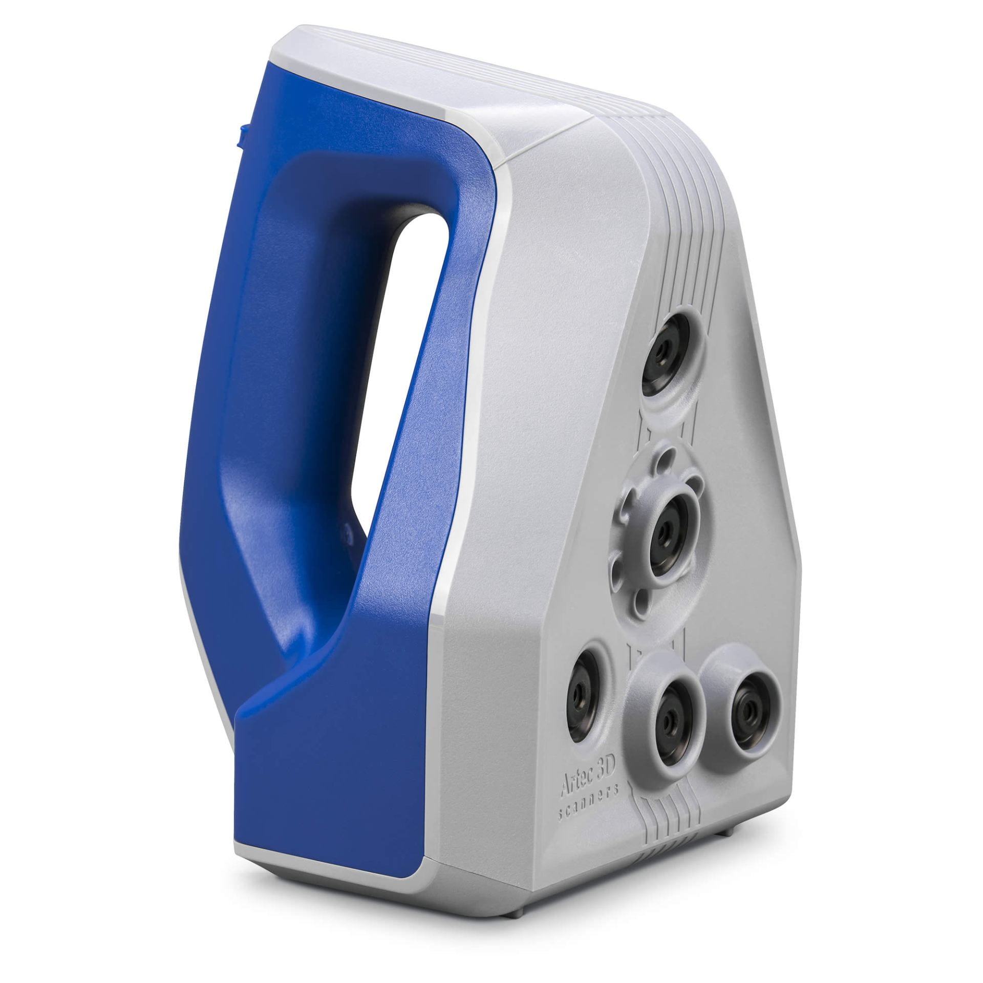
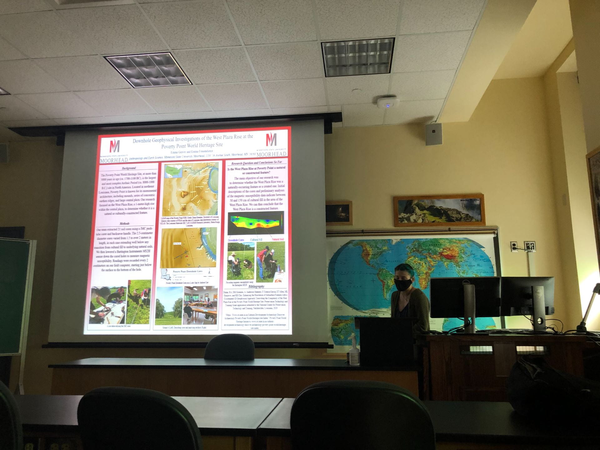
After a great introduction from Dr. Lara Homsey-Messer, Emma Frauendienst started us off with her presentation about her summer fieldwork at the Poverty Point World Heritage Site. Poverty Point, one of the largest Archaic Period sites in North America, is located in Louisiana. Her work, titled Downhole Geophysical Investigations of the West Plaza Rise at the Poverty Point World Heritage Site, began after receiving a grant, and facing both covid and flooding setbacks. Her team extracted 21 new soil cores, focusing on the West Plaza Rise to determine if it was a natural or constructed feature. After analysis of the cores and magnetic susceptibility data showing heavy cultural fill, it was determined that the West Plaza Rise was culturally constructed!

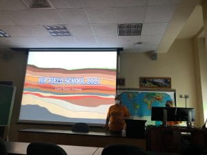
First year graduate students Mikala Hardie and Richard Farley.

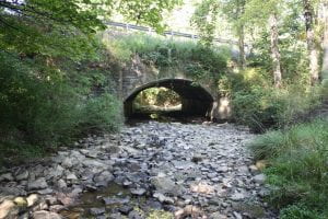
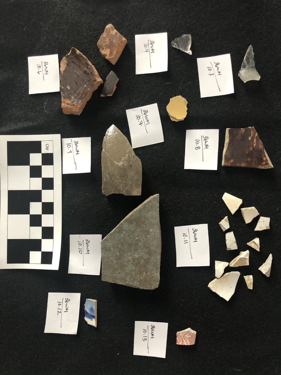
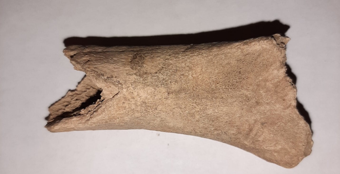
Mikala Hardie and Richard Farley then discussed their experiences as Graduate Assistants during IUP’s Newport Field School. Newport, a small shipping town located along the Conemaugh River, was occupied from around 1790 into the early 19th century. The excavation began with shovel test pits, ground penetrating radar, and several test units, before excavation units were opened. The woods crew, led by Mikala, worked to find the walls of the general store, while also uncovering artifacts such as, porcelain, faunal remains, mochaware, and a builder’s trench, to name a few. The field crew, supervised by Richard, focused on finding the blacksmith shop and hotel, along the way uncovering post holes, slag, redware, pearlware, creamware, and transfer printed earthenware, among other things. The field school utilized photogrammetry, magnetometry, GPS, and a total station to also collect valuable information about the site. If anyone wants to know more about what it’s like as a graduate assistant at a field school, just ask Mikala and Richard, who also filled out forms and logs, took lots of pictures, and organized and supervised those working at the site!

Second year graduate student Ashely Nagle and first year graduate student Sonja Rossi-Williams.

Ashley Nagle and Sonja Rossi-Williams presented next about their time spent as Graduate Assistants in Lower Saxony, Germany at IUP’s Forensic Field School! From July to mid-August, they worked at a World War 2 B-24 aircraft crash site! They used GPR to first define the sides of their 2X2, and then used shovels more than trowels to remove the soil in their units. The team learned about archaeological methods and practices used in Germany and took several excursions across Germany, including to Hannover, Berlin, and Munich, making this an incredible cultural experience as well as archaeological. They did not find what they were looking for, an unaccounted-for soldier, but they did make progress on the site itself. The team were even featured in a German newspaper! In the future, the site will most likely undergo more excavations, hopefully by IUP students!

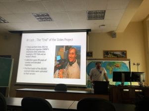
First year graduate student Luke Nicosia.

Luke Nicosia was the final presenter, recounting his internship in July and August this summer with the Landmark Society of Western New York, a historic preservation agency.  Founded in 1937, it is one of the oldest such societies in the US and seeks to advise property and homeowners on historic preservation planning and awareness, raise funding, and protect local historic sites. Luke conducted fee-for-service survey work and worked on their library projects. He edited site narratives and report drafts, finished reconnaissance on a survey on village properties, did covenant review, and worked in the library scanning and inventorying. He finished a massive slides project after scanning and digitizing over 80,000 slides over the course of many years (this is not his first time interning with the Landmark Society)! He also mentioned that there are many ways one can get involved in the field of historical preservation, many that align with the field of archaeology!

Thank you to all the presenters and everyone who attended our first colloquium of What We Did This Summer/Recently!

PHAST Activity: Rugh/Haymaker Mill Site

Written by Gage Huey

Haymaker Run Bridge

The Rugh/Haymaker Mill Site (36WM1204) is a historic-period archaeological site located in Murrysville, Westmoreland County, Pennsylvania. This summer, four IUP Archaeology students in the Pennsylvania Highway Archaeological Survey Team (PHAST) recovered diagnostic artifacts from deposits associated with late 18th and early 19th century grist and sawmills that were constructed along Haymakers Run by two early Euro-American settlers, Michael Rugh and his son-in-law, Jacob Haymaker. These early mills used the water from Haymakers Run as a power source for the lumber saws and grinding stones. These mills are indicative of the kinds of early agricultural and industrial enterprises that settlers in this region developed to facilitate both longer and larger-term settlement of this region. Early maps of the region often focus on the industrial and extractive potentials of resources showing major rivers used for navigation, streams for mill placement, and indicating mineral rich for extraction.

This site was identified through a Phase I archaeological survey conducted by PHAST in order to comply with Section 106 of the National Historic Preservation Act (NHPA) of 1966.  The NHPA requires federal agencies (and the state agencies like PennDOT who use funding from federal agencies) to take into account the ways that their undertakings may affect the archaeological resources both above and below the ground surface. The bridge where State Route 4041 crosses Haymakers Run is in need of replacement and because bridges and other transportation related infrastructure falls under PennDOT control, it also falls under NHPA regulations.  In addition to replacement of the bridge structure itself, attention must be given to the construction activities and temporary access needs during construction (i.e. right of way, easements, drainage and erosion control measures, and/or temporary staging or runaround). The improvements may also affect archaeological resources, so cultural resource professionals (CRPs) must employ strategies to determine what may be affected by this undertaking.

In order to begin the Phase I investigation, background research was conducted using resources such as Pennsylvania’s Cultural Resource Geographic

Shovel Test Pit

Information Systems (CRGIS), soil surveys, topographic maps showing landforms, historical maps, and historic period aerial photographs. These sources help us understand what kinds of activities were or were likely happening in a particular area in the past. Once the likelihood of finding archaeological resources is assessed, CRPs visit the site to conduct a pedestrian survey. This field view helps CRPs identify areas of prior disturbance, which informs the development of a below-ground testing strategy. For this project, the excavation of five shovel test pits (STPs) was planned at a regular 15-meter interval to test the below-ground potential for intact archaeological deposits. This summer, the PHAST crew recovered a variety of historic artifacts through the course of excavation.  The recovery of cultural material in the initial 5 STPs resulted in the need for additional testing to confirm the extent of these deposits. Each STP was dug according to Pennsylvania State Historic Preservation Office (PA SHPO) archaeological guidelines, with a diameter of 57 cm to a depth of 10 cm into sterile subsoil to test for all periods of human occupation on this landform. In total, 11 STPs were excavated, recovering 125 artifacts and contributing to the identification of the Rugh/Haymaker Mills site.

Diagnostic ceramic sherd recovered from STPs

Of the 125 artifacts recovered, 69 could be attributed to a particular time period.  These diagnostic artifacts included ceramic sherds, glass, animal bone, and a cut nail. The ceramics were analyzed by PennDOT Senior Archaeologist Angela Jaillet-Wentling who calculated a mean ceramic date of 1815. This date was re-calculated to 1817 based on the presence of olive-colored glass and a machine-cut nail. Accounting for a time lag between artifact manufacture and deposition, the material culture correlates well with the documentary evidence that the Rugh/Haymaker mills was constructed by 1809 and operated until at least 1875. Although the faunal remains from this site were not relevant to the dating of the deposits, the presence of a humerus from a domestic pig (Sus scrofa) certainly adds a depth of detail to the everyday lives of the settlers at the site. The fragmented humerus showed possible evidence of butchery which, along with other faunal remains found on the site, could provide important data to help improve our understanding of the type of foods early Euro-American settlers were raising and/or eating.


Pig humerus fragment recovered from the site

Overall, the archaeological resources encountered during the Phase I Survey resulted in the formal identification of the Rugh/Haymaker Mills Site. Because this potentially eligible site was located within the proposed project area for the bridge replacement, CRPs were tasked with making a choice for the future of this site: further investigation or avoidance. Thankfully, we were able to avoid additional investigation and impacts thanks to early site identification and flexible design. When the work for the Haymakers Run bridge replacement project begins, temporary construction fencing will be placed to protect the Rugh/Haymaker Mills site from any negative impacts that the bridge replacement may cause. This way, the intact archaeological deposits at the site can stay in situ; in other words, the cultural resources will stay where they are for the foreseeable future. This outcome is a best-case scenario because it allows for cooperation between the goals of archaeology and the Pennsylvania Department of Transportation (PennDOT). The proposed bridge replacement over Haymakers Run is able to go forward without major impediments or changes to the project and the undertaking will not negatively affect the archaeological resources associated with the Rugh/Haymaker Mills Site. At its best, Cultural Resource Management gives archaeologists a seat at the table when federally funded undertakings are planned in locations with potential for archaeological deposits. This is a great example of the things that can be accomplished through compliance with Section 106 of the NHPA.

You can read more about their summer here:(https://iblog.iup.edu/trowelsandtribulations/2020/09/25/phast-2020/)

Follow IUP Anthropology on Facebook, Twitter, and Instagram

PHAST 2020

Written by Miriah Amend

From the backwoods of Meadville, to the capital of Pennsylvania, the Pennsylvania Highway Archaeological Survey Team (PHAST) traveled around the state to conduct Phase I survey for several PennDOT projects this summer. The PHAST program provided archaeological field experience for four students from the IUP Department of Anthropology as well as GIS experience for a student from the Department of Geography and Regional Planning. The 2020 PHAST Crew completed 13 projects this summer, at most projects this consisted of digging shovel test pits, or STP’s, each one ranging from a few centimeters to a meter deep in the ground. We worked in a lot of different environments, forests, open fields, even a steep slope. What all these places had in common was being right next to a road or bridge that is planned to be improved or replaced by PennDOT.


Adapting to changes brought on by the COVID-19 Pandemic, the PHAST team did things a little differently this summer. Masking up and distancing during field work and van rides were new challenges, but this summer had familiar field challenges as well- many projects were surrounded by poison ivy or stinging nettles! With all of our projects being off busy roads, we always had to be careful when working, especially when crossing roads or bridges. Weather-wise, the crew was lucky, we only missed one day of field work due to thunderstorms! We spent this rainy-day cleaning artifacts and working on writing and making figures and maps for our reports. At the end of the day, archaeology could still be done, rain or shine!

Working alongside Dr. William Chadwick, the PHAST crew also assisted in a cemetery relocation project just outside of Indiana this summer. The crew took turns using ground penetrating radar (GPR) technology in order to locate potentially unmarked burials. Getting experience running the GPR was a great way to get our feet wet in the exciting world of geophysics, and the preliminary analysis of the data suggests that there we did in fact pass over a few unmarked graves.

Another project the team tackled was between Titusville and Meadville, up in the northwestern part of the state. There, our crew pulled out a variety of historic artifacts such as early 1900’s bottles, ceramic pieces, and various metal scraps, including an old metal shoehorn. This project area was near the foundation of known historic mill, so we weren’t too surprised to find historic material in this area, although I don’t think any of us expected it in this quantity!


Wrapping up the summer, the PHAST crew found even more artifacts- early historic pottery, glass, and even faunal remains! These were recovered during our last project, a bridge replacement near Murraysville. With these findings, additional STPs were required and this project turned from taking one day, to several. Who would have expected historic artifacts to be underneath a dense layer of rock just under the surface? It just goes to show the importance of Phase I survey, you never know what may be just below ground until you look!

Follow IUP Anthropology on Facebook, Twitter, and Instagram

Musings of a Recent IUP Graduate

By Samantha Taylor

Let’s face it…grad school feels like an eternity. My two years at IUP felt almost as long if not longer than my four years in undergrad. It’s only been six months since I received my M.A. from IUP and time is flying by. So much has happened and I’m proud to say that IUP has adequately prepared me for life as a professional archaeologist.

A brick pathway found beneath a potential robber’s trench in front of Spotswood’s Enchanted Castle.

This past summer I accepted a job as the assistant site director for Virginia Commonwealth University’s field school at the Fort Germanna/Enchanted Castle Site in Orange County, Virginia. The position was 15 weeks long and my first foray into supervising. I was nervous to teach students how to dig and to serve as a role model for future archaeologists. My job description included assisting the site director (the amazing Dr. Eric Larsen), supervising our four interns, and teaching field school students. Our goal was to locate the Fort Germanna, an early 18th century fort built by Lt. Governor Alexander Spotswood for German colonists. The fort supposedly intersected the west hyphen of the Enchanted Castle, Spotswood’s house which postdated the abandonment of the fort. This summer we excavated the area to the north of the structure which hugged the façade of the house. While we did not find the fort, we were able to better understand the function of the front lawn of the Enchanted Castle. Meanwhile, students and interns were able to gain valuable experience. I was incredibly fortunate that my boss, interns, and students were all wonderful and talented. During my time at Germanna, I took a particular interest in helping design the four public access days that Germanna hosted this past summer. In fact, I will be chairing a session the first ever paper session on Germanna Archaeology and presenting on Germanna public archaeology at MAAC next spring (be there or be square). I doubt I’ve enjoyed a job as much as I’ve enjoyed my time at Germanna. Not only was my position fulfilling, but I made lifelong friends with my crew and was able to inspire some of them to continue pursuing archaeology as a career.

An overview of all of the Test Units opened at Germanna during the 2018 season.

My job at Germanna came to an end on August 30th, but fortunately my next job was already lined up. I started my current position at New South Associates, Inc. on September 4th. I am an archaeologist/field director at the Greensboro office in North Carolina. My job description includes directing field work and writing reports for various projects across the southeast. I spend about 50% of my job working in the field with a variety of archaeologists who come from all over. The other 50% of my time is spent synthesizing data and writing reports.

The Field School on our last day! We were small but mighty!

While it’s only been six months since I graduated from IUP, I feel as though my post-grad school career has been successful and fulfilling thus far. It’s definitely not always easy, and takes just as much dedication and time-management as school did. I know I have a long road ahead of me still, but wherever archaeology takes me I’ll be happy to go. So, to all the current graduate students and prospective graduate students here’s my advice: grad school is an emotional and physical commitment. It isn’t easy but it is worth it. Your two years in classes will feel like an eternity. Your time spent working on your thesis will feel never-ending. But the good news is that the grass is greener on the other side, and that these challenges will ultimately prepare you for what is ahead. Don’t give up, keep going! Your M.A. is on the horizon!

Learning how to 3D Scan artifacts, courtesy of Dr. Bernard Means from VCU’s Virtual Curation Lab (VCL)

IUP Anthropology Department