Pennsylvania Highway Archaeological Survey Team – MidSeason Update

By Kate Peresolak

IMG_4367

The 2016 PHAST Interns: (l to r) Brendan Cole, Kelsey Schneehagen, and Sarah Henley.

At this point in the summer, time is flying PHAST, at least for the members of PennDOT’s Highway Archaeological Survey Team. As the field director, I supervise three graduate and/or undergraduate students hired as PennDOT interns and, together, we complete small archaeological investigations ahead of PennDOT transportation projects. This year’s crew includes Sarah Henley, an IUP Graduate student, and two IUP archaeology undergraduates: Brendan Cole and Kelsey Schneehagen.

DSCN1033

Brickworks foundation, Westmoreland County.

This PHAST season began in May, and fieldwork for seven of our current 11 projects for the 2016 season is complete. We worked near a Berks County covered bridge dating to 1869 and a culvert replacement area in Juniata County. We also utilized Ground Penetrating Radar (GPR) to survey the remnant concrete foundation of a large historic brickworks in Westmoreland County. Additional GPR survey, archaeological testing, and two days at an urban site in Pittsburgh are only some of the projects that await us.

IMG_4542

Just some of the artifacts recovered from a recent PHAST project.

Cultural resource interns from Harrisburg and other state locations spend one to two days working with PHAST to experience archaeological fieldwork in Pennsylvania. In addition to working with other interns, the crew networks with established field archaeologists and other professionals working in cultural resource management (CRM). They are exposed to varying field conditions, projects, and also laboratory tasks including report graphics production, ArcMap figure creation, curation documentation, and artifact analysis.

IMG_4591

Kelsey slingin’ soil.

The crew’s employment will continue through October, which is enough time to also learn how artifact and documentary collections are prepared for submission to the State Museum of Pennsylvania.

Check back in September for a final update on our summer activities!

IMGP1508

Kate checking the soil profile at the bottom of an excavation unit.

Voices from the Field – Hanna’s Town Sixteen Years Later: My Career has come full circle.

By David Breitkreutz

This summer I’ve been mostly keeping up with my thesis research – a spatial analysis of Hanna’s Town using geophysics. The IDS Multi-Array Stream X ground penetrating radar, the FM 256 Fluxgate Gradiometer, and the Syscal Kid electrical resistivity meter were employed to help determine the layout of the settlement, potentially locate evidence of the 1782 raid, and to determine the extent to which geophysical applications are useful in surveying large archaeological sites. The past few weeks I’ve been employed, with TRC, on a historic Phase II near Cumberland, Maryland. After work I’ve been analyzing the results of my geophysical investigations and actually writing the thesis.

Van

IDS Multi-Array Stream X GPR at Hanna’s Town.

While conducting background research, on previous archaeological and geophysical investigations at Hanna’s Town, I reminded myself that I worked at Hanna’s Town in the summer of 2000, while employed with Christine Davis Consultants, Inc. out of Verona, Pennsylvania. Enviroscan Inc. was sub-contracted to conduct geophysical investigations using magnetometers and ground-penetrating radar. This was the first geophysical investigation conducted at Hanna’s Town. Also, the project was my introduction to geophysical techniques and public archaeology.

That summer the Westmoreland County Historical Society sponsored their first archaeology day camp for children and teenagers, between the ages of 11-15. The students were treated to demonstrations by re-enactors, they screened dirt from our excavations, a few were allowed to “play” with the GPR, and the students were given field trips to Bushy Run. The most rewarding aspect of the project was teaching the students that had a genuine interest in archaeology. The most frustrating thing for me was debating, with the chaperons, why it’s unproductive to have the students collect cigarette butts at a Colonial site.

Over the course of the next sixteen years I became less condescending towards volunteers, avocationalists, students, and supervisors. I had learned that interest in archaeology can greatly aid in site preservation. Public archaeology/history can also generate a pride in local history. During my resistivity survey, earlier this summer, a WCHS volunteer re-enactor approached me asking me “can I help you.” I jokingly informed him that his help will be “greatly appreciated” and that I needed the “electrodes placed in 50cm intervals.” In the end he really didn’t want to help and only wanted to know if I had permission to be on the property. The re-enactor was there to guide students, from local elementary schools, around the site. There was at least six bus-loads of children per day at the site during the early summer days. It was great to see these field trips.

syscal

Syscal Kid Electrical Resistivity Survey at Hanna’s Town

Newspaper

Pittsburgh Post-Gazette Article dated July 5, 2000.

While researching the Davis project I found an article from the Pittsburgh Post-Gazette, dated July 5 2000, titled High-tech ‘dig’ aims to find Hanna’s Town buildings . Unfortunately, the pictures from the newspaper article were too black to distinguish a younger and thinner Dave. Nonetheless I was seized with a sense of nostalgia. The “trip down memory lane” made me realize (or fear) that my entire career in archaeology has come full circle. Sixteen years later I am working on the same site, arguing with the same volunteers, while asking the same research questions using geophysical techniques. Within the article former WCHS Director James Steeley stated that the goal of the project was to locate where the houses and buildings “really were.” This is exactly the same research objectives as my thesis. In fact this dilemma has stifled all archaeologists that have conducted research at Hanna’s Town. The biggest lesson I learned here is that the results, and methods used, from an archaeological or geophysical investigation may not answer the research objectives set forth. Even if the research objectives weren’t accomplished it is still important to interpret the results from the data collected. I won’t divulge my preliminary results from my thesis research. But I will say that I keep on telling myself “a good thesis is a completed thesis”.

Another Kind of Summer Project

By Sarah Neusius

Summer is often the time for academic archaeologists to do fieldwork, but this summer my energies are focused on something different, and certainly not less important: the preservation and use of archaeological datasets. Most archaeologists know that there’s a lot more to archaeology than fieldwork, but even after the cleaning, cataloging, and analysis of materials, archaeologists still have a responsibility to the data they have generated. Articles and reports allow us to present our interpretations of what we have found, and curation facilities care for and make accessible the actual artifacts we recover. However, the observations we make about artifacts, in other words, the data we generate, also are important to curate. Keeping our data accessible to future archaeologists so they can reevaluate our conclusions in the light of new information and new theoretical perspectives is an archeological obligation, but one on which our discipline is just beginning to focus. The digital age provides both greater possibilities and greater challenges for us in this respect.

Of course it is now standard to record archaeological data in digital format. Everything from artefactual datasets and images to field notes and geophysical data can be stored digitally reducing concerns about  storing paper records and images so that they will remain stable. On the other hand we all know that both software and hardware evolve at a lightening speed, rapidly making the formats we use obsolete and our data inaccessible. Nowadays archaeologists also are increasingly interested in the new ways to share their data that the internet provides. Along with web publishing there are many efforts to provide open access to archaeological data.

tdarmap7616

The Worldwide Distribution of Resources stored in tDAR (from www.tdar.org, accessed 7/6/16 )

tdarbreakdown7616

Types of Data Stored in tDAR (from www.tdar.org, accessed 7/6/16 )

Among these the Digital Archaeological Record or tDAR, which has been developed by archaeologists and computer scientists under the auspices of Digital Antiquity now affiliated with Arizona State University. tDAR is an international repository for digital archaeological data, images, and documents that provides open access and includes integrative tools for analysis and has a core mission of helping archaeologists be better stewards of the data they generate. tDAR promises to keep these resources accessible in perpetuity by migrating to new digital formats as they become standard, and it also provides some powerful tools for integrating datasets created in different formats by different archaeologists so that comparison among site assemblages, settings, regions, and time periods is possible. These integrative aspects of tDAR allow archaeologists to address macro level questions in ways the published record does not because we can use and combine the original datasets rather than just the published summary data.

All of this is why my main project this summer is working with other zooarchaeologists who are part of the Eastern Archaic Faunal Working Group (EAFWG). Together and with funding from the National Science Foundation (BCS-1430754)   we are preserving and integrating more than 50 Archaic Period (ca. 10,000-3,000 BP) faunal datasets and associated documents in tDAR. Eventually these datasets will be publicly accessible for students and other researchers in the EAFWG collection within tDAR.

EAFWGJan2015B (2)

The Eastern Archaic Faunal Working Group

These datasets were generated over the last sixty or more years by Kosterphotosarchaeologists working on sites located in the interior parts of the Eastern North America. Because of a strong interest in human-environment interactions among American archaeologists during this period, recovery and analysis of animal remains as well as of bone and other artifacts was standard in these excavations. This tradition of emphasizing zooarchaeological analysis continues today among Midwestern and Southeastern Modocimages.archaeologists interested in all of the Pre-Columbian periods. Good preservation has meant that large amounts of animal bone as well as mussel and snail shell often are recovered and significant faunal datasets have been generated for this region. Some of the better known of these sites are emblematic of the Eastern Archaic including Modoc Rock Shelter and the Koster site in Illinois, the Green River shell middens such as Carlston Annis in Kentucky, and Dust Cave in Northern Alabama, but there are many other Archaic sites as well. Some of these Dust Cavedatasets were recorded on paper only, and some of the earliest digital faunal datasets were also created as a result of these excavations. Moreover archaeologists in this region continue to generate significant faunal data today. Unfortunately, these data have remained dispersed across a wide variety of institutions and inaccessible to the larger archaeological community because they are recorded in a variety of formats and curated by individual researchers, some of whom are now deceased or no longer actively involved in Archaic period scholarship.

The EAFWG includes zooarchaeologists from IUP, the Illinois State Museum, the University of Kentucky, Florida State University, the Illinois Archaeological Survey, State University of New York at Oneonta and the University of Michigan at Flint. Besides meeting at professional conferences and staying in touch through email and conference calls, we have held formal workshops. In fact, our most recent workshop was hosted here at IUP in mid-May and included my GA, Scott Rivas as well as myself.

EAFWG@SAA 2016

EAFWG at SAA 2016. Scott Rivas is at right and Sarah Neusius is second to right.

Our goal is to use tDAR to preserve significant Archaic period faunal datasets and to bring them collectively to bear on research into the Archaic Period in Eastern North America. Not surprising traditional explanations for Archaic period variability and change, which have seen environment and demography as causal, have been questioned by contemporary researchers arguing that cultural identities, sociopolitical interactions, and ritual practices also explain some Archaic phenomena. In essence today’s archaeologists seek to understand Archaic period hunter-gatherers as more than participants in the ecosystem, and this raises new questions about the way Archaic data has been interpreted over the last half century or more. We think zooarchaeological data has much to contribute to these debates. Ultimately we have some macro-level questions about the variable use of aquatic resources by people who lived in this area during the Archaic period, which we believe will contribute meaningfully to better understanding of the Archaic period. However, we aren’t there yet, and instead are immersed in a long process.

Over the past year and through this summer I have been involved with myriad details, most of which would be far too boring for a blog such as this. However, I hope you can see why there are many steps in the EAFWG project. These have been accomplished with the help of several IUP undergraduate students and graduate students, and have included 1) creating digital databases from paper records in the first place, 2) finding and removing errors from digital datasets, 3) uploading digital datasets to tDAR, 4) providing metadata about what is in each dataset and what variables it contains, and 5) relating datasets created through the use of tDAR ontologies. We also have been exploring how comparable our Archaic datasets are in terms of taphonomy and contexts sampled, and working on measuring environmental and demographic variation during the Archaic period. By the end of the summer, we hope to begin to consider our research questions concerning the use of aquatic animals more directly.

For me personally, this summer project has meant little chance to be outside as much as I would prefer or to develop the muscles and fieldwork tan that I often do. Regardless, because the Archaic period was my first love in North American archaeology and this project is giving me an opportunity to revisit my dissertation research on the Koster site, it also is pretty exciting for me. Both collaboration with other zooarchaeologists, and looking at data I know well with new perspectives is a lot of fun. So if you encounter me this summer and find me slightly glassy eyed from staring at the computer screen, rest assured that I’m still absorbed in archaeology!


Fort Necessity 2016

0630161244

Fort Necessity 2016 field crew. L to R: Mike White head (supervisor), Eden VanTries, James Miller, Hannah Harvey, Samantha Jacobs, Dwayne Santella (Cal U), and Cheryl Frankum.

This week we will finish excavations at Fort Necessity National Battlefield. It’s been a good seven weeks, but all good things must come to an end. This is actually our second season at Fort Necessity. Last summer we conducted a large-scale geophysical survey using ground-penetrating radar, gradiometry, and resistivity. This summer we tested more than thirty geophysical anomalies, as well as completed a shovel test pit and metal detecting survey. We’ll be back out at the site in August to do another metal detecting survey as part of a class taught by Advanced Metal Detecting for the Archaeologist (check back later in the summer for more on that). All of this work is funded by a grant from the National Park Service (NPS) through the Cooperative Ecosystem Study Units Network.

Untitled

Gradiometer results from the 2015 geophysical survey at Fort Necessity National Battlefield. The the fort itself, with its earthworks, palisade, and storehouse, is situated near the center of the image.

The Fort Necessity partnership between IUP and NPS has the dual goals of providing good real-world experience for archaeology students while providing the park with high quality research that will help them interpret and manage this nationally significant cultural resource. For those of you not familiar with Fort Necessity, it is the most recognizable landmark from a young George Washington’s foray into western Pennsylvania, during which he helped touch off the French and Indian War, and by extension the Seven Years War, which is arguably the first world war…kind of a big deal. But back to the project goals – this has certainly been a great opportunity for students. A total of 11 graduate and undergraduate students have honed their archaeological skills over the past two years, while making some money, and living in exotic Uniontown. For some of these students this is their first taste of CRM life and nearly all of them have loved it.

0622161052a

Buried 18th century A Horizon.

IMG950850

Clay pipestem (photo by Cheryl Farnkum).

IMG_0706

Hannah and James hard at work.

We’ve also fulfilled our objective of providing the park with updated archaeological data. We’ve been able to identify nearly all of the geophysical anomalies. Most of the features date to after the George Washington period, however. Much of what we’ve found relates to the roughly two centuries between the battle and the establishment of the park. We’ve uncovered field drains, old roads, reenactor campfires, and fill episodes. But there have been highlights as well. Near the fort we uncovered a buried A horizon containing 18th century artifacts. We’ve also uncovered pieces of shot that may help us reconstruct the battle and several artifacts that date to the time of the fort. And we’ve still got a week to go.

If you are in Fayette County next week, stop by and see us.

Voices from the Field: Interning at Grand Portage National Monument

By Danielle Kiesow

This summer I’m the archaeology intern at the Grand Portage National Monument in the most northern tip of Minnesota along the shores of Lake Superior and it’s been a great experience! Grand Portage National Monument is unique in that it’s located within the Grand Portage Reservation (home of the Grand Portage Band of the Lake Superior Chippewa, Minnesota Chippewa Tribe, also known as the Ojibwe or Anishinaabe) so I have the chance to work alongside the locals and together we can learn more about their past.

I’m accompanied by the Chief of Resources at the Park, Bill Clayton, and Jammi Ladwig, a PhD candidate at the University of Minnesota. We’re doing a lot of different things during my summer here including monitoring sites for any looting, helping out with some excavations at Isle Royale National Park just a few miles away in Lake Superior, participating in cultural resource management (CRM) work, archival research, working on my thesis, and even chainsaw training. Definitely the most challenging part of my internship is finding time to do everything!

NWC Depot

The reconstructed Great Hall in the North West Company Depot overlooking Lake Superior.

Grand Portage is known for its importance in the fur trade, and in fact it’s named after the 8.3-mile portage from Lake Superior to the Pigeon River that divides Minnesota from Ontario. Through previous archaeology from the 1930s and into the 1970s, Grand Portage National Monument has been able to reconstruct the stockade and some of the buildings of the North West Company’s depot that existed from 1731-1803.

Montreal Canoe

What better way to learn a little bit about the lives of the voyageurs than paddling in a replica Montreal canoe?

Even though the fur trade is the focus of the park here, my thesis work is all about what happened after the fur trade: when the English packed up their things (including a few of the buildings) and moved across the newly designated border to establish Fort William (today Thunder Bay, Ontario). The Hungry Years, as they’re still called by the descendants on the reservation, followed the end of the fur trade and lasted into the beginning of the reservation era, when the U.S. government wrote the Treaty of 1854 that established the Grand Portage Reservation. My thesis is looking at the land use and gardening or farming practices on the reservation from 1854 until 1930 to analyze the relationship between the Ojibwe at Grand Portage and the Indian Agents from the Bureau of Indian Affairs (BIA). This time period has, until recently, been largely ignored by the National Monument and much of the descendent community that can remember what life was like during this period have passed. It’s important for all of us – the National Park Service, the descendent community, and everyone else – to understand the suffering that resulted out of racism and to celebrate the strength and perseverance of the Grand Portage Ojibwe. Knowing that my thesis is one of the first research projects about the Ojibwe perspective during the transition into living on the reservation is definitely the best part of my internship.

I have been conducting research at the Minnesota History Center in St. Paul and the National Archives in Chicago for more background into the BIA-Grand Portage relations before I excavate the yard of a former BIA building in August. The most important thing I’ve learned during my research is the resiliency and resourcefulness of the Grand Portage Ojibwe throughout the years. Instances like creating tolls and selling items along the Grand Portage to earn money from the voyageurs, petitioning the Indian Agency and making their voices heard during a time where Indian Agents called them the sons and daughters of the Commissioner of Indian Affairs (and treated them as such), and never leaving their land or their fishing economy even though they were without electricity until the 1950s and without plumbing until 1976.

BIA Combined

Before and after: a ca. 1920 photograph of the BIA building (top of the photo) with surrounding yard and outbuildings, looking northeast. The foundations of the building are seen in the next photo taken this summer, looking southwest.

PRELIMINARY RESULTS OF THE 2016 IUP ARCHAEOLOGICAL FIELD SCHOOL AT THE SQUIRREL HILL SITE

By Lara Homsey-Messer

From May 16 to June 17th, 10 students from IUP and 2 students from Clarion University ventured to the Squirrel Hill site in New Florence, PA, to learn archaeological field techniques, including excavation methods, shovel testing, and using high-tech equipment such as a total station and ground penetrating radar.

SquirrelHill1bClockwise from upper left, students practicing test unit excavation,
ground penetrating radar survey, using a compass, and using a total station.

Perhaps the most humorous aspect of this site is the feeling that you are on the set of LOST and that something might come crashing out of the bamboo jungle at any minute…well, technically it is Japanese Knotwood, but it sure looks like bamboo and is clearly where the phrase “grows like weeds” comes from. These hardy students braved not only the bamboo (as we lovingly called it), but also a six-day work week (yep, Monday through Saturday folks), a gypsy moth caterpillar infestation (it’s hard to keep a unit floor clean with these buggers falling in every other second), more than one drenching storm (being dry and clean is totally overrated…), and all sorts of critters running amuck in our test units (we miss our resident mouse in Test Unit 2).

SquirrelHill2Representative pics of the “bamboo” (top), an impending mid-afternoon storm,
and our cute resident mouse.

Seriously, though, these students learned a lot about not just archaeology over these five weeks, but also the Monongahela folks who lived in this village over five centuries ago. Squirrel Hill has been known to archaeologists since the 1950s, and has been heavily collected by local residents for decades. The site is currently listed on the National Register of Historic Places and the land it sits on is now owned by the Archaeological Conservancy. The site is believed to be a Johnston-phase Monongahela village (ca. 1450-1590). Very little systematic study has been conducted at the site, so many questions remain to be answered, including its occupation and cultural affiliations; location & extent of site boundaries; the internal arrangement of houses, plaza, and stockades; and its relationship with neighboring communities such as the Johnston Site, the location of previous IUP field schools.

This summer we opened 10, 1 x1 meter, test units in areas that previous geophysical survey identified as “hotspots.” We also conducted additional ground penetrating radar survey and shovel-tested around the Conservancy’s property line. We found pottery, lithic flakes, a LOT of fire-cracked rock, and over 80 features (such as post molds and storage pits). Perhaps most intriguing, we now suspect that there may be more than the one, Johnston-phase, occupation at the site. Many of the post molds intersect and intrude other features, minimally suggesting some rebuilding. Interestingly, we discovered several features (including a large rock cluster), nearly a meter below the surface. Fortunately, we were able to collect charcoal from them for radiocarbon dating; it will be very interesting to see if these enigmatic features are contemporaneous with, or pre-date, the Mon occupation. We hope to have these dates before the end of the calendar year, so check back if you want to find out the results…

SquirrelHill3Rock cluster feature nearly a meter below surface (left)
and two possible egg-shaped, post-enclosed storage pits (right).

Many thanks to the folks who visited us this summer and offered their expertise, volunteer labor, support, and enthusiasm. Special thanks to Bill Johnson for sharing his knowledge of Mon ceramics, Sarah Neusius and Bev Chiarulli for expertise on Mon culture, and Dr. and Mrs. Driscoll for their support of IUP Archaeology. Your visits made our day!

SquirrelHill4From left to right: Dr. Bill Johnson giving an impromptu lesson on Mon ceramics, Dr. Sarah Neusius giving students excavation tips, and Dr. and Mrs. Driscoll chatting with students.

Underwater Archaeology and the Pennsylvania Archaeology Shipwreck Survey Team

IUP is pretty well landlocked, but that doesn’t mean that we can’t take our archaeology underwater. Last weekend I taught an underwater archaeological wreck survey course at Erie, PA. The course was organized through the Pennsylvania Archaeology Shipwreck Survey Team (PASST) and sponsored by the Regional Science Consortium, Pennsylvania Sea Grant, Divers World dive shop, and Erie Maritime Museum.

wreck-erie-1Shipwreck off of Presque Isle, Erie, PA (Courtesy of PASST)


From Friday night through Sunday afternoon, 15 students learned the basics of underwater archaeological recording. We started Friday evening with a lecture on maritime archaeology, archaeological ethics, and how to accurately record an archaeological site underwater (lots of trilateration!). Saturday morning we met at the Erie Maritime Museum to practice these skills using items from their collections. Teams of four recorded a lifeboat, the deadwood of a large vessel, and two mock debris fields. In the afternoon we took these skills to the pool. Working with the same teams, the class recorded PVC structures, ladders, and other items on the pool bottom. The materials were not archaeological but the skills were. Everyone learned that pulling a tape and communicating locations and measurements got a lot harder without gravity and the ability to speak. On Sunday morning we travelled to Dinardo’s in Grove City to take the training to the real world. This time the teams did two dives to record two intentionally sunk vessels and a motorcycle while dealing with limited visibility, a silty bottom, and the bulky suits and gloves that come with diving in chilly water. Everyone did an excellent job throughout the weekend! The importance of preplanning and communication became increasingly apparent as did the slow and meticulous nature of archaeology – dreams of recording a shipwreck in one dive disappeared like bubbles from a regulator. Everyone also gained an appreciation for what can be learned by studying a shipwreck and it caused them to think more carefully about sites that they have dived dozens of times.

0611160955a 0611161014b 0611161025b0611161313

Practicing at the Erie Maritime Museum and in the pool. Nice plumb bob work in the bottom left image.

Having completed the course all of the participants now have the privilege of diving on PASST projects. PASST was founded in 2013 by representatives of the Regional Science Consortium, Flagship Niagara League, Indiana University of PA, PA DCNR, PA DEP, PA Historical Museum Commission, PA Sea Grant, S.O.N.S. of Lake Erie, and the local diving community with the goal of preserving and promoting the maritime heritage of Pennsylvania’s portion of Lake Erie. Drawing on educators, historians, divers, and archaeologists PASST is dedicated to the documentation, scientific study, and educational promotion of Pennsylvania’s underwater archeological resources. As part of this mission, PASST organizes divers to document shipwrecks in Lake Erie. PASST-trained divers have the skills ethical orientation to participate in those efforts.

0612160843 0612160842

Divers entering Dinardo’s Quarry for the open water portion of the course. The water was a balmy 65 degrees above the thermocline.

These dives will be happening throughout the summer, and next, and the one after that… there are a lot of shipwrecks to record. Another underwater archaeological wreck survey course is planned for next summer. This is not strictly an IUP course, but it is open to IUP students who have an Advanced diving certification and an interest in archaeology. The class is also a way foPASST-final-logor us to engage the general public in recording and preserving the history of the Commonwealth.

Thanks to Matt Dickey, Jeanette Schnars, David Boughton, and Joe Lengieza for making the class a success.

On Tour with the Society for Pennsylvania Archaeology

by Dr. Sarah Neusius

Next to excavation one of the most fun things for an archaeologist to do is go visit someone else’ site and look at their artifacts. Between June 2 and 5, Dr. Phil and I got to do just that when I co-led the 2016 Society for Pennsylvania Archaeology (SPA) field trip with Dr. John Nass of California University of Pennsylvania. This year we went to see the archaeology going on in Virginia at places like Mt Vernon, Montpelier, and Monticello with a group of 20 professional and avocational archaeologists.

We started in Bedford, PA where we had evening orientation which covered the estates we would be visiting and cool facts about the four early US Presidents’ who had homes in Virginia: Washington, Jefferson, Madison and Monroe. Then we loaded into vans and headed south to Virginia early Friday morning.

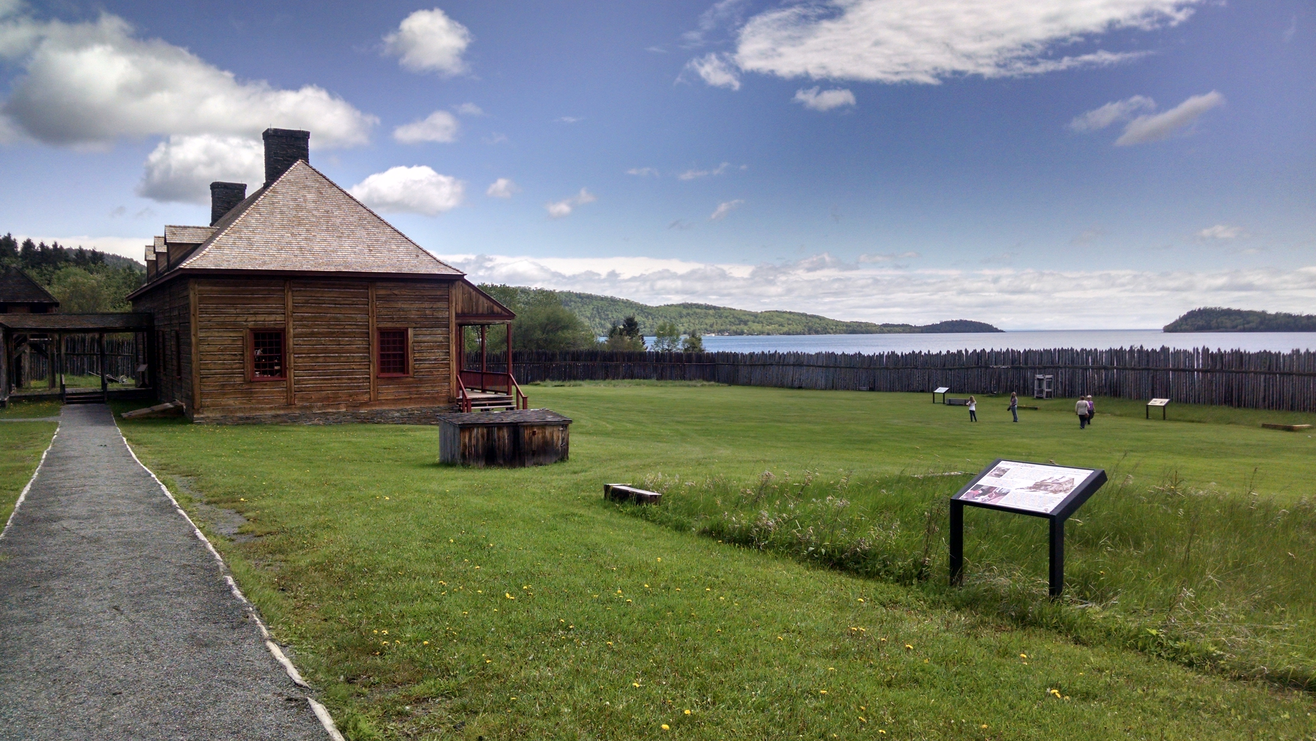
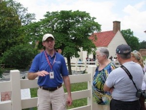
On Friday we battled DC traffic to get to Mount Vernon where we had a tour of the house and then a tour by Dr. Luke Pecoraro, Director of Archaeology. He took us around the grounds and included visits to the locations of several excavations as well as to the archaeology laboratory. One interesting thing is that grave locations at the current excavation of the slave cemetery are being exposed but not excavated, and regardless, the prehistoric artifacts that have been recovered indicate that there is a Late Archaic site at this same spot. We also learned that there are lots of student and volunteer opportunities to get involved with Mt. Vernon archaeology that we can share with IUP students.

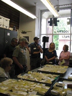
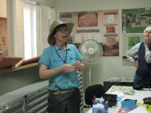
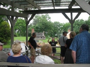
Later Friday afternoon we visited Washington’s boyhood home where archaeologists with the George Washington Foundation including Dr. Dave Muraca and Laura Galke gave us tours of the site and the lab. Unfortunately we got caught in a downpour while viewing the excavations and the foundations for the house now being reconstructed. However, the staff was very nice to let us drip into the lab anyway and look at some of the many artifacts (men’s wig curlers, a masonic pipe and much more!), which they have recovered because of their thorough excavations.

In the evening we had a lecture by Dr. Doug Owsley from the Smithsonian Institution who talked about his forensic studies of early burials found at St. Mary’s City and Jamestown. Though a century earlier than the rest of this field trip’s explorations, Dr. Owsley’s recent work on these burials is fascinating and cutting edge!

Sarah middenGaulke

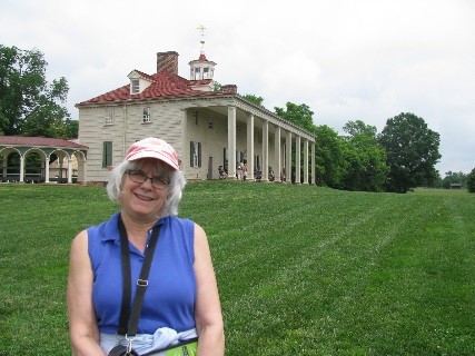
Friday pictures: Here I am on tour at Mt Vernon; Dr. Pecararo explaining findings at Mount Vernon’s South midden; Laura Galke discussing the many men’s wig curlers found at Ferry Farm.

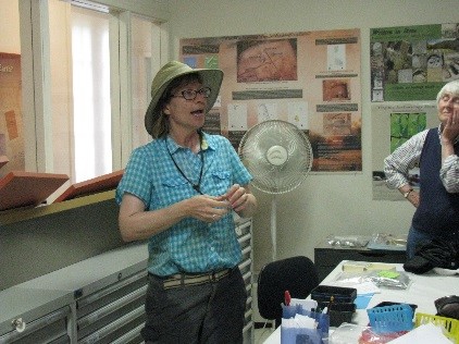
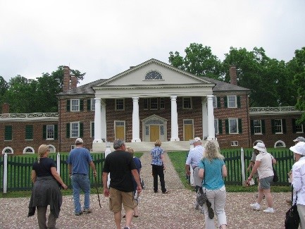
On Saturday we had another packed day visiting Madison’s Montpelier before going to Jefferson’s home at Monticello, both of which are historic sites near Charlottesville. Madison may be less well known than other presidents, but our fourth President was a complicated man responsible for the division of our government into three branches, our leader in the War of 1812, and of course, husband to Dolley Madison. Together they may have been our nation’s first “power couple”! The archaeology at Montpelier, which we learned about from Stephanie Hallinan, Director of Public Archaeology, is also interesting. At the moment, Montpelier archaeologists are focusing on homes of the enslaved population, especially the domestic slaves and skilled craftsmen who were housed close to the Montpelier mansion.

We had so much fun at Montpelier that we were late getting to Monticello and had to switch our house tour to the end of the afternoon. This meant that Dr. Fraser Neiman, Director of Archaeology, took us on our landscape archaeology tour first. During this tour we hiked the hill at Monticello learning how the use of the land changed when the plantation switched from tobacco production to wheat farming and how this apparently affected the social relationships of everyone living there from owners to overseers to slaves. When it came time to tour the house, the guides actually made us take off our shoes, which were encrusted with Monticello’s red clay from our hike through the woods! So I can say I have been in Thomas Jefferson’s home barefoot!

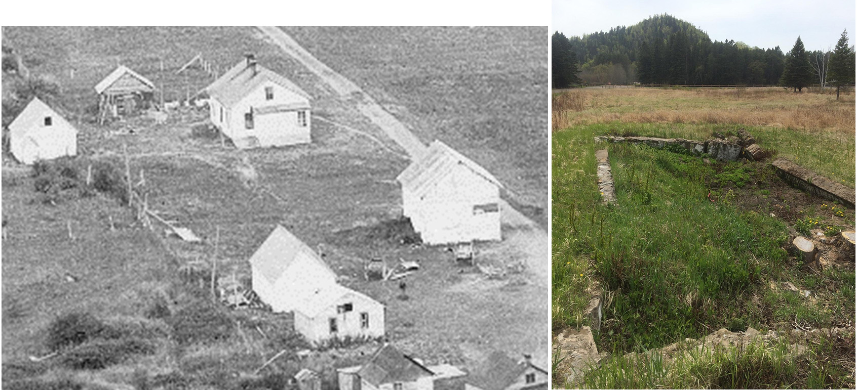
Saturday evening we heard a lecture by Kyle Edwards, UVA Ph.D. student who is doing his dissertation on Monroe’s home at Highland, which is also near Charlotte. The most recent development is that new archaeological work there shows Monroe did have a substantial house at Highland. Even though the interpretation for many years has been that he only had a small, cabin-sized house, that structure is now believed to have been a guest house. Archaeology has debunked another historical myth!

Hallinan Montpellier Neiman

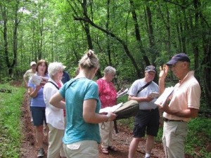
Saturday pictures: Stephanie Hallinan explaining the excavations and slave cabin reconstructions underway at Montpelier; Our group approaching the house at Montpelier; Dr. Neiman (far right) explaining the excavations Monticello Archaeology has been doing in the woods downslope from the house at Monticello.

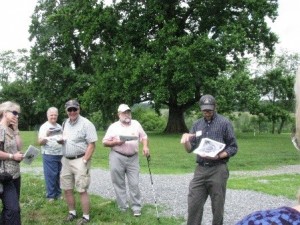
Sunday was our last day, but we drove south again so as not to miss Jefferson’s retreat at Poplar Forest. One of the interesting things about Poplar Forest is that the reconstruction, which has been heavily driven by archaeology, is still underway so one can really see how the staff is working to reconstruct this place accurately. The house tour was full of stories about people like the master craftsman, a slave, who made the friezes and other trim to Jefferson’s specifications. Then, Dr. Jack Gary, Director of Archaeology led us on a tour explaining how they are reconstructing the landscape using archaeology to find details like the spacing of ornamental trees. I hadn’t thought the reconstructing a landscape could be so fascinating, but it was another testament to what we can learn from modern archaeology. Beside that Poplar Forest is a special place, still remote and relatively unknown, which everyone interested in archaeology, historic preservation, and/or Jefferson should visit.

After Poplar Forest we had a long ride back to Bedford before dispersing in the evening for our various homes, but this gave us lots of time to debrief and talk about our experiences. It was another great SPA field trip! Keep in mind that the SPA will be doing similar trips early each June and you might like to join us on one. You might even consider joining the SPA in order to take advantage of this and other member benefits which include the Pennsylvania Archaeologist, one of the longest running state archaeology journals in the country. At just $18 for students and $25 for non-students or $30 for families, membership is a great bargain. For details on joining see www.pennsylvaniaarchaeology.com). Then stay tuned for word on plans for another memorable trip next June!

Gary Lab Poplar Forrest

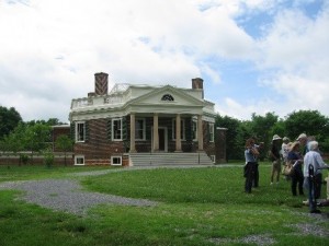
Sunday pictures: Dr. Gary giving the archaeology tour to our group including Dr. Phil with original Jefferson era trees in the background; Our group in the lab at Poplar Forest; View of the octagonal house, sometimes considered Jefferson’s masterpiece, during the SPA tour.

Whole Lotta Archaeology Goin’ On

Summer 2016 is a busy time for IUP Archaeology! We have at least 10 active field projects involving more than 25 students, as well as several laboratory projects running throughout the summer. These projects offer students unparalleled opportunities to learn archaeological skills in a wide variety of contexts, and in some cases to make a little money. These are also ‘real’ projects in that they are designed to contribute to our understanding of past humans’ lives and are part of faculty and graduate student research programs.

IMG_7093Throughout the summer we will highlight some of the projects taking place at IUP. We’ll try to have a new blog post once a week all summer so check back regularly.


IMG_4565A taste of what’s to come:

Initial results from the IUP Archaeology Field School at the Late Prehistoric Squirrel Hill site

Reports from National Park Service funded work at Fort Necessity National Battlefield

Underwater archaeology training in Lake Erie

Updates from the Pennsylvania Highway Archaeology Survey Team (PHAST)

Stories from the Johnston Site, Historic Hanna’s Town, and the NSF Faunal Analysis Working Group

Check back soon!

IMG_6542