PHAST Activity: Rugh/Haymaker Mill Site

Written by Gage Huey

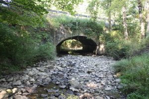
Haymaker Run Bridge

The Rugh/Haymaker Mill Site (36WM1204) is a historic-period archaeological site located in Murrysville, Westmoreland County, Pennsylvania. This summer, four IUP Archaeology students in the Pennsylvania Highway Archaeological Survey Team (PHAST) recovered diagnostic artifacts from deposits associated with late 18th and early 19th century grist and sawmills that were constructed along Haymakers Run by two early Euro-American settlers, Michael Rugh and his son-in-law, Jacob Haymaker. These early mills used the water from Haymakers Run as a power source for the lumber saws and grinding stones. These mills are indicative of the kinds of early agricultural and industrial enterprises that settlers in this region developed to facilitate both longer and larger-term settlement of this region. Early maps of the region often focus on the industrial and extractive potentials of resources showing major rivers used for navigation, streams for mill placement, and indicating mineral rich for extraction.

This site was identified through a Phase I archaeological survey conducted by PHAST in order to comply with Section 106 of the National Historic Preservation Act (NHPA) of 1966.  The NHPA requires federal agencies (and the state agencies like PennDOT who use funding from federal agencies) to take into account the ways that their undertakings may affect the archaeological resources both above and below the ground surface. The bridge where State Route 4041 crosses Haymakers Run is in need of replacement and because bridges and other transportation related infrastructure falls under PennDOT control, it also falls under NHPA regulations.  In addition to replacement of the bridge structure itself, attention must be given to the construction activities and temporary access needs during construction (i.e. right of way, easements, drainage and erosion control measures, and/or temporary staging or runaround). The improvements may also affect archaeological resources, so cultural resource professionals (CRPs) must employ strategies to determine what may be affected by this undertaking.

In order to begin the Phase I investigation, background research was conducted using resources such as Pennsylvania’s Cultural Resource Geographic

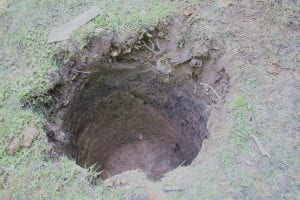
Shovel Test Pit

Information Systems (CRGIS), soil surveys, topographic maps showing landforms, historical maps, and historic period aerial photographs. These sources help us understand what kinds of activities were or were likely happening in a particular area in the past. Once the likelihood of finding archaeological resources is assessed, CRPs visit the site to conduct a pedestrian survey. This field view helps CRPs identify areas of prior disturbance, which informs the development of a below-ground testing strategy. For this project, the excavation of five shovel test pits (STPs) was planned at a regular 15-meter interval to test the below-ground potential for intact archaeological deposits. This summer, the PHAST crew recovered a variety of historic artifacts through the course of excavation.  The recovery of cultural material in the initial 5 STPs resulted in the need for additional testing to confirm the extent of these deposits. Each STP was dug according to Pennsylvania State Historic Preservation Office (PA SHPO) archaeological guidelines, with a diameter of 57 cm to a depth of 10 cm into sterile subsoil to test for all periods of human occupation on this landform. In total, 11 STPs were excavated, recovering 125 artifacts and contributing to the identification of the Rugh/Haymaker Mills site.

Diagnostic ceramic sherd recovered from STPs

Of the 125 artifacts recovered, 69 could be attributed to a particular time period.  These diagnostic artifacts included ceramic sherds, glass, animal bone, and a cut nail. The ceramics were analyzed by PennDOT Senior Archaeologist Angela Jaillet-Wentling who calculated a mean ceramic date of 1815. This date was re-calculated to 1817 based on the presence of olive-colored glass and a machine-cut nail. Accounting for a time lag between artifact manufacture and deposition, the material culture correlates well with the documentary evidence that the Rugh/Haymaker mills was constructed by 1809 and operated until at least 1875. Although the faunal remains from this site were not relevant to the dating of the deposits, the presence of a humerus from a domestic pig (Sus scrofa) certainly adds a depth of detail to the everyday lives of the settlers at the site. The fragmented humerus showed possible evidence of butchery which, along with other faunal remains found on the site, could provide important data to help improve our understanding of the type of foods early Euro-American settlers were raising and/or eating.


Pig humerus fragment recovered from the site

Overall, the archaeological resources encountered during the Phase I Survey resulted in the formal identification of the Rugh/Haymaker Mills Site. Because this potentially eligible site was located within the proposed project area for the bridge replacement, CRPs were tasked with making a choice for the future of this site: further investigation or avoidance. Thankfully, we were able to avoid additional investigation and impacts thanks to early site identification and flexible design. When the work for the Haymakers Run bridge replacement project begins, temporary construction fencing will be placed to protect the Rugh/Haymaker Mills site from any negative impacts that the bridge replacement may cause. This way, the intact archaeological deposits at the site can stay in situ; in other words, the cultural resources will stay where they are for the foreseeable future. This outcome is a best-case scenario because it allows for cooperation between the goals of archaeology and the Pennsylvania Department of Transportation (PennDOT). The proposed bridge replacement over Haymakers Run is able to go forward without major impediments or changes to the project and the undertaking will not negatively affect the archaeological resources associated with the Rugh/Haymaker Mills Site. At its best, Cultural Resource Management gives archaeologists a seat at the table when federally funded undertakings are planned in locations with potential for archaeological deposits. This is a great example of the things that can be accomplished through compliance with Section 106 of the NHPA.

You can read more about their summer here:(https://iblog.iup.edu/trowelsandtribulations/2020/09/25/phast-2020/)

Follow IUP Anthropology on Facebook, Twitter, and Instagram

PHAST 2020

Written by Miriah Amend

From the backwoods of Meadville, to the capital of Pennsylvania, the Pennsylvania Highway Archaeological Survey Team (PHAST) traveled around the state to conduct Phase I survey for several PennDOT projects this summer. The PHAST program provided archaeological field experience for four students from the IUP Department of Anthropology as well as GIS experience for a student from the Department of Geography and Regional Planning. The 2020 PHAST Crew completed 13 projects this summer, at most projects this consisted of digging shovel test pits, or STP’s, each one ranging from a few centimeters to a meter deep in the ground. We worked in a lot of different environments, forests, open fields, even a steep slope. What all these places had in common was being right next to a road or bridge that is planned to be improved or replaced by PennDOT.


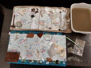
Adapting to changes brought on by the COVID-19 Pandemic, the PHAST team did things a little differently this summer. Masking up and distancing during field work and van rides were new challenges, but this summer had familiar field challenges as well- many projects were surrounded by poison ivy or stinging nettles! With all of our projects being off busy roads, we always had to be careful when working, especially when crossing roads or bridges. Weather-wise, the crew was lucky, we only missed one day of field work due to thunderstorms! We spent this rainy-day cleaning artifacts and working on writing and making figures and maps for our reports. At the end of the day, archaeology could still be done, rain or shine!

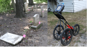
Working alongside Dr. William Chadwick, the PHAST crew also assisted in a cemetery relocation project just outside of Indiana this summer. The crew took turns using ground penetrating radar (GPR) technology in order to locate potentially unmarked burials. Getting experience running the GPR was a great way to get our feet wet in the exciting world of geophysics, and the preliminary analysis of the data suggests that there we did in fact pass over a few unmarked graves.

Another project the team tackled was between Titusville and Meadville, up in the northwestern part of the state. There, our crew pulled out a variety of historic artifacts such as early 1900’s bottles, ceramic pieces, and various metal scraps, including an old metal shoehorn. This project area was near the foundation of known historic mill, so we weren’t too surprised to find historic material in this area, although I don’t think any of us expected it in this quantity!


Wrapping up the summer, the PHAST crew found even more artifacts- early historic pottery, glass, and even faunal remains! These were recovered during our last project, a bridge replacement near Murraysville. With these findings, additional STPs were required and this project turned from taking one day, to several. Who would have expected historic artifacts to be underneath a dense layer of rock just under the surface? It just goes to show the importance of Phase I survey, you never know what may be just below ground until you look!

Follow IUP Anthropology on Facebook, Twitter, and Instagram

Digging PHAST

Written by Brendan Cole

The PennDOT Archaeological Survey Team (PHAST) is an internship program between IUP and PennDOT. It provides one student with the paid opportunity to be an archaeological field director and gives three students the opportunity to be paid archaeological field technicians. This year’s crew consisted of me (Brendan Cole) as the field director with Janee Becker, Andrew Malhotra, and Heather Lash as my trusty field technicians. It was my job to lead small Phase I archaeological surveys while helping teach and to give Janee, Andrew, and Heather the opportunities they needed to grow as archaeologists and prepare for finding a job in post-graduate life.

Over the course of 18 weeks we put over 7,000 miles on our relatively new and previously shiny rental mini-van for a summer full of archaeology. By the end of the summer we completed eleven Phase I archaeological surveys and participated in one Phase III with AECOM.  All our projects were for PennDOT projects like bridge rehabilitations, bridge replacements, road safety improvements, trails, and a transmission line project in Eckley Miner’s Village.

The PHAST Crew 2019: Brendan Cole, Andrew Malhotra, Janee Becker, and Heather Lash.

One thing that every Cultural Resources Management (CRM) archaeologist knows is that you don’t find sites everywhere you stick a shovel in the ground, in fact it can be quite rare depending on where you are at and what kind of project it is. The PHAST crew experienced this this summer when we only found 1 site out of our 11 surveys. That’s a whopping .09% success rate for finding a site.

The one site we did identify was historical and located in Northampton County, PA. Every shovel test that we dug was positive for historic artifacts. Some shovel tests contained cultural materials at such a deep level we had to dig our first test unit of the summer. It consisted of multiple layers of stratigraphy containing artifacts such as whole bricks, ceramics, glass, and metal objects like nails. In total the project yielded a couple hundred artifacts. We don’t have an exact date yet for the site as we have not yet completed a full analysis of the artifact assemblage.

After it was all said and done, we drove our van for 7,000+ miles around Pennsylvania, successfully completed multiple surveys, learned new skills, ate great food, and unsurprisingly visited multiple breweries along the way (remember we are archaeologists).

Applications for next summer’s crew will open this winter.

https://www.iup.edu/anthropology/

For more from IUP Anthropology check out our Facebook, Twitter, and Instagram

IUP at the 83rd Annual Society for American Archaeology Meeeting

By: Genevieve Everett

Cherry Blossoms around the Tidal Basin

Employers should allow attendees/participants the Monday after the Society for American Archaeology (SAA) conference off. Let me tell you, I’m exhausted, but I’m feeling energized by all the amazing papers that I had the chance to hear, and the poster’s that were exhibited throughout the week.

Wednesday morning, myself, and 6 of my classmates (and luggage) crammed into the Arch Services van, and headed to the 83rd Annual SAA conference held in Washington, DC, in the lovely Woodley Park neighborhood. This was my first ever SAA conference. We arrive mid-afternoon at our small, but cozy Air Bnb that was located about a half hour (walk) from the conference center. After settling in a bit, we all walked to the conference center to register. We walked past yellow daffodils and purple flowers’ cascading down stonewalls, the first real sign of spring. One route we could take to and from the conference was through the National Zoo! After a delicious Lebanese meal (and cocktail), we all headed back to the Air Bnb to prepare for the first day of presentations, posters, and seeing old friends/colleagues.

IUP Ethics Bowl team

Thursday morning was a BUSY day. I was up bright and early to go to Sami’s presentation on her thesis research at Pandenarium, a 19th century Freedman site in Mercer County, PA. This was one of her last presentations before she graduates in May! She did really great! Shortly after I wandered around the poster session, and was particularly interested in the Caves and Rockshelter posters. From there, I headed to watch our Ethics Bowl team debate Cornell University. The point of the Ethics Bowl is to put two teams from different universities in front of a panel of judges, and debate about hypothetical (and in some cases based on real events) ethical issues within archaeology. Our team did amazing, however, they did not make it to the final round. Later I walked around the Expo room browsing books and picking up free “swag”, and from there I stopped by to see Sami and Angie Jaillet-Wentling’s poster. They were presenting the results of the public archaeology days they held this past fall at Pandenarium, which contributed to the assemblage Sami was examining for her thesis.

Sami and Angie at their poster session

The remainder of Thursday I spent alone, going from session to session. This past fall I helped excavate a quarry site in Northern Maine (if you go back to the September blog posts, you can read about it) under the supervision of Nathaniel Kitchel and Heather Rockwell. In the afternoon, Nathaniel presented a paper that the two co-authored on the results of this excavation. Next, I stopped by a talk in honor of Dennis Stanford. I especially enjoyed Ciprian Ardelean’s talk that was partially about working with Dennis Stanford, but also the Chiquihuite Cave in Zacatecas Mexico. Mr. Ardelean talked about being an “outsider” from Romania working in the Americas. He also talked about the importance of working with students. More specifically, the merit and value of getting dirty, working in isolation for so many days, being in nature and cooking and enjoying meals together. I really connect with this notion.

Friday I decided to head toward the Washington monument to see the Cherry Blossoms in full bloom. I did a loop around the Tidal Basin, dodging hordes of school groups. Despite the tourist traffic along the way, it was such a pleasant walk. I wanted to hit up the Natural History Museum, but again, it was swamped with school groups, so I turned around and headed back to the conference. I hit up a few more talks, had a drink with my mentor, and went out to Haikan, an amazing ramen place with some friends. The rest of the night was spent celebrating the fact that our classmate/friend Zaakiyah won the Paul Goldberg Award, a national award, awarded to a single MA student in either the geosciences or archaeology!

Zaakiyah with the Paul Goldberg Award!

On Saturday, my main objective was to attend the symposium, “Wicked Awesome” Archaeology: New Data and Directions In The Archaeological Northeast”. A few friends/acquaintances were presenting during this session, including Dick Boisvert and Zachary Singer. Dick Boisvert is my mentor and is on my thesis committee. He talked about the legacy of the State Conservation and Rescue Archaeology Program (SCRAP). Following Dick, Zach discussed “New Investigations of the Paleoindian Component at the Templeton Site in Western Connecticut”. Much like SCRAP, students and volunteers help excavate the Templeton Site, which to me, is always a wonderful collaboration. After their talk I met up with my family, and we walked through the National Zoo. Later, we met up with my boyfriend, and grabbed dinner at a Mexican restaurant where delicious food and margarita’s were consumed.

The Government, University, and Heritage Stewardship crew!

Sunday, the final day of the conference, and the day of my presentation (at 8 am) in the “Government, Universities, and Heritage Stewardship: A Student and Young Professional Symposium”. I was in this symposium with several IUP classmates, some fellow PennDOT interns, and two graduate students from the University of Montana. My paper was titled, “From Field School to Graduate School: How One Public Archaeology Program Has Made It All Possible”. I discussed the benefits/legacy of SCRAP, and how I am using SCRAP data to complete my Master’s thesis. I also provided some preliminary results/conclusions to my thesis research. As my first time presenting at a conference, I have to say, I don’t think I bombed! I felt pretty confident up there, but that took A LOT of practicing over and over again. Everyone that participated in the symposium did great, and each person had a really interesting topic that related to their collaboration with state or federal government agencies. After our symposium, we jumped in the van, and headed back to Indiana.

Personally, the SAA’s were an amazing experience for me. Roughly 20 plus IUP students, past and present, attended the conference. In addition, three professors in the graduate and undergraduate Anthro department presented papers.  It felt really good knowing that IUP had a strong presence, one that shows that we are a tight knit group, and that we are able to successfully transition from our undergraduate or graduate studies into viable careers in archaeology. Most IUP graduates are working in CRM, while some are getting their PhD’s. I hope that we can continue to show the archaeological community that we have a strong program for years to come. See you all next year in Albuquerque!!!

IUP ANTHROPOLOGY DEPARTMENT

Upcoming Graduate Student Research Presentations from the UK to VA

By: Genevieve Everett

Conference season is upon us! I thought it would be nice to highlight the graduate students that are representing IUP and our department by presenting their research in the form of papers and posters at the following conferences/forums:

  1. The Middle Atlantic Archaeological Conference (MAAC) in Virginia Beach, VA- March 15-18
  2. The Graduate Scholars Forum at KCAC on IUPs campus, April 4
  3. The 89th Annual  Society for Pennsylvania Archaeology(SPA) Meeting in DuBois, PA- April 6-8
  4. The Annualy Society for American Archaeology (SAA) Conference in Washington, DC- April 11-15
  5. The Seminar for Arabian Studies (SAS) in Bloomsbury, London-August 3-5

Below you will read about each student’s individual project/research and which conferences/forum you can find them at this year!

Kristina Gaugler

Presenting research at: IUP Graduate Students Forum

Spatial Database Development for Confluence Park Master Plan

The goal of this project is to create a series of spatial data layers that document the existing environmental conditions at Confluence Park, a 15 acre site managed by the Allegheny Arboretum at Indiana University of Pennsylvania. These maps will contribute to the develop of a support system designed to complement future site planning activities and will include the current topography, vegetation, hydrology, existing structures, and site access points. Factors that may influence the decisions of future planning or construction will be assessed, including the location and condition of on-site sewage systems and retention ponds, riparian zones, and a rapid-bio assessment of streams. This information will help delineate locations on the site that may be suitable for future development. With the tools and basemaps created, users will be able to overlay applications to suit their needs and allow for varying types of analyses to be performed.

Britney Elsbury-Orris

Presenting research at: SPA and SAA

The Kirshner Site (36WM213) is a multi-component site in South Huntington township, Westmoreland county, Pennsylvania that contains two Middle Monongahela villages. Relatively little is known about Monongahela use of animals.  Fortunately, good faunal preservation has made zooarchaeological analyses of materials from this site possible. Identifying and analyzing these faunal remains with respect to taxa and skeletal elements, as well as human and animal modifications, provides important new information. The distribution of faunal remains across the features of the site and its two components has been examined, as they have the implications for relationships between the site’s inhabitants and their environment. These data provide insights into the nature of this site and the activities of its occupants. Comparisons with other faunal studies, like those done on zooarchaeological materials from other Middle Monongahela sites, including the Johnston Site (36IN2) and the Hatfield Site (36WH678), further expands on the understanding of the Kirshner Site and the Middle Monongahela tradition.

Matthew Bjorkman

Presenting research at: IUP Graduate Scholars Forum

Indiana County FEMA Data-based Flood Hazard Analysis

Co-authored with Eisbeiry Cordova-Ortiz & Shanice Ellison

In the past decade we have frequently seen the effects of intense precipitation events, particularly the damage they cause in populated areas. Due to the increased frequency of these events, state and local government officials across the country have developed flood hazard analyses for their jurisdictions. Taking this into consideration, Indiana county is developing a flood management plan to prepare for any adverse effects caused by 100-year storms. Using ArcGIS, a geodatabase was developed to build a 100-year flood depth grid (FDG) using Federal Emergency Management Agency (FEMA) data from Pennsylvania Spatial Data Access (PASDA).  The FDG was used to identify structures that are located in a flood zone and would be susceptible to damage. This project highlights concentrations of vulnerable buildings and provides the value of the estimated monetary damages. These results will assist the county with its development of its comprehensive emergency management plan.

Using LiDAR to Analyze Landscape Evolution: A Case Study of the Squirrel Hill Site (36WM0035)

Light detection and ranging (LiDAR) is an active remote sensing system that has, on occasion, been used by archaeologists to conduct paleolandscape reconstruction studies. Understanding what the landscape looked like is essential for archaeologists to determine how prehistoric sites formed. Rivers are a primary operator in landscape evolution, as meandering and avulsing rivers can create major alterations to a landscape through deposition and erosional processes. Changes in a river’s position on the landscape will have great impacts on the location and preservation potential of archaeological sites This study utilizes LiDAR data from Indiana and Westmoreland counties in Pennsylvania to study landscape evolution near the archaeological site of Squirrel Hill, a Monongahela village site. The goal of the research was to use remote sensing technologies to identify and map extinct channels of the Conemaugh River to understand how the evolution of the landscape around the Squirrel Hill site has affected the site’s formation and preservation.

Samantha Taylor

Presenting research at: MAAC, SPA, SAA

Looking Through Dirty Dishes: A Comparative Analysis of Ceramics at the John and Rosie Allen Residence, Pandenarium, Mercer County, Pennsylvania.

African Diaspora archaeology has become one of the most impactful means by which archaeologists supplement our current understanding of the past. Not only does this subfield have the potential to benefit descendant and local communities, but it also enables professionals to fill in the blank gaps left by the systematic disenfranchisement and intentional illiteracy of an entire group of people. One site with the potential to enhance our understanding of the African Diaspora is Pandenarium (36ME253) a freed African American settlement in western Pennsylvania. Current research at Pandenarium focuses on a comparative ceramic analysis with nearby archaeological sites, other freed African American sites, and slave quarters at plantations. The goal of this research is to determine the socio-economic status of individuals living at Pandenarium, along with participation in local and regional markets. The results of the analysis featured in this paper are a foundation for future comparative studies featuring Pandenarium.

Mesfer Alqahtani

Presenting poster at: SAA and the IUP Graduate Scholars Forum

Presenting paper at: SAS

SAA:

GIS Investigations on Stone-Circle Structures in the North of Saudi Arabia

The theme of the poster will address archaeological phenomena in the north of Saudi Arabia. The archaeological phenomena are stone-built structures that can be seen by satellite images. These stone-built structures have various types, and one of them is the circle type.

The poster will show the method of creating predictive models of stone circles by using the Geographic Information System (GIS). To create these models, two zones from the north of Saudi Arabia should be selected: study zone and applied zone. The study zone is where the distribution of stone circle locations will be analyzed to create predictive models. The applied zone is where predictive models will be applied to be testable in the future.

The predictive models will be based on quantifiable attributes of stone-circle locations from the study zone. These attributes will include the relationship between stone-circle locations and environmental variables such as the landform and the distance of water resources. These attributes will be analyzed by ArcGIS to obtain environmental characteristics representing high, middle, or low probability models for the presence of stone-circle locations. In the applied zone, similar environmental characteristics will be identified to determine high, middle, low predictive models.

SAS:

Geospatial Investigation of Circular Stone Structures in Northern Saudi Arabia

The paper will focus on the circular type of stone-built structures in Harrat Al-Harrah of northern Saudi Arabia. The goal of the research is to recognize the locational patterns for these circular structures based on five quantifiable geographic attributes: elevation, slope, land-cover, distance to sabkhas (temporary water bodies), and distance to wadies (water streams).

The probability modeling methodology conducted uses Remote Sensing and GIS technologies. This study includes identified locations of circular structures in one zone to create the model and a second zone to test the model (225 square miles and 81 squared miles total) of Harrat Al-Harrah, examining the correlative relationship between these locations and the five geographic factors. The results show the favorable geographic factors related to the locations of circular structures in the two zones of Harrat Al-Harrah.

The significance of this research lies in the contribution of recognizing the locational patterns of circular stone structures in two zones of Harrat Al-Harrah that have never been studied before and difficult to access. This pattern will be useful for comparative studies with locational patterns of circular structures in other areas of the Arabian Peninsula when conducting more investigations on this type of stone structures.

IUP Graduate Scholar Forum:

Geospatial investigation of circular stone structures in Northern Saudi Arabia

The theme of this poster will address stone-built structures in northern Saudi Arabia. Specifically, the circular type stone-built structure will be the focus of this research. Stone-built structures are an archaeological phenomena that can be seen via satellite images within this region of the world.

The goal of the research is to recognize the pattern of geographic locations for these circular stone-built structures based on five quantifiable geographic attributes. These attributes include elevation, slope, land-cover, distance to sabkhas (temporary water bodies), and distance to wadies (water streams). Remote Sensing and GIS technologies are used to conduct probability modeling for this research. This study includes identifying all the locations of circular structures in one zone, building a model for their locations, and then examining a second zone using the model. The results show the favorable locations for circular structures in these two zones based on the model.

Ross Owen

Presenting research at: SAA

PennDOT Highway Archaeological Survey Team: Providing Immersive CRM Work Experience to Students

Despite there being more applicants with graduate degrees than there are jobs, the CRM industry suffers from the number of people holding graduate degrees but lacking experience conducting archaeological surveys for Section 106 compliance. Additionally, conducting archaeological surveys is cost-prohibitive and can be a burden on state agencies on projects where federal funds are not involved. These two issues in the field of compliance archaeology prompted the creation of the PennDOT Highway Archaeological Survey Team (PHAST). Through a partnership with Indiana University of Pennsylvania, each year PHAST gives 4 students an opportunity to work on and complete small Phase I and II surveys for the Pennsylvania Department of Transportation. The students gain experience in the field, and are employed in the lab to perform the necessary background research, GIS mapping, curation and documentation following the guidelines of the Pennsylvania Historical and Museum Commission. Much of this experience is outside the purview of most field technician positions. This paper will explore the successes and failures of the PHAST program from both a professional and financial point of view. How have the students benefitted from their experience within the program, and how has the state benefitted from the services provided?

Andrew Malhotra

Presenting research at: SPA (Co-authored with John Nass, Jr. (Callifornia University of Pennsylvania)

Presenting research at: IUP Graduate Scholars Forum

SPA:

Social Signaling and the use of Style Amongst Late Prehistoric Monongahela Populations: Possible Evidence for Intervillage Political Integration

Communication between groups of people occurs for different reasons and, when using material culture, can take many forms. During the Late Prehistoric period evidence of social signaling in the form of shared stylistic traits appears at several late Monongahela villages from southwestern Pennsylvania. The stylistic trait consists of various forms of executing lip decoration on ceramic jars. The form of decoration using various tools results in the lip looking like a piecrust. This specific form of decoration appears from the Johnson site in Indiana County to the Foley Farm site in Greene County.In is the intent of this paper to document the temporal and spatial documentation and the social/political significance of this stylistic design is the subject of this paper.

IUP Graduate Scholars Forum:

Sanborn Maps of Indiana: Reconstructing the Urban Geography of Indiana, PA

This project will consist of analysis of Sanborn Fire Insurance Maps from 1887-1936 of Indiana Borough in order to depict urban growth patterns, major employers and how these factors changed over time. These maps were brought into ArcMap 10.5 to be georeferenced with road intersections and buildings, digitizing the most important ones. Attribute data including census and city directory data was also extracted for database creation. Through construction of a detailed database and data extraction of these maps, the goals of documenting and analyzing how the borough of Indiana and its people have developed and changed through the target years can be achieved. A future goal is to develop an interactive map with attribute information about its features for use by the public and historical society.

Genevieve Everett

Presenting Research at: SAA and Graduate Student Forum (abstract for forum not provided)

From Field School to Graduate School: How One Public Archaeology Program Has Made It All Possible

The Paleoindian Period of New Hampshire has been studied extensively, particularly in the White Mountains. Volunteers and avocationals from the summer field school known as the State Conservation And Rescue Archaeology Program (SCRAP) have excavated several of the known Paleoindian sites in northern New Hampshire. It is the goal of New Hampshire State Archaeologist, Richard Boisvert to make information and data recovered by SCRAP accessible to scholars as potential thesis and dissertation topics.

This paper outlines how the principal investigators participation in the SCRAP field school has been beneficial to her professional and academic career, including her current Master’s thesis. The purpose of this thesis is to produce a spatial and statistical analysis of the artifact assemblage from excavation block K at the Potter Site (27-CO-60) located in Randolph, New Hampshire in comparison with the Jefferson VI (27-CO-74) salvage block in Jefferson, New Hampshire. This comparison not only examines the spatial relationships within one Paleoindian site (27-CO-60), but also helps the principal investigator make inferences about the similarities and differences between two Paleoindian sites in close proximity. Public archaeology programs such as SCRAP are a valuable part of North American Archaeology, without SCRAP this work would not be possible.

Zaakiyah Cua

Presenting research at: SAA and the IUP Graduate Scholars Forum

SAA:

Loyalhanna Lake: a Geoarchaeological Approach to Understanding the Archaeological Potential of Floodplains

Unlike uplands, floodplains generally yield stratified deposits that may include deeply buried landscapes and archaeological sites. Most state specifications for cultural resources surveys require floodplains to be geomorphically evaluated in order to identify buried landscapes. This is most frequently accomplished via trenching, an effective, but timely, costly, and sometimes destructive method. This project reports on an alternative technique utilizing a multi-proxy methodology coupling geophysical survey with auger sampling. These non-invasive and limited-impact methods produce accurate results without causing extensive destruction to cultural resources. The study area, located along Loyalhanna Creek in Westmoreland Country in western Pennsylvania, is managed by the US Army Corps of Engineers – Pittsburgh District (USACE). As a federal agency, the USACE is mandated to identify and preserve cultural resources by Section 110 of the National Historic Preservation Act (NHPA). Unfortunately, federal agencies often face limited staffing, resources and funding to address management of cultural resources. In addition to proposing a method for identifying buried landscapes, this project also provides a case study of partnerships between federal agencies and public universities; a mutually beneficial collaboration which provides agencies with data essential to land management while simultaneously providing students valuable opportunities to conduct cultural resource management assessments.

IUP Graduate Scholars Forum:

Misery Bay Ice Survey Preliminary Results: a Case Study for Testing Geophysical Methods and Collaboration with Stakeholders

Ground-penetrating radar (GPR) and gradiometry are two geophysical methods typically used by archaeologists in terrestrial environments to locate subsurface features. This study took terrestrial geophysical methods out on the frozen ice surface of Misery By, Presque Isle State Park, PA; testing instrument limits across two acres of the bay. If successful, this study has major implications to geophysical maritime investigations, broadening the reach of cultural resource management within these environments by government agencies. In addition to testing new methodology, the project was a collaboration between the PA DCNR, Regional Science Consortium, PA Sea Grant, PASST, and Indiana University of Pennsylvania Applied Archaeology program. The collaborative and public nature of the project drew in stakeholders, largely contributing to the success of the study. This poster presents the preliminary results of the project; both a case study for testing new methods, and the positive implications for collaborative and public cultural resource surveys.

Heather R. MacIsaac

Presenting research at: IUP Graduate Scholars Forum

The Squirrel Hill site in Westmoreland County, Pennsylvania, was a Monongahela village inhabited from A.D. 1450 to A.D. 1613. Past research conducted by IUP archaeologists at the Squirrel Hill site uncovered evidence of housing, storage areas, and burials. There are conflicting interpretations of the village’s development and expansion over time. One interpretation is that the site contains a single village with an open, central plaza for communal activities, and that the village gradually expanded southward. Another interpretation is that the site contains two overlapping villages occupied at different times. To evaluate these interpretations, this research incorporates a statistical analysis of artifacts and a spatial analysis of structural features based on materials from the 2016 IUP archaeological field school. This research also investigates whether the Squirrel Hill site was inhabited by Monongahela traditional people only or by an amalgamation of Monongahela tradition and nearby McFate phase people.


IUP ANTHROPOLOGY DEPARTMENT
One Luddites Journey Learning GIS

By: Genevieve Everett

Before graduate school I asked friends that had been through graduate programs for some advice, and again and again I was warned that it would fly by fast. They weren’t wrong. Here I am, deep into my final semester of graduate school wondering what happened to the time. I guess it’s true, time flies when you’re having fun….or when you’re really stressed out.

One of the most stressful courses I signed up for in this program was the “Applied Spatial Methods in Archaeology” class. This class consisted of learning/using ArcGIS to create viewsheds, data dictionaries, etc., out of archaeological data. I had never used GIS, and I am not the most technologically savvy person out there, so I knew going into this class that I would be out of my comfort zone. I got passing grades in the class, but there were very few moments where I felt fully confident using ArcGIS. It was frustrating, and I hated asking my classmates for help, because we all have our own stresses to deal with. Looking back, I was so thankful that I took the class, because it has been immensely useful since.

Fake Boundary to show use of Websoil Survey and ArcGIS

This past summer working for PennDOT as a PHAST intern I used ArcGIS all the time to georeference historic maps, historic aerials, engineering plans, and to draw in project area boundaries, which I converted into maps for reports. One of my favorite uses of GIS is creating an AOI in Web Soil Survey, which creates a shapefile showing the soil(s) in the project area. First you upload the project area boundary into Web Soil Survey, which displays the project area boundary (in the real world coordinates that you set in ArcGIS), and the soils present within it. You then download the shapefile associated with the AOI, and bring it into ArcGIS. I created a fake project boundary to show what the end product looks like. In this example there are two soils present, 14B and 214A, which have unique names. For example, 14B, which makes up 98% of this fake project boundary is called Sheepscot. Sheepscot is a cobbly very fine sandly loam. Web Soil Survey also provides information about elevation, slope, farmland classification, typical stratigraphic profile information, and parent material. All of this information comes in handy when writing technical reports.

Another reason I am really glad I took that class is that I have been using ArcGIS heavily for my thesis. Part of my thesis is conducting a spatial analysis of lithics and lithic raw material from a Paleoindian site in New Hampshire, in comparison to another site nearby. By extension, I am attempting to determine what type of activity or activities were being carried out in this area. With the help of Dr. Chadwick, classmates, past theses, and my own problem solving (mostly through the ESRI website), I have made a lot of progress and learned a few new things. One of those things was creating a “fishnet” to create the excavation block grid out of two datum points, because there is no GPS data. Most recently I taught myself how to create Choropleth maps. Choropleth maps display where individual or multiple artifacts are in relation to one another in the excavation block using color gradients. As you can see in the image, each color is correlated with a particular number of Waste Flakes, and the quadrants for which they were found. For example, the red quadrants in the “Total Waste Flakes K-Block” image are the quadrants that have a higher count of waste flakes (90-176). I am also looking at the distribution of artifacts by Zone (or Strat), which are easily displayed in these Choropleth maps for comparison (shown below). My next step is to take these Choropleth maps, and do hot spot/cluster analysis.

The moral of the story? Try something new, even if it scares you. It’s cliché, but you’ll never know if you don’t try.

IUP ANTHROPOLOGY DEPARTMENT

Tools of the Trade: Actual Archaeology at PennDOT

By : Angela Jaillet-Wentling

From underneath a rusty 1927 Studebaker coupe car (an antique even in my youth) frame, my Papa called out to myself and my brother, “Can one of you kids hand me a the flat-head screwdriver with the stubby handle?” At the ripe old ages of six and four, we may very well have handed him a pair of pliers for all we knew.  He’d roll out on his card dolly with a smile, accuse us of being monkey wrenches, show us the tool he’d meant and head back under an engine most people had given up on fifty years prior. What I’d learned from my Papa, even as I spent more time playing with and picking on my younger brother, was that every job has a tool and some tools are more appropriate than others.

Photo 1. Shovel testing /Phase I archaeological survey, Lawrence County, Pennsylvania. Courtesy Angie Jaillet-Wentling (2017).

One of the first things about archaeology that I found re latable was this idea. I also like dirt, so it’s worked out well as a life/career choice for me! I began my career in Cultural Resources Management (CRM) in transportation through an internship with the Pennsylvania Department of Transportation (PennDOT). As a note though, when I told my Papa that I wanted to be an archaeologist and there were jobs for in places like PennDOT, he laughed and hit me with one of the biggest myths I face as a transportation archaeologist “So, you’re going to hold up progress on the highways?!” Another thing my Papa taught me is that you can face almost anything with humor and a quick response. Being new to the profession, I don’t know that I had a good response to his question other than to laugh, give him a mock grumpy look, and say it wasn’t true. This is still true, but now I can tell him we rarely “hold up” a project and that we’re there to ensure that we don’t inadvertently lose out on our shared heritage by pushing projects through without consideration.

As a PennDOT archaeologist, we’re hired as historic preservation specialists and called Cultural Resource Professionals (CRPs) (https://www.paprojectpath.org/penndot-crm/home).  We help guide the implementation of PennDOT’s cultural resources program and the ways in which the individual engineering districts navigate the Section 106 (of the National Historic Preservation Act, as amended [1966, 2016]) (http://www.achp.gov/nhpa.pdf) process and how it may affect the overarching National Environmental Policy Act (NEPA) (1969) (https://www.whitehouse.gov/sites/whitehouse.gov/files/ceq/NEPA_full_text.pdf), process.  On a more localized level, what this means is that I work as one part of a team which includes myself covering below-ground cultural resources and my counterpart, an architectural historian, covering the above-ground cultural resources realm. We attend design field views early in the project planning process, provide guidance as to what studies may be needed, sometimes performing these studies ourselves, and ensure that each project follows the process in the most efficient way possible. We’re responsible for Findings of Effect or the determination of whether a project’s activities will affect cultural resources and, if so, how PennDOT can mitigate for that impact.

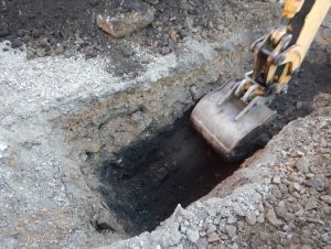
Photo 2. Backhoe Sounding of Ground-Penetrating Radar survey, Fayette County, Pennsylvania. Courtesy Angie Jaillet-Wentling (2017).

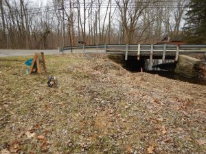
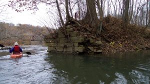
That all sounds awfully convoluted and legal, and it is, but it’s also done in equal parts archaeology technical know-how and documentation (findings, reports, and even public outreach).  On any given day, I can be found roadside wielding a soil probe or shovel to determine the extent of previous disturbances (Photo 1) or monitoring the removal of modern overburden by a backhoe to ground-truth the results of a ground-penetrating radar survey (Photo 2) or floating in a kayak in freezing weather to delineate canal resources (Photo 3) or pecking away on my keyboard to notify Federally-Recognized Tribes and Nations across the nation of project status or preparing legally-binding programmatic agreements.  We conduct background research on our projects to provide the best guidance possible and sometimes this gives us a better idea of the methods we’d like to use to investigate differing project areas and potential cultural resources.

Preparing haphazardly for this blog post, I asked Gen Everett what she’d like me to write about.  She though that I should discuss what I do as a CRP and possibly advice for graduates heading towards CRM.  There’s a joke archaeologists like to tell about classifying artifacts, you’re either a lumper or a splitter – as in you either associate or you differentiate the different characteristics of artifacts. I’m going to lump what I find most critical to completion of my daily duties and advice into one basic idea: know your tools and to do this ask questions! 

Photo 3. Canal survey of a portion of the Kiskiminetas River, Westmoreland and Armstrong Counties, Pennsylvania. Left: Angie Jaillet-Wentling. Middle Background: Railroad Trestle. Right: Canal Towpath Bridge Abutment. Courtesy Don Burden (2017).

Archaeology and CRM is filled with resources (and not just the cultural/archaeological/historical kind) in both its practitioners and its methodologies. Familiarize yourself with different methods of investigation so that you can develop a nuanced and effective approach to identifying and evaluating cultural resources that may be impacted by a project. This means that you might need to move beyond the standard shovel testing to remote sensing methods to backhoe trenches. You should be comfortable with the different options, so that you’re confident in choosing the most appropriate tool for the task.  To be comfortable and confident, familiarize yourself with the methods and the people that know them best understanding that you might not be the expert, but you know who is. You can’t come by this knowledge without putting in the research and asking questions!

Once you get to the point where you have something to impart, be it knowledge or support, it probably doesn’t hurt to share it with others. I think this applies to research and experience. What’s the use in learning about our history, if you can’t use that to help others increase awareness?  Publish and present what you can.  Graduate students in the future will likely cite it or critique it, but it furthers your field of study.  I was very fortunate to have early and often mentorship from PennDOT, in the form of the usually laughing and story-telling, Mr. Joe Baker. I count myself even more fortunate in my latest stint as a PennDOT CRP, because we get to work with and help mentor the PennDOT Highway Archaeology Survey Team (PHAST) (https://iblog.iup.edu/trowelsandtribulations/tag/phast/, https://iblog.iup.edu/trowelsandtribulations/2017/08/31/my-summer-as-a-phast-intern/, or https://iblog.iup.edu/trowelsandtribulations/2016/07/13/pennsylvania-highway-archaeological-survey-team-midseason-update/comment-page-1/). It’s a joy to hear their questions, answer what I can, and pose some back to them.

Angie Jaillet-Wentling

Angela Jaillet-Wentling, M.A., RPA | Historic Preservation Specialist

PA Department of Transportation

Bureau of Project Delivery | Cultural Resources Unit

CRP Archaeologist Engineering Districts 12-0/11-0


IUP ANTHROPOLOGY DEPARTMENT