California Love: An Archaeological Survey on Santa Rosa Island

By: Matthew Bjorkman and Britney Elsbury-Orris

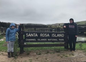
During our undergraduate years at Penn State (2013-2014), we worked in the Zooarchaeology labs sorting shell midden assemblages from the California Channel Islands. The project was a part of Dr. Christopher Jazwa’s dissertation, which involved studying how patterns of human settlement, subsistence, and mobility were influenced by the changing environment and cultural factors. Five years later, we were lucky enough to receive an invite from Dr. Jazwa to participate in a week-long survey on Santa Rosa Island. The goals of the project were to survey new areas of the island, primarily the interior, to identify and record new archaeological sites for the National Park Service (NPS). Our team consisted of four members: Ourselves, Dr. Jazwa, and Kirk Schmitz (a master’s student at the University of Nevada, Reno).

Day 1: Visit to La Brea Tar Pits and Pink’s

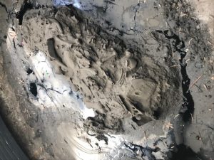
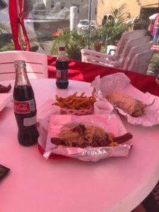
View of faunal remains in the Observation PitOn our first day in Los Angeles, we visited the La Brea Tar Pits and its associated museum. The La Brea Tar Pits are located in central Los Angeles, and the world’s most famous Ice Age fossil active excavation site. The museum included a park, which contained sculptures of Ice Age animals, a Pleistocene garden, and ongoing excavations of the tar pits, as well as the George C. Page museum. The museum contains fossils excavated from pits, some dating back to the earliest excavation in 1915. The museum contained a fossil lab (called the “Fish Bowl”) that allowed visitors to view the scientists and volunteers in their ‘natural environment’ while they worked to remove tar from the fossilized remains. For us, the coolest part of the La Brea Tar Pits was the Observation Pit, which allowed us to get up close and personal with an active tar pit that still housed the remains of extinct Ice Age animals. After La Brea, we visited Pink’s Hot Dogs in Hollywood to eat some of the most ridiculous hot dogs humans have ever made. The portions were so enormous that it put us into a food coma, allowing us to rest for our trip to the island the following day.

View of faunal remains in the Observation Pit

Pink’s Hot Dogs


Day 2: Traveling to Santa Rosa and Foraging for Dinner

Waking up early is not our thing. Thankfully the jet lag made our 6 A.M. wake-up call much easier. After loading up our gear and supplies into “the Wagon” (as Dr. Jazwa calls it) we departed to the docks in Ventura, Ca. We boarded the Ocean Ranger, a boat owned by the NPS, and we departed on our 3 hour ride to Santa Rosa (Gilligan’s Island anyone??). We arrived at the Santa Rosa dock in the early afternoon and quickly took our belongs up to the park housing. Our first order of business was to travel to the south side of Santa Rosa to collect mussels from the intertidal zone that would be used for isotopic testing…and dinner! The collection process was not as easy as we would have envisioned, since the tide was relatively high that day. Despite taking some unwanted dips in the Pacific Ocean, we were able to collect our sample (approximately 50 mussels and 20 turban snails) and returned back to housing.  Unbeknownst to us, Dr. Jazwa apparently also has his Ph. D. in the culinary arts (not really), as this was the first of many amazing meals he cooked for us during our stay.

Collecting mussels

Midden site along the coast


Day 3+4: Rain, Rain, Go Away!

Our survey got off to a slow start. During the first 3 days we were on Santa Rosa, the island received more rain than it had all year! Santa Rosa is primarily made up of sandstone rock, meaning the roads do not handle water very well, making getting to the survey area impossible. Instead of surveying during these days, Dr. Jazwa gave us a tour of closer sites along the coast. Most of these sites were ones that we had analyzed material from while at PSU. Our tour of the island included visiting the historic ranches, coastal shell midden sites, and Cherry Canyon. While walking through Cherry Canyon, Dr. Jazwa pointed out the numerous rockshelter sites that have been identified.

Rockshelter in Cherry Canyon


Day 4: Let the Survey Begin!

The rain had ceased and we could finally start our survey! Unfortunately, the roads were still closed due to the rain so we had to hike a few miles to our survey area. The hike was generally nice, except for the stream crossings and climbing over a mountain ridge. The plan for the project was to do a surface survey along ridge tops on the interior of the island to locate possible inland habitation sites. Our luck was good from the start, as we were able to identify and record four sites that day. All four sites contained lithic scatters that were visible on the surface. We found some really interesting artifacts at two of the larger sites , such as a volcanic chopper, lithic cores, a part of a sandstone vessel bowl, and a broken projectile point. For each site, we had to record the site boundary and the location of the most significant artifacts using a Trimble. We created a sketch map of these features and took site overview photos, as well as close-ups of the significant artifacts. On our return trip to housing after surveying we walked through one of the only two Torrey Pine stands in the world (the other is a golf course in San Diego). The detour added a couple more miles to our hike, but it was well worth the extra leg pain.

Sandstone vessel fragment

Recording a site

The massive pinecones from Torrey Pines


Day 5: Oh Deer!

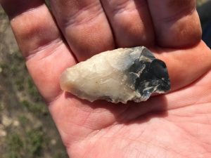
We did not have quite as much luck on our second day of survey. We only located one site, but were able to survey a large swath of land. The site we identified was a large shell midden and lithic scatter adjacent to an old road. We found an almost complete chalcedony projectile point (lying in the road!) and two possible groundstone artifacts. While we were not able to locate any other sites, we did find three complete skeletons of deer/elk. We learned that deer and elk populations were brought to the island by humans in the mid 1900s, but were fully eradicated by 2017 to preserve the natural state of the island. With our final day of survey in the books, we headed back to housing to prepare for our departure and the end of our vacation.

View from atop a ridgeline

Chalcedony projectile point


Day 6: Island Packers

We arrived at the dock about an hour and half before our ride home arrived. We used this time to explore the Carrington Point Marine Reserve and play in the sand.  We saw previously identified sites on top of the cliffs, and wandered in coastal caves and rockshelters. An Island Packers boat (equipped with a bar!) picked us and some tourists up to take us back to Ventura. The ocean had some large swells making our return trip exciting or terrifying, depending on how you look at it. We got lucky enough to see some dolphins riding the large waves during the ride, and honestly they were handling the waves better than we were! The Packers boat made a short stop at Painted Cave, a large marine cave on the northern side of Santa Cruz Island, and we were able to take some awesome pictures of it. To put a stamp on our trip, we returned to Pink’s (again) before being dropped off at LAX to return to good ole IUP.

This project was one of the greatest experiences we have had in our young career in archaeology. We were able to learn a lot of new information about the islands, as well as pick up on some new techniques and methods for doing archaeology. We would like to thank Dr. Jazwa for inviting us to be a part of the project, and our professors for allowing us to go on the trip. We recommend visiting the islands if you are ever in southern California!

IUP ANTHROPOLOGY DEPARTMENT

Upcoming Graduate Student Research Presentations from the UK to VA

By: Genevieve Everett

Conference season is upon us! I thought it would be nice to highlight the graduate students that are representing IUP and our department by presenting their research in the form of papers and posters at the following conferences/forums:

  1. The Middle Atlantic Archaeological Conference (MAAC) in Virginia Beach, VA- March 15-18
  2. The Graduate Scholars Forum at KCAC on IUPs campus, April 4
  3. The 89th Annual  Society for Pennsylvania Archaeology(SPA) Meeting in DuBois, PA- April 6-8
  4. The Annualy Society for American Archaeology (SAA) Conference in Washington, DC- April 11-15
  5. The Seminar for Arabian Studies (SAS) in Bloomsbury, London-August 3-5

Below you will read about each student’s individual project/research and which conferences/forum you can find them at this year!

Kristina Gaugler

Presenting research at: IUP Graduate Students Forum

Spatial Database Development for Confluence Park Master Plan

The goal of this project is to create a series of spatial data layers that document the existing environmental conditions at Confluence Park, a 15 acre site managed by the Allegheny Arboretum at Indiana University of Pennsylvania. These maps will contribute to the develop of a support system designed to complement future site planning activities and will include the current topography, vegetation, hydrology, existing structures, and site access points. Factors that may influence the decisions of future planning or construction will be assessed, including the location and condition of on-site sewage systems and retention ponds, riparian zones, and a rapid-bio assessment of streams. This information will help delineate locations on the site that may be suitable for future development. With the tools and basemaps created, users will be able to overlay applications to suit their needs and allow for varying types of analyses to be performed.

Britney Elsbury-Orris

Presenting research at: SPA and SAA

The Kirshner Site (36WM213) is a multi-component site in South Huntington township, Westmoreland county, Pennsylvania that contains two Middle Monongahela villages. Relatively little is known about Monongahela use of animals.  Fortunately, good faunal preservation has made zooarchaeological analyses of materials from this site possible. Identifying and analyzing these faunal remains with respect to taxa and skeletal elements, as well as human and animal modifications, provides important new information. The distribution of faunal remains across the features of the site and its two components has been examined, as they have the implications for relationships between the site’s inhabitants and their environment. These data provide insights into the nature of this site and the activities of its occupants. Comparisons with other faunal studies, like those done on zooarchaeological materials from other Middle Monongahela sites, including the Johnston Site (36IN2) and the Hatfield Site (36WH678), further expands on the understanding of the Kirshner Site and the Middle Monongahela tradition.

Matthew Bjorkman

Presenting research at: IUP Graduate Scholars Forum

Indiana County FEMA Data-based Flood Hazard Analysis

Co-authored with Eisbeiry Cordova-Ortiz & Shanice Ellison

In the past decade we have frequently seen the effects of intense precipitation events, particularly the damage they cause in populated areas. Due to the increased frequency of these events, state and local government officials across the country have developed flood hazard analyses for their jurisdictions. Taking this into consideration, Indiana county is developing a flood management plan to prepare for any adverse effects caused by 100-year storms. Using ArcGIS, a geodatabase was developed to build a 100-year flood depth grid (FDG) using Federal Emergency Management Agency (FEMA) data from Pennsylvania Spatial Data Access (PASDA).  The FDG was used to identify structures that are located in a flood zone and would be susceptible to damage. This project highlights concentrations of vulnerable buildings and provides the value of the estimated monetary damages. These results will assist the county with its development of its comprehensive emergency management plan.

Using LiDAR to Analyze Landscape Evolution: A Case Study of the Squirrel Hill Site (36WM0035)

Light detection and ranging (LiDAR) is an active remote sensing system that has, on occasion, been used by archaeologists to conduct paleolandscape reconstruction studies. Understanding what the landscape looked like is essential for archaeologists to determine how prehistoric sites formed. Rivers are a primary operator in landscape evolution, as meandering and avulsing rivers can create major alterations to a landscape through deposition and erosional processes. Changes in a river’s position on the landscape will have great impacts on the location and preservation potential of archaeological sites This study utilizes LiDAR data from Indiana and Westmoreland counties in Pennsylvania to study landscape evolution near the archaeological site of Squirrel Hill, a Monongahela village site. The goal of the research was to use remote sensing technologies to identify and map extinct channels of the Conemaugh River to understand how the evolution of the landscape around the Squirrel Hill site has affected the site’s formation and preservation.

Samantha Taylor

Presenting research at: MAAC, SPA, SAA

Looking Through Dirty Dishes: A Comparative Analysis of Ceramics at the John and Rosie Allen Residence, Pandenarium, Mercer County, Pennsylvania.

African Diaspora archaeology has become one of the most impactful means by which archaeologists supplement our current understanding of the past. Not only does this subfield have the potential to benefit descendant and local communities, but it also enables professionals to fill in the blank gaps left by the systematic disenfranchisement and intentional illiteracy of an entire group of people. One site with the potential to enhance our understanding of the African Diaspora is Pandenarium (36ME253) a freed African American settlement in western Pennsylvania. Current research at Pandenarium focuses on a comparative ceramic analysis with nearby archaeological sites, other freed African American sites, and slave quarters at plantations. The goal of this research is to determine the socio-economic status of individuals living at Pandenarium, along with participation in local and regional markets. The results of the analysis featured in this paper are a foundation for future comparative studies featuring Pandenarium.

Mesfer Alqahtani

Presenting poster at: SAA and the IUP Graduate Scholars Forum

Presenting paper at: SAS

SAA:

GIS Investigations on Stone-Circle Structures in the North of Saudi Arabia

The theme of the poster will address archaeological phenomena in the north of Saudi Arabia. The archaeological phenomena are stone-built structures that can be seen by satellite images. These stone-built structures have various types, and one of them is the circle type.

The poster will show the method of creating predictive models of stone circles by using the Geographic Information System (GIS). To create these models, two zones from the north of Saudi Arabia should be selected: study zone and applied zone. The study zone is where the distribution of stone circle locations will be analyzed to create predictive models. The applied zone is where predictive models will be applied to be testable in the future.

The predictive models will be based on quantifiable attributes of stone-circle locations from the study zone. These attributes will include the relationship between stone-circle locations and environmental variables such as the landform and the distance of water resources. These attributes will be analyzed by ArcGIS to obtain environmental characteristics representing high, middle, or low probability models for the presence of stone-circle locations. In the applied zone, similar environmental characteristics will be identified to determine high, middle, low predictive models.

SAS:

Geospatial Investigation of Circular Stone Structures in Northern Saudi Arabia

The paper will focus on the circular type of stone-built structures in Harrat Al-Harrah of northern Saudi Arabia. The goal of the research is to recognize the locational patterns for these circular structures based on five quantifiable geographic attributes: elevation, slope, land-cover, distance to sabkhas (temporary water bodies), and distance to wadies (water streams).

The probability modeling methodology conducted uses Remote Sensing and GIS technologies. This study includes identified locations of circular structures in one zone to create the model and a second zone to test the model (225 square miles and 81 squared miles total) of Harrat Al-Harrah, examining the correlative relationship between these locations and the five geographic factors. The results show the favorable geographic factors related to the locations of circular structures in the two zones of Harrat Al-Harrah.

The significance of this research lies in the contribution of recognizing the locational patterns of circular stone structures in two zones of Harrat Al-Harrah that have never been studied before and difficult to access. This pattern will be useful for comparative studies with locational patterns of circular structures in other areas of the Arabian Peninsula when conducting more investigations on this type of stone structures.

IUP Graduate Scholar Forum:

Geospatial investigation of circular stone structures in Northern Saudi Arabia

The theme of this poster will address stone-built structures in northern Saudi Arabia. Specifically, the circular type stone-built structure will be the focus of this research. Stone-built structures are an archaeological phenomena that can be seen via satellite images within this region of the world.

The goal of the research is to recognize the pattern of geographic locations for these circular stone-built structures based on five quantifiable geographic attributes. These attributes include elevation, slope, land-cover, distance to sabkhas (temporary water bodies), and distance to wadies (water streams). Remote Sensing and GIS technologies are used to conduct probability modeling for this research. This study includes identifying all the locations of circular structures in one zone, building a model for their locations, and then examining a second zone using the model. The results show the favorable locations for circular structures in these two zones based on the model.

Ross Owen

Presenting research at: SAA

PennDOT Highway Archaeological Survey Team: Providing Immersive CRM Work Experience to Students

Despite there being more applicants with graduate degrees than there are jobs, the CRM industry suffers from the number of people holding graduate degrees but lacking experience conducting archaeological surveys for Section 106 compliance. Additionally, conducting archaeological surveys is cost-prohibitive and can be a burden on state agencies on projects where federal funds are not involved. These two issues in the field of compliance archaeology prompted the creation of the PennDOT Highway Archaeological Survey Team (PHAST). Through a partnership with Indiana University of Pennsylvania, each year PHAST gives 4 students an opportunity to work on and complete small Phase I and II surveys for the Pennsylvania Department of Transportation. The students gain experience in the field, and are employed in the lab to perform the necessary background research, GIS mapping, curation and documentation following the guidelines of the Pennsylvania Historical and Museum Commission. Much of this experience is outside the purview of most field technician positions. This paper will explore the successes and failures of the PHAST program from both a professional and financial point of view. How have the students benefitted from their experience within the program, and how has the state benefitted from the services provided?

Andrew Malhotra

Presenting research at: SPA (Co-authored with John Nass, Jr. (Callifornia University of Pennsylvania)

Presenting research at: IUP Graduate Scholars Forum

SPA:

Social Signaling and the use of Style Amongst Late Prehistoric Monongahela Populations: Possible Evidence for Intervillage Political Integration

Communication between groups of people occurs for different reasons and, when using material culture, can take many forms. During the Late Prehistoric period evidence of social signaling in the form of shared stylistic traits appears at several late Monongahela villages from southwestern Pennsylvania. The stylistic trait consists of various forms of executing lip decoration on ceramic jars. The form of decoration using various tools results in the lip looking like a piecrust. This specific form of decoration appears from the Johnson site in Indiana County to the Foley Farm site in Greene County.In is the intent of this paper to document the temporal and spatial documentation and the social/political significance of this stylistic design is the subject of this paper.

IUP Graduate Scholars Forum:

Sanborn Maps of Indiana: Reconstructing the Urban Geography of Indiana, PA

This project will consist of analysis of Sanborn Fire Insurance Maps from 1887-1936 of Indiana Borough in order to depict urban growth patterns, major employers and how these factors changed over time. These maps were brought into ArcMap 10.5 to be georeferenced with road intersections and buildings, digitizing the most important ones. Attribute data including census and city directory data was also extracted for database creation. Through construction of a detailed database and data extraction of these maps, the goals of documenting and analyzing how the borough of Indiana and its people have developed and changed through the target years can be achieved. A future goal is to develop an interactive map with attribute information about its features for use by the public and historical society.

Genevieve Everett

Presenting Research at: SAA and Graduate Student Forum (abstract for forum not provided)

From Field School to Graduate School: How One Public Archaeology Program Has Made It All Possible

The Paleoindian Period of New Hampshire has been studied extensively, particularly in the White Mountains. Volunteers and avocationals from the summer field school known as the State Conservation And Rescue Archaeology Program (SCRAP) have excavated several of the known Paleoindian sites in northern New Hampshire. It is the goal of New Hampshire State Archaeologist, Richard Boisvert to make information and data recovered by SCRAP accessible to scholars as potential thesis and dissertation topics.

This paper outlines how the principal investigators participation in the SCRAP field school has been beneficial to her professional and academic career, including her current Master’s thesis. The purpose of this thesis is to produce a spatial and statistical analysis of the artifact assemblage from excavation block K at the Potter Site (27-CO-60) located in Randolph, New Hampshire in comparison with the Jefferson VI (27-CO-74) salvage block in Jefferson, New Hampshire. This comparison not only examines the spatial relationships within one Paleoindian site (27-CO-60), but also helps the principal investigator make inferences about the similarities and differences between two Paleoindian sites in close proximity. Public archaeology programs such as SCRAP are a valuable part of North American Archaeology, without SCRAP this work would not be possible.

Zaakiyah Cua

Presenting research at: SAA and the IUP Graduate Scholars Forum

SAA:

Loyalhanna Lake: a Geoarchaeological Approach to Understanding the Archaeological Potential of Floodplains

Unlike uplands, floodplains generally yield stratified deposits that may include deeply buried landscapes and archaeological sites. Most state specifications for cultural resources surveys require floodplains to be geomorphically evaluated in order to identify buried landscapes. This is most frequently accomplished via trenching, an effective, but timely, costly, and sometimes destructive method. This project reports on an alternative technique utilizing a multi-proxy methodology coupling geophysical survey with auger sampling. These non-invasive and limited-impact methods produce accurate results without causing extensive destruction to cultural resources. The study area, located along Loyalhanna Creek in Westmoreland Country in western Pennsylvania, is managed by the US Army Corps of Engineers – Pittsburgh District (USACE). As a federal agency, the USACE is mandated to identify and preserve cultural resources by Section 110 of the National Historic Preservation Act (NHPA). Unfortunately, federal agencies often face limited staffing, resources and funding to address management of cultural resources. In addition to proposing a method for identifying buried landscapes, this project also provides a case study of partnerships between federal agencies and public universities; a mutually beneficial collaboration which provides agencies with data essential to land management while simultaneously providing students valuable opportunities to conduct cultural resource management assessments.

IUP Graduate Scholars Forum:

Misery Bay Ice Survey Preliminary Results: a Case Study for Testing Geophysical Methods and Collaboration with Stakeholders

Ground-penetrating radar (GPR) and gradiometry are two geophysical methods typically used by archaeologists in terrestrial environments to locate subsurface features. This study took terrestrial geophysical methods out on the frozen ice surface of Misery By, Presque Isle State Park, PA; testing instrument limits across two acres of the bay. If successful, this study has major implications to geophysical maritime investigations, broadening the reach of cultural resource management within these environments by government agencies. In addition to testing new methodology, the project was a collaboration between the PA DCNR, Regional Science Consortium, PA Sea Grant, PASST, and Indiana University of Pennsylvania Applied Archaeology program. The collaborative and public nature of the project drew in stakeholders, largely contributing to the success of the study. This poster presents the preliminary results of the project; both a case study for testing new methods, and the positive implications for collaborative and public cultural resource surveys.

Heather R. MacIsaac

Presenting research at: IUP Graduate Scholars Forum

The Squirrel Hill site in Westmoreland County, Pennsylvania, was a Monongahela village inhabited from A.D. 1450 to A.D. 1613. Past research conducted by IUP archaeologists at the Squirrel Hill site uncovered evidence of housing, storage areas, and burials. There are conflicting interpretations of the village’s development and expansion over time. One interpretation is that the site contains a single village with an open, central plaza for communal activities, and that the village gradually expanded southward. Another interpretation is that the site contains two overlapping villages occupied at different times. To evaluate these interpretations, this research incorporates a statistical analysis of artifacts and a spatial analysis of structural features based on materials from the 2016 IUP archaeological field school. This research also investigates whether the Squirrel Hill site was inhabited by Monongahela traditional people only or by an amalgamation of Monongahela tradition and nearby McFate phase people.


IUP ANTHROPOLOGY DEPARTMENT

Working At the Carnegie Museum: A Love Affair.

By: Kristina Gaugler

The Carnegie Museum and I have a long history.

Early photograph of the Hall of Architecture

I was born and raised in the North Side of Pittsburgh, and like many a “city kid” I was shuttled by school bus to and from the Carnegie Museum throughout grade school, middle school, and high school. I have vivid memories of sitting at the long wooden tables in the museum cafeteria, under enormous glass windows, scarfing my brown bag lunch so I could get back to exploring. I was the kid who shushed classmates who were interrupting the docents, who asked a thousand questions, read every single word on the exhibit displays, and who didn’t want to leave at the end of the day. When I was an angst-ridden teenager, I would hang out at the museum after school, moping around the hall of architecture or sitting alone in the replica Egyptian tomb. Visiting the museum now, so many years later, I still have the same feelings of comfort and wonder as I did when I was younger. As an archaeologist and general history enthusiast, I love all museums, but the Carnegie definitely holds a special place for me. It feels like my museum.

My purpose in writing this post is to share some of my experiences working and volunteering at the Carnegie. I hope that I also highlight the notion that outreach programs and education within public institutions is valuable, worth our efforts, and fun for people of all ages.

I went to the University of Pittsburgh for my undergraduate in anthropology. While attending Pitt I had a work-study position through the Carnegie at the “Bone Hunters Quarry,” where I taught visitors (mostly school groups) about extinct animals through the excavation of a fake site. I learned that if you gave a small child a chisel and told them to dig wherever they wanted, you were very likely to ignite a spark within them that excited their curiosity in the past. Although, on occasion a spark was ignited within them to throw the chisel, sometimes narrowly missing your own head, those times were fun too. Either way, this was the first time that I really began to discover how much I enjoyed talking to visitors about archaeology and history.

Talking with visitors during Artifact I.D. day at the Carnegie

After graduating from Pitt, I found work as an archaeological field technician. Eventually though, I decided that I wanted to take a break from full time field work to prepare to go back to graduate school. Through a series of fortunate events I began, once again, to work for the Carnegie Museum. This time I volunteered at the Edward O’Neil Research Center, which is the Carnegie Museums off-site collections facility. My supervisor and friend, Amy Covell, allowed me the freedom to work on projects that interested me in the lab. When I started volunteering at the annex, the building was in the process of being renovated and many artifacts were going to be moved to new locations. Thus, I began my time there by helping to build permanent supports for fragile materials, including prehistoric pottery, stone tools, and glass artifacts. I learned proper handling of artifacts in accordance with the most current curatorial procedures, and I learned conservation techniques used in cleaning objects, including removing old plastics, adhesives, and ink that were used in the early days of museum storage and curation.

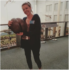
My favorite task at the museum however, was to be a part of the educational outreach programs. Last June I had the opportunity to speak with visitors about archaeology during the Carnegie’s “After Dark Program,” a monthly series where guests can come to the museum in the evening to explore, eat, drink, and hear lectures on various subjects. Another one of my favorite programs at the museum is “Artifact Identification Day.” This event gives visitors the opportunity to bring in their heirlooms and artifacts to have them identified by staff. It is always amazing, and sometimes humorous (see photo of me holding a Lodoicea) to help identify the items that people bring.

Holding a Lodoicea, or sea coconut, during Artifact I.D. Day. Lodoicea is the largest seed in the world! (And yes, it does look like a butt)


I have often thought of the Carnegie as being a museum of a museum. The Carnegie began acquiring artifacts and creating exhibits over a hundred years ago, and many of those early exhibits and artifacts are still on display. Working and volunteering at the museum gave me the opportunity to be a part of the team of people who were helping to conserve and protect these cherished items for future generations. To me, protecting artifacts and archaeological sites begins by showing people why they should care about them. For this reason, programs and institutions that promote stewardship of the past are incredibly important. History is made up of millions of stories. One of those stories is bound to pique the interest of someone! I’m very thankful for my time at the Carnegie, and I look forward to many more years of learning and visiting!

Photo of “Early Hall of Architecture” from: http://carnegiemuseums.org/about-us/our-history/

IUP DEPARTMENT OF ANTHROPOLOGY

“Me Too”: Taking a Stance Against Work-Place Harassment in Archaeology

By: Genevieve Everett

I’ve been thinking a lot about the “Me Too” movement and how women have been affected by work related harassment and assault within the field of Archaeology. As a woman coming to the end of my graduate studies, I am preparing for a future of working as a “field-based scientist”. I have been thinking about what it means to be a woman in the sciences, and the unpleasant experiences so many women have experienced and endured in the not so distant past. I obviously cannot speak for every individual that identifies as female, but I can say that the subject of work place harassment and assault has only recently been publicly addressed, and quantified in two well-known (within the field of Archaeology) surveys. The results of the surveys were provided by the Southeastern Archaeological Conference (SEAC) in “Preliminary Results of the SEAC Sexual Harassment Survey” (Meyers et al. 2015), and in the article, “Survey of Academic Field Experiences (SAFE): Trainees Report Harassment and Assault” (Clancy et al. 2014). While the SEAC survey is very important, and sheds light on improper work related harassment (when is it ever proper?) specific to archaeology, I am going to briefly discuss the SAFE survey.

It should be noted, not all respondents to the SAFE survey were Archaeologists, however, Archaeologists did account for 159 of the respondents (23%), out of a total of 666 total respondents (Clancy et al. 2014). The SAFE survey was distributed as a link through email and social media calling for field-based scientists, such as CRM professionals. Participants were asked to respond to a series of questions pertaining to age, gender, etc. And most importantly, questions related to sexual harassment and assault, whether personal or observed.

In terms of demographics, the results indicate that 77.5% of the respondents were women (Clancy et al. 2014). Likewise, various respondents provided varying sexual orientations and ethnicities, however, majority of respondents were heterosexual and white. Professionally, respondents included, students (grad/undergrad), professors (of all levels), researchers, and all others outside of the field of academia. Long story short, the survey indicated that women at the “Trainee” level of the employment ladder provided that they have experienced either harassment, assault, or both at higher rates than any other professional. For example, 84% of women at the trainee level indicated that they have experienced some sort of work related harassment, while women in “higher” positions experienced lower rates of harassment (Clancy et. al 2014). In the survey, most women indicated that the perpetrators were higher on the “professional hierarchy”, people in “power”.

If we look at trends of the “Me Too” movement, women around the country are coming out with allegations against men of “power”, individuals that control the purse strings. It might not seem like it, but what’s happening in Hollywood and politics is also happening in Archaeology (made clear in the SAFE survey), and it has been happening for a very long time. I’ve heard people say, “Why are women all of a suddenly speaking out?” They’re not “suddenly” speaking out, many women have come forward, but we haven’t heard about it, because the individuals that are, are either not famous enough or they have been ordered under legal agreements to keep silent about the case. I think it’s great that the systemic problem of work place harassment and assault are being addressed in our field, but more needs to be done. I’d be very curious to see the results of a similar survey now, in 2018, when women are banding together to support one another and speak out. I’d like to see responses to how men and women would like to see and contribute to a safe working environment. How can this be achieved? I completely agree with Clancy and her colleagues that the only way to improve the unwanted and uncomfortable situations in the field is, “raising awareness of the presence of hostile work behaviors, discrimination, harassment, and assault (particularly women); creating guidelines for respectful behavior; and adopting independent reporting and enforcement mechanisms” (Clancy et al. 2014). The only way forward is to re-educate professionals, for BOTH men and women at all levels of the profession to take a hard stance against work place assault and harassment, and support those that still fall victim to these experiences.

IUP DEPARTMENT OF ANTHROPOLOGY

Drowning in Dirty Dishes: My Thesis Research At Pandenarium

By: Samantha Taylor

Upon enrolling in graduate school, I had a pretty clear understanding of what aspects of archaeology interested me the most: the African Diaspora and historic ceramics. I never imagined that I would actually be able to pull those two interests together into a thesis topic, but here I am over a year later, waist-deep in artifacts from my thesis site.

The Half-Cellar Foundation at the John and Rosie Allen Residence

My thesis research is on Pandenarium, an antebellum (pre-Civil War) African American diaspora site in northwestern Pennsylvania. In its prime, Pandenarium was home to dozens of ex-slaves who had been freed by their owner, Virginia physician Charles Everett, upon his death. Along with freeing his former slaves, Everett’s will also funded the creation of a modest-sized settlement in Mercer County, Pennsylvania. The freed people of Pandenarium arrived to the settlement in the fall of 1854 to find 24 furnished houses that were built by the local abolitionists. Rosie Allen, a first generation occupant of Pandenarium, was quoted saying that the settlement was “just like heaven.” Despite the economic pull of nearby cities such as Sharon, New Castle, and Mercer, Pandenarium was inhabited until the 1930s.

Excavating Test Unit 2 during the first day of the Public Archaeology Event

My research focuses specifically on a single household at Pandenarium belonging to John and Rosie Allen, the original inhabitants and first-generation freed slaves at the site. In particular, I want to compare the ceramics found around the Allen’s half-cellar foundation to those recovered from a nearby (the Old Economy Village), another antebellum freed African American site (Timbuctoo, New Jersey), and a Virginia plantation that neighbored Everett’s (Monticello, Virginia). The comparative analysis focuses on structures at each of these sites that date approximately to the same time period that Pandenarium was inhabited. By conducting this analysis I hope to determine what types of ceramics the Allen’s were using, how they were using them, and in what ways they were participating in the local and regional economy.

After nearly four months of deliberation and planning with my thesis committee, my thesis fieldwork began on July 14th 2017 and was completed September 17th  2017. Of course there was a month-long break in between those dates in which no fieldwork occurred and my hands (and brain?) were bleeding from all of the washing and cataloging I was doing. Fieldwork consisted of a total of 28 shovel tests around the half-cellar foundation, and two judgmental 1-meter by 1-meter test units.

Both professionals and the interested public were involved in the weekends activities

In order to accomplish this I enlisted the help of my committee, fellow graduate students, and the public. The first weekend of fieldwork went without problem. I was assisted by my amazing mentor, Casey Campetti, and was able to clear the land, lay out my STP grid, and even finish digging the first three STPs. However the next three weekends were riddled with bad weather and poor field conditions, causing me to cancel a total of four days of field work. By the first week of August, 25 of my STPs were completed but we were unable to begin the two test units. Angela Jaillet-Wentling, one of my committee members and the only other person to conduct archaeological research at Pandenarium, and I were able to organize a public archaeology weekend at the site in order to introduce the site to the public and finish up my fieldwork.

Pandenarium’s inaugural Public Archaeology Event occurred on September 16th and 17th. The invitation was extended to the local Society for Pennsylvania Archaeology chapter, graduate students and anthropology professors at IUP, retired veterans, a reporter from a local newspaper, and interested members of the local government. A total of 19 individuals attended the public event, 8 of which participated both days. The event consisted of a site tour, a quick informative speech about the site, the excavation of two test units and three STPs, along with a lunch generously provided by the Jaillet-Wentling clan. The event was also featured on the front page of the Record Argus Newspaper on September 24th, 2017. Overall, feedback from the Public Archaeology Event at Pandenarium was positive and most attendants were interested in attending future public archaeol

A small sample of some of the unique artifacts found at Pandenarium

ogy events. Angie and I hope to assist in hosting more public archaeology events at Pandenarium in the future, as the site is a rare glimpse into a marginalized past.

Following Pandenarium’s Public Archaeology Event, my fieldwork was completed and I have been in cataloging hell. I’m being dramatic, I actually really enjoy cataloging, researching, and analyzing everything that has been unearthed at Pandenarium. To date, I have cataloged and washed 3,226 artifacts from Pandenarium. Also, I currently have a really awesome undergraduate student assisting me with washing! So far this whole “thesis” thing has been a really insane, stressful, and educational experience. I feel as though I’ve really grown as an archaeologist and a person. My future goals for this site are the following: to get Pandenarium listed on the National Register, to track down descendants and get them more involved in archaeology and research at the site, and to hopefully inspire someone *cough* Dr. Ford *cough* to start an undergraduate field school at the site.

In the meantime, if you have questions shoot me an email (TJKW@iup.edu) and keep yourself updated on my research by following the hashtag #Pandenarium2017.

Pandenarium Public Archaeology Day 2017 Article

IUP ANTHROPOLOGY DEPARTMENT

Munsungun and Moose

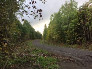
Logging road

By: Genevieve Everett

At the beginning of September, one week into the second year of my graduate studies I packed my car and headed up to Maine to help friends of mine that had received grants to excavate near a quarry site for nine days. I’ve spent countless hours in cars on road trips up and down the east coast; so spending half a day at the drivers seat is very familiar to me. All I require is good music or talk radio and a leg stretch every now and again. Amanda Telep, a recent IUP undergraduate came along for the adventure.

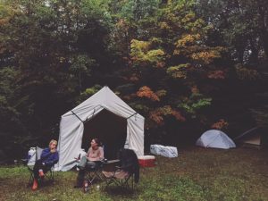
Home Sweet Camp

On our first day we met up with Heather Rockwell and Nathaniel Kitchel and the rest of the crew. Nathaniel and Heather both received their PhDs from the University of Wyoming, however, they have focused much of their research in New England. Before we arrived at our campsite, we had to drive close to 55 miles on bumpy narrow logging roads. To give you an idea of how remote this area was, when Amanda and I were leaving to cross from the United States into Canada, the boarder officer asked, “Are you lost?” We arrived at our campsite at dusk just as the rain began, and yes, the rain stayed with us for most of the trip. I kept joking that I had “water front property”, because a huge puddle had formed just outside my tent. After setting up, we all huddled inside of the canvas tent to eat salsa mixed with mac and cheese, which can only be described as hot gooey deliciousness. We used the canvas tent as our meeting place every morning and evening for meals. The area we were in is pretty remote; so all provisions were brought in with the hope that nothing was left behind.

Okay, so onto the archaeology, and why we were there…

Amanda, Heather and Lara workin hard!

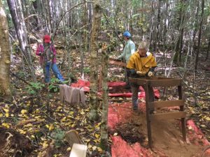
Every morning we drove into the site looking out for the giant logging trucks that seem to creep up on you out of nowhere. On our first official day in the field, Nathaniel and Heather gave us a tour of the quarry and the area where Heather was focusing her research. So far, the site(s) have a prehistoric component, however no temporal determination has been made. Several transects were laid out to cover Heather’s area of interest (eventually each STP was plotted with a GPS). Shovel testing made it possible for Heather to begin determining where concentrations of artifacts were being recovered, and finding the boundary (based on sterile shovel tests). We were finding hundreds of flakes every day, especially in the tree throw that took almost an entire day to excavate!

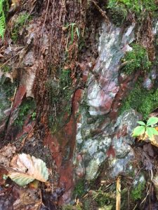
Some of the Munsungun at the outcrop peaking through moss

On one of the last days I had an opportunity to go up to the quarry site where Nathaniel was excavating a 1 meter x 1 meter test unit at the base of the quarry outcrop. This outcrop is a Munsungun chert source, a raw material utilized by prehistoric peoples to make stone tools. Interestingly enough, Munsungun chert is found in the form of lithics and lithic debitage at many Paleoindian sites in the White Mountains of New Hampshire, hundreds of miles away. By the time I got up to the quarry site Nathaniel and Tom (another volunteer) had excavated roughly 30 cm through natural shatter and cultural debris (flakes, etc). It was almost overwhelming how much cultural material was present at the quarry. There was a peaceful eeriness about this area, broken up by the chatter of angry red squirrels from time to time.

Counting flakes at the end of the day…on a plate.

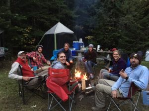
A couple of our afternoons were spent driving to and from (a total of about 45 miles) what we dubbed “Cell Phone Mountain” to check email and make phone calls, because there is zero cell service out there. I have to admit, it was really nice being disconnected from the world for a few days. The view from on top of “Cell Phone Mountain” was phenomenal, especially since fall starts early up there, so we had a chance to see some really gorgeous fall foliage. Every night we took turns making dinner and cleaning up. On those evenings when it wasn’t raining we sat around a fire admiring the night sky unobstructed by light pollution. We also managed to make a considerable dent in the beer that we all brought along with us, because archaeologists “work hard, play harder”. Honestly, we were in bed most nights before 10 pm, because we were up every morning at 6:30 am. So yeah, not much in the way of partying.

The entire crew minus Tom and myself

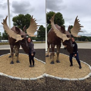
All in all, this trip was an incredible professional and educational experience. I got to meet new colleagues that I hope I will have a chance to work with one day. I was also offered invaluable advice about starting/finishing my thesis. If I was forced to say one bad thing to say about this trip, it would be that we didn’t see a living/breathing moose, only a reproduction of one at the Kennebunk rest stop. Maybe next time!


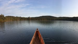
Canoeing on one of the last days in the pond behind camp

Gettin fancy in our field clothes

Our only moose sighting

Test unit next to the outcrop

In the bushes to get out of the way of a logging truck!


IUP ANTHROPOLOGY DEPARTMENT


A Trip to Philly for a Look at the CRM Industry

By: Patrick McGinley

23rd Annual ACRA Conference

Hello, my name is Patrick McGinley, and I am a second-year grad student in the Applied Archaeology M.A. program. The weekend of Friday September 8th, I travelled to Philadelphia, PA, with Dr. William Chadwick and four other second-year grad students from the CRM II class being taught this Fall to attend the 23rd annual American Cultural Resources Association (ACRA) conference. ACRA is a national trade association for firms working in the Cultural Resource Management (CRM) industry, of which IUP is a member through its Archaeological Services. We left Thursday the 7th to stay in Philly overnight so that we could attend the first sessions early Friday morning. The conference had a total of 10 sessions over two days, and we had time to do some sightseeing as well.

The sessions covered a wide variety of topics, from political issues, to tax credit programs for historical preservation, to climate change’s effects on the industry, to the I-95 Philadelphia Project. On Saturday, “Student Day,” there was a special meet-and-greet session and a question-and-answer session with a panel which had several decades of experience in the CRM industry between them. One of the most interesting sessions for me personally was regarding the future of CRM in the Trump administration, which discussed what President Trump’s actions to this point suggest about his attitude toward regulation reform, environmental policy, and infrastructure development. The sessions that were specifically designed for students were valuable and definitely one of the highligh

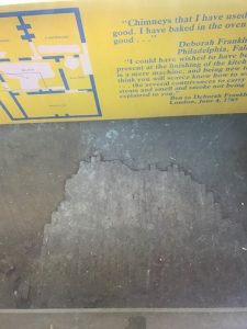
The brick flooring from Benjamin Franklin’s cellar kitchen

ts of the weekend. The meet-and-greet allowed us to connect with many of the attendees of the conference, all of whom are actively employed in the industry all over the country. I even got to talk briefly with the president of ACRA, Duane Peter. The Q&A featured five panelists, including IUP’s own Dr. Chadwick, who discussed how to prepare for and get a job in this industry and gave tips for being successful in it.

During our lunch breaks and in the evenings after the last session had ended, we had time to explore the heart of Philadelphia and eat some great food. The conference was located along Rittenhouse Square, so we were already in Center City. In addition to all the nice places to eat, we were able to see Independence Hall, the Liberty Bell, the Benjamin Franklin Museum, and more.

Ultimately, I think this was a valuable experience for my classmates and I for several reasons. It is important to go to these types of conferences as a student in order to get a glimpse of what the professional world looks like. The professionals attending these conferences are very knowledgeable about archaeology, CRM, and a whole host of other topics pertaining to our field. Also, it is crucial to make connections with these people and to get to know them, because they will be our future peers, if not future employers. Lastly, I think attending the ACRA conference in particular was important for us because it gave us an opportunity to hear about the “business side” of CRM and archaeology. Moreover, it has made me more aware of what the industry is like and the larger world in which it operates. As we heard from the speakers, the importance of associations like ACRA has increased in recent years to ensure that cultural resource and heritage protection laws are strengthened and updated as the CRM industry continues to grow into the 21st century.

The grad students enjoying the conference and Philadelphia!


IUP Anthropology Department


Reflections On A Summer At Historic Hanna’s Town

By: Heather MacIsaac and Kristina Gaugler, Field School Supervisors

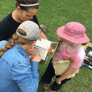
Heather works with Karlena and Marina to identify soil colors with a Munsell book. (Photo credit: Dr. Ben Ford).

Between July 18th and August 18th, I had the privilege of training and working with eleven IUP students at Hanna’s Town. Most of these students had no prior experience with excavation, arriving on the first day armed with sunblock, lunches, and a willingness to learn as much about fieldwork as they could.

Close-up of a 20th century ring. (Photo credit: Heather MacIsaac)

Under guidance from Dr. Ben Ford and Dr. Bill Chadwick, the students set up six excavation units. The professors selected the areas for units based on the preliminary results of a geophysical survey conducted by graduate student David Breitkreutz. Geophysics benefits archaeologists by highlighting things below ground which may be the remnants of former human activity – houses, roads, fireplaces, burials – but is not precise enough to reveal exactly what lies under the surface. Field school students excavated in areas where Breitkreutz’s survey results pointed to buried circular patterns and a long, thick stripe that cut across the empty field near the reconstructed Hanna’s Town Fort. Were these subterranean shapes colonial era hearths or Native American round houses, and could the stripe be the original Forbes Road, the main street of the Hanna’s Town settlement? Only excavation could answer those questions.

My own first experience with digging took place during my sophomore year of undergrad at the site of a 19th century observatory in Wisconsin. As luck would have it, the first few weeks of digging produced nothing but rocks, but at some point the rocks appeared less and less in the excavation unit and were replaced by broken lab equipment, early lightbulbs, and even pieces of neon-painted pottery from when the observatory turned into a hip young poets’ club in the 1960s before the building was demolished. As I worked with students this summer, I found myself envious from time to time of the quality of the equipment available to them: canopies for shade, rain-proof field journals, binders for paperwork, and a fully working digital total station!

It was incredible watching the students gain confidence in their abilities, to see them face and overcome challenges each day, and to take ownership of their work and knowledge when visited by the public, tour guides, county reps, and other professors. While things didn’t always go as planned (i.e. flooded units or runaway notes), everyone had a good time at field school. Excavation uncovered the remains of wagon ruts and campfires, part of a large but yet unidentified stone structure, and a possible storage space for a prehistoric Native American house, all things which will prompt future research and a continued interest among students and visitors alike in Pennsylvania’s history.

-Heather

Working hard or hardly working? Kristina decided to spend break exploring reconstructed cabins at Hanna’s Town. (Photo credit: Heather MacIsaac)

On July 12th, 2017 I visited Hanna’s Town prior to the start of fieldwork to help get the site ready in preparation for their arrival. Coincidentally, almost exactly two hundred and thirty-five years earlier from that day, on July 13th, 1782, Hanna’s Town was attacked and burned to the ground by a force of Seneca and British soldiers. Fortunately, this ominous coincidence was not foreshadowing of the peril to come. In fact, short of a few rain storms, our entire field season was quite pleasant.

Using the established Hanna’s Town site grid, we located the six test units we would be excavating. Ten of the eleven participating students were split into pairs and assigned to a test unit. The eleventh student, Brennan Winzer, also a graduate student at IUP, was actually doing his own field work in a separate area of the site, although he had help from a rotating set of our students daily. The units were laid out in 5ft x 5ft squares (at historic sites we typically don’t use the metric system!) and after discussing the finer points of excavation techniques, we began digging. It is important to note, that across the Hanna’s Town site there is a layer of soil disturbance due to years of plowing. Therefore, the artifacts that come out of these upper most levels are likely not in situ. Indeed, all

A view of a stone feature that extended into the next unit. It is unknown if it is part of a historic or prehistoric structure. (Photo credit: Heather MacIsaac)

of the test units that I was personally responsible for supervising had large visible plow scars and/or mixed top soils, and the features we encountered were primarily located at the interface between the plow zone and the subsoil, the tops of them likely removed by plowing.

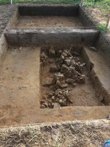
Throughout our excavations, there were some particularly interesting features, and a few of them would definitely benefit from further study. There was a semicircular ring of post molds in a test unit west of the reconstructed fort. Although no artifacts were associated with this feature, it’s appearance suggested that it could possibly represents the border of a Native American structure, probably prior to the Hanna’s Town occupation.  In our trench unit, there appeared to be a wagon rut, in what we hope was the remnant of a long searched for road. A few interesting artifacts were discovered near this feature, including what seemed to be a two tined fork. My favorite feature at the site was located within two adjacent units. A large pile of burnt rocks, showing visible heat induced cracks, reddening and spalls, were lying in what appeared to be two straight(ish) interconnected lines. It is still unclear what this feature is, in part because we found no artifacts in association with it.

In 2009 I completed my own first field school at Kincaid Mounds in Illinois. A few years later, while working as a field and lab technician, I would often muse over the things that I wished I could share, or advice I would give, to students who were planning on entering this field. Fast forward to me supervising this field school, and I am so glad that I had the opportunity to get to do just that. It was great sharing my experience with students new to field work. They say that teaching is sometimes the best way to learn. I definitely felt that together, we all became better archaeologists, and at the same time learned more about the history of a very interesting site in western Pennsylvania.

-Kristina

First Day vs. Last Day: Everyone gradually accepted that they would become walking dirt clods. (Photo credit: Dr. Bill Chadwick and Dr. Sarah Neusius)

IUP Anthropology Department

My summer as a PHAST intern

By: Genevieve Everett

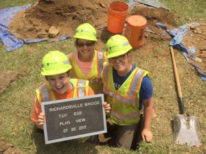
PHAST 2017 Crew (from left to right: Sami, Zaakiyah, Gen)

This is going to sound real cliché, but time flies when you’re having fun! That’s exactly how I feel about this past summer as a PennDOT Highway Archaeological Survey Team (PHAST) intern. Last day of Spring 2017 classes was Friday May 12th, so my parents came to visit me in Pittsburgh that weekend as a celebration for finishing my first year of graduate school. The following Monday, May 15th was our first day of work. Yes, not much of a break, but that’s being in grad school! Our first week was basically orientation where Joe Baker, the PHAST Supervisor told us that if we weren’t feeling lost during our first few weeks of work there was something wrong with us. Well, speaking for myself, I was definitely feeling a bit lost and rusty in the digging shovel test pit department since it had been quite some time, but after a couple of weeks of doing it day after day I was becoming more confident in my work.

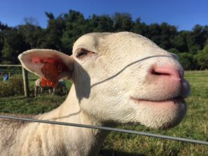
A friendly little sheep at one of our projects

We were immersed in CRM life: living out of a suitcase, staying in hotels, and eating out for every meal. Our projects took us to different counties all over the Common Wealth, which was probably one of my favorite aspects about this job. We saw parts of Pennsylvania that I would have otherwise skipped over on the way to other places. Pennsylvania is BEAUTIFUL! Most of the work we were doing was Phase I (bridge replacements/rehabilitation), however, we did do some Phase II work, several GPR surveys, metal detecting, cleaning/cataloging artifacts, mapping in ArcGIS, and writing reports.

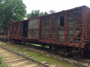
Old wooden boxcar at the Muddy Creek Forks project

One of my favorite projects this summer was a Phase I/II at historic Muddy Creek Forks Village in York County. We excavated around the railroad Section House built by the Maryland and Pennsylvania Railroad in the early 20th century for the Section Gang. The Section Gang maintained 10 miles of track year round, storing their track car and tools in the Section House. The Ma & Pa Railroad was an important part of industrial life in early-mid 20th century, making it easier for individuals to travel between York and Baltimore and to ship/receive goods. The Section House is an important resource for understanding what early-mid 20th century life may have been like for railroad workers. Eventually, the Section House will be raised onto a new foundation, and rehabilitated for future generations to enjoy along the walking path at the Ma & Pa Railroad Historic Village. Seriously, if you’re ever in the area, visit this site.

All in all, it has been an incredible and educational summer. As much as I love being out in the field I am definitely ready to start back up with classes and work on my thesis!

Visit the IUP Anthropology Department


My thesis fieldwork in Cyprus (by Sarah Henley)

This past May, I traveled to Cyprus to conduct my Masters thesis research. The purpose of my research is to use portable X-Ray Fluorescence (pXRF) analyze the elemental composition of Roman and Late Roman Period (30 B.C. to A.D. 614) Cypriot Red Slip ware (CRS) sherds, which basically provides a chemical “fingerprint” for sherds made from different clay sources.  My original goal was to compare my results to naturally-occurring clay bed samples in order to investigate their origin of manufacture, as well as regional trade patterns across Cyprus and parts of neighboring Turkey.

I traveled with Dr. Robert S. Moore from the IUP History department, and Dr. William R. Caraher from the University of North Dakota History department. We spent the first night in Larnaca, Cyprus, which is located in Larnaca Bay on the southeastern part of the island. Larnaca is a somewhat noisy city, with an oceanfront full of restaurants, an ancient fort at one end, and a marina on the other. There is also a beautiful church located down the road from the fort. Throughout the city there are various types of architecture, which gives the city character. As you make your way down small alleys you can find shops and more restaurants. The beach was also nice, but not as beautiful as other places I have seen in the Mediterranean.

The next day, we traveled to Polis, which is located on the western side of the island, and to give you an idea of the island’s size it took about 3 hours to get there from Larnaca. The inner terrain of Cyprus is beautiful with the Troodos Mountains, and the southwestern coast, which both reminded me of Greece. Polis was a nice small town, and much quieter then Larnaca.  The next 4 days we worked in a small, fairly dirty, basement where all the ceramic artifacts were curated. The first day I spent running tests with CRS body sherds to figure out how to go about collecting my data. I had not anticipated for each ceramic sherd to have concretion, which are limestone deposits that accumulate on artifacts that have been in the ground for long periods of time. Concretion can only be completely removed by acid, which takes a great amount of time to remove.  The next 3 days I spent collecting my data. I tried to test areas on each sherd that had the least amount of concretion.  On May 20th we returned to Larnaca. The last 4 days we worked in a warehouse, which was cleaner then the curation building in Polis. The sherds were in bags, which were in crates that were marked by excavation unit(s). Dr. Moore had e-mailed me a list of the CRS sherds, and I pulled them from the crates, and bags. Fortunately, these sherds had less concretion on them because they were surface finds.

XRF unit (left) and example of concretion on an CRS sherd (right)

A professor from Messiah College’s history department, Dr. David K. Pettegrew, an associate of Dr. Moore and Dr. Caraher’s, brought a group of undergraduate students to Cyprus. On my last day I had the opportunity to talk to the students about pXRF and my thesis. While in Cyprus Dr. Moore showed me the sites in which the sherds I tested came from. In Polis the sherds were excavated from the porch of a Christian basilica dating to the 6th/7th century A.D. In Larnaca the sherds were collected from a Roman Period site that used to be a major southern port town.  Overall, I had a  good experience; the only down side was I was not able to collect clay bed samples as originally planned. Later in June I will be meeting with the Applied Research Lab people at IUP, who will help me to statistically statistically analyze my data.

IUP Department of Anthropology