By Ross Owen
Metarhyolite is a metamorphic rock which occurs naturally on the South Mountain, near the Pennsylvania-Maryland border. For as long as 10,000 years, metarhyolite has been quarried from pits dug into bedrock, and then shaped into blades and projectile points. Between 5,000 to 2,700 years ago, the frequency of metarhyolite artifacts and the distances they are found at increased substantially (from the Chesapeake Bay to Western PA and Southern NY). The reasons for this are not well known.
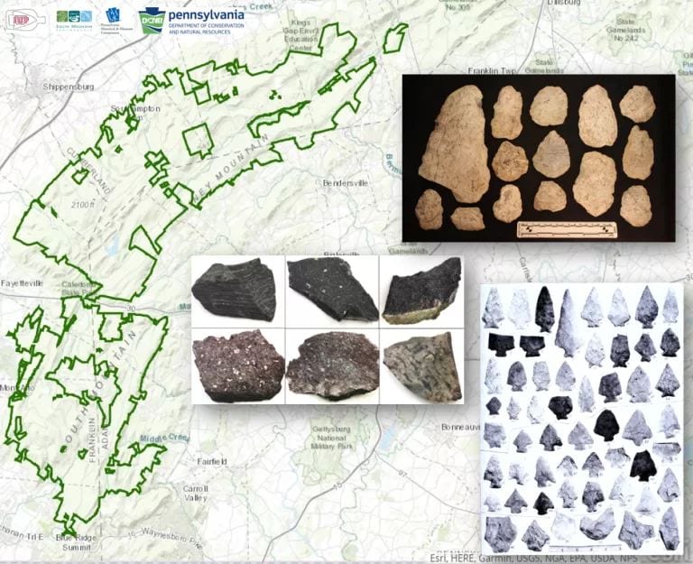
Michaux State Forest boundary in background. Representative photographs of metarhyolite artifacts and natural samples in foreground.
Michaux State Forest in Pennsylvania currently includes much of the area that was quarried for metarhyolite stone-tool production. Evidence of quarrying can be seen on the forest floor – pits in the bedrock typically surrounded by the chipped stone debris left as evidence of past people splitting boulders into manageable sizes to transport out of the mountains and into the neighboring valleys to the East and West.
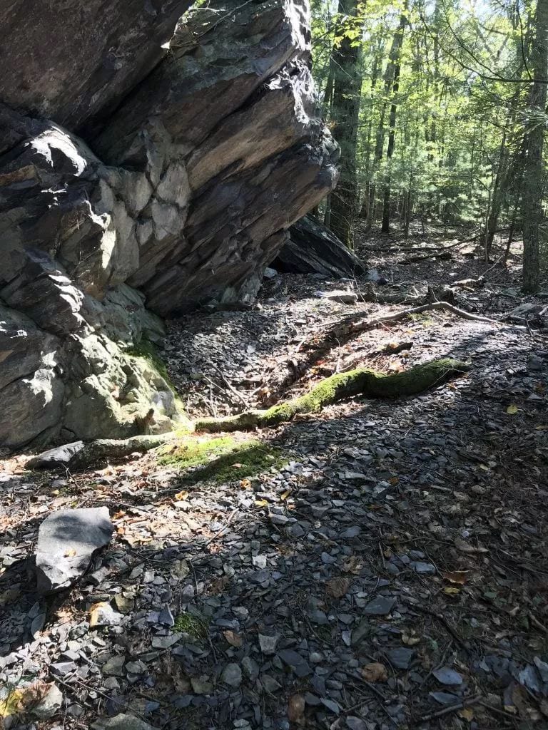
Chipped stone debris at base of metarhyolite outcrop. The pit in the center is from looters illegally taking artifacts from the site.
My thesis aims to incorporate our current understanding of the prehistoric quarrying in Michaux State Forest into the forest’s management plans and policies. Ongoing research of the quarries is only possible if they are preserved for future generations, and without a clear framework for managing the quarries along with the other resources that the forest manages, their preservation is in jeopardy.
“You can’t plan for what you don’t know you have.”
Roy Brubaker, District Forester, Michaux State Forest
This quote sums up frustrations accompanying the management of archaeological resources at any scale quite well. Before management strategies can be developed, inventory and context are needed. In this case a variety of methods were used to collect information about the prehistoric archaeological resources in Michaux State Forest. A field survey coupled with Geographic Information System (GIS) development and analysis studied the distribution of prehistoric quarries throughout the forest. Geochemical analysis using portable-X-Ray Fluorescence (pXRF) and petrographic microscopy was used to describe the variable chemical and mineral composition of metarhyolite outcrops in Pennsylvania, Maryland, and in artifact collections found at archaeological sites around the region.
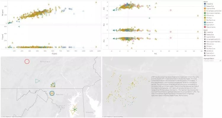
The dashboard above display figures depicting the raw reading taken by the pXRF device for specific elements, as well as the results of Principle Component Analysis used to identify elemental factors contributing to the pXRF results. The maps correspond to the locations of the sample groups used in this study.
The results of this study have led to the development of management practices for the prehistoric quarries in Michaux State Forest, which will be presented to the Department of Conservation and Natural Resources, as well as the State Historic Preservation Office. There is ongoing consultation between the agencies, the research team, and the South Mountain Partnership which helped to fund the study. The project uses inter-agency collaboration and inter-disciplinary research to improve our understanding of the prehistoric quarries in South Mountain and help state agencies manage them more efficiently and effectively.