By Danielle Kiesow
This summer I’m the archaeology intern at the Grand Portage National Monument in the most northern tip of Minnesota along the shores of Lake Superior and it’s been a great experience! Grand Portage National Monument is unique in that it’s located within the Grand Portage Reservation (home of the Grand Portage Band of the Lake Superior Chippewa, Minnesota Chippewa Tribe, also known as the Ojibwe or Anishinaabe) so I have the chance to work alongside the locals and together we can learn more about their past.
I’m accompanied by the Chief of Resources at the Park, Bill Clayton, and Jammi Ladwig, a PhD candidate at the University of Minnesota. We’re doing a lot of different things during my summer here including monitoring sites for any looting, helping out with some excavations at Isle Royale National Park just a few miles away in Lake Superior, participating in cultural resource management (CRM) work, archival research, working on my thesis, and even chainsaw training. Definitely the most challenging part of my internship is finding time to do everything!
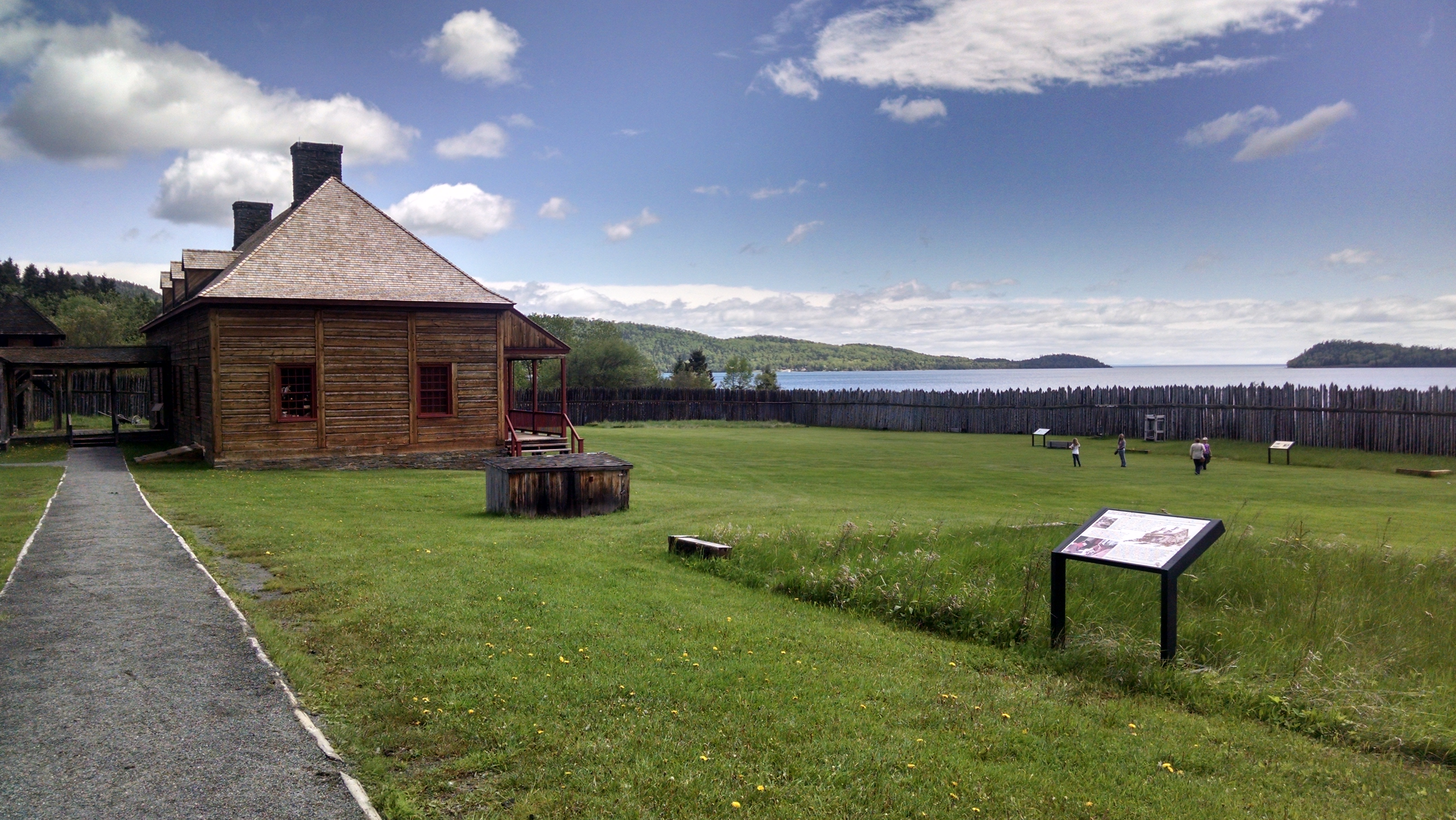
The reconstructed Great Hall in the North West Company Depot overlooking Lake Superior.
Grand Portage is known for its importance in the fur trade, and in fact it’s named after the 8.3-mile portage from Lake Superior to the Pigeon River that divides Minnesota from Ontario. Through previous archaeology from the 1930s and into the 1970s, Grand Portage National Monument has been able to reconstruct the stockade and some of the buildings of the North West Company’s depot that existed from 1731-1803.
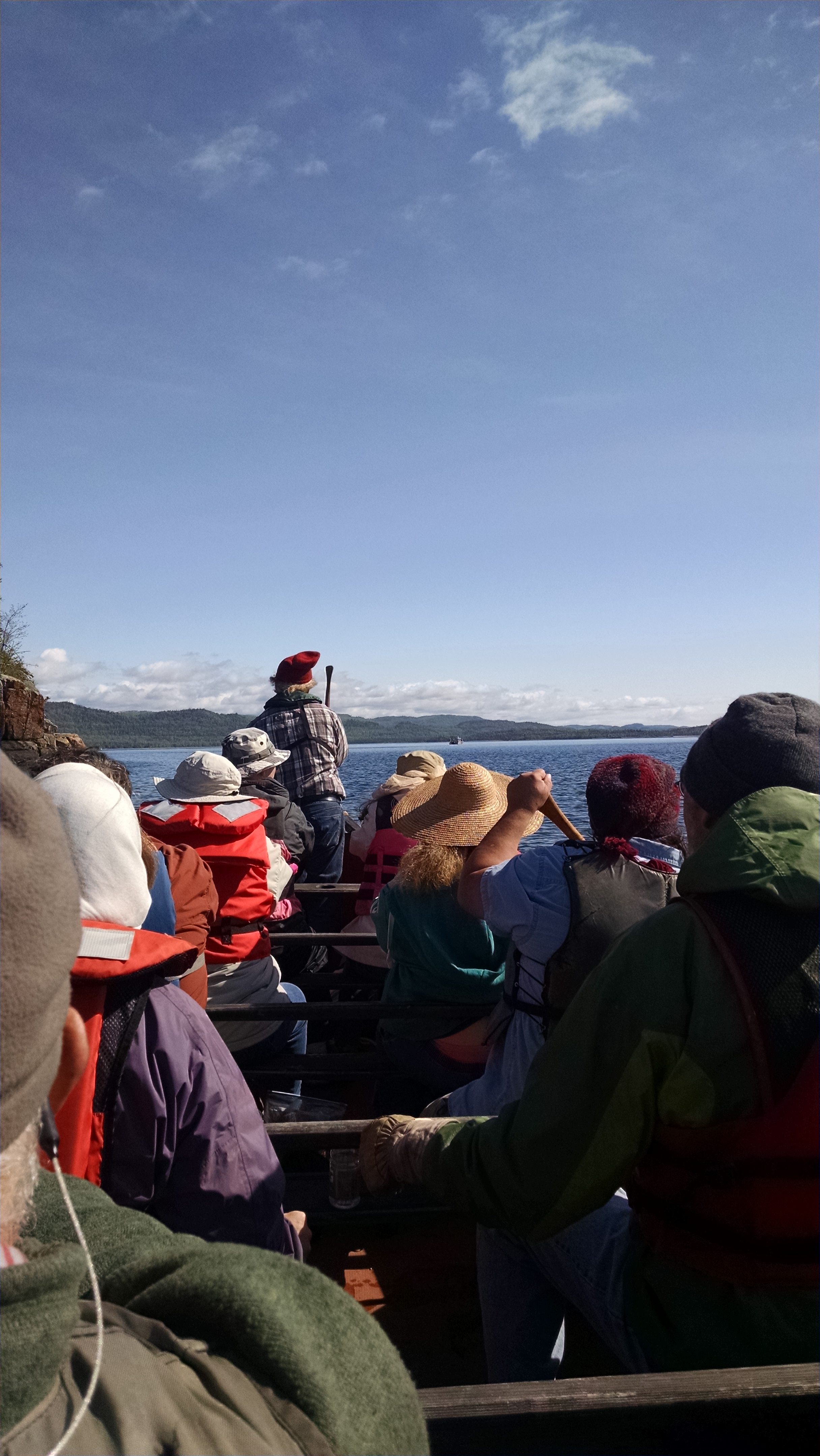
What better way to learn a little bit about the lives of the voyageurs than paddling in a replica Montreal canoe?
Even though the fur trade is the focus of the park here, my thesis work is all about what happened after the fur trade: when the English packed up their things (including a few of the buildings) and moved across the newly designated border to establish Fort William (today Thunder Bay, Ontario). The Hungry Years, as they’re still called by the descendants on the reservation, followed the end of the fur trade and lasted into the beginning of the reservation era, when the U.S. government wrote the Treaty of 1854 that established the Grand Portage Reservation. My thesis is looking at the land use and gardening or farming practices on the reservation from 1854 until 1930 to analyze the relationship between the Ojibwe at Grand Portage and the Indian Agents from the Bureau of Indian Affairs (BIA). This time period has, until recently, been largely ignored by the National Monument and much of the descendent community that can remember what life was like during this period have passed. It’s important for all of us – the National Park Service, the descendent community, and everyone else – to understand the suffering that resulted out of racism and to celebrate the strength and perseverance of the Grand Portage Ojibwe. Knowing that my thesis is one of the first research projects about the Ojibwe perspective during the transition into living on the reservation is definitely the best part of my internship.
I have been conducting research at the Minnesota History Center in St. Paul and the National Archives in Chicago for more background into the BIA-Grand Portage relations before I excavate the yard of a former BIA building in August. The most important thing I’ve learned during my research is the resiliency and resourcefulness of the Grand Portage Ojibwe throughout the years. Instances like creating tolls and selling items along the Grand Portage to earn money from the voyageurs, petitioning the Indian Agency and making their voices heard during a time where Indian Agents called them the sons and daughters of the Commissioner of Indian Affairs (and treated them as such), and never leaving their land or their fishing economy even though they were without electricity until the 1950s and without plumbing until 1976.
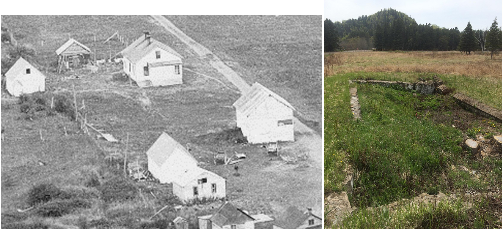
Before and after: a ca. 1920 photograph of the BIA building (top of the photo) with surrounding yard and outbuildings, looking northeast. The foundations of the building are seen in the next photo taken this summer, looking southwest.