Rocks and Roosters

By: John Rolf

Hey. What’s up? My name is John Rolf and I am a first year graduate student at IUP. As cliche as it sounds, I have wanted to be an archaeologist since I was a child. I used to devour anything I could related to foreign cultures, exotic locales, and action-adventure. Basically I was a huge fan of Indiana Jones and Dirk Pitt. However, with a subscription to Archaeology magazine, I learned early on that archaeology wasn’t all about fighting nazis and combing the desert for lost arks. Still that did not deter me from seeking a career in the field, rather it made me more fascinated by it.

rocks

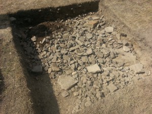
Rocks: the worst thing to dig through

I received my BA from WVU, go Mountaineers, in sociology and anthropology with a focus in anthropology. It was here that I worked closely with Doug Sahady as a teaching assistant for both the WVU 2013 Field School and Archaeology Lab the following semester. It was during the field school that I learned two very important things besides how to conduct an archaeological investigation; digging through a garden of rocks is not fun and roosters make wonderful companions at archaeological sites since they eat all the bugs you dig up. That fall, as monotonous as it was, I assisted in cataloguing over 7,000 artifacts that semester too. If you want to talk about fun, try sitting in a shed looking at rocks for hours on end picking out what are artifacts and what are not, and then developing a database for it all on top of it. During this time, I also assisted Carl Mauer, president of the Society for Pennsylvania Archaeology – Mon/Yough Chapter 3, at the Schriver Farm site near Garards Fort, PA. We never really found anything outside of small chert flakes at this site, but it did give me a ton of experience conducting site surveys, laying grids, and identifying artifacts.

john-rolf

Me in Colorado!

After my undergrad, I took a year off to think about what I wanted to do, and at the time Colorado seemed like a good idea. So I moved to Colorado Springs. It was a beautiful place and I would have loved to stay out west, but grad school started scratching the back of my brain. I was interested in pursuing a degree that focused on the applied aspects of Archaeology, and I wanted a program that let me implement technology into my investigations. Ever since I attended a seminar in my undergrad about a man who used magnetometers for geophysically surveying a field, I’ve wanted to get training to do that professionally, plus use it in archaeological investigations. After a few Google searches, I stumbled upon IUP. I filled out the application a few weeks later, took my GRE’s (which are the worst by the way), packed up and headed back across the country to Oakland, Maryland, aka my hometown, but not before I visited the beautiful town of McCall, Idaho where my wonderful girlfriend was attending school at the MOSS Program.

If you ask anyone in my graduate class, they will tell you how great grad school is, and it really is, but there is no way to express the amount of work involved in pursuing a masters degree in Archaeology. By the end of the semester I will have written enough words to fill a small novel (literally!). I wouldn’t change a thing though. This program has taught me so much this semester alone and I cannot wait to continue on my educational journey here at IUP.

Attending My First ESAF Conference!

By: Cheryl Frankum

1st

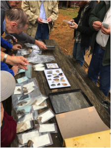
Looking at artifacts in the Snyder Complex

The conference experience for a typical graduate student can range from total exhilaration in meeting and connecting with new people and discovering new work being done to terrifying bouts of stage fright if you need to present. Luckily for myself and the crowd- I was not presenting, and I attended my first Eastern States Archaeological Federation (ESAF) conference solely as a care-free attendee! This allowed me the focus and ability to attend almost all of the conference, so please enjoy my synopsis of a wonderful meeting.

2nd

Snyder complex- Jen Rankin showing Paleo stratigraphy

ESAF offered an incredible fieldtrip on Thursday November 3, 2016 that visited two of the most notable Paleo-Indian sites in New Jersey: the Snyder Complex and the Plenge Site. The tour was well attended, and began with a caravan of our vehicles that arrived to the Snyder Farms location. Jen Rankin (Temple, AECOM) and Michael Stewart (Temple, NJHPO) took visitors through an imaginative journey of what the site would have looked like then and now. Their study has partly focused on examining and understanding the past Paleo environment along the Delaware River, and how this changed through time. Guests were treated to a special look at Jen’s current excavations and were offered a hands-on experience with the artifacts that were recovered from the site!

3rd

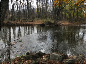
the Plenge Site- tributary to Delaware River

4th

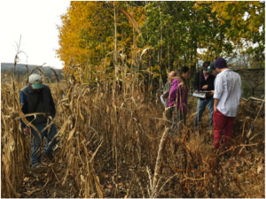
Plenge Site- everyone gathered to look at surface where most fluted points were found

The Plenge Site tour was led by Joe Gingerich, with a special visit from Leonard Ziegler (SPA) who has been instrumental in collecting and recording the site since its discovery in the early 1970s. The Plenge site is one of the most important Paleo sites as it has produced 226 fluted points to date. The tour consisted of your everyday corn fields along the riverfront, and what a view it was!

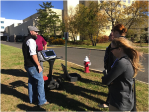
The Friday sessions I attended delved into Pennsylvania quarries and discussed where Native Americans were obtaining their toolstone. If you went to the SPA meeting this past spring- Friday was a repeat of that. A real treat was when Peter Leach from GSSI gave the IUP crew a special demonstration of the new GPR model SIR 4000! We all did some transects right there over concrete and disturbed areas, and of course he showed off the instruments new bells and whistles. Friday night was the Canadian-American Friendship party, and while I went with the intention of meeting Canadians, I actually met archaeologist from SUNY and UCONN! I did ask Kurt Carr where I could find some Canadians to introduce myself to, and he jokingly replied to find the people holding the green beer bottles!

Being that I have a great interest in Historical Archaeology, I was ready for the Saturday session that consisted of multiple presenters5th who worked on the I-95 project- Urban Archaeology in Historic Philadelphia! This was exceptionally entertaining for me as I am going to begin excavation on my first privy next week, and many of the AECOM presenters spoke about the privies excavated on this project, over 400!

I always try to make the very most of every conference, and ESAF was no exception. I was able to learn many new things, meet new people, and reconnect with the ones I admire! I would call this meeting a success, and encourage all of you to attend as many of these types of events as possible.

PCSS Conference

By: Genevieve Everett

This past weekend I drove out to Harrisburg for the 63rd annual Pennsylvania Council for Social Studies (PCSS) conference. The conference theme this year was “Creating Global Citizens Through Issues Focused Instruction”.

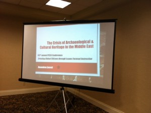
Part of my public archaeology assistantship is to go to this conference to present to social studies teachers from all over the state. My contribution to the conference was a presentation on “The Crisis in Archaeological and Cultural Heritage in the Middle East”. The first question I asked my audience, “have any of you taught arpcss-conferencechaeology in your classrooms?” was received with side-glances and heads awkwardly turning to look at their neighbor to see if they had taught the subject. I took that as a resounding, “NO”. From there I began to discuss cultural heritage destruction, and back that up with several case studies. I began with two based in the Middle East concerning the Giant Buddha’s of Bamiyan Province in Afghanistan and Palmyra in Syria. These are two examples of religiously motivated destruction of cultural resources and heritage, but I didn’t want my audience to think that this only happens in the Middle East. I wanted to drive home that the destruction of cultural resources and heritage is a global issue. Not all destruction is religiously motivated, we also see looting and selling of antiquities on the black market in economically depressed countries, and individuals that loo

giant-buddhas

Giant Buddha of Bamiyan

t sites for their own personal collections. I continued to explain context and its importance in archaeology. When artifacts and features are looted, broken or completely destroyed, they lose their meaning and interpretive value. I ended the discussion by talking about Sarah Parcak, the satellite archaeologist that is using satellite imagery to compare maps over time that show increased looting, especially in Egypt. Parcak hopes to use these maps to prevent further looting of sites worldwide. Did I mention she is my hero? To read more about her research follow the link below!

looting

Two satellite images depicting increased looting holes at a site in Egypt between 2009 and 2012

My main goal at this conference was to get these teachers interested (and excited) in incorporating archaeology into their curriculum by providing resources that they can use in their classroom. One such lesson plan called, “Trash Talk” has students examine modern trash the way that archaeologists look at trash pits to make inferences about the people that were using the objects, and how they were used. I even found a lesson plan pertaining to context, which I will provide a link to below. I had fantastic social studies and history teachers growing up, but I do not recall being taught archaeology at all. I hope that my presentation opened the eyes of some of these teachers, veterans and newbies to a new way of presenting the past to their students.

Links:

Sarah Parcak- National Geographic fellow and satellite archaeologist

Context exercise


International Archaeology Day in a few words…

By: Genevieve Everett

photo-2-3

Atlatl demo on the Oak Grove

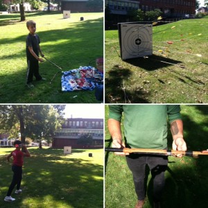
This past weekend in the midst of midterms and homecoming we held our International Archaeology Day event for the public. It was a beautiful, unseasonably warm fall day. Campus was abuzz with students and alumni headed to the game, and along the way they had a chance throw darts/spears with an atlatl, “a tool that uses leverage to achieve greater velocity in dart-throwing, and includes a bearing surface which allows the user to store energy during the throw”. It’s basically like throwing darts at the bar on steroids (kind of, sort of). It’s really fun, and gives you a perspective on the concentration and precision that must have gone into the use of this tool by early humans. Did I mention that it’s REALLY fun!?

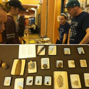
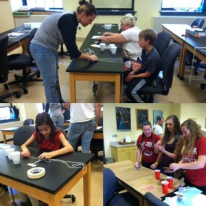
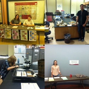
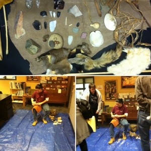
After a vigorous workout of throwing darts you could head into McElhaney Hall on the ground floor where undergraduate and graduate students were set up to teach you about everything from micro-artifacts to what a flotation/wet lab is. I won’t bore you with a description of everything, instead I will share photos of the days events, because that’s much more exciting! Before I do that, I hope that everyone that was able to attend had a fun and educational experience, and we look forward to seeing you next year!

photo-1

Prehistoric table and prehistoric artifacts


photo-1-4

Kids room making wampum and hand painting

photo-1-3

Historic archaeology, zooarch lab, micro-artifacts, and Zaakiyah handing out dirt cups!

photo-4

Flint knapping demo

photo-3-1

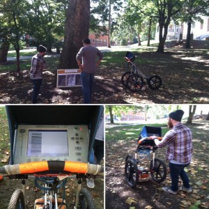
Chris giving a GPR demo on the Oak Grove.

Special thanks to: Susanna Haney for coming out and giving the flint knapping demo, Lori and Andy Majorsky & Margie and Frank for putting on the atlatl demo! LAST, BUT NOT LEAST: All of the students that participated in the event!!


Cited material:

https://en.wikipedia.org/wiki/Spear-thrower

I Can Munsell That Pt. 2

By: Genevieve Everett

Side note: THIS SATURDAY, OCTOBER 15th from 12-3pm  at McElhaney Hall on the Ground Floor is our INTERNATIONAL ARCHAEOLOGY DAY event! Come one, come all!

What’s Halloween without candy? I remember having the occasional box of raisins or
bag of pretzels thrown in my pillow casecandy-corn, and for most children, this was unacceptable! When I think of Halloween candy, I think of CANDY CORN! For those that have never had the tiny morsel’s, they are pure sugar shaped into what you’re supposed to assume is little kernels of corn? Who knows? Whatever it is, I love it! Time to Munsell!

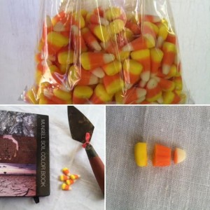
So, as you can see in the photograph, I ‘dissected’ the candy corn into three parts: white, orange and yellow. I pulled out the handy, dandy Munsell and put the white piece to the test, and guess what? There is a ‘WHITE’ section at the very back of the Munsell Color Book. I wanted to know what makes soil white, and this is what I found out, “Clear or white (soils), usually due to the presence of calcium and magnesium carbonates, gypsum or other more soluble salts”. Cool!  So, the white piece came out (to me) as 2.5Y9.5/1….WHITE! Next, I took the yellow piece of the candy corn and tested it against the several yellowish colors. Yellows in the Munsell vary from straight up yellow to varying hues of reddish yellows and brownish yellows. The closest I could come to this bright yellow candy was 2.5Y8/8…YELLOW! Last, but no least, the orange piece. First I want to point out thacandy-corn-munsellt the word orange does not show up in the Munsell Color Book ONCE. According to the Munsell color blog, “orange isn’t part of Munsell’s primary hue color. The color is represented in Munsell’s “intermediate hues”—the colors between two primary hues.  So the color orange is referred to as “yellow-red” (YR) because it is located between the primary hues, red and yellow”. This does not mean that orange doesn’t exist naturally in the natural world. SO, this led me to look at the reddish yellows. I went back and forth between 5YR and 7.5YR…and I decided the orange that is candy corn orange does not fit any of the Munsell colors. It’s its own unique combination of yellow 5 and red 3 dye!

To learn more about ‘hue, value, and chroma’, click the first link “Soil Color Never Lies”, below!

Cited material:

Soil color never lies

The Color Orange Touches Off a Testy Debate


I Can Munsell That

By: Genevieve Everett

munsell-book

I’ve decided to continue something that a previous poster started, and that is to Munsell something other than soil!

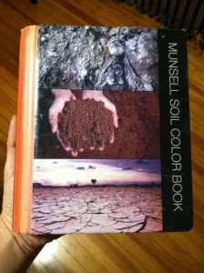
First, what is the Munsell color system? The Munsell color system was created by Dr. Albert H. Munsell (1858-1918), an accomplished artist and inventor. “Munsell’s work in developing a systematic approach to teaching and communicating was influential in evolving color science theory at the turn of the century.” We as archaeologists use the Munsell color system to describe soil colors in a profile. I won’t go too deep into this subject, because, well, I am not well versed in it (yet!), but if you want to learn more, I suggest taking the soils class when it is made available.

cat-munsell

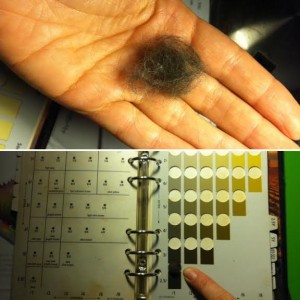
Now for the fun part! I’ve been thinking, about what to Munsell, and I came to a conclusion, a dangerous one…my vicious cat, Isabelle! I’ve decided that this entire series, at least for the month of October will be ‘Halloween’ themed, so, what better way to do that than with a black (or is she?!) cat. Isabelle decided to be extremely cooperative today with this photo shoot until I put a trowel near her body. Luckily cats shed, A WHOLE LOT, and I was able to find clumps of her hair on the floor.

In the field, you take a small piece of soil from the profile with your trowel, and pack it down so that you can place it under one of the many color chips in the book. NEVER TOUCH THE COLOR CHIP, because they will fade. It usually helps to either be in full sunlight or full shade, because I’m telling yocat-hair-munsellu, many soil colors look like various shades in the book. For example, there are three shades of ‘yellowish brown’ (10YR 5/4, 5/6, 5/8), all of which look pretty much the same, so do yourself a favor and make it a little easier on the eyes. In my case, I took the wadded up ball of fur, and tested it under various color chips. 5YR 2.5/1, black? No. 7.5YR 2.5/1? No. 2.5Y2.5/1, black? YES! Okay, this is not scientific by any means, but it looked the closest to me, and since no one else has tested a Munsell on cat fur before, I’m going to stick with this answer.

What ‘Halloween’ themed thing, blob or monster would you like to see put to the Munsell next week? Leave comments below!

I will leave you with a really cool website, Munsell.com. Check out their color blog! The link below was a project they did to describe the unique soil colors of several National Parks in the United States for the 100th anniversary of the National Park Service:

The Soil Colors of the National Parks

Quoted material:

Albert H. Munsell & The Munsell Color Theory


International Archaeology Day 2016

By: Genevieve Everett

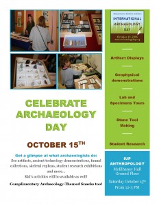
International Archaeology Day is upon us! Saturday, October 15th to be exact. Get excited!! Dr. Lara and I have been meeting weekly to discuss logistics, and reaching out to undergraduate and graduate students to get involved. Some of you have participated in the past, and for some of you it’s your first time. Our event will include Historic and Prehistoric archaeology, a GPR demo, flintknapping, Zooarch, a kids table, and much more!open-house-flyer-16-1

This is our chance to show the community what we know, and why archaeology is important, and connects us to the past. It is not only our duty to educate the community, but make it fun at the same time. If we just put a bunch of artifacts on a table and tell our guests what they are and where they came from, that isn’t interesting or fun. We as archaeologists know that they are interesting, but how can we make them come alive?

We can ask people to come to Archaeology Day, even bribe them with snacks, but we want them to walk away saying, “Wow, that was really cool! I want to get involved in my local archaeology chapter” or “I am changing majors tomorrow”. Most importantly, we want them to walk away thinking that archaeological sites are a valuable resource that should be protected. Now, I know that isn’t going to happen with everyone, but that is how we should think about this day. It’s an opportunity to show the public why we do what we do.

We look forward to seeing you all there!

The Bronze Age in Northern Vietnam

By: Francis Allard

allard-2

Bronze artifact from Hanoi

During the month of July, I spent one week in Hanoi (Vietnam) with a colleague who teaches at another university. Our objective was to meet with archaeologists at the Institute of Archaeology of Vietnam to discuss the establishment of a new project that focuses on the development of Bronze Age societies in northern Vietnam, from the earliest evidence of bronze metallurgy in that area (in about 1200 BCE) to the last centuries of the first millennium BCE (at which point large complex bronzes such as drums were being manufactured). Although I’ve worked mostly in southern China since the 1990s, I’ve also made multiple trips to northern Vietnam over the past 25 years. My interest in the archaeology of that area is in fact not surprising, since these two adjoining areas (southern China and northern Vietnam) share many cultural traits with one another.

allard-4

Dog with a 2,000 year old decorated brick (village near Hanoi, Vietnam)

While in Vietnam, my colleague and I also met with a number of archaeologists at universities and museums, visits which resulted in us gaining access to over 20 bronze artifacts or fragments dating to the period we’re interested in. As you can see in the photos, it’s possible (and sometimes preferable) to work with incomplete artifacts or even small fragments (as long as we know which type of artifact it came from). We were given permission to take these objects out of Vietnam and are planning to conduct XRF (X-ray fluorescence) analysis on them to determine their copper, tin and lead content, information that can then be used to understand how knowledge of metallurgy was transmitted among craft specialists and adapted to meet local conditions. Following the completion of the XRF analysis, our plan it to return to Vietnam to do the same with additional bronze objects and to discuss with our Vietnamese colleagues the future expansion of the project to include field activities.

Exploring the Late Prehistoric in Central Western Pennsylvania

By Sarah W. Neusius

More than a decade and a half ago, then Director of IUP Archaeological Services, Dr. Beverly Chiarulli, and I observed that Pennsylvania archaeologists sometimes referred to the area around Indiana as vacant during the last centuries of the Pre-Columbian period. The dominant cultural tradition archaeologists recognize for southwestern Pennsylvania after AD 1000 is the Monongahela tradition, and while there had been a lot of research on Monongahela sites in counties to our south and west, there wasn’t much known about the inhabitants of our immediate area. Thus it was fairly logical to assume that this was a cultural backwater or even vacant at this time. The tradition that our area was used only for hunting early in the Historic era also supported this idea.

However, based on work that Dr. Chiarulli had been doing with the Pennsylvania state site files and predictive modeling, she knew that there was a relatively large numbers of Late Prehistoric or Late Woodland village sites recorded – at least 30 apparent villages for the Conemaugh-Blacklick and Crooked Creek watersheds alone. This went against the assumption that this part of the state, which can be called central western Pennsylvania, was a sort of cultural backwater and even uninhabited after AD 1000. The problem obviously seemed to be that most of these sites had not received much professional attention; very little was known about them, and even less was included in the regional literature.
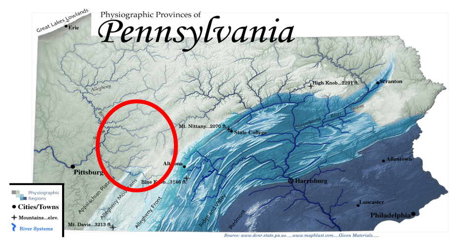
LPP area

Red circle outlines the approximate area of interest for the IUP Late Prehistoric.

The IUP Late Prehistoric Project or LPP, was initiated because of these observations, and it continues today because there is still a lot to learn. It only made sense for IUP archaeologists to explore these recorded sites. They are accessible, potentially well preserved, and likely to add significantly to Pennsylvania archaeology. Since approximately 2000, many IUP faculty and students have focused on learning more about sites in the Conemaugh-Blacklick, Crooked Creek, and Loyalhanna drainages of west-central Pennsylvania dating between approximately AD 1000 and 1600. We have employed field schools, student projects, and MA thesis research to learn about these sites. We also have been incorporating sites studied by IUP archaeologists during the 1970s and early 1980s as several of these are LPP villages that haven’t been thoroughly analyzed and written up. Occasionally the work of IUP Archaeological Services has dovetailed with these efforts as well. Dr. Chiarulli, myself, and Dr. Phil Neusius all have participated in excavations and analyses related to this project. With this summer’s field school at the Squirrel Hill site, Dr. Homsey-Messer and Dr. Chadwick also have become part of this initiative. Together, we are adding significantly to archaeological knowledge of the distribution of people during the Late Prehistoric. Some of our information has been shared through meetings presentations, Masters theses (available through the IUP website) and publications. However, there is a great deal more to be written about, and I am currently working hardest on this aspect of the project.

Before explaining a little bit more about the areas of research that have been pursued, I’d like to clarify the use of the term Late Prehistoric. You may have learned that Late Woodland is the name archaeologists use for the end of the Pre-Columbian times in places like Pennsylvania. In the southern Midwest and Southeast, Late Woodland follows the collapse of Middle Woodland Hopewellian societies by approximately AD 500. It continues in these areas until Missisisppian cultural developments are evident between AD 800 and 1000, when archaeologists designate a Mississippian period continuing until Historic times. Elsewhere evidence of Mississippian tradition societies has not been found by archaeologists, and in the Upper Midwest the Late Woodland often is not seen as ending until European Contact. The situation on the eastern edges of the MIdwest, is a little more complicated. Some archaeological traditions including the Fort Ancient tradition, found mostly in Ohio and West Virginia, and the Monongahela tradition, found mostly in Pennsylvania and West Virginia, often have been designated as Late Prehistoric because of the similarities in dating, presumed interactions with Mississippian societies, and similar material culture (e.g. shell-tempererd pottery and communities with central plazas). Thus, it has been more common to call Monongahela tradition sites Late Prehistoric than Late Woodland. Because central Western Pennsylvania encompasses the northern edges of the Monongahela area and some of our sites can be considered Monongahela, we use the term Late Prehistoric rather than Late Woodland for our project.

One of the highlights of the LPP is the development of an extensive catalogue of radiocarbon dates for the sites in our area. When we began this project in 2000, there were not any radiocarbon dates for the LPP sites and villages. Now there are approximately 85 dates some of which are standard radiometric dates, but the majority of which are AMS dates. These latter Accelerator Mass Spectrometry dates now are the preferred radiocarbon dating method because they require less carbonized materials – as little as 20 mg as opposed to the 10 grams required for wood charcoal by standard radiometric dating methods. This means less material is destroyed in the dating process. Another advantage of AMS dating is that the dates often are more precise; they usually have date ranges within 50 years plus or minus from the mean. In any case in just over a decade and half we have greatly increased our ability to understand the chronology of the Late Prehistoric in our area. Most importantly we have been able to show that occupation of these watersheds spans the entire Late Prehistoric as shown in this chart of some of the dates we have obtained for Conemaugh-Blacklick Watershed sites. Note the AD years from AD 100 to almost AD 1800 in calibrated years across the bottom of the chart. These dates certainly span the Late
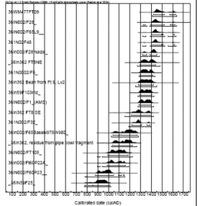
conemaugh dates pic

Radiocarbon date ranges for some Conemaugh-Blacklick watershed sites.

Prehistoric period from AD 1000-AD 1600. Calibrated years are approximations of calendar years based on adjusting radiocarbon years to known fluctuations in the amounts of carbon in the atmosphere. This figure gives you date ranges at both the 68% confidence interval (dark brackets) and the 95% confidence interval (gray lines) so that the earliest date on this chart has a 95% probablity of falling between approximately AD 650 and AD 1175 and a 68% probabilty of falling between approximately AD 775 and AD 1025 while the most recent date falls between ca. AD 1290 and AD 1780 at the 95% confidence interval and between ca. AD1400 and AD 1650 at the 68% confidence interval.

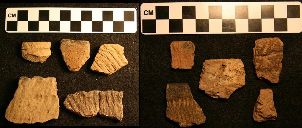
Another highlight of the LPP has been our identification of a possible cultural boundary between Mononghaela people and their neighbors to the north. Although many of our sites can be assigned to the Johnston Phase of the Monongahela tradition, others, especially those in the Crooked Creek drainage, appear not to truly be Monongahela, and to exhibit closer ties to Late Woodland groups living in northwestern Pennsylvania. These more northerly people seem to have made different ceramics, especially pots made with limestone temper as opposed to shell temper, as well as possibly to have less organized villages. Recently, and in part due to LPP research, the Crooked Creek Complex has been defined to encompass these sites, but there is a lot more that needs to be learned about these sites and those still further north, as much of the data remains in the hands of avocational archaeologists, and has only been partially studied. Important Crooked Creek Complex sites for which IUP has collections are Mary Rinn (36IN29) and Fleming (36IN26). This year an undergraduate honors thesis will be exploring the Mary Rinn site through geophysics as well.
ceramics

Contrasting ceramics from the Johnston site (Johnston Phase Monongahela) and the Mary Rinn site (Crooked Creek Complex).

A major undertaking of LPP archaeologists has been re-investigation of the Johnston site (36IN2) , located near Blairsville. This large village site is the type site for Johnston Phase Monongahela (AD 1450-1590), and it may be the second largest known Monongahela village. It was excavated in the 1950s by archaeologists from the Carnegie Museum of Natural History in Pittsburgh before the completion of the Conemaugh lock and dam. Today it is buried beneath flood sediments of the Conemaugh River Lake on land belonging to the US Army Corps of Engineers. By conducting five IUP archaeological field schools at Johnston beginning in 2006, we have added greatly to the information on this site, demonstrating that it is a multi-component site of some complexity, and we have called the definition of the Johnston Phase itself into question. Although, there is still much more potential for research at Johnston, we have obtained more than 40 radiocarbon dates from this site alone and recovered hundreds of thousands of artifacts. As a result, we are pausing in our excavations to take more thorough stock of what we have been learning. Graduate and undergraduate theses have now focused on ceramics, bone tools, faunal remains, lithics, FCR, and botanical remains from the Johnston site. Three others still in progress are exploring the site’s geomorphology, the spatial distribution of materials, and micro-artifactual evidence, and I am immersed in the analysis and write-up of our findings as well.

excavation shot

Excavations in progress at the Johnston site, 2012 (left), 2010 (right).

These are only a few highlights of the IUP Late Prehistoric Project, which has been employing excavation, geophysical survey, as well as faunal, botanical, lithic and ceramic analyses to gather evidence concerning the forgotten or porrly understood Late Prehistoric villages of central western Pennsylvania. As a result these villages are forgotten no more. If you are an IUP graduate or undergraduate student, you should consider joining other IUP archaeologists and getting involved with some aspect of this project. There are many worthwhile projects that you might undertake, and I will be happy to explore possibilities with you.   Whether or not the LPP is your cup of tea, it is an important part of the archaeology IUP is doing, and you can anticipate hearing more about it in the future.

Advanced Metal Detecting for Archaeologists at Fort Necessity

Uncontrolled metal detecting can be one of the most destructive activities at an historic-period archaeological site, especially a battle or military site. And it is illegal to metal detect, or remove any artifacts, from a National Park without an Archaeological Resource Protection Act (ARPA) permit. But with the proper research design and permits a systematic metal detector survey can be a very powerful archaeological tool. That’s what 16 IUP students and faculty learned at Fort Necessity this past weekend.

The class was taught by the Advanced Metal Detecting for Archaeologists (AMDA) as a Register of Professional Archaeologists (RPA) continuing education course. In addition to IUP, 10 other participants from Cal, Juniata, University of Binghamton, and the National Park Service took the class. AMDA is a group of professional archaeologists dedicated to integrating metal detecting into archaeological research. Since IUP has an excellent assemblage of geophysical equipment, it was natural for us to add metal detecting to our skill-set.

DSCF2876 - Copy

IUP Anthropology undergraduates Amanda Telep, Chyna Haley, James Miller, and Brendan Cole learning proper technique from AMDA instructor Sheldon Skaggs. Photo by Chris Espenshade.

The class began with a day of lectures on the mechanics and use of metal detectors, as well as many examples of how metal detectors can be used for historic and pre-contact period archaeology. The next two days were spent in the field collecting real archaeology data.

Quick history of Fort Necessity: A 22-year old George Washington was sent to western PA to push the French from the region. On May 28, 1754 colonial and native soldiers under Washington’s command killed Joseph Coulon de Jumonville and most of his force who were carrying a message ordering Washington’s force to leave the area. Expecting a reprisal from the French, Washington’s troops fortified their depot in the Great Meadows, naming it Fort Necessity. On July 3, 1754 French soldiers under the command of Louis Coulon de Villiers, Jumonville’s brother, attached Fort Necessity. After a day of fighting in the rain Washington surrendered. The killing of Jumonville, which Washington admitted to in his surrender, ignited the Seven Years War, the first truly inter-continental war.

DSCF2885 - Copy

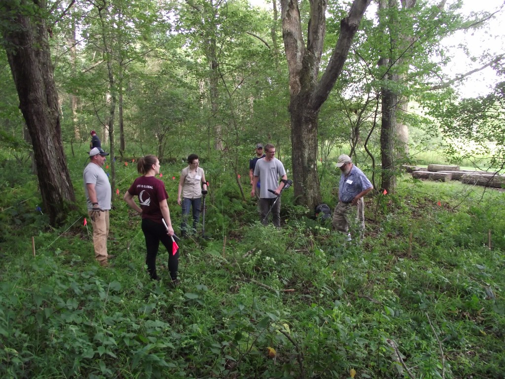
Metal detector survey at Fort Necessity National Battlefield. Note the string transects to ensure proper coverage and the pin flags to mark finds. Photo by Chris Espenshade.

It has long been believed that the heaviest French fire came from the tree line southeast of the fort where the trees reached within 60 yards of the fort. That’s where we focused our metal detecting efforts for the field portion of the class. We found evidence of the battle in the form of dropped and fired musket balls as well as other artifacts relating to the attack. These data confirm that at least some of the French were attacking from this location.

We also now have a cadre of IUP archaeologists trained to use metal detectors on an archaeological site – a skill that we can use here and that students can take with them into the professional world. It was a very productive and successful weekend.

DSCF2891 - Copy

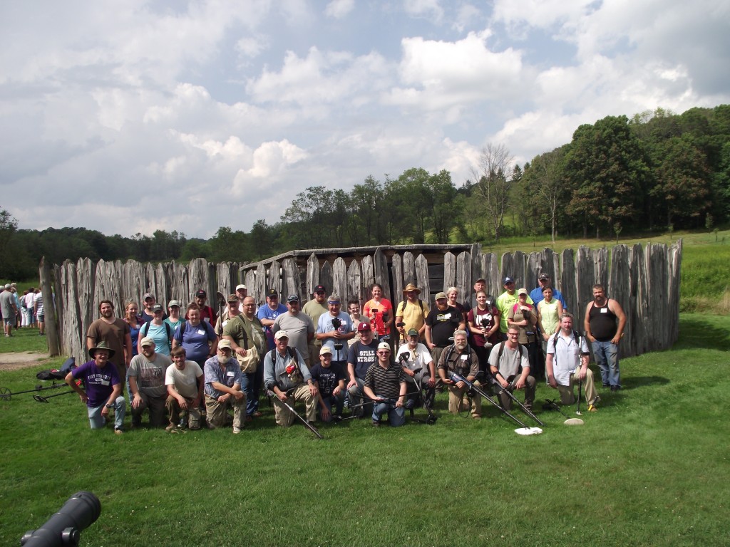
AMDA Fort Necessity National Battlefield Class Photo. Photo by Chris Espenshade.