By: Genevieve Everett
Conference season is upon us! I thought it would be nice to highlight the graduate students that are representing IUP and our department by presenting their research in the form of papers and posters at the following conferences/forums:
- The Middle Atlantic Archaeological Conference (MAAC) in Virginia Beach, VA- March 15-18
- The Graduate Scholars Forum at KCAC on IUPs campus, April 4
- The 89th Annual Society for Pennsylvania Archaeology(SPA) Meeting in DuBois, PA- April 6-8
- The Annualy Society for American Archaeology (SAA) Conference in Washington, DC- April 11-15
- The Seminar for Arabian Studies (SAS) in Bloomsbury, London-August 3-5
Below you will read about each student’s individual project/research and which conferences/forum you can find them at this year!
Kristina Gaugler
Presenting research at: IUP Graduate Students Forum
Spatial Database Development for Confluence Park Master Plan
The goal of this project is to create a series of spatial data layers that document the existing environmental conditions at Confluence Park, a 15 acre site managed by the Allegheny Arboretum at Indiana University of Pennsylvania. These maps will contribute to the develop of a support system designed to complement future site planning activities and will include the current topography, vegetation, hydrology, existing structures, and site access points. Factors that may influence the decisions of future planning or construction will be assessed, including the location and condition of on-site sewage systems and retention ponds, riparian zones, and a rapid-bio assessment of streams. This information will help delineate locations on the site that may be suitable for future development. With the tools and basemaps created, users will be able to overlay applications to suit their needs and allow for varying types of analyses to be performed.
Britney Elsbury-Orris
Presenting research at: SPA and SAA
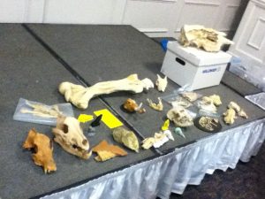
The Kirshner Site (36WM213) is a multi-component site in South Huntington township, Westmoreland county, Pennsylvania that contains two Middle Monongahela villages. Relatively little is known about Monongahela use of animals. Fortunately, good faunal preservation has made zooarchaeological analyses of materials from this site possible. Identifying and analyzing these faunal remains with respect to taxa and skeletal elements, as well as human and animal modifications, provides important new information. The distribution of faunal remains across the features of the site and its two components has been examined, as they have the implications for relationships between the site’s inhabitants and their environment. These data provide insights into the nature of this site and the activities of its occupants. Comparisons with other faunal studies, like those done on zooarchaeological materials from other Middle Monongahela sites, including the Johnston Site (36IN2) and the Hatfield Site (36WH678), further expands on the understanding of the Kirshner Site and the Middle Monongahela tradition.
Matthew Bjorkman
Presenting research at: IUP Graduate Scholars Forum
Indiana County FEMA Data-based Flood Hazard Analysis
Co-authored with Eisbeiry Cordova-Ortiz & Shanice Ellison
In the past decade we have frequently seen the effects of intense precipitation events, particularly the damage they cause in populated areas. Due to the increased frequency of these events, state and local government officials across the country have developed flood hazard analyses for their jurisdictions. Taking this into consideration, Indiana county is developing a flood management plan to prepare for any adverse effects caused by 100-year storms. Using ArcGIS, a geodatabase was developed to build a 100-year flood depth grid (FDG) using Federal Emergency Management Agency (FEMA) data from Pennsylvania Spatial Data Access (PASDA). The FDG was used to identify structures that are located in a flood zone and would be susceptible to damage. This project highlights concentrations of vulnerable buildings and provides the value of the estimated monetary damages. These results will assist the county with its development of its comprehensive emergency management plan.
Using LiDAR to Analyze Landscape Evolution: A Case Study of the Squirrel Hill Site (36WM0035)
Light detection and ranging (LiDAR) is an active remote sensing system that has, on occasion, been used by archaeologists to conduct paleolandscape reconstruction studies. Understanding what the landscape looked like is essential for archaeologists to determine how prehistoric sites formed. Rivers are a primary operator in landscape evolution, as meandering and avulsing rivers can create major alterations to a landscape through deposition and erosional processes. Changes in a river’s position on the landscape will have great impacts on the location and preservation potential of archaeological sites This study utilizes LiDAR data from Indiana and Westmoreland counties in Pennsylvania to study landscape evolution near the archaeological site of Squirrel Hill, a Monongahela village site. The goal of the research was to use remote sensing technologies to identify and map extinct channels of the Conemaugh River to understand how the evolution of the landscape around the Squirrel Hill site has affected the site’s formation and preservation.
Samantha Taylor
Presenting research at: MAAC, SPA, SAA
Looking Through Dirty Dishes: A Comparative Analysis of Ceramics at the John and Rosie Allen Residence, Pandenarium, Mercer County, Pennsylvania.
African Diaspora archaeology has become one of the most impactful means by which archaeologists supplement our current understanding of the past. Not only does this subfield have the potential to benefit descendant and local communities, but it also enables professionals to fill in the blank gaps left by the systematic disenfranchisement and intentional illiteracy of an entire group of people. One site with the potential to enhance our understanding of the African Diaspora is Pandenarium (36ME253) a freed African American settlement in western Pennsylvania. Current research at Pandenarium focuses on a comparative ceramic analysis with nearby archaeological sites, other freed African American sites, and slave quarters at plantations. The goal of this research is to determine the socio-economic status of individuals living at Pandenarium, along with participation in local and regional markets. The results of the analysis featured in this paper are a foundation for future comparative studies featuring Pandenarium.
Mesfer Alqahtani
Presenting poster at: SAA and the IUP Graduate Scholars Forum
Presenting paper at: SAS
SAA:
GIS Investigations on Stone-Circle Structures in the North of Saudi Arabia
The theme of the poster will address archaeological phenomena in the north of Saudi Arabia. The archaeological phenomena are stone-built structures that can be seen by satellite images. These stone-built structures have various types, and one of them is the circle type.
The poster will show the method of creating predictive models of stone circles by using the Geographic Information System (GIS). To create these models, two zones from the north of Saudi Arabia should be selected: study zone and applied zone. The study zone is where the distribution of stone circle locations will be analyzed to create predictive models. The applied zone is where predictive models will be applied to be testable in the future.
The predictive models will be based on quantifiable attributes of stone-circle locations from the study zone. These attributes will include the relationship between stone-circle locations and environmental variables such as the landform and the distance of water resources. These attributes will be analyzed by ArcGIS to obtain environmental characteristics representing high, middle, or low probability models for the presence of stone-circle locations. In the applied zone, similar environmental characteristics will be identified to determine high, middle, low predictive models.
SAS:
Geospatial Investigation of Circular Stone Structures in Northern Saudi Arabia
The paper will focus on the circular type of stone-built structures in Harrat Al-Harrah of northern Saudi Arabia. The goal of the research is to recognize the locational patterns for these circular structures based on five quantifiable geographic attributes: elevation, slope, land-cover, distance to sabkhas (temporary water bodies), and distance to wadies (water streams).
The probability modeling methodology conducted uses Remote Sensing and GIS technologies. This study includes identified locations of circular structures in one zone to create the model and a second zone to test the model (225 square miles and 81 squared miles total) of Harrat Al-Harrah, examining the correlative relationship between these locations and the five geographic factors. The results show the favorable geographic factors related to the locations of circular structures in the two zones of Harrat Al-Harrah.
The significance of this research lies in the contribution of recognizing the locational patterns of circular stone structures in two zones of Harrat Al-Harrah that have never been studied before and difficult to access. This pattern will be useful for comparative studies with locational patterns of circular structures in other areas of the Arabian Peninsula when conducting more investigations on this type of stone structures.
IUP Graduate Scholar Forum:
Geospatial investigation of circular stone structures in Northern Saudi Arabia
The theme of this poster will address stone-built structures in northern Saudi Arabia. Specifically, the circular type stone-built structure will be the focus of this research. Stone-built structures are an archaeological phenomena that can be seen via satellite images within this region of the world.
The goal of the research is to recognize the pattern of geographic locations for these circular stone-built structures based on five quantifiable geographic attributes. These attributes include elevation, slope, land-cover, distance to sabkhas (temporary water bodies), and distance to wadies (water streams). Remote Sensing and GIS technologies are used to conduct probability modeling for this research. This study includes identifying all the locations of circular structures in one zone, building a model for their locations, and then examining a second zone using the model. The results show the favorable locations for circular structures in these two zones based on the model.
Ross Owen
Presenting research at: SAA
PennDOT Highway Archaeological Survey Team: Providing Immersive CRM Work Experience to Students
Despite there being more applicants with graduate degrees than there are jobs, the CRM industry suffers from the number of people holding graduate degrees but lacking experience conducting archaeological surveys for Section 106 compliance. Additionally, conducting archaeological surveys is cost-prohibitive and can be a burden on state agencies on projects where federal funds are not involved. These two issues in the field of compliance archaeology prompted the creation of the PennDOT Highway Archaeological Survey Team (PHAST). Through a partnership with Indiana University of Pennsylvania, each year PHAST gives 4 students an opportunity to work on and complete small Phase I and II surveys for the Pennsylvania Department of Transportation. The students gain experience in the field, and are employed in the lab to perform the necessary background research, GIS mapping, curation and documentation following the guidelines of the Pennsylvania Historical and Museum Commission. Much of this experience is outside the purview of most field technician positions. This paper will explore the successes and failures of the PHAST program from both a professional and financial point of view. How have the students benefitted from their experience within the program, and how has the state benefitted from the services provided?
Andrew Malhotra
Presenting research at: SPA (Co-authored with John Nass, Jr. (Callifornia University of Pennsylvania)
Presenting research at: IUP Graduate Scholars Forum
SPA:
Social Signaling and the use of Style Amongst Late Prehistoric Monongahela Populations: Possible Evidence for Intervillage Political Integration
Communication between groups of people occurs for different reasons and, when using material culture, can take many forms. During the Late Prehistoric period evidence of social signaling in the form of shared stylistic traits appears at several late Monongahela villages from southwestern Pennsylvania. The stylistic trait consists of various forms of executing lip decoration on ceramic jars. The form of decoration using various tools results in the lip looking like a piecrust. This specific form of decoration appears from the Johnson site in Indiana County to the Foley Farm site in Greene County.In is the intent of this paper to document the temporal and spatial documentation and the social/political significance of this stylistic design is the subject of this paper.
IUP Graduate Scholars Forum:
Sanborn Maps of Indiana: Reconstructing the Urban Geography of Indiana, PA
This project will consist of analysis of Sanborn Fire Insurance Maps from 1887-1936 of Indiana Borough in order to depict urban growth patterns, major employers and how these factors changed over time. These maps were brought into ArcMap 10.5 to be georeferenced with road intersections and buildings, digitizing the most important ones. Attribute data including census and city directory data was also extracted for database creation. Through construction of a detailed database and data extraction of these maps, the goals of documenting and analyzing how the borough of Indiana and its people have developed and changed through the target years can be achieved. A future goal is to develop an interactive map with attribute information about its features for use by the public and historical society.
Genevieve Everett
Presenting Research at: SAA and Graduate Student Forum (abstract for forum not provided)
From Field School to Graduate School: How One Public Archaeology Program Has Made It All Possible
The Paleoindian Period of New Hampshire has been studied extensively, particularly in the White Mountains. Volunteers and avocationals from the summer field school known as the State Conservation And Rescue Archaeology Program (SCRAP) have excavated several of the known Paleoindian sites in northern New Hampshire. It is the goal of New Hampshire State Archaeologist, Richard Boisvert to make information and data recovered by SCRAP accessible to scholars as potential thesis and dissertation topics.
This paper outlines how the principal investigators participation in the SCRAP field school has been beneficial to her professional and academic career, including her current Master’s thesis. The purpose of this thesis is to produce a spatial and statistical analysis of the artifact assemblage from excavation block K at the Potter Site (27-CO-60) located in Randolph, New Hampshire in comparison with the Jefferson VI (27-CO-74) salvage block in Jefferson, New Hampshire. This comparison not only examines the spatial relationships within one Paleoindian site (27-CO-60), but also helps the principal investigator make inferences about the similarities and differences between two Paleoindian sites in close proximity. Public archaeology programs such as SCRAP are a valuable part of North American Archaeology, without SCRAP this work would not be possible.
Zaakiyah Cua
Presenting research at: SAA and the IUP Graduate Scholars Forum
SAA:
Loyalhanna Lake: a Geoarchaeological Approach to Understanding the Archaeological Potential of Floodplains
Unlike uplands, floodplains generally yield stratified deposits that may include deeply buried landscapes and archaeological sites. Most state specifications for cultural resources surveys require floodplains to be geomorphically evaluated in order to identify buried landscapes. This is most frequently accomplished via trenching, an effective, but timely, costly, and sometimes destructive method. This project reports on an alternative technique utilizing a multi-proxy methodology coupling geophysical survey with auger sampling. These non-invasive and limited-impact methods produce accurate results without causing extensive destruction to cultural resources. The study area, located along Loyalhanna Creek in Westmoreland Country in western Pennsylvania, is managed by the US Army Corps of Engineers – Pittsburgh District (USACE). As a federal agency, the USACE is mandated to identify and preserve cultural resources by Section 110 of the National Historic Preservation Act (NHPA). Unfortunately, federal agencies often face limited staffing, resources and funding to address management of cultural resources. In addition to proposing a method for identifying buried landscapes, this project also provides a case study of partnerships between federal agencies and public universities; a mutually beneficial collaboration which provides agencies with data essential to land management while simultaneously providing students valuable opportunities to conduct cultural resource management assessments.
IUP Graduate Scholars Forum:
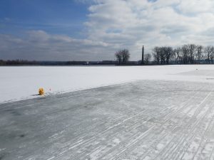
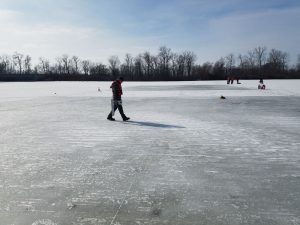
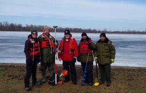
Misery Bay Ice Survey Preliminary Results: a Case Study for Testing Geophysical Methods and Collaboration with Stakeholders
Ground-penetrating radar (GPR) and gradiometry are two geophysical methods typically used by archaeologists in terrestrial environments to locate subsurface features. This study took terrestrial geophysical methods out on the frozen ice surface of Misery By, Presque Isle State Park, PA; testing instrument limits across two acres of the bay. If successful, this study has major implications to geophysical maritime investigations, broadening the reach of cultural resource management within these environments by government agencies. In addition to testing new methodology, the project was a collaboration between the PA DCNR, Regional Science Consortium, PA Sea Grant, PASST, and Indiana University of Pennsylvania Applied Archaeology program. The collaborative and public nature of the project drew in stakeholders, largely contributing to the success of the study. This poster presents the preliminary results of the project; both a case study for testing new methods, and the positive implications for collaborative and public cultural resource surveys.
Heather R. MacIsaac
Presenting research at: IUP Graduate Scholars Forum
The Squirrel Hill site in Westmoreland County, Pennsylvania, was a Monongahela village inhabited from A.D. 1450 to A.D. 1613. Past research conducted by IUP archaeologists at the Squirrel Hill site uncovered evidence of housing, storage areas, and burials. There are conflicting interpretations of the village’s development and expansion over time. One interpretation is that the site contains a single village with an open, central plaza for communal activities, and that the village gradually expanded southward. Another interpretation is that the site contains two overlapping villages occupied at different times. To evaluate these interpretations, this research incorporates a statistical analysis of artifacts and a spatial analysis of structural features based on materials from the 2016 IUP archaeological field school. This research also investigates whether the Squirrel Hill site was inhabited by Monongahela traditional people only or by an amalgamation of Monongahela tradition and nearby McFate phase people.
IUP ANTHROPOLOGY DEPARTMENT
